- Rutledge, Missouri
Infobox Settlement
official_name = Rutledge, Missouri
settlement_type =Town
nickname =
motto =
imagesize =
image_caption =
image_
imagesize =
image_caption =
image_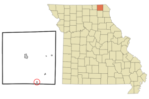
mapsize = 250x200px
map_caption = Location of Rutledge, Missouri
mapsize1 =
map_caption1 =subdivision_type = Country
subdivision_name =United States
subdivision_type1 = State
subdivision_name1 =Missouri
subdivision_type2 = County
subdivision_name2 = Scotland
government_footnotes =
government_type =
leader_title =
leader_name =
leader_title1 =
leader_name1 =
established_title =
established_date =unit_pref = Imperial
area_footnotes =area_magnitude =
area_total_km2 = 0.3
area_land_km2 = 0.3
area_water_km2 = 0.0
area_total_sq_mi = 0.1
area_land_sq_mi = 0.1
area_water_sq_mi = 0.0population_as_of = 2000
population_footnotes =
population_total = 103
population_density_km2 = 307.7
population_density_sq_mi = 797.0timezone = Central (CST)
utc_offset = -6
timezone_DST = CDT
utc_offset_DST = -5
elevation_footnotes =
elevation_m = 235
elevation_ft = 771
latd = 40 |latm = 18 |lats = 53 |latNS = N
longd = 92 |longm = 5 |longs = 17 |longEW = Wpostal_code_type =
ZIP code
postal_code = 63563
area_code = 660
blank_name = FIPS code
blank_info = 29-63776GR|2
blank1_name = GNIS feature ID
blank1_info = 0725692GR|3
website =
footnotes =Rutledge is a village in Scotland County,
Missouri ,United States . The population was 103 at the 2000 census.The surrounding area is also the home to three
intentional communities :Dancing Rabbit Ecovillage, a growingecovillage on 280 rolling acres;Sandhill Farm ; andRed Earth Farms .Rutledge is known for a large flea market held monthly March-November just south of the town. More information on the flea market can be found at the link below.
Geography
Rutledge is located at coor dms|40|18|53|N|92|5|17|W|city (40.314634, -92.087963)GR|1.
According to the
United States Census Bureau , the town has a total area of 0.1square mile s (0.3km² ), all of it land.Demographics
As of the
census GR|2 of 2000, there were 103 people, 41 households, and 25 families residing in the town. Thepopulation density was 797.0 people per square mile (305.9/km²). There were 72 housing units at an average density of 557.2/sq mi (213.8/km²). The racial makeup of the town was 100.00% White.There were 41 households out of which 26.8% had children under the age of 18 living with them, 48.8% were married couples living together, 12.2% had a female householder with no husband present, and 36.6% were non-families. 36.6% of all households were made up of individuals and 17.1% had someone living alone who was 65 years of age or older. The average household size was 2.51 and the average family size was 3.38.
In the town the population was spread out with 29.1% under the age of 18, 7.8% from 18 to 24, 23.3% from 25 to 44, 20.4% from 45 to 64, and 19.4% who were 65 years of age or older. The median age was 36 years. For every 100 females there were 94.3 males. For every 100 females age 18 and over, there were 97.3 males.
The median income for a household in the town was $14,063, and the median income for a family was $17,500. Males had a median income of $11,667 versus $17,917 for females. The
per capita income for the town was $9,545. There were 25.0% of families and 43.8% of the population living below thepoverty line , including 93.8% of under eighteens and 13.6% of those over 64.References
External links
*http://www.rutledge-fleamarket.com
Wikimedia Foundation. 2010.