- Duenweg, Missouri
-
Duenweg, Missouri — City — Location of Duenweg, Missouri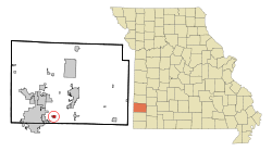
Coordinates: 37°4′45″N 94°24′43″W / 37.07917°N 94.41194°WCoordinates: 37°4′45″N 94°24′43″W / 37.07917°N 94.41194°W Country United States State Missouri County Jasper Area – Total 0.5 sq mi (1.4 km2) – Land 0.5 sq mi (1.4 km2) – Water 0.0 sq mi (0.0 km2) Elevation 1,079 ft (329 m) Population (2010) – Total 1,121 – Density 1,949.7/sq mi (752.8/km2) Time zone Central (CST) (UTC-6) – Summer (DST) CDT (UTC-5) ZIP code 64841 Area code(s) 417 FIPS code 29-20314[1] GNIS feature ID 0717154[2] Duenweg (pronounced dŭn·ə·wāg′) is a city in Jasper County, Missouri, United States. The population was 1,121 at the 2010 census. It is part of the Joplin, Missouri Metropolitan Statistical Area.
Contents
Geography
Duenweg is located at 37°4′45″N 94°24′43″W / 37.07917°N 94.41194°W (37.079035, -94.411881)[3].
According to the United States Census Bureau, the city has a total area of 0.5 square miles (1.3 km2), all of it land.
Demographics
Historical populations Census Pop. %± 1960 529 — 1970 656 24.0% 1980 703 7.2% 1990 940 33.7% 2000 1,034 10.0% 2010 1,121 8.4% U.S. Decennial Census As of the census[1] of 2000, there were 1,034 people, 425 households, and 295 families residing in the city. The population density was 1,949.7 people per square mile (753.3/km²). There were 458 housing units at an average density of 863.6 per square mile (333.7/km²). The racial makeup of the city was 94.00% White, 0.87% African American, 2.32% Native American, 0.29% Asian, 0.29% from other races, and 2.22% from two or more races. Hispanic or Latino of any race were 1.26% of the population.
There were 425 households out of which 40.9% had children under the age of 18 living with them, 48.9% were married couples living together, 16.5% had a female householder with no husband present, and 30.4% were non-families. 26.4% of all households were made up of individuals and 6.8% had someone living alone who was 65 years of age or older. The average household size was 2.43 and the average family size was 2.91.
In the city the population was spread out with 29.9% under the age of 18, 11.9% from 18 to 24, 32.3% from 25 to 44, 17.2% from 45 to 64, and 8.7% who were 65 years of age or older. The median age was 30 years. For every 100 females there were 79.5 males. For every 100 females age 18 and over, there were 78.1 males.
The median income for a household in the city was $25,350, and the median income for a family was $29,226. Males had a median income of $24,688 versus $19,167 for females. The per capita income for the city was $12,342. About 13.4% of families and 16.0% of the population were below the poverty line, including 20.9% of those under age 18 and 11.8% of those age 65 or over.
History
Duenweg's first settlers
In the year 1855, two brothers, Elijah C. and James C. Webb, traveled from Overton County, Tennessee, with their families, to settle in southwest Missouri. They made their home in the area that today is known as Duenweg. They named their little settlement “Harmony Grove”. A cemetery, of that same name, still remains in that area, just west of Duenweg.
Discovery of lead and zinc
In 1895, a mining camp where G. P. Ashcraft and J. Allen Hardy had been opening up some great lead “diggings”, attracted the attention of Indiana capitalists, by the name of Louis and Otto Duenweg. The Duenweg’s purchased some of the largest of the newly discovered mines in the region. The camp was given the name Duenweg, in honor of the men who had made large investments and had undertaken the work of developing this new territory.The town first came into prominence when H. U. Dale, Josiah Bennett, and others sunk an experimental mine shaft that later was given the name “The Newsboy”. This mine was a great producer of lead and zinc. The 40 acres (160,000 m2) on which this mine was located had but a few years before been just plain grass land selling for $10 an acre, but after the discovery of ore, the land sold for $40,000 an acre. For many years, tons of high grade lead and zinc ore came out of the earth in and around Duenweg, and the town thrived. However, in 1920, the mines in the Duenweg area began to close. By 1922, most of the district’s mining operations had been moved to new fields in Kansas and Oklahoma. Duenweg’s population reached an all time low of 350 residents in the 1930s. Businesses began to disappear and others deteriorated.
Fire
During Duenweg’s eminent years, it built up a sizable business district, with doctor’s offices, livery stables, hotels, theaters, etc. However, nearly all of the businesses were destroyed in November 1904 when fire broke out in one of the livery stables. Martin Lown, Rawl Hastings and Dr. William Gaddie helped in rebuilding some of those lost wooden structures with brick buildings, that house Duenweg City Hall and various other businesses today. One of the better known businesses that makes it home in the city of Duenweg today is Tri State Motor Transit. The specialized trucking firm is the largest of its kind in the nation.
Education
Educating the children of Duenweg has always been of great importance. Their first school was built in 1870, and was called “Harmony Grove School”. It was located about half-way between 7th and 20th Streets on Prosperity Road. The first class to graduate from this school was in 1900, and Mr. Harry Stirling was the principal at that time. A new “Duenweg School” was constructed in 1912, at the corner of Sterling and Irwin Streets, which housed grades one through twelve, elementary grades downstairs and secondary grades upstairs. In 1959 an elementary school was erected behind the existing structure, and it remains today at 202 Malloy Circle, having had additions built on to accommodate all of the children of elementary age. The original building housed grades one through six, while today it houses kindergarten through fifth grades. The older structure housed grades seven through twelve, in 1959. The class of 1965 was the last class to graduate from Duenweg High School.
In 1966, Duenweg Consolidated Schools became a part of the Joplin School District, requiring junior high and high school students to be bused into the city of Joplin. Today grades six through eight attend Middle School in Joplin and grades nine through twelve attend Joplin High School.
Incorporation
On January 6, 1954, various town leaders, along with their attorney, presented their petition to the Jasper County Court to have the town of Duenweg incorporated as a city. The court declaration stated that it be ordered, adjudged and decreed by the Court that the corporate powers and duties of said town so incorporated should vest in a Board of Trustees, to consist of five members, and that Charles Little, Melton Mitchell, Lloyd Rogers, Eugene Parker and Harley Mac Needham were thereby appointed as members of the first Board of Trustees. They held their offices until their successors were “duly elected and qualified as provided by law”. Duenweg’s first mayor, Eugene (Gene) Parker, was appointed from that first Board of Trustees. Over the years, only seven other men have served as mayor for the City of Duenweg: Earl Cunningham, Portor Johnson, Kenneth Neal, Albert Wolfe, Earl Wayne Goddard, Charles Cossey, and Russell Olds. Donald Johnson served as Mayor Pro-tem for a short time, following the resignation of Earl Wayne Goddard.
Water system
In the early days of Duenweg, many of its citizens had their own water well near their homes. For those who did not have a well, John Thomas Cossey drove a water wagon for many years, and sold water for about 10 cents a barrel. Around 1911, Dick Blosser, a pioneer driller from Duenweg, was hired to drill the first public well in the town, and Al Apple ran the Duenweg Water Works with son, Guy, who later took charge of the operation. On February 18, 1956, Duenweg residents voted on a bond issue to finance the purchasing, constructing, extending and improving a new waterworks system for the city.
Fire department
Soon after the new water system was installed, Duenweg organized a volunteer fire department. Over the years Duenweg Fire Department recognized the need for advanced training of its members. The department has received train in Firemanship One and Two, Advanced Firemanship, First Aid, Propane Gas Control, Hazardous Materials, Radiation Detection, Civil Defense, Disaster Training, Wild Life Cover, Foam Application, Extraction, CPR, Arson Detection, Aircraft Rescue, Smoke Training, Rope and Ladder, and People Rescue. The Duenweg Fire Department continues to grow in training, equipment, as well as respect.
Today
Today the city of Duenweg continues to grow. Since January 1, 2002, Duenweg has doubled in size, moving her northern and southern boundaries to Newman Road and 20th Street, respectively. Mayor Russell Olds has said that the continuing growth of the city is helping in “writing a new chapter to its history”.
References
The History of DUENWEG, MISSOURI by Billie June Bartley Ingram. A copy of this book may be obtained by contacting Billie Ingram at P. O. Box 149, Duenweg, MO 64841.
- ^ a b "American FactFinder". United States Census Bureau. http://factfinder.census.gov. Retrieved 2008-01-31.
- ^ "US Board on Geographic Names". United States Geological Survey. 2007-10-25. http://geonames.usgs.gov. Retrieved 2008-01-31.
- ^ "US Gazetteer files: 2010, 2000, and 1990". United States Census Bureau. 2011-02-12. http://www.census.gov/geo/www/gazetteer/gazette.html. Retrieved 2011-04-23.
Municipalities and communities of Jasper County, Missouri Cities Alba | Asbury | Carl Junction | Carterville | Carthage | Duenweg | Jasper | Joplin‡ | La Russell | Neck City | Oronogo | Purcell | Reeds | Sarcoxie | Waco | Webb City

Villages Airport Drive | Avilla | Brooklyn Heights | Carytown | Duquesne | Fidelity
Unincorporated
communitiesDudenville‡ | Kendricktown | Maxville | Scotland
Footnotes ‡This populated place also has portions in an adjacent county or counties
Categories:- Cities in Jasper County, Missouri
- Communities on U.S. Route 66
- Joplin metropolitan area


Wikimedia Foundation. 2010.