- Coolbellup, Western Australia
-
Coolbellup
Perth, Western Australia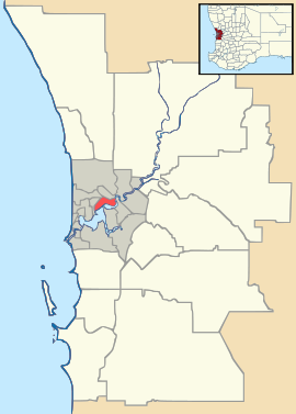
 Coolbellup
Population: 4752 (2006 census)[1] Postcode: 6163 Area: 3.1 km² (1.2 sq mi) Location: 15 km (9 mi) from Perth LGA: City of Cockburn State District: Willagee Federal Division: Fremantle Suburbs around Coolbellup: Hilton Samson Kardinya Hamilton Hill Coolbellup North Lake Spearwood Bibra Lake Bibra Lake Coordinates: 32°04′55″S 115°49′05″E / 32.082°S 115.818°E
Coolbellup is a suburb in Perth, Western Australia, located within the local government area of the City of Cockburn.
Coolbellup takes its name from the Aboriginal name for the nearby North Lake; confusingly, there is also an adjoining suburb with the name of North Lake.
Contents
History
The original inhabitants were an aboriginal tribe from the Swan River who made their campsites along Perth's central lakes to avoid the salty lakes closer to the coast. 16 aboriginal campsites have been found in the City of Cockburn.
Coolbellup was originally the eastern portion of George Robb's Cockburn Sound Location 10[2] and Coolbellup was recorded as the aboriginal name of a lake near the eastern boundary of the grant in 1842 by A.C Gregory. Surveys by RM. King in 1877 showed the local name to be North Lake and both names were shown on plans[3]. The lake is in fact the northernmost of the chain of lakes lying between Mandurah and the Swan River. Early landholders in the area were G. Jarvis, Joseph Meller and the Dixon family.
In the 1920s most of the area was taken up with dairy farms however, a cattle borne disease destroyed the dairy industry in the area. An abattoir operated in the area up until the 1950s. A vineyard also operated in the area and remained in production until it was cleared for housing in the late 1970s for what is now known as the suburb of North Lake. Large portions of native bushland remained and native wildlife flourished in the area with a large population of kangaroos. In 1954 most of the land was resumed by the State Housing Commission and an intensive post-war housing scheme developed for the area. In 1957 it was decided that the suburb should be called Coolbellup in preference to North Lake.
During the 1960s the area's population grew quickly with families moving into modern brick houses on large blocks provided at low cost loans by the state government. A number of flats were also constructed in the area. A shopping area was constructed in the middle of the suburb. A hotel/motel was also built nearby, The Coolbellup Motor Hotel.
By the late 1980s Coolbellup's post war population boom was over and gradually the demographics changed from young families with children to older residents. The suburbs appearance was also in need or revitalisation.
During the late 1990s a suburb revitalisation project began. This included demolition of flats and replacement with higher quality dwellings. Some flats have also been converted to high quality apartments. Roads, Parks and Sporting grounds have also been improved.
The changes together with the suburbs location and Perth real estate trends have resulted in a significant increase in property values in the area. Most public housing has now been sold off to private owners. The houses in the area are typified as 1960s 3 bedroom 1 bathroom brick and tile cottages with solid timber floors on 700 sqm. blocks. These houses are once again proving popular with younger couples and families seeking character homes within 15 km of the CBD.
Geography
It is bounded by Winterfold Road (named after The Winterfold Estate, which was the home of the Healy family) to the north, Stock Road (originally part of a stock route from Robb Jetty to Midland Junction) to the west, North Lake Road to the east, and Forrest Road (named after Sir John Forrest, the then Surveyor General of Western Australia) and the Roe Highway reservation to the south[4]. The main streets within Coolbellup are Coolbellup Avenue, Counsel Road, Cordelia Avenue, Hargreaves Road, Antigonus Street and Waverley Road.
The natural features of the area include gentle undulating land with the highest points in the Coolbellup Avenue Waverley Road area.
The only water features are lakes located at North and Bibra Lake, although these are no longer in the Coolbellup locality.
Facilities
Commercial
Coolbellup Shopping Centre is located on Coolbellup Avenue and Cordelia Avenue, and contains the Coolbellup Hotel.
Recreation/Community
There are a number of parks with Coolbellup. The main park, Len Packham Reserve, located on Waverley Road to the rear of the Coolbellup Shopping Centre is used for little league soccer training and the park also has basketball courts and a skatepark. Also adjacent to the shops, on Cordelia Avenue is the Coolbellup library. The other main park is Tempest Reserve on Coolbellup Avenue, home of the Coolbellup Australian Football Club.
Education
Formerly there were three state government primary schools in the area Coolbellup Primary, North Lake Primary and old Koorilla Primary(original school on Cordelia Ave) however these have been closed due to declining numbers of young families and children in the suburb and replaced with a single school, Coolbellup Community School (which adjoins Len Packham Reserve). The former school sites are all proposed to be redeveloped for housing. A High School known as North Lake Senior High School was constructed on Winterfold Road in the early 1970s in what was then a Pine Plantation. The area it was located in was later re zoned out of Coolbellup as Sommerville and later Kardinya. The school closed as a high school in the early 1990s and is now an adult education campus.
Religious
There are three churches in Coolbellup, a Baptist Church, and a Uniting Church both on Waverley Road and a Catholic Church (St Theresa's) on Friar John Way. Due to new Catholic churches being built at nearby Hilton and Yangebup, it was decided that a Catholic church in Coolbellup was no longer needed, Saint Teresa's ceased services in 1999, however the building remains church property and is used as a community hall.
References
- ^ Australian Bureau of Statistics (25 October 2007). "Coolbellup (State Suburb)". 2006 Census QuickStats. http://www.censusdata.abs.gov.au/ABSNavigation/prenav/LocationSearch?collection=Census&period=2006&areacode=SSC51331&producttype=QuickStats&breadcrumb=PL&action=401. Retrieved 2008-10-05.
- ^ Cockburn: The Making of a Community Michael Berson, 1978, Town of Cockburn, ISBN 9596533-0-9
- ^ Western Australian Land Information Authority. "History of metropolitan suburb names". http://www.landgate.wa.gov.au/corporate.nsf/web/History+of+metropolitan+suburb+names. Retrieved 2007-10-12.
- ^ Department of Land Information. StreetSmart® Perth Street Directory (50 (2009) ed.). West Australian Newspapers Ltd. pp. Maps 431-432, 461-462. ISBN 978-1-921048-28-9.
Suburbs of the City of Cockburn | Perth | Western Australia Atwell · Aubin Grove · Banjup · Beeliar · Bibra Lake · Cockburn Central · Coogee · Coolbellup · Hamilton Hill · Hammond Park · Henderson · Jandakot · Leeming · Munster · North Coogee · North Lake · South Lake · Spearwood · Success · Wattleup · Yangebup
Categories:- Suburbs of Perth, Western Australia

Wikimedia Foundation. 2010.