Mahoosuc Notch

Mahoosuc Notch
Mahoosuc Notch
Elevation 750 m (2,461 ft)
Traversed by Appalachian Trail
Location
Location Oxford County, Maine,  United States
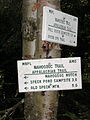
Range Mahoosuc Range
Coordinates 44°32.29′N 70°59.36′W / 44.53817°N 70.98933°W / 44.53817; -70.98933
Topo map USGS Old Speck Mountain

Mahoosuc Notch is a deep gap in the Mahoosuc Range of western Maine, traversed by the Appalachian Trail. The boulders on this mile-long section of trail present obstacles that must be climbed over and sometimes under, creating a unique hiking experience. There are occasional ten-foot drops, and places where packs must be removed to squeeze beneath a boulder.

Many thru-hikers call this stretch one of the slowest on the 2,179-mile (3,507 km) trail. This so-called "killer mile" or the "Toughest Mile" is a very tough section that can cause even the most experienced hikers to slow down. There are good spots to pitch a tent on both sides of the Notch. On the South end they are right next to the trail junction. On the Northern side, spots are a few hundred yards down along the brook.


Wikimedia Foundation. 2010.

Игры ⚽ Нужна курсовая?

Look at other dictionaries:

  • Mahoosuc Range — Range Country United States States Maine …   Wikipedia

  • Grafton Notch State Park — Der Grafton Notch State Park ist mit einer Größe von 1259 Hektar einer der größten State Parks im US Bundesstaat Maine. Screw Auger Falls Inhaltsverzeichnis …   Deutsch Wikipedia

  • Grafton Notch — Infobox Mountain Pass Name = Grafton Notch Photo = Caption = Elevation = 470 metres (1,550 feet) Location = Oxford County, Maine, USA Range = Mahoosuc Range Coordinates = coord|44|35.80|N|70|56.81|W |type:pass region:US ME |display=title,inline… …   Wikipedia

  • Appalachian Trail — This article is about the trail. For the conservation group, see Appalachian Trail Conservancy. For the train station, see Appalachian Trail (Metro North station). Appalachian Trail Map of Appalachian Trail Length …   Wikipedia

  • Sentier des Appalaches — Carte du Sentier des Appalaches. Localisation Côte est des États Unis Type Grande randonnée Longueur 3 510 km Points de départ …   Wikipédia en Français

  • Appalachian Trail by state — The Appalachian National Scenic Trail spans fourteen U.S. states during its journey that is 2,179 miles (3,507 km) long, including Georgia, North Carolina, Tennessee, Virginia, West Virginia, Maryland, Pennsylvania, New Jersey, New York,… …   Wikipedia

  • Old Speck Mountain — seen from Eyebrow Trail Elevation …   Wikipedia

  • Baldpate Mountain (Maine) — Infobox Mountain Name = Baldpate Mountain (East Peak) Photo = Caption = Elevation = convert|3790|ft|m| 1|lk=on [Summit elevation between 3,780 and 3,800 feet.] Prominence = convert|2240|ft|m| 1|abbr=on [Key col elevation between 1,540 and 1,560… …   Wikipedia

  • List of Maine state parks — This list includes state parks, State Reserved areas, and State Historic Areas in the U.S. state of Maine. Contents 1 State Parks 2 Public Reserved Land 3 State Historic Sites 4 …   Wikipedia

  • New England/Acadian forests — New England Acadian forests White Mountains of New Hampshire …   Wikipedia

Share the article and excerpts

Direct link
Do a right-click on the link above
and select “Copy Link”