- Narrikup, Western Australia
-
Narrikup
Western Australia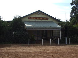
Narrikup District Hall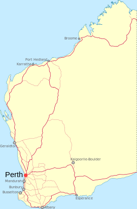
 Narrikup
Population: 515 (2006 Census)[1] Established: 1900s Postcode: 6326 Location: - 18 km (11 mi) S of Mount Barker
- 32 km (20 mi) NW of Albany
LGA: Shire of Plantagenet State District: Blackwood-Stirling Federal Division: O'Connor Coordinates: 34°46′26″S 117°42′07″E / 34.774°S 117.702°E
Narrikup is a small town between Albany and Mount Barker in the Great Southern region of Western Australia. At the 2006 census, Narrikup had a population of 515.[1]
The name Narrikup comes from the Aboriginal name of a nearby brook which is thought to mean "place of abundance".[2]
The area was visited by Thomas Wilson who travelled from Albany in 1829 when he camped on the banks of the stream west of the current townsite".[3]
The town is located on the Great Southern Railway line which was completed in this area in 1889, although initially the siding was named Hay River.[4]
A reserve for the townsite was put aside in 1901 and in 1905 20 lots were surveyed, the townsite was finally gazetted in 1907.
References
- ^ a b Australian Bureau of Statistics (25 October 2007). "Narrikup (State Suburb)". 2006 Census QuickStats. http://www.censusdata.abs.gov.au/ABSNavigation/prenav/LocationSearch?collection=Census&period=2006&areacode=SSC55011&producttype=QuickStats&breadcrumb=PL&action=401. Retrieved 19 July 2011.
- ^ Western Australian Land Information Authority. "History of country town names". http://www.landgate.wa.gov.au/corporate.nsf/web/History+of+country+town+names. Retrieved 2008-08-21.
- ^ "Albany Gateway - NARRIKUP HISTORY". 2008. http://www.albanygateway.com.au/Town/Narrikup/Local_History/. Retrieved 2008-08-21.
- ^ Western Australian Land Information Authority. "History of country town names". http://www.landgate.wa.gov.au/corporate.nsf/web/History+of+country+town+names. Retrieved 2008-08-21.
External links
- Welcome to Narrikup (Albany Gateway)
Towns in the Great Southern region of Western Australia Amelup · Badgebup · Borden · Bornholm · Boscabel · Bow Bridge · Boxwood Hill · Bremer Bay · Broomehill · Cartmeticup · Chinocup · Cranbrook · Denmark · Elleker · Frankland · Gairdner · Gnowangerup · Jerramungup · Jingalup · Kalgan · Katanning · Kendenup · King River · Kojonup · Kwobrup · Little Grove · Lower King · Manypeaks · Mount Barker · Muradup · Narrikup · Needilup · Nyabing · Ocean Beach · Ongerup · Pingrup · Porongurup · Redmond · Tambellup · Tenterden · Torbay · Tunney · Wellstead · Woodanilling
Categories:- Towns in Western Australia
- Great Southern (Western Australia)
- Australian Aboriginal placenames
- Western Australia geography stubs


Wikimedia Foundation. 2010.