- Mosstodloch
-
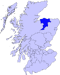
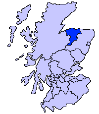
Mosstodloch (Scottish Gaelic: Mos Tudlach) is a small village in Moray, Scotland, lying near the A96 between Fochabers and Elgin on the west bank of the River Spey.
Construction work on a bypass for Mosstodloch and the neighbouring village of Fochabers, costing £31.5m, started in February 2010 [1] and the Mosstodloch section opened on 27 September 2011. The Fochabers section is still under construction and is due to open by May 2012. The project was significantly delayed due to conflict regarding the proposed route, and discovery of a Neolithic settlement on the site of the bypass.
The village also fields a team, Mosstodloch FC in the local welfare league.
References
Coordinates: 57°37′46″N 3°06′55″W / 57.62953°N 3.11522°W
Places in Moray Achnastank · Aberlour · Alves · Archiestown · Arradoul · Auchbreck · Auchinderran · Auchindoun · Auchnarrow · Auchenhalrig · Aultmore · Backlands · Ballindalloch · Bogmoor · Branderburgh · Broadley · Buckie · Burghead · Burniestrype · Cabrach · Chapeltown · Clochan · College of Roseisle · Craigellachie · Cullen · Cummingston · Dallas · Darnaway · Deskford · Dipple · Drummuir · Drybridge · Dufftown · Duffus · Dyke · Elgin · Farmtown · Findhorn · Findochty · Fochabers · Forres · Fogwatt · Garmouth · Glass · Hopeman · Ianstown · Inchberry · Keith · Kellas · Kingston · Kinloss · Knockando · Lhanbryde · Longmorn · Lossiemouth · Maggieknockater · Miltonduff · Mosstodloch · Nether Dallachy · Newmill · Ordiquish · Portessie · Portgordon · Portknockie · Rathven · Rafford · Rothes · Rothiemay · Spey Bay · Strathlene · Stotfield · Tomintoul · Unthank · Upper Dallachy · Urquhart
 Categories:
- Places in Moray
Wikimedia Foundation. 2010.