- Culbone Church
-
 Culbone Church
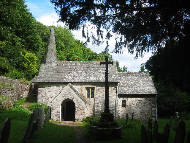
Culbone (St Beuno's) Church located in the village of Culbone in Somerset, England is said to be the smallest church in England.[1]
The church seats about 30 people, and the chancel is 13.5 feet (4.1 m) x 10 feet (3.0 m), the nave 21.5 feet (6.6 m) x 12.33 feet (3.8 m) and the building has a total length of 35 feet (10.7 m).[2] Services are still held there, despite the lack of access by road. The church is probably pre-Norman in origin, with a 13th century porch, and late 15th century nave. It was refenestrated and reroofed around 1810 and the spirelet added in 1888. It underwent further restoration in 1928.
It has been designated by English Heritage as a grade I listed building[3] and the churchyard cross is grade II* listed.
Joan D'Arcy Cooper, wife of the late potter Waistel Cooper, attended the church and is buried in the graveyard. In the television version of the Lorna Doone story it was the scene of the filming of the marriage of John Ridd at Oare church.
See also
- List of Grade I listed buildings in West Somerset
References
- ^ "Parish Churches". Somerset County archives. http://www.somerset.gov.uk/archives/ASH/Parishchs.htm. Retrieved 2007-10-24.
- ^ "Culbone". Minehead Online. http://www.minehead-online.co.uk/culbone.htm. Retrieved 2007-10-24.
- ^ "Culbone church". Images of England. http://www.imagesofengland.org.uk/details/default.aspx?id=265441. Retrieved 2007-10-24.
- Layley, Charles G. (1985). St. Beuno's Culbone "The smallest complete Parish Church in England". Barnstaple: Aycliffe Press Ltd., on behalf of Culbone Parochial Church Council.
External links
- Details from listed building database (265441) - church, grade I. Images of England. English Heritage.
- Details from listed building database (265442) - churchyard cross, grade II*. Images of England. English Heritage.
- St. Beuno's (Culbone) churchyard Survey, completed 15th November 2008 by EA Knutsen, Student, Sheffield University
Categories:- Churches in Somerset
- 15th-century architecture
- Grade I listed churches
- Grade I listed buildings in Somerset
- Grade II* listed buildings in Somerset
Wikimedia Foundation. 2010.