- Dalyellup, Western Australia
-
Dalyellup
Bunbury, Western Australia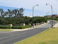
Population: 3,239 (2006)[1] Established: 1999 Postcode: 6230 Area: 8.8 km² (3.4 sq mi) Location: 11 km (7 mi) SSW of Bunbury LGA: Shire of Capel State District: Collie-Preston Federal Division: Forrest Suburbs around Dalyellup: Usher College Grove Indian Ocean Dalyellup Gelorup Stratham Coordinates: 33°24′07″S 115°37′30″E / 33.402°S 115.625°E
Dalyellup is an outer southern suburb of Bunbury, a city in Western Australia, located within the Shire of Capel local government area. The suburb was established in 1999 when the Department of Housing and Works entered into a joint venture with Satterley Property Group to develop Dalyellup Beach Estate, a master-planned community which is expected to yield 3,000 lots by its completion in 2012. The area is embroiled in a controversy over toxic waste dumping.
In the original advertising campaign, Dalyellup was heavily promoted as "A village in the Forest by the Sea". Along this theme the local private Lutheran school is called "Ocean Forest'.
Contents
Demographics
At the 2006 census, Dalyellup had a population of 3,239.[1] This was an increase from the 2001 census population of 352.[2]
Dalyellup residents had a median age of 29—well below the median of 37 in the Bunbury statistical district[3]—and the median individual income was above-average for the region—$683 per week compared with $492 per week. The population of Dalyellup was predominantly Australian-born—74.9% as at the 2006 census—while significant English (7.2%) and South African (3.6%) minorities were identified. At the 2006 census, 1.73% of residents identified as Indigenous Australians.
The most popular religious affiliations in descending order in the 2006 census were no religion, Anglican, Roman Catholic and Uniting.
Facilities
 Tuart Walk.
Two large areas within the suburb have been set aside as open space - about 100 hectares (247 acres) of pristine tuart forest, officially named the Usher-Dalyellup Regional Park in 2003, with an interpretative walkway leading to Ocean Drive in neighbouring Usher which was opened on 8 October 2007 by the Minister for the South West,[4] and about 120 hectares (297 acres) of dunes and foreshore to the south. A small shopping centre provides for daily needs, but most residents use Bunbury's shopping facilities.[5]
The placement of a larger shopping centre is currently been considered, due to the rapidly increasing population.
Education
Dalyellup Primary School opened in 2001 in the local shopping centre with 91 students, moving into its own premises in April 2004. The school as at 2007 has a student population of 493 students from Years 1-7, and 179 pre-primary students. The school also serves the neighbouring areas of Gelorup, Stratham and College Grove.[6] The Department of Education and Training has planned a middle school, Dalyellup Secondary College, to cater for years 7-10 from 2009.[7] Dalyellup is within the catchment area for Newton Moore Senior High School and is about 6 kilometres (4 mi) from the Bunbury campus of Edith Cowan University. Other schools serving the area include Ocean Forest Lutheran College in the east of the suburb and Bunbury Cathedral Grammar School located in Gelorup.[8]
Dalyellup Secondary College became Dalyellup College and now since the start of 2009 has been running on two campusess, Harthog Road campus (the old Dalyellup Primary School) accommodates Years K to 4, whilst the newly built Wake Drive campus accommodates years 5 to 8. The school will grow a year at a time such that the present Year 8s in 2009 will be able to complete year 12 at the school.
Transport
Dalyellup is served by the 401 route from Bunbury's central bus station, terminating at the end of Norton Promenade on the coast with a journey time of approximately 35 minutes. The route is operated by Bunbury City Transit for the Public Transport Authority.[9]
Politics
As an emerging suburb, Dalyellup is yet to find a consistent political trend. However, in the last two elections at both state and federal level, its voters have favoured the Liberal Party.
2007 Federal Election
Source: AECLiberal 44.3% Labor 26.9% Independent 16.0% Greens 4.33% CDP 2.17% 2004 Federal Election
Source: AECLiberal 64.0% Labor 23.2% Greens 4.33% Family First 2.17% One Nation 2.05% 2001 Federal Election
Source: AECLiberal 44.7% Labor 33.3% One Nation 9.93% Greens 6.38% Democrats 3.55% 2008 State Election
Source: WAECLiberal 47.4% Labor 31.5% Family First 9.15% Greens 9.09% CDP 2.87% 2005 State Election
Source: WAECLiberal 42.1% Labor 33.7% Family First 7.39% The Nationals 5.62% Greens 5.22% 2001 State Election
Source: WAECLiberal 40.5% Labor 18.9% One Nation 12.5% Greens 9.81% The Nationals 9.19% Toxin dumping scandal
A titanium dioxide (TiO2) refining company called Millennium Inorganic Chemicals has dumped waste at a Dalyellup site for the past two decades.[10] Residents have been calling for the closure of the site because of concerns over the radioactivity of the waste and its proximity to a residential estate. In May 2007, Cristal and Millennium Inorganic Chemicals (MIC) combined their manufacturing platforms to form Cristal Global, a now Abu Dhabi based company. The company is known as Cristal Global throughout Bunbury and Dalyellup when advertising and sponsoring, but is known as Millennium Inorganic Chemicals when noted about their dumping of toxic waste residue.[11] In September, 2009, the scandal led to the resignation of two Shire of Capel councillors in protest.[12] The resignations follow reports revealing slurry residue from processing titanium dioxide contained heavy metals, radioactive thorium, dioxins (a type of carcinogen) and even Furans(a type of mutagen). A DEC report said concentrations of chromium(III) in shallow groundwater at the site were "found to exceed adopted assessment levels for marine aquatic ecoystems...".[13] Environmental crusader Erin Brockovich and an Australian legal firm are investigating if residents have grounds to sue for damages. In the United States of America, the waste residue from the titanium dioxide processing company DuPont, is considered to be in the top 10% of all American polluters. Unfortunately the same chloride process is being used by Millennium Inorganic Chemicals to process and produce titanium dioxide.
External links
- Dalyellup Beach homepage (Satterley)
- Greater Bunbury Region Scheme (EPA report) contains some information about vegetation in Dalyellup.
References
- ^ a b Australian Bureau of Statistics (25 October 2007). "Dalyellup (State Suburb)". 2006 Census QuickStats. http://www.censusdata.abs.gov.au/ABSNavigation/prenav/LocationSearch?collection=Census&period=2006&areacode=SSC53651&producttype=QuickStats&breadcrumb=PL&action=401. Retrieved 2007-10-21.
- ^ Australian Bureau of Statistics (9 March 2006). "5050513 (Census Collection District)". 2001 Census QuickStats. http://www.censusdata.abs.gov.au/ABSNavigation/prenav/LocationSearch?collection=Census&period=2001&areacode=5050513&producttype=QuickStats&breadcrumb=PL&action=401. Retrieved 2007-10-21. Map
- ^ Australian Bureau of Statistics (25 October 2007). "Bunbury (WA) (Statistical District)". 2006 Census QuickStats. http://www.censusdata.abs.gov.au/ABSNavigation/prenav/LocationSearch?collection=Census&period=2006&areacode=5074&producttype=QuickStats&breadcrumb=PL&action=401. Retrieved 2007-10-21.
- ^ South West Development Commission. "Investing in infrastructure and place - Tuart Walk". http://www.swdc.wa.gov.au/index.php?pageid=346. Retrieved 2007-10-21.[dead link]
- ^ Department of Housing and Works. "Initiatives - Dalyellup". Perth. http://www.dhw.wa.gov.au/landsales/site_files/corporate/initiatives2.htm#capel. Retrieved 2007-10-21.
- ^ Department of Education and Training. "Schools Online". http://www2.eddept.wa.edu.au/schoolprofile/home.do. Retrieved 2007-10-21.
- ^ Department of Education and Training (18 October 2007). "Proposed Changes and New Schools". http://www.det.wa.edu.au/education/schoolinfo/ESTAT/Latest/NewSchools.htm. Retrieved 2007-10-21.
- ^ Department of Land Information. StreetSmart® Perth Street Directory (50 (2009) ed.). West Australian Newspapers Ltd. pp. Map B7. ISBN 978-1-921048-28-9.
- ^ Bunbury 5, TransBunbury, effective 18 January 2004. Accessed 21 October 2007
- ^ "Shire to vote on waste dumping - ABC News (Australian Broadcasting Corporation)". www.abc.net.au. http://www.abc.net.au/news/stories/2009/07/22/2633021.htm?site=news. Retrieved 2009-11-25.
- ^ "Govt pressured over Dalyellup toxic waste - ABC News (Australian Broadcasting Corporation)". www.abc.net.au. http://www.abc.net.au/news/stories/2009/04/28/2554840.htm?site=news. Retrieved 2009-11-25.
- ^ Towie, Narelle (2009-09-19). "Councillors quit over chemical dumping - PerthNow". www.news.com.au. http://www.news.com.au/perthnow/story/0,21598,26096452-5017007,00.html. Retrieved 2009-11-25.
- ^ "Conflict query over waste dump licence - The West Australian". au.news.yahoo.com. http://au.news.yahoo.com/thewest/a/-/breaking/6224911/conflict-query-over-waste-dump-licence/. Retrieved 2009-11-25.
Suburbs of the Bunbury region | South West | Western Australia City of Bunbury Nearby suburbs Australind · Dalyellup · Dardanup West · Eaton · Gelorup · Kemerton · Leschenault · Millbridge · Stratham · Waterloo
Categories:- Suburbs of Bunbury


Wikimedia Foundation. 2010.