- Northern Liberties, Philadelphia, Pennsylvania
-
Northern Liberties Historic District
 Houses on North 5th Street
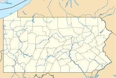

Location: Roughly bounded by Brown, Boone & Galloway, Green & Wallace, and Fifth & Sixth Sts.
Philadelphia, PennsylvaniaCoordinates: 39°57′47″N 75°8′42″W / 39.96306°N 75.145°WCoordinates: 39°57′47″N 75°8′42″W / 39.96306°N 75.145°W Area: 20.5 acres (8.3 ha) Built: 1791 Architect: Unknown Architectural style: Greek Revival, Italianate, Federal Governing body: Private NRHP Reference#: 85003471[1] Added to NRHP: October 31, 1985 Northern Liberties is a neighborhood in Philadelphia, Pennsylvania, United States.
Contents
Boundaries
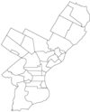
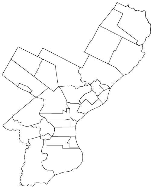
Northern Liberties is located north of Center City (specifically, Old City) and is bordered by Girard Avenue to the north; Callowhill Street to the south; North 6th Street to the west; and the Delaware River to the east (from Callowhill Street to Laurel Street; from Laurel Street to Girard Avenue the eastern boundary is North Front Street). The historical boundaries were slightly different, with Vine Street as the southern border and the Cohocksink Creek serving as the northern border. The creek now flows as a storm sewer under the following streets (starting at the Delaware River and running from southeast to northwest): Canal, Laurel, Bodine, Cambridge, and Orkney Streets.
History
Originally a portion of the Northern Liberties Township, the district first gained limited autonomy from the township by an Act of Assembly on March 9, 1771. The Act provided for the appointment of persons to regulate streets, direction of buildings, etc. By March 30, 1791 a second Act enabled the inhabitants of that portion of the Northern Liberties between Vine Street and Pegg’s Run (Cohoquinoque Creek) and the middle of Fourth Street and the Delaware River to elect three commissioners to lay taxes for the purpose of lighting, watching and establishing pumps within those bounds.
On March 28, 1803, the Legislature passed an act to incorporate that part of the township of the Northern Liberties lying between the west side of Sixth Street and the Delaware River and between Vine Street and Cohocksink Creek, thus creating the District of Northern Liberties. Under the Consolidation law the district ceased to exist in 1854, and become a part of Philadelphia.
 Map of Philadelphia County, Pennsylvania highlighting Northern Liberties District prior to the Act of Consolidation, 1854
Early in its history, the location just outside Philadelphia allowed the area to thrive in manufacturing, as mills, breweries, leather tanneries, paints and chemical works, tool making factories, and iron and stove foundries once lined the neighborhood. It also holds the status as a famous red-light district in the United States. Prior to annexation, the township was created as a less densely populated alternative to nearby Philadelphia. Because of this, it was later known colloquially as "Philadelphia's first suburb." However, the Southwark neighborhood claims this distinction as well.Artisan immigrants from Germany moved into Northern Liberties in great numbers in the 19th century. In the early 1900s, the area saw an influx of immigrants from Eastern Europe. Many left the challenges they faced in the Austria-Hungary Empire. Many were Slovak and they established St. Agnes Slovak Roman Catholic Church at Fourth and Brown Streets. Many Romanians settled in the area and they still worship at Holy Trinity Romanian Orthodox Church at American and Bodine Streets.
In 1985, the Northern Liberties Historic District was created, dedicated to preserving the Italianate architecture, Greek revival, and Federal style buildings which characterizes the area. The historic district is bounded by Brown, Boone and Galloway, Green and Wallace, and Fifth and Sixth Sts.
Today
In recent years, Northern Liberties has become a major enclave of young professionals, students, artists, and design professionals. Large improvement and revitalization projects have also been undertaken recently, causing a large jump in property values. The neighborhood's proximity to Center City has made it one of the city's most desirable development districts, both for commercial and residential real estate. Like most Philadelphia neighborhoods, the housing stock is primarily made up of rowhouses, although new development in recent times has brought apartment and condominium complexes.
Northern Liberties contains two privately owned but public parks, both established and owned by non-profits run by the neighbors. Orianna Hill Park is known as an off-leash area for dogs; the other, Liberty Lands, is a 2-acre (8,100 m2) park and playground.
Northern Liberties is served by SEPTA's Market-Frankford El with stops at Spring Garden and Girard. The station at Spring Garden is unique for being in the median of I-95. The elevated line's tracks then break away from the expressway's right-of-way to tower over Front Street through the neighborhood as it heads north away from Center City.
 German Society of Pennsylvania
In 2005, service resumed on SEPTA's long-delayed Girard Avenue trolley at the northern boundary of the neighborhood.
Economy
The area is home to numerous boutique stores and small bars and restaurants.
A Superfresh supermarket opened in August, 2011 on 2nd Street between Girard and Germantown Avenues, near a large mixed use development called The Piazza at Schmidts.Yards Brewing Company is located in Northern Liberties.[2]
Education
 The Daniel Boone School at Hancock and Wildey
Primary and Secondary Schools
Northern Liberties residents are assigned to schools in the School District of Philadelphia.
Residents south of Poplar Street are zoned to the General Philip Kearny School for grades Kindergarten through 8[3][4] and Benjamin Franklin High School[5] for high school.
Residents north of Poplar Street are zoned to James R. Ludlow School for grades Kindergarten through 8[3] and Kensington High School for grades 9 through 12.[6]
Other schools in Northern Liberties consist of:
Laboratory Charter School - Walter D. Palmer Leadership Academy - Bodine High School of International Affairs
Public libraries
Residents are served by the Ramonita de Rodriguez Branch of the Free Library of Philadelphia, which is located at 600 West Girard Avenue. The branch was known as the Girard Avenue Branch prior to the 1977 rename.[7]
Religious Life
Churches and Houses of Worship
- Immaculate Conception Catholic Church, Front and Allen Streets
- Seamens Church Institute, 475 N. 5th Street
- St. Andrew's Russian Orthodox Cathedral, 707 N 5th Street
- St. Peter's Catholic Church,/St. John Neumann Shrine 5th Street and Girard Avenue
- St. Michael's Russian Orthodox, 335 Fairmount Avenue
- Covenant House of God, 721 N 5th Street
- St. Agnes-St. John Slovak Catholic Church, 4th and Brown Streets
- Second Christian Missionary, 1150 N 4th Street
- Holy Trinity Romanian Orthodox Church, 723 N. Bodine Street
See also
External links
- NorthernLiberties.org NorthernLiberties.org - Created in 2001 - Home of the Northern Liberties Message Board, a bulletin board open to all.
- Northern Liberties Neighbors Association (NLNA)
- Northern Liberties Real Estate
- Read Northern Liberties blog and live there
- Friends of Orianna Hill Park
- Chronology of the Political Subdivisions of the County of Philadelphia, 1683-1854
- Information courtesy of ushistory.org
- Incorporated District, Boroughs, and Townships in the County of Philadelphia, 1854 By Rudolph J. Walther - excerpted from the book at the ushistory.org website
- Historic Photographs of Northern Liberties, PhillyHistory.org
References
- ^ "National Register Information System". National Register of Historic Places. National Park Service. 2007-01-23. http://nrhp.focus.nps.gov/natreg/docs/All_Data.html.
- ^ "Contact." Yards Brewing Company. Retrieved on March 14, 2010.
- ^ a b "K-8 Public Schools Boundary Map." Center City Schools. Retrieved on November 7, 2008.
- ^ "Philadelphia Neighborhoods." City of Philadelphia. Retrieved on November 7, 2008.
- ^ "Where the Graduates Go." Kearney School. Retrieved on November 7, 2008.
- ^ "Where the Graduates Go." James R. Ludlow School. Retrieved on November 7, 2008.
- ^ "Ramonita de Rodriguez Branch." Free Library of Philadelphia. Retrieved on November 7, 2008.
Neighborhoods of the North Philadelphia section of Philadelphia, Pennsylvania Allegheny West • Brewerytown • Cabot • Cedarbrook • East Oak Lane • Fairhill • Fairmount • Feltonville • Fern Rock • Francisville • Franklinville • Glenwood • Hartranft • Hunting Park • Ivy Hill • Logan • Ludlow • Nicetown-Tioga • North Central • Northern Liberties • Ogontz • Olde Kensington • Olney • Poplar • Sharswood • South Lehigh • Spring Garden • Stanton • Strawberry Mansion • Templetown • West Kensington • West Oak Lane • Yorktown

Incorporated Districts, Boroughs, and Townships in the County of Philadelphia, Pennsylvania prior to the Act of Consolidation, 1854 Aramingo Borough | Belmont District | Blockley Township | Bridesburg Borough | Bristol Township | Byberry Township | Delaware Township | Frankford Borough | Germantown Borough | Germantown Township | Kensington District | Kingsessing Township | Lower Dublin Township | Manayunk Borough | Moreland Township | Moyamensing District | Northern Liberties District | Northern Liberties Township | Oxford Township | Passyunk Township | Penn District | Penn Township | Philadelphia City | Roxborough Township | Richmond District | Southwark District | Spring Garden District | West Philadelphia Borough | Whitehall Borough
 Categories:
- Historic districts in Pennsylvania
- Neighborhoods in Philadelphia, Pennsylvania
- Municipalities in Philadelphia County prior to the Act of Consolidation, 1854
- National Register of Historic Places in Philadelphia, Pennsylvania
- Houses on the National Register of Historic Places in Pennsylvania
- Federal architecture in Pennsylvania
- Italianate architecture in Pennsylvania
- Buildings and structures completed in 1791
- Historic districts in Philadelphia, Pennsylvania
- Populated places established in 1771


Wikimedia Foundation. 2010.