- Majagua, Cuba
-
Majagua — Municipality — Location of Majagua in Cuba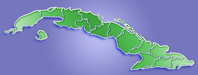

Coordinates: 21°55′28″N 78°59′26″W / 21.92444°N 78.99056°WCoordinates: 21°55′28″N 78°59′26″W / 21.92444°N 78.99056°W Country  Cuba
CubaProvince Ciego de Ávila Area[1] - Total 544 km2 (210 sq mi) Elevation 110 m (361 ft) Population (2004)[2] - Total 26,617 - Density 48.9/km2 (126.7/sq mi) Time zone EST (UTC-5) Area code(s) +53-43 Majagua is a municipality and city in the Ciego de Ávila Province of Cuba. It is located in the eastern part of the province, and is bisected by the Carretera Central highway.
In addition to the city, it includes the villages Guayacanes, Jicotea, Las Coloradas, and La Calera.
Demographics
In 2004, the municipality of Majagua had a population of 26,617.[2] With a total area of 544 km2 (210 sq mi),[1] it has a population density of 48.9 /km2 (127 /sq mi).
See also
References
- ^ a b Statoids (July 2003). "Municipios of Cuba". http://www.statoids.com/ycu.html. Retrieved 2007-10-06.
- ^ a b Atenas.cu (2004). "2004 Population trends, by Province and Municipality". Archived from the original on 2007-09-27. http://web.archive.org/web/20070927111826/http://www.atenas.inf.cu/todo/Estadisticas/TABLA+No_3balance.htm. Retrieved 2007-10-06. (Spanish)
Municipalities in Ciego de Ávila Province Baraguá · Bolivia · Chambas · Ciego de Ávila · Ciro Redondo · Florencia · Majagua · Morón (includes Cayo Coco) · Primero de Enero · Venezuela Categories:
- Populated places in Cuba
- Ciego de Ávila Province
- Cuba geography stubs

Wikimedia Foundation. 2010.