- Metro Villa de Cortés
-
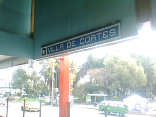
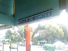 Overhead station sign and street beyond, 2008

Metro Villa de Cortés is a station on Line 2 of the Mexico City Metro system.[1][2] It is located in the Benito Juárez borough of Mexico City, directly south of the city centre on Calzada de Tlalpan.[1] It is a surface station.
The station logo depicts a helmet of the type used by the Spanish conquerors (conquistadores) who, led by Hernán Cortés, invaded the Aztec empire in the 16th century.[1] The name of this station comes from the area in which it is now located, which was known as the Villa de Cortés in colonial times.[1] The metro station opened on 1 August 1970.[3]
Metro Villa de Cortés provides a transfer with trolleybus Line "M", which runs between this station and the INFONAVIT Iztacalco neighbourhood.[4]
See also
References
- ^ a b c d "Villa de Cortés" (in Spanish). Sistema de Transporte Colectivo. http://www.metro.df.gob.mx/red/estacion.html?id=38. Retrieved 18 August 2011.
- ^ Archambault, Richard. "Villa de Cortés » Mexico City Metro System". http://mexicometro.org/metro/line2/villa-de-cortes/. Retrieved 18 August 2011.
- ^ Monroy, Marco. "Opening Dates for Mexico City's Subway". In Schwandl, Robert. http://www.urbanrail.net/am/mexi/mex-history.htm. Retrieved 18 August 2011.
- ^ "Servicios.- Servicio de Transportes Eléctricos del D.F.: Línea: M LINEA M CIRCUITO VILLA DE CORTÉS" (in Spanish). Servicio de Transportes Eléctricos. http://www.ste.df.gob.mx/servicios/consultaLinea.html?id_trolebus=M. Retrieved 18 August 2011.
External links
Preceding station Mexico City Metro Following station Xola Línea 2 Nativitas Transfer Stations Coordinates: 19°23′15″N 99°08′20″W / 19.38753°N 99.138994°W
Categories:- Mexico City metro stations
- Railway stations opened in 1970

Wikimedia Foundation. 2010.