- Boylston, Massachusetts
Infobox Settlement
official_name = Boylston, Massachusetts
nickname =
motto =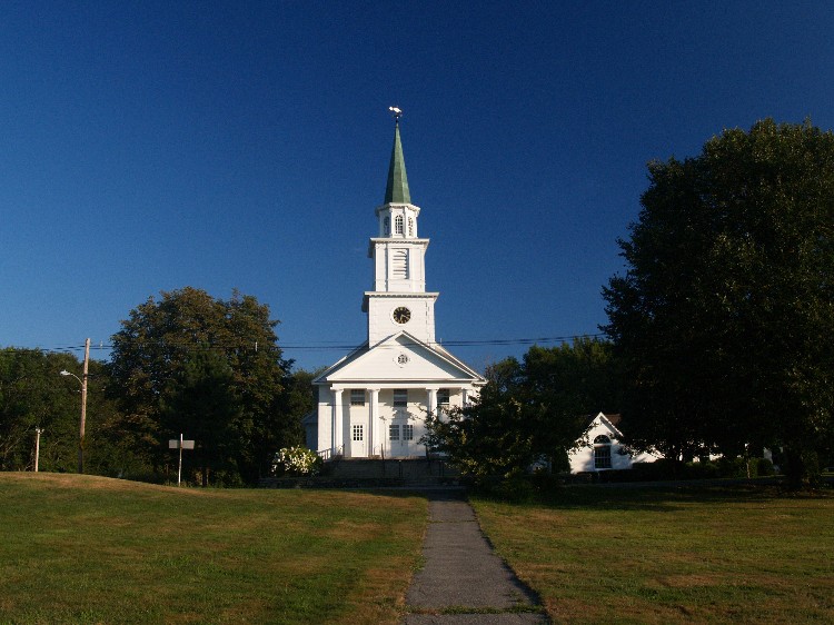
imagesize =
image_caption = Boylston Town Common
image_
mapsize = 250px
map_caption = Location in Worcester County in Massachusetts
mapsize1 =
map_caption1 =
subdivision_type = Country
subdivision_name =United States
subdivision_type1 = State
subdivision_name1 =Massachusetts
subdivision_type2 = County
subdivision_name2 = Worcester
established_title = Settled
established_date = 1705
established_title2 = Incorporated
established_date2 = 1786
established_title3 =
established_date3 =
government_type =Open town meeting
leader_title = Town
Administrator
leader_name = Joseph Connelly (interim)
leader_title1 =
leader_name1 =
area_magnitude =
area_total_km2 = 51.0
area_total_sq_mi = 19.7
area_land_km2 = 41.5
area_land_sq_mi = 16.0
area_water_km2 = 9.4
area_water_sq_mi = 3.6
population_as_of = 2000
settlement_type = Town
population_total = 4008
population_density_km2 = 96.5
population_density_sq_mi = 250.0
elevation_m = 135
elevation_ft = 443
timezone = Eastern
utc_offset = -5
timezone_DST = Eastern
utc_offset_DST = -4
latd = 42 |latm = 23 |lats = 30 |latNS = N
longd = 71 |longm = 42 |longs = 15 |longEW = W
website = [http://www.boylston-ma.gov/ www.boylston-ma.gov]
postal_code_type = ZIP code
postal_code = 01505
area_code = 508 / 774
blank_name = FIPS code
blank_info = 25-07525
blank1_name = GNIS feature ID
blank1_info = 0619478
footnotes =Boylston is a town in Worcester County,
Massachusetts ,United States . The population was 4,008 at the 2000 census.History
Boylston was first settled in 1705 and officiallyincorporated in 1786.
Geography
According to the
United States Census Bureau , the town has a total area of 19.7 square miles (51.0 km²), of which, 16.0 square miles (41.5 km²) of it is land and 3.6 square miles (9.4 km²) of it (18.50%) is water.The Town of Boylston is approximately convert|10.5|sqmi|km2 and consists of 12,652.8 acres (51 km²). With a population of approximately 4400 residents, the town is predominantly a residential community. The
Wachusett Reservoir , Boston's water source, lies in the northwestern part of the town and covers about 5000 acres (20 km²) of land. The town maintains approximately convert|45|mi|km of roadway, has convert|9|mi|km of sidewalks, and has its own Municipal Light Department, Water District, and volunteer fire and ambulance service.The town of Boylston is bordered by the towns of: Shrewsbury,
West Boylston , Sterling, Clinton, Berlin, and Northborough.Demographics
As of the 2000 census, there were 4,008 people, 1,573 households, and 1,140 families residing in the town. The
population density was 250.0 people per square mile (96.5/km²). There were 1,606 housing units at an average density of 100.2/sq mi (38.7/km²). The racial makeup of the town was 96.71% White, 0.67% African American, 0.22% Native American, 1.37% Asian, 0.25% from other races, and 0.77% from two or more races. Hispanic or Latino of any race were 0.57% of the population.There were 1,573 households out of which 33.2% had children under the age of 18 living with them, 63.9% were married couples living together, 6.6% had a female householder with no husband present, and 27.5% were non-families. 22.3% of all households were made up of individuals and 8.6% had someone living alone who was 65 years of age or older. The average household size was 2.55 and the average family size was 3.02.
In the town the population was spread out with 24.3% under the age of 18, 4.4% from 18 to 24, 31.3% from 25 to 44, 27.8% from 45 to 64, and 12.3% who were 65 years of age or older. The median age was 40 years. For every 100 females there were 99.0 males. For every 100 females age 18 and over, there were 96.5 males.
The median income for a household in the town was $67,703, and the median income for a family was $77,604. Males had a median income of $56,019 versus $43,277 for females. The
per capita income for the town was $32,274. About 2.4% of families and 2.8% of the population were below thepoverty line , including 0.5% of those under age 18 and 9.8% of those age 65 or over.Government
Infobox Mass Town Govt
county= Worcester
clerk_courts = Dennis P. McManus (D)
cty_treasurer = Position Eliminated
da = Joseph D. Early, Jr. (D)
deeds = Anthony J. Vigliotti (D)
probate = Stephen Abraham (D)
sheriff = Guy W. Glodis (D)
state_rep = Harold P. Naughton, Jr (D)
state_sen = Harriette L. Chandler (D)
gov_councilors = Thomas J. Foley (D)
fed_rep = James P. McGovern (D-3rd District),
fed_sen =Edward Kennedy (D)John Kerry (D)Education
Boylston currently operates a junior-senior high school with the neighboring town of Berlin, called the Tahanto Regional Middle/High School.
SeeBerlin-Boylston Regional School District .The school mascot is a stag, and the teams' colors are white and green. In 2005, the school erected the Traveling Vietnam Wall on campus.
Photos
References
External links
* [http://www.boylston-ma.gov/ Information about Boylston]
* [http://www.bbrsd.org/ Berlin-Boylston School District website]
Wikimedia Foundation. 2010.