- Montgomery Village, Maryland
-
Montgomery Village — CDP — Location of Montgomery Village, Maryland
Coordinates: 39°10′35″N 77°11′34″W / 39.17639°N 77.19278°WCoordinates: 39°10′35″N 77°11′34″W / 39.17639°N 77.19278°W Country United States State Maryland County Montgomery Area – Total 6.5 sq mi (16.9 km2) – Land 6.5 sq mi (16.8 km2) – Water 0.0 sq mi (0.1 km2) Elevation 371 ft (113 m) Population (2000) – Total 38,051 – Density 5,875.1/sq mi (2,268.4/km2) Time zone Eastern (EST) (UTC-5) – Summer (DST) EDT (UTC-4) ZIP codes 20877, 20879, 20886 Area code(s) 301, 240 FIPS code 24-53325 GNIS feature ID 1712797 Montgomery Village is a northern suburb of Gaithersburg in an unincorporated area in Montgomery County, Maryland, United States. It is a large, planned suburban community, developed in the late 1960s and 1970s right outside Gaithersburg city limits. Montgomery Village is a part of the Greater Gaithersburg Area which has a population of over 200,000 people.
Contents
Geography
Although Montgomery Village is an unincorporated area, its boundaries are defined according to Montgomery County zoning rules and by its own unique zipcode. Montgomery Village uses Gaithersburg addresses even though the village is outside city limits. Montgomery Village is recognized by the United States Census Bureau as a Census-designated Place, and by the United States Geological Survey as a populated place located at 39°10′35″N 77°11′34″W / 39.17639°N 77.19278°W (39.176469, -77.192654)[1].
According to the United States Census Bureau, the place has a total area of 6.5 square miles (17 km2), of which, 6.5 square miles (17 km2) of it is land and 0.04 square miles (0.10 km2) of it (0.46%) is water.
Demographics
As of the census[2] of 2000, there were 38,051 people, 14,142 households, and 9,729 families residing in the area. The population density was 5,875.1 people per square mile (2,267.2/km²). There were 14,548 housing units at an average density of 2,246.2 per square mile (866.8/km²). The current racial makeup of the area is 38.10% White, 23.20% African American, 0.20% Native American, 10.70% Asian, 0.00% Pacific Islander, .50% from other races, and 2.90% from two or more races. Hispanic or Latino of any race were 24.40% of the population.
There were 14,142 households out of which 36.8% had children under the age of 18 living with them, 52.5% were married couples living together, 12.6% had a female householder with no husband present, and 31.2% were non-families. 24.0% of all households were made up of individuals and 4.9% had someone living alone who was 65 years of age or older. The average household size was 2.68 and the average family size was 3.21.
In the area, the population was spread out with 26.6% under the age of 18, 7.5% from 18 to 24, 35.4% from 25 to 44, 23.5% from 45 to 64, and 7.0% who were 65 years of age or older. The median age was 34 years. For every 100 females there were 90.9 males. For every 100 females age 21 and over, there were 87.7 males.
The median income for a household in the area was $66,828, and the median income for a family was $74,920 (these figures had risen to $89,601 and $97,837 respectively as of a 2008 estimate[3]). Males had a median income of $50,046 versus $38,665 for females. The per capita income for the area was $29,620. About 3.9% of families and 7.1% of the population were below the poverty line, including 6.6% of those under age 18 and 3.4% of those age 65 or over.
History
Historical populations Census Pop. %± 1980 18,725 — 1990 32,315 72.6% 2000 38,051 17.8% source:[4] Montgomery Village was created in 1962 by Kettler Brothers, Inc. The vision for a planned community in Gaithersburg is credited to architect Charles Kettler, who incorporated Kettler Brothers with his brothers Milton and Clarence in 1952. The first land purchase was the Walker Farm in 1962. subsequent purchases were the Thomas Farm, The Mills Farm, The French Farm, The Patton Farm, The Fulks Farm, The Wilson Farm and The James Walter Deppa property. The Walker Farm was the largest of all the properties the Kettlers bought. It was 412 acres (1.67 km2) and now is Walkers Choice, Cider Mill, Horizon Run, Christopher Court, Dockside, Nathan’s Hill, Millrace, the Montgomery village Library, Montgomery Village Day-Care Center, the Off-Price Centers, Bayberry, the Verandahs, Grover’s Forge, Lake Whetstone, South Valley Park and part of Lakeforest Mall.
On Feb. 28, 1966, the Kettler brothers broke ground for the first house in Montgomery Village. The first model homes were opened in Lakeside of Whetstone in August 1967. In September, more opened in the Clusters of Stedwick. The Montgomery Village Golf Club also opened in September of that year. The first residents of Montgomery Village moved in on September 25, 1967 in Goshenside. They were the Bartik family. Also on the same day, the Crosby family moved into a home on Whetstone Drive.
The Montgomery Village Foundation was incorporated in 1966. In 1968, the Whetstone Community Center opened as well as Whetstone Elementary and Montgomery Village Middle schools. In 1970, The Village Mall opened, which is now the Village Shopping Center on Montgomery Village Avenue. Then in 1971, the Holiday Inn opened. In 1973, bus service to Washington, D.C. began.[5] In 1998, Montgomery Village began using its own zip code, 20886.[6]
Schools Supporting Montgomery Village, MD
Elementary Schools
- Watkins Mill Elementary
- Laytonsville Elementary
- Stedwick Elementary
- Goshen Elementary
- Whetstone Elementary
- Summit Hall Elementary
- South Lake Elementary
Middle schools
- Montgomery Village Middle School
- Gaithersburg Middle School
- Neelsville Middle School
- Forest Oak Middle School
High Schools
References
- ^ "US Gazetteer files: 2010, 2000, and 1990". United States Census Bureau. 2011-02-12. http://www.census.gov/geo/www/gazetteer/gazette.html. Retrieved 2011-04-23.
- ^ "American FactFinder". United States Census Bureau. http://factfinder.census.gov. Retrieved 2008-01-31.
- ^ 2006-2008 American Community Survey 3-Year Estimates
- ^ "CENSUS OF POPULATION AND HOUSING (1790-2000)". U.S. Census Bureau. http://www.census.gov/prod/www/abs/decennial/index.html. Retrieved 2010-07-17.
- ^ Montgomery Village Foundation - Village History
- ^ Top Montgomery Village news stories for 1998
External links
- Montgomery Village Foundation
- Personal Weather Station in Montgomery Village
- Montgomery Village Community Band
Municipalities and communities of Montgomery County, Maryland Cities 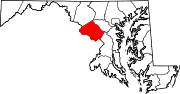
Towns Villages &
Special Tax DistrictsCDPs Ashton-Sandy Spring | Aspen Hill | Bethesda | Brookmont | Burtonsville | Cabin John | Calverton‡ | Chevy Chase | Clarksburg | Cloverly | Colesville | Damascus | Darnestown | Fairland | Forest Glen | Friendship Village | Germantown | Hillandale‡ | Kemp Mill | Montgomery Village | North Bethesda | North Kensington | North Potomac | Olney | Potomac | Redland | Rossmoor | Silver Spring | South Kensington | Travilah | Wheaton–Glenmont | White Oak
Other
communitiesAshton | Beallsville | Boyds | Brinklow | Carderock | Carole Highlands | Comus | Dawsonville | Derwood | Dickerson | Ednor | Fairview | Glenmont | Hyattstown | Kentlands | Norbeck | North Bethesda Market | Seneca | Sandy Spring | Shady Grove | Sherwood Forest | Spencerville | Wheaton
Footnotes ‡This populated place also has portions in an adjacent county or counties
Categories:- Unincorporated communities in Maryland
- Populated places in Montgomery County, Maryland
- Census-designated places in Maryland
- Populated places established in 1962


Wikimedia Foundation. 2010.