- Owls Head, Maine
-
Owls Head, Maine — Town — Glimpse of village and harbor in 1910 Location within the state of Maine
 Owls Head, Maine
Coordinates: 44°3′57″N 69°4′31″W / 44.06583°N 69.07528°W Country United States State Maine County Knox Incorporated 1921 Area – Total 19.6 sq mi (50.8 km2) – Land 8.9 sq mi (23.0 km2) – Water 10.7 sq mi (27.7 km2) Elevation 52 ft (16 m) Population (2000) – Total 1,601 – Density 180.1/sq mi (69.5/km2) Time zone Eastern (EST) (UTC-5) – Summer (DST) EDT (UTC-4) ZIP code 04854 Area code(s) 207 FIPS code 23-56135 GNIS feature ID 0582656 Owls Head is a town in Knox County, Maine, United States. The population was 1,601 at the 2000 census. A resort and fishing area, the community is home to the Knox County Regional Airport. It includes the village of Ash Point.
Contents
History
When Samuel de Champlain explored Owl's Head in 1605, the Abenaki Indians called it Bedabedec Point, meaning "Cape of the Winds." Mariners would name it for the shape of the promontory, which they thought resembled the head of an owl.[1] First incorporated as part of Thomaston in 1777, and then as part of South Thomaston in 1848, Owls Head was itself set off and incorporated on July 9, 1921. The town is home to both the Owls Head Light Station, a 30-foot (9.1 m) tall granite lighthouse built in 1826 to mark the southern entrance of Rockland Harbor, and to the Owls Head Transportation Museum.[2]
Owls Head was a filming location for the 2001 movie In the Bedroom.[3]
Geography
According to the United States Census Bureau, the town has a total area of 19.6 square miles (51 km2), of which, 8.9 square miles (23 km2) of it is land and 10.7 square miles (28 km2) of it (54.64%) is water. Located on the Owls Head peninsula, the town is on Penobscot Bay. The highest point in Owls Head is Post Hill, 194 feet (59m) high.
Demographics
 Owls Head Light and part of harbor viewed from the Owls Head Transportation Museum's Stearman Biplane, taken on 2003/10/5
As of the census[4] of 2000, there were 1,601 people, 723 households, and 469 families residing in the town. The population density was 180.1 people per square mile (69.5/km²). There were 992 housing units at an average density of 111.6 per square mile (43.1/km²). The racial makeup of the town was 98.94% White, 0.06% African American, 0.06% Native American, 0.19% Asian, 0.12% from other races, and 0.62% from two or more races. Hispanic or Latino of any race were 0.31% of the population.
There were 723 households out of which 21.3% had children under the age of 18 living with them, 56.2% were married couples living together, 6.2% had a female householder with no husband present, and 35.1% were non-families. 29.3% of all households were made up of individuals and 14.7% had someone living alone who was 65 years of age or older. The average household size was 2.20 and the average family size was 2.68.
In the town the population was spread out with 18.6% under the age of 18, 5.2% from 18 to 24, 22.3% from 25 to 44, 29.8% from 45 to 64, and 24.1% who were 65 years of age or older. The median age was 47 years. For every 100 females there were 92.9 males. For every 100 females age 18 and over, there were 88.0 males.
The median income for a household in the town was $40,107, and the median income for a family was $49,231. Males had a median income of $31,685 versus $21,970 for females. The per capita income for the town was $22,660. About 4.2% of families and 8.1% of the population were below the poverty line, including 11.0% of those under age 18 and 6.7% of those age 65 or over.
Sites of interest
- Birch Point State Park
- Mussel Ridge Historical Society
- Owls Head Light Station
- Owls Head Transportation Museum
References
- ^ History of Owls Head Light
- ^ Town History -- Owls Head, Maine
- ^ "IMDB listing of In The Bedroom filming locations". http://www.imdb.com/title/tt0247425/locations. Retrieved January 8, 2010.
- ^ "American FactFinder". United States Census Bureau. http://factfinder.census.gov. Retrieved 2008-01-31.
External links
Municipalities and communities of Knox County, Maine City 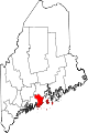
Towns Appleton | Camden | Cushing | Friendship | Hope | Isle au Haut | North Haven | Owls Head | Rockport | St. George | South Thomaston | Thomaston | Union | Vinalhaven | Warren | Washington
Plantation Unorganized
territoryCDPs Other
villagesCoordinates: 44°04′56″N 69°03′26″W / 44.08222°N 69.05722°W
Categories:- Towns in Knox County, Maine


Wikimedia Foundation. 2010.