- Chesterville, Maine
-
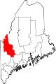
Chesterville, Maine — Town — Location within the state of Maine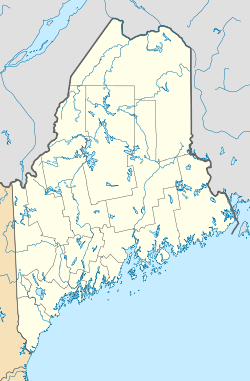
 Chesterville, Maine
Coordinates: 44°33′3″N 70°5′8″W / 44.55083°N 70.08556°W Country United States State Maine County Franklin Area – Total 37.6 sq mi (97.5 km2) – Land 36.5 sq mi (94.4 km2) – Water 1.2 sq mi (3.0 km2) Elevation 377 ft (115 m) Population (2000) – Total 1,170 – Density 32.1/sq mi (12.4/km2) Time zone Eastern (EST) (UTC-5) – Summer (DST) EDT (UTC-4) ZIP code 04938 Area code(s) 207 FIPS code 23-12595 GNIS feature ID 0582409 Chesterville is a town in Franklin County, Maine, United States. The population was 1,170 at the 2000 census.
Geography
According to the United States Census Bureau, the town has a total area of 37.6 square miles (97 km2), of which, 36.5 square miles (95 km2) of it is land and 1.2 square miles (3.1 km2) of it (3.11%) is water.
Demographics
As of the census[1] of 2000, there were 1,170 people, 467 households, and 324 families residing in the town. The population density was 32.1 people per square mile (12.4/km²). There were 684 housing units at an average density of 18.8 per square mile (7.2/km²). The racial makeup of the town was 98.46% White, 1.20% Asian, 0.09% from other races, and 0.26% from two or more races. Hispanic or Latino of any race were 0.51% of the population.
There were 467 households out of which 33.8% had children under the age of 18 living with them, 56.5% were married couples living together, 7.5% had a female householder with no husband present, and 30.6% were non-families. 22.1% of all households were made up of individuals and 7.7% had someone living alone who was 65 years of age or older. The average household size was 2.50 and the average family size was 2.94.
In the town the population was spread out with 25.0% under the age of 18, 7.6% from 18 to 24, 29.1% from 25 to 44, 27.3% from 45 to 64, and 10.9% who were 65 years of age or older. The median age was 38 years. For every 100 females there were 95.7 males. For every 100 females age 18 and over, there were 97.1 males.
The median income for a household in the town was $31,563, and the median income for a family was $35,938. Males had a median income of $29,615 versus $20,592 for females. The per capita income for the town was $15,376. About 10.0% of families and 12.7% of the population were below the poverty line, including 10.7% of those under age 18 and 15.2% of those age 65 or over.
References
- ^ "American FactFinder". United States Census Bureau. http://factfinder.census.gov. Retrieved 2008-01-31.
Municipalities and communities of Franklin County, Maine Towns Avon | Carrabassett Valley | Carthage | Chesterville | Eustis | Farmington | Industry | Jay | Kingfield | New Sharon | New Vineyard | Phillips | Rangeley | Strong | Temple | Weld | Wilton
Plantations Unorganized
territoriesCDPs Chisholm | Farmington | Wilton
Village Coordinates: 44°33′04″N 70°05′10″W / 44.55111°N 70.08611°W
Categories:- Towns in Franklin County, Maine


Wikimedia Foundation. 2010.