- Chalmette, Louisiana
-
Chalmette Census-designated place Country United States State Louisiana Parish St. Bernard Elevation 3 ft (0.9 m) Coordinates 29°56′44″N 89°57′42″W / 29.94556°N 89.96167°W Area 7.9 sq mi (20.5 km2) - land 7.3 sq mi (19 km2) - water 0.6 sq mi (2 km2), 7.59% Population 32,069 (2000) Density 4,369.6 / sq mi (1,687.1 / km2) Timezone CST (UTC-6) - summer (DST) CDT (UTC-5) Area code 504 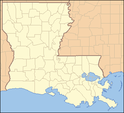
 Location of Chalmette in Louisiana
 Location of Louisiana in the United States
 Location of Chalmette, Louisiana, between the Mississippi River and MRGO canal, east and south of New Orleans.
Chalmette is a census-designated place (CDP) in and the parish seat of St. Bernard Parish, Louisiana, United States.[1] The population was 32,069 at the 2000 census. It is part of the New Orleans–Metairie–Kenner Metropolitan Statistical Area. Chalmette is located east of downtown New Orleans and south of Arabi, Louisiana, towards Lake Borgne.
The community was named after plantation owner I. Martin de Lino de Chalmette, whose surname is, in turn, derived from the French word chalmette— "pasture land, fallow land" (used especially in a mountainous area) — and has been traced to the Proto-Celtic *kalm.
Contents
History
Chalmette was the location of what is often called The Battle of New Orleans, where United States forces under Major General Andrew Jackson defeated the British, led by brevet Lieutenant General Sir Edward Pakenham in January, 1815. The battlefield is preserved as a national monument, and the military Chalmette National Cemetery is adjacent.
 Chalmette Battlefield, with house and monument along the Mississippi River.
Hurricane Katrina
On 29 August 2005, the 25-foot (7.6 m) storm surge from Hurricane Katrina overflowed through the Mississippi River Gulf Outlet (also commonly known as MR-GO) - a commercial channel dug by the Army Corps of Engineers in the 1960s - and flooded most of the town, with waters as high as 14 to 15 feet (4.9 m)[2] in some places. As a result, Chalmette was entirely destroyed. A majority of the population evacuated shortly before the storm hit, but there was still significant loss of life.
As of 25 October 2005, most of the buildings were deemed unsaveable. Despite findings published by the EPA, the toxic chemicals in the water from local oil refineries have been postulated to be an ongoing health hazard by several civilian ecological groups. Especially notable was the large oil spill originating in Chalmette's large Murphy Oil facility, where the storm surge knocked over a huge oil tank (see photo below).
 Hurricane Katrina: cars in Chalmette, Louisiana post-hurricane.
The parish administrative headquarters served as the site for a Federal Emergency Management Agency (FEMA) trailer park for numerous civil servants who were laboring in the rebuilding effort. A year later, parish employees were still working shifts around the clock to bring the community back to life.
Another center in the rebuilding effort was centered at Our Lady of Prompt Succor which served the congregations of the seven other Roman Catholic parishes as well as the main office of Catholic Relief Services. It also served as the only place to hold funerals for the first 12 months after Katrina.
 Hurricane Katrina aerial photo of oil spill in Chalmette, Louisiana, showing oil slick on streets (September 2005).
Deputies working for the St. Bernard Parish Sheriff stated in early December 2005 that the oil tank floated in the flood. When the water receded, the tank settled on uneven ground. Its structural integrity was compromised and the oil spill occurred. By late November, the Murphy facility was functional, as was a small cluster of businesses around the intersection of Paris Road and St. Bernard Highway, on the least damaged River side of Chalmette. The devastated residential areas further away from the River were open during daylight hours for residents to salvage belongings from their damaged residences. The majority of people staying in Chalmette full-time were living in trailers, that started to be supplied by FEMA or private enterprise on October 12; although many who had been promised FEMA trailer housing were still waiting as late as March 2006.
"Camp Premier", now "Camp Hope", was established as a base camp for the community rebuilding efforts, facilitating the work of relief organizations, the National Guard and private individuals. As of August 2007, the camp is located to P.G.T. Beauregard Middle School and is operated by Habitat for Humanity to provide for relief volunteers in St. Bernard Parish. Other relief organizations, such as the St. Bernard Project, have also participated in the rebuilding of Chalmette, from distributing supplies, to clearing debris, to preparing damaged houses for homeowners to return.
The Chalmette Battlefield was also partially flooded in low-lying areas, destroying the Visitor's Center, which was removed for rebuilding, and temporarily replaced with a house trailer to attempt re-opening the park for visitors in 2007.
Gradual recovery
 Mardi Gras 2006 in Chalmette: float #10 "The FEMA Ship" (click to enlarge)
St. Bernard Parish has celebrated Mardi Gras with parades in Chalmette. In February 2006, the krewe of the Knights of Nemesis held a parade, past many buildings still in ruins, along the streets of Chalmette.
As of early 2008, many businesses have returned to the area, schools have reopened, although the population remains significantly below pre-Katrina levels.
Due to Hurricane Katrina, the St. Bernard Parish School Board succeeded in getting a school open despite considerable difficulties, including telling FEMA that it would not wait for the agency. The parish opened the St. Bernard Unified School as a K-12 school in late 2005.
With the opening of the 2006-2007 school year, the Unified school reverted to Chalmette High School and now houses grades 8-12. The former Andrew Jackson High School has been repaired and now houses grades PK3-5. Trist Middle School houses grades 6 through 7.
The Catholic and private school sector was lost to Katrina.
The archdiocese of New Orleans has consolidated all local schools into one on the Our Lady of Prompt Succor campus. It has grades PK-8.
Geography
Chalmette is located at 29°56′44″N 89°57′42″W / 29.94556°N 89.96167°W (29.945504, -89.961602)[3], along the Mississippi River and has an elevation of 3 feet (0.9 m)[4]. It is located east of New Orleans, and is part of the Greater New Orleans Area.
According to the United States Census Bureau, the CDP has a total area of 7.9 square miles (20 km2), of which, 7.3 square miles (19 km2) of it is land and 0.6 square miles (1.6 km2) of it (7.56%) is water.
Chalmette is on the east bank of the Mississippi River, just downriver from Arabi, Louisiana, approximately 2 miles (3 km) from the border of New Orleans.
Demographics
As of the census[5] of 2000, there were 32,069 people, 12,321 households, and 8,821 families residing in the CDP. The population density was 4,369.6 people per square mile (1,686.9/km²). There were 12,896 housing units at an average density of 1,757.2 per square mile (678.4/km²). The racial makeup of the CDP was 92.69% White, 2.39% African American, 0.44% Native American, 1.80% Asian, 0.03% Pacific Islander, 0.95% from other races, and 1.71% from two or more races. Hispanic or Latino of any race were 4.81% of the population.
There were 12,321 households out of which 31.8% had children under the age of 18 living with them, 52.3% were married couples living together, 14.7% had a female householder with no husband present, and 28.4% were non-families. 23.7% of all households were made up of individuals and 10.0% had someone living alone who was 65 years of age or older. The average household size was 2.57 and the average family size was 3.04.
In the CDP the population was spread out with 23.7% under the age of 18, 10.0% from 18 to 24, 28.1% from 25 to 44, 23.9% from 45 to 64, and 14.3% who were 65 years of age or older. The median age was 37 years. For every 100 females there were 94.6 males. For every 100 females age 18 and over, there were 91.1 males.
The median income for a household in the CDP was $36,699, and the median income for a family was $43,804. Males had a median income of $33,916 versus $24,896 for females. The per capita income for the CDP was $17,480. About 9.2% of families and 12.0% of the population were below the poverty line, including 16.5% of those under age 18 and 8.5% of those age 65 or over.
Education
Chalmette is served by the St. Bernard Parish Public Schools district.
As of 2007, Chalmette is served by three schools in unincorporated areas:
- Andrew Jackson Elementary School (in Chalmette)
- Trist Middle School (in the community of Meraux)
- Chalmette High School (in Chalmette)
Before Katrina, Chalmette was served by other schools including:
- C.F. Rowley Elementary School
- Joseph J. Davies Elementary School
- Lacoste Elementary School
- Lynn Oaks (K-7)
- Our Lady of Prompt Succor Catholic School (K-8)
- Chalmette Middle School
- Andrew Jackson Fundamental Magnet High School (now the site of Andrew Jackson Elementary School, soon to be Andrew Jackson Middle School)
- St. Bernard High School
- Archbishop Hannan High School
- Arabi Elementary (formerly Arabi Park Middle)
- Saint Mark Elementary
- Saint Louise Elementary
- Saint Robert Bellarmine Catholic School (Pre-K- 8)
- Sebastion Roy Elementary
- P.G.T Beauregard
See also
- Andrew Jackson Fundamental Magnet High School
- Chalmette High School
- Chalmette National Cemetery
- Nita Rusich Hutter
- Mississippi River Gulf Outlet
- Samuel B. Nunez, Jr.
- Leander Perez
- Jean Lafitte National Historical Park and Preserve
- The Colony U.S. TV series
References
- ^ "Find a County". National Association of Counties. http://www.naco.org/Counties/Pages/FindACounty.aspx. Retrieved 2011-06-07.
- ^ "Six months Later—A Vision of Chaos, Determination, Courage, and Generosity" (report), Heidi (health care worker), St. Bernard Parish Medical HHS Clinic, Chalmette, LA, webpage: ADC: notes how flood trapped people in attics, in standing water.
- ^ "US Gazetteer files: 2010, 2000, and 1990". United States Census Bureau. 2011-02-12. http://www.census.gov/geo/www/gazetteer/gazette.html. Retrieved 2011-04-23.
- ^ "US Board on Geographic Names". United States Geological Survey. 2007-10-25. http://geonames.usgs.gov. Retrieved 2008-01-31.
- ^ "American FactFinder". United States Census Bureau. http://factfinder.census.gov. Retrieved 2008-01-31.
External links
- Chalmette Battlefield - Visitor Information: from National Park Service, nps.gov.
- Chalmette photos after Hurricane Katrina, photos of Katrina damage in Wikimedia Commons.
- Chalmette photos after Hurricane Katrina on KatrinaDestruction.com, from late September 2005.
Municipalities and communities of St. Bernard Parish, Louisiana Parish seat: ChalmetteCDPs 
Unincorporated
communitiesCaernarvon | Contreras | Delacroix Island | Hopedale | Kenilworth | Reggio | Sebastopol | Shell Beach | Toca | Verret | Versailles | Yscloskey
Ghost towns Categories:- Census-designated places in Louisiana
- Populated places in St. Bernard Parish, Louisiana
- Greater New Orleans
- Places affected by Hurricane Katrina
- Parish seats in Louisiana


Wikimedia Foundation. 2010.