- Napoleonville, Louisiana
-
"Napoleonville" redirects here. For the town in northwestern France that briefly bore this name, see Pontivy.
Village of Napoleonville Village Country United States State Louisiana Parish Assumption Elevation 20 ft (6.1 m) Coordinates 29°56′16″N 91°01′36″W / 29.93778°N 91.02667°W Area 0.2 sq mi (0.5 km2) - land 0.2 sq mi (1 km2) - water 0.0 sq mi (0 km2), 0% Population 686 (2000) Density 3,917.9 / sq mi (1,512.7 / km2) Timezone CST (UTC-6) - summer (DST) CDT (UTC-5) Area code 985 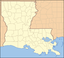
 Location of Napoleonville in Louisiana
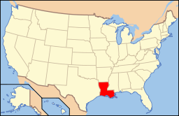 Location of Louisiana in the United States
Napoleonville is a village in and the parish seat of Assumption Parish, in the U.S. state of Louisiana.[1] The population was 686 at the 2000 census. It is part of the Pierre Part Micropolitan Statistical Area.
Contents
History
As early as 1807 the community that later became Napoleonville was known as "Canal." This canal extended west from Napoleonville to Lake Verret.[2] The town was named by a soldier who served under Napoleon Bonaparte.
The first permanent settlements in this region were made by the French and Spanish (including Islenos) about the middle of the 18th century along Bayou Lafourche, between the present towns of Donaldsonville and Napoleonville. From 1755 to 1764, the population was increased by the immigration of the exiled Acadians who entered the area clearing the land and building comfortable homes. The town was officially incorporated on March 11, 1878.[3]
Geography
Napoleonville is located at 29°56′16″N 91°1′36″W / 29.93778°N 91.02667°W (29.937778, -91.026750)[4].
According to the United States Census Bureau, the village has a total area of 0.2 square miles (0.5 km²), all land.
Demographics
As of the census[5] of 2000, there were 686 people, 246 households, and 170 families residing in the village. The population density was 3,917.9 inhabitants per square mile (1,471.5/km²). There were 288 housing units at an average density of 1,644.8 per square mile (617.8/km²). The racial makeup of the village was 29.01% White, 69.83% African American, 0.44% Native American, and 0.73% from two or more races. Hispanic or Latino of any race were 0.29% of the population.
There were 246 households out of which 30.1% had children under the age of 18 living with them, 37.0% were married couples living together, 27.6% had a female householder with no husband present, and 30.5% were non-families. 25.2% of all households were made up of individuals and 12.6% had someone living alone who was 65 years of age or older. The average household size was 2.79 and the average family size was 3.40.
In the village the population was spread out with 28.1% under the age of 18, 10.1% from 18 to 24, 26.8% from 25 to 44, 21.1% from 45 to 64, and 13.8% who were 65 years of age or older. The median age was 34 years. For every 100 females there were 81.5 males. For every 100 females age 18 and over, there were 75.4 males.
The median income for a household in the village was $18,977, and the median income for a family was $21,339. Males had a median income of $26,750 versus $16,607 for females. The per capita income for the village was $12,005. About 31.4% of families and 31.8% of the population were below the poverty line, including 48.8% of those under age 18 and 16.7% of those age 65 or over.
Notable natives and residents
- Paul Carmouche, former District Attorney of Caddo Parish
- Papa Celestin, Jazz bandleader
- Joe Harrison, state representative
- Brandon Jacobs, NFL running back
- Charles Melancon, former U.S. representative
- Risley C. Triche, attorney; former state representative
- Tramon Williams, NFL cornerback
- Kim Willoughby, Team USA Volleyball (2008 Beijing Olympics)
National Guard
The village is home to the 928th Sapper Company, a combat engineer unit of the 769th Engineer Battalion of the Louisiana Army National Guard which in turn is headquartered at Baton Rouge, Louisiana. Both of these units belong to the 225th Engineer Brigade headquartered at Camp Beauregard near Pineville, Louisiana.
Twin towns
The town maintains twinning links with:
 Pontivy (Napoléonville in 1804), France since 1989
References
- ^ "Find a County". National Association of Counties. http://www.naco.org/Counties/Pages/FindACounty.aspx. Retrieved 2011-06-07.
- ^ www.rootsweb.com "History of Assumption Parish"
- ^ www.lsuagcenter.com "The History of Assumption Parish"
- ^ "US Gazetteer files: 2010, 2000, and 1990". United States Census Bureau. 2011-02-12. http://www.census.gov/geo/www/gazetteer/gazette.html. Retrieved 2011-04-23.
- ^ "American FactFinder". United States Census Bureau. http://factfinder.census.gov. Retrieved 2008-01-31.
Municipalities and communities of Assumption Parish, Louisiana Parish seat: NapoleonvilleVillage Napoleonville

CDPs Unincorporated
communitiesAlbermarie | Belle Alliance | Belle River | Belle Terre | Boeuf | Brule | Bruly St. Martin | Cancienne | Cedar Grove Plantation | Chula | Church Spur | Elm Hall | Elmfield | Enola | Foley | Freetown | Georgia | Glenwood | Himalaya | Ingleside | Klotzville | Leche | Little Texas | Madewood | Magnolia | Monty | Munsons | Oakley | Percie | Plattenville | Ratliff | St. Thomas | Star | Sweet Home | Westfield | Woodlawn
Categories:- Populated places established in 1807
- Populated places in Assumption Parish, Louisiana
- Villages in Louisiana
- Parish seats in Louisiana
- Populated places in Louisiana with African American majority populations


Wikimedia Foundation. 2010.