- Middlesboro, Kentucky
-
Middlesboro, Kentucky — City — Aerial view of Middlesboro
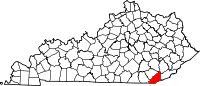
Motto: "Fac et Spera" translation: Do and Hope Location of Middlesboro, Kentucky
Coordinates: 36°36′37″N 83°43′24″W / 36.61028°N 83.72333°WCoordinates: 36°36′37″N 83°43′24″W / 36.61028°N 83.72333°W Country United States State Kentucky County Bell Incorporated March 14, 1890 Government – Type Mayor-Council – Mayor Bill Kelley – City Clerk Area – Total 7.6 sq mi (19.8 km2) – Land 7.6 sq mi (19.8 km2) – Water 0.0 sq mi (0.0 km2) Elevation 1,154 ft (352 m) Population (2000) – Total 12,384 – Density 1,359.1/sq mi (524.8/km2) Time zone Eastern (EST) (UTC-5) – Summer (DST) EDT (UTC-4) ZIP code 40965 Area code(s) 606 FIPS code 21-51924 GNIS feature ID 498153 Middlesboro, also spelled Middlesborough, is a city in Bell County, Kentucky, United States. The population was 10,384 at the 2000 census.[1] The estimated July 1, 2009 population of the city is 14,835.[2] The entire micropolitan area has a population of 69,060 (as of 2000 census)[3] which includes all of Bell County. It is the principal city of the Middlesborough, KY Micropolitan Statistical Area. Middlesboro is the largest city in Southeast Kentucky.[4]
The city was incorporated in 1890 as "Middlesborough", named after the town of Middlesbrough on the south bank of the River Tees in what was then the North Riding of Yorkshire, now known as North Yorkshire England. The U.S. Post Office began using the spelling "Middlesboro" in 1894.[5] Both spellings are used interchangeably; for example, the city's school district uses the Middlesboro spelling,[6] as does the Kentucky Secretary of State's Land Office.[7]
The city is located on the Kentucky side of the Cumberland Gap near the Cumberland Gap National Historical Park.
As the coal industry has declined over the last several years, the area has been increasingly hoping for a growth in tourism, primarily from the nearby national park. Pine Mountain State Resort Park is also located in nearby Pineville.
The town is home to the Middlesboro Country Club. Founded in 1889, the 9-hole course is one of the oldest golf courses in the country. The club also claims to be the oldest continuously played course in the nation. Pianist Ben Harney originated ragtime music in Middlesboro in the early 1890s, inspired by the fusion of African-American and local music styles heard in the community's saloons.[8]
Geologists believe that the Middlesboro basin between Pine Mountain and the Cumberland Mountains is the remains of an ancient meteorite crater, which would give the town the rare distinction of being one of the few cities in the world completely built inside a crater. The crater is one of three known astroblemes in the state.
Middlesboro was recently featured on the History Channel's "How The States Got Their Shapes" on an episode titled Forces of Nature. The city was also one of BBC's "Seven Wonders of the Solar System."[9]
Contents
History
In 1674 the first known white man passed through the area, Gabriel Arthur. He was followed by the explorers Dr. Thomas Walker in 1750 and Daniel Boone in 1769.[10] It was not until 1886 that the story of Middlesborough began. In that year a businessman from Knoxville, Tennessee made his first trip to the region. Alexander Alan Arthur was the son of a Scotsman, though he spent much of his early life in Montreal. He saw great promise in the region and after surveying the land he went to Asheville, North Carolina in an attempt to raise funds to begin development of the city he envisioned. The wealthy of America's Gilded Age had mansions around Asheville, and while Arthur was successful in garnering support from the sons of the these families, the patriarchs were not as eager. Not to be dissuaded, Arthur traveled to England to raise funds.[10]
Arthur, after the land was surveyed again, was able to raise substantial funds to begin his grand city. All looked well at first and development was rapid. Just south of the Cumberland Gap, in the area of Lincoln Memorial University today, a grand resort hotel had been built. The Four Seasons Hotel contained some 700 rooms, including a 200-room spa and sanitarium. $1.5 million was spent to build and furnish the hotel in 1892.[10] However, fires and poor quality iron ore left the project's coffers empty with nothing to refill them (which steel production was meant to do). An 1890 fire and the 1893 U.S. stock market decline further mired the dream of Alexander Arthur.[10]
 View of Middlesboro from Cumberland Gap National Historical Park
The city continued to have troubles and triumphs as it changed and grew. Like the rest of America, it was affected greatly with the Great Depression but quickly recovered, installing the first electric street cars of any municipality west of Washington, D.C. The 1930s was an era when Middlesboro saw a rapid change. Then known as "Little Las Vegas," the town had no shortage of slot machines, saloons, and brothels.[11] The city kept changing with the decades and in the 1950s had a population of roughly 15,000 residents. The nickname "The Athens of the Mountains" was given to the city due to its large support for the arts. Middlesboro was one of the few cities in Eastern Kentucky to boast a grand opera house and one of the finest school districts in the state. The first shopping mall was built in the city sometime during the 1960s. The 1970s decade brought a revival in the coal industry and the city once again prospered. Middlesboro began looking forward to turning 100 years old in the late 1980s and held a grand centennial celebration in 1990 that included a ball, air show, beauty pageant, an establishment of a new city park, along with many other things to help celebrate the huge milestone. The city started to prepare for the future and looked for new ways to prosper with the opening of the Cumberland Gap Tunnel in 1996.[12]
Currently, Middlesboro is investing in downtown revitalization to help create new business and give the city a better image. In 2004, Discover Downtown Middlesboro, Inc. was formed to promote and lead the revamping of the historic downtown area. Since its inception, Discover Downtown Middlesboro has helped numerous businesses receive a face-lift and has restored the historic Fountain Square in downtown. In June 2011 a severe flash flood damaged many homes and businesses in Middlesboro. Following a rainfall of 8.5" in 48 hours, the waterways could not cope with the deluge. Two area residents perished in the flood, and dozens were left homeless.
Geography
Middlesboro is located at 36°36′37″N 83°43′24″W / 36.61028°N 83.72333°W (36.610146, -83.723230)[13]. The city sits just inside the Cumberland Gap, along U.S. Route 25E, and is believed to have been built inside a meteorite crater.
According to the United States Census Bureau, the city has a total area of 7.6 square miles (20 km2), all of it land. U.S. 25E provides four-lane connection to Interstate 75 at Corbin, 45 miles to the northwest. With the recently completed renovations on U.S. 25E, travelers now have four-lane connection to Interstate 81 at Morristown, Tennessee, 45 miles to the south.
Climate
Middlesboro distinctly experiences all four seasons, with vivid fall foliage and snow in the winter. Average high is 87 °F in July, the warmest month, with the average lows of 24 °F occurring in January, the coolest month. The highest recorded temperature was 112 °F in July 1930. The lowest recorded temperature was -18 °F in January 1985. Average annual precipitation is 42.8 inches (1,090 mm), with the wettest month being March, averaging 5.25 inches (133 mm).
Climate data for Middlesboro, Kentucky Month Jan Feb Mar Apr May Jun Jul Aug Sep Oct Nov Dec Year Record high °F (°C) 77
(25)79
(26)93
(34)93
(34)100
(38)102
(39)112
(44)105
(41)104
(40)94
(34)82
(28)78
(26)112
(44)Average high °F (°C) 45
(7)50
(10)58
(14)68
(20)76
(24)83
(28)87
(31)86
(30)80
(27)69
(21)58
(14)48
(9)67 Average low °F (°C) 24
(−4)26
(−3)33
(1)39
(4)48
(9)58
(14)62
(17)62
(17)56
(13)43
(6)34
(1)27
(−3)43 Record low °F (°C) −18
(−28)−14
(−26)−4
(−20)20
(−7)26
(−3)34
(1)42
(6)40
(4)30
(−1)16
(−9)3
(−16)−11
(−24)−18
(−28)Precipitation inches (mm) 4.86
(123.4)3.91
(99.3)5.25
(133.4)3.91
(99.3)5.08
(129)4.63
(117.6)4.35
(110.5)4.41
(112)2.97
(75.4)3.13
(79.5)4.35
(110.5)4.44
(112.8)51.29
(1,302.8)Source: The Weather Channel.[14] Demographics
Historical populations Census Pop. %± 1890 3,271 — 1900 4,162 27.2% 1910 7,305 75.5% 1920 8,041 10.1% 1930 10,850 34.9% 1940 11,777 8.5% 1950 14,482 23.0% 1960 12,607 −12.9% 1970 11,878 −5.8% 1980 12,251 3.1% 1990 11,328 −7.5% 2000 10,384 −8.3% Est. 2009 9,835 [2] −5.3% U.S. Census Bureau[15] As of the census[16] of 2000, there were 10,384 people, 4,443 households, and 2,927 families residing in the city. The population density was 1,359.1 people per square mile (524.8/km²). There were 4,955 housing units at an average density of 648.5 per square mile (250.4/km²). The racial makeup of the city was 92.84% White, 4.90% African American, 0.38% Native American, 0.63% Asian, 0.04% Pacific Islander, 0.19% from other races, and 1.02% from two or more races. Hispanics or Latinos of any race were 0.79% of the population.
There were 4,443 households out of which 28.4% had children under the age of 18 living with them, 43.1% were married couples living together, 18.3% had a female householder with no husband present, and 34.1% were non-families. 31.5% of all households were made up of individuals and 14.2% had someone living alone who was 65 years of age or older. The average household size was 2.30 and the average family size was 2.88.
The age distribution was 23.6% under the age of 18, 8.9% from 18 to 24, 26.6% from 25 to 44, 23.9% from 45 to 64, and 17.0% who were 65 years of age or older. The median age was 39 years. For every 100 females there were 83.5 males. For every 100 females age 18 and over, there were 78.1 males.
The median income for a household in the city was $19,565, and the median income for a family was $25,016. Males had a median income of $23,285 versus $19,040 for females. The per capita income for the city was $13,189. About 24.4% of families and 28.1% of the population were below the poverty line, including 41.2% of those under age 18 and 16.5% of those age 65 or over.
Transportation
The city's main thoroughfare is U.S. 25E. The U.S. 25E Tunnel (a.k.a. the Cumberland Gap Tunnel) is a .87-mile (1.40 km) tunnel that travels underneath the famous Cumberland Gap. The northern terminus is located in Middlesboro and the southern terminus is in Cumberland Gap, Tennessee.[12] Middlesboro is one of the few cities in Kentucky that was not built on or near a significant waterway, so it is not reachable by water. The only major body of water near the city is Fern Lake, a small lake that sits on the Kentucky-Tennessee border. A man-made waterway called Yellow Creek Canal flows through the heart of the city. It is built and maintained by the U.S. Army Corps of Engineers.
Middlesboro is served by the Middlesboro-Bell County Airport, which is a single runway, general aviation airport. The airport was established in 1944, however, the first recorded flight into the city was in 1912. It serves as the home for 45 aircraft and more than 16,000 operations annually. The Middlesboro-Bell County Airport was also the home of the famed P-38 Lightning, Glacier Girl. The aircraft was restored on site at the airport, where she made her first maiden flight in October of 2002. The airport has recently undergone a major renovation, including the addition of a brand new terminal that features public restrooms, lounge, kitchen, and a radio room that can be used for up-to-date weather information. Other renovations/additions include a jet fuel tank, which will allow more air traffic to use the facility. In the near future, the airport plans to widen and expand the current runway and taxiway, plus add new hangars for aircraft, new runway lighting, and an Aircraft Weather Observation System (AWOS). The Middlesboro-Bell County Airport is one of ten airports to receive this new system. The closest major airport to Middlesboro is the McGhee Tyson Airport in Knoxville, Tennessee, which is 75.5 miles (121.5 km) or about 1 hour 40 minutes away.
Unlike many other American cities, Middlesboro does not have a traditionally named Main Street. The city's equivalent street is named Cumberland Avenue, which runs through Middlesboro's historic downtown district. Discover Downtown Middlesboro, Inc. (DDM) is a non-profit downtown revitalization effort charged with the restoration of the downtown area. DDM has been around since 2004 and since then, has restored Middlesboro's famed Fountain Square, completed many historical murals in town, started and formed a farmer's market, updated signage in the downtown area, and received grants for new plantings for the numerous planters that line Cumberland Avenue. Many of the streets which run parallel to Cumberland Avenue (east-west) are named for peerages and locales in Britain, while perpendicular (north-south) streets are named numerically. U.S. 25E is also known as 12th street, with higher numbers found as one moves west.
Twin town
Middlesboro is twinned with:
 Middlesbrough, England, UK:[17]
Notable residents
- Lee Majors, American actor.
- Trish Suhr, comedian and star of the TV show Clean House.
- Susan Kingsley, stage and movie actress.
- Gerry Bussell, American football defensive back for Denver Broncos.
- Julie Parrish, American film, stage and television actress.
- Van "Piano Man" Walls, American rhythm and blues piano player.
- William McElwee Miller, American missionary to Persia and author.
- Johnnie Sue Bridges, American author and photographer.
- Leonard F. Mason, Medal of Honor recipient.
- David Grant Colson, U.S. Representative from. Kentucky.
- Georgia Turner, singer of the Rising Sun Blues.
- Msgt. Michael King, former Crew Chief of Air Force One.
- Ben Harney, although not a permanent resident of Middlesboro, gained his inspiration to create ragtime music from the country, Southern tunes played in the city's bars at the time and blended it with African-American music styles. This new genre became known as ragtime. Therefore, ragtime is considered to have been created in Middlesboro. Downtown Middlesboro features a giant mural of a sheet music cover featuring "The Father of Ragtime," Ben Harney, and the role Middlesboro played in creating ragtime music.
See also
References
- ^ American Factfinder Retrieved on 2010-03-11
- ^ a b Annual Estimates of Resident Population for Incorporated Cities in Kentucky: April 1, 2000 to July 1, 2009 United States Census Bureau. Retrieved on 2010-07-08
- ^ "Table 1. Annual Estimates of the Population of Metropolitan and Micropolitan Statistical Areas: April 1, 2000 to July 1, 2009 (CBSA-EST2009-01)" (CSV). 2009 Population Estimates. United States Census Bureau, Population Division. 2010-03-23. http://www.census.gov/popest/metro/tables/2009/CBSA-EST2009-01.csv. Retrieved 2010-06-06.
- ^ Kleber, John E., ed (1992). The Kentucky Encyclopedia. Associate editors: Thomas D. Clark, Lowell H. Harrison, and James C. Klotter. Lexington, Kentucky: The University Press of Kentucky. ISBN 0813117720. Retrieved on 2010-06-29
- ^ University of Kentucky Atlas Retrieved on 2010-03-11
- ^ Middlesboro Independent Schools Retrieved on 2010-03-11
- ^ Kentucky Secretary of State's Land Office Retrieved on 2010-03-11
- ^ cityofmiddlesboro.org Retrieved on 2010-03-11
- ^ Woodward, Stephen (August 2009). "BBC comes to the 'Crater'". Middlesboro, KY, USA: Middlesboro Daily News. http://middlesborodailynews.com/bookmark/3237109. Retrieved 05 November 2011.
- ^ a b c d History of Middlesboro, Kentucky Retrieved on 2010-03-11
- ^ Schreiner, Bruce (January 11, 2010). "Midway College to Open Pharmacy School in Ky.". ABC News. http://abcnews.go.com/Business/wireStory?id=9531710. Retrieved 2010-02-07.
- ^ a b Cumberland Gap Tunnel National Park Service. Retrieved on 2010-08-17
- ^ "US Gazetteer files: 2010, 2000, and 1990". United States Census Bureau. 2011-02-12. http://www.census.gov/geo/www/gazetteer/gazette.html. Retrieved 2011-04-23.
- ^ "Monthly Averages for Middlesboro, KY". The Weather Channel. http://www.weather.com/weather/wxclimatology/monthly/USKY1149from=month_bottomnav_undeclared. Retrieved March 26, 2010.
- ^ Historical Census Data Retrieved on 2010-1-8
- ^ "American FactFinder". United States Census Bureau. http://factfinder.census.gov. Retrieved 2008-01-31.
- ^ "LGA Database of twinning towns (list printout pending database redevelopment)". http://www.lga.gov.uk/lga/core/page.do?pageId=29208. Retrieved 2009-07-02.
External links
- Middlesboro, Kentucky City Guide
- The Middlesboro Daily News
- Middlesboro Independent Schools
- Middlesborough History
Municipalities and communities of Bell County, Kentucky Cities Middlesboro | Pineville
Eastern Mountain Coal Fields Counties Cities and towns
10k-25kAshland • MiddlesboroCities and towns
5k-10kCities and towns
1k-5kBarbourville • Beattyville • Catlettsburg • Clay City • Cumberland • Elkhorn City • Evarts • Grayson • Greenup • Harlan • Hazard • Jackson • Jeffersonville • Jenkins • Louisa • Manchester • Olive Hill • Paintsville • Pineville • Prestonsburg • Raceland • Russell • Salyersville • South Shore • Stanton • West Liberty • Wheelwright • Whitesburg • Worthington • WurtlandCities and towns
under 1kAllen • Bellefonte • Benham • Blackey • Blaine • Booneville • Buckhorn • Camargo • Campton • Cedarville • Coal Run Village • Fleming-Neon • Frenchburg • Hindman • Hyden • Inez • Lakeview Heights • Loyall • Lynch • Martin • McKee • Pippa Passes • Sandy Hook • Vicco • Wallins Creek • Warfield • WaylandStatistical areas 50 most populous cities of Kentucky Categories:- Populated places in Bell County, Kentucky
- Cities in Kentucky
- Populated places established in 1890


Wikimedia Foundation. 2010.