- Maryland Route 920
-
Maryland Route 920

MD 920 (Market Lane) highlighted in redRoute information Maintained by MDSHA Location Counties: Somerset Highway system Maryland highway system
Interstate • US • State • Minor • Former • Turnpikes←  MD 918
MD 921  →
→Maryland Route 920 (MD 920) is a collection of unsigned state highways in the U.S. state of Maryland. These 19 highways are service roads constructed to restore access to private property or county highways whose access was compromised by the expansion of U.S. Route 13 to a partially-controlled access divided highway in the 1960s between West Pocomoke and Princess Anne in Somerset County. US 13 was expanded to a divided highway from the southern end of the Princess Anne bypass south past Kings Creek in 1962, south through Westover in 1963, and south to about 2 miles (3.2 km) north of MD 667 in 1964.[1][2][3] The Princess Anne bypass was expanded to a divided highway in 1965.[4] US 13's expansion to a four-lane highway in Maryland was completed in 1966 when the federal highway was expanded to a divided highway from north of MD 667 south past West Pocomoke to the southern end of the Pocomoke City bypass.[5]
- MD 920 is the designation for Market Lane, a 0.97-mile (1.56 km) service road that runs from US 13 adjacent to Bardwell Drive north to US 13 at its intersection with North Central School Road. The highway parallels the southbound side of US 13, with its northern terminus just south of the southern terminus of MD 675 in Princess Anne. MD 920 provides access to the Princess Anne Shop of the Maryland State Highway Administration at its northern end.[6][7]
- MD 920A is the designation for Brittingham Lane, a 0.42-mile (0.68 km) service road that runs from MD 362 in Princess Anne north to a dead end, paralleling the southbound side of US 13.[6][8]
- MD 920B is the designation for Spring Lane, a 0.32-mile (0.51 km) service road that runs from the intersection of US 13 and MD 673A (Sam Barnes Road) north to Camp Road in Westover, paralleling the northbound side of US 13. MD 920B provides access to a park and ride near its southern terminus.[6][9]
- MD 920C is the designation for Sawmill Lane, a 0.17-mile (0.27 km) service road that runs from the intersection of US 13 and Old Princess Anne Road east to a dead end in Westover, paralleling the southbound side of US 13.[6][10]
- MD 920D is the designation for Lisa Lane, a 0.42-mile (0.68 km) service road that runs between two dead ends on the northbound side of US 13 near Westover. The road is connected to US 13 by a spur in the middle of its length.[6][11]
- MD 920F is the designation for Tips Lane, a 0.08-mile (0.13 km) service road that heads east from the intersection of US 13 and MD 920H (Fortune Lane). The road meets MD 920G, then turns north to a dead end.[6][12]
- MD 920G is the designation for another segment of Tips Lane, a 0.09-mile (0.14 km) service road that heads east from MD 920F, paralleling the northbound side of US 13.[6][13]
- MD 920H is the designation for Fortune Lane, a 0.09-mile (0.14 km) service road that heads south from the intersection of US 13 and MD 920F, then turns west to a dead end.[6][14]
- MD 920J is the designation for Lake Somerset Road, a 0.23-mile (0.37 km) service road that runs from a dead end east to the entrance to Lake Somerset Camp. The road, which parallels the southbound side of US 13, is connected to that highway by a spur adjacent to the eastern terminus.[6][15]
- MD 920K is the designation for Flea Market Lane, a 0.16-mile (0.26 km) service road that runs from Walter Johnson Road north to a dead end, paralleling the northbound side of US 13.[6][16]
- MD 920L is the designation for Greenhill Lane, a 0.83-mile (1.34 km) service road that runs from Mennonite Church Road east to a dead end, passing two churches while paralleling the southbound side of US 13.[6][17]
- MD 920M is the designation for an unnamed 0.04-mile (0.064 km) long service road that runs north from Walter Johnson Road near the county highway's southern intersection with US 13.[6][18]
- MD 920N is the designation for Dukes Lane, a 0.10-mile (0.16 km) service road that runs between two dead ends on the southbound side of US 13. The road is connected to US 13 by a spur toward its west end.[6][19]
- MD 920O is the designation for Cottman Lane, a 0.11-mile (0.18 km) service road that runs between two dead ends on the southbound side of US 13. The road is connected to US 13 by a spur toward its west end at US 13's northern intersection with Costen Road.[6][20]
- MD 920P is the designation for Woods Lane, a 0.28-mile (0.45 km) service road that runs from US 13 at its intersection with MD 920Q north, then turns west to parallel the northbound side of US 13.[6][21]
- MD 920Q is the designation for Quail Lane, a 0.20-mile (0.32 km) service road that runs from US 13 at its intersection with MD 920P south, then turns west to parallel the southbound side of US 13.[6][22]
- MD 920R is the designation for Fishing Hole Road, a 0.06-mile (0.097 km) service road that runs between two dead ends on the northbound side of US 13. The road is connected to US 13 by a spur in the middle of its length.[6]
- MD 920S is the designation for Short Lane, a 0.10-mile (0.16 km) service road that runs between two dead ends on the southbound side of US 13 near MD 920R. The road is connected to US 13 by a spur near its western end.[6]
- MD 920T is the designation for Dairy Lane, a 0.04-mile (0.064 km) service road that runs between two dead ends on the southbound side of US 13. The road is connected to US 13 by a spur in the middle of its length.[6]
References
- ^ Maryland State Roads Commission. Maryland: Official Highway Map (Map) (1962 ed.).
- ^ Maryland State Roads Commission. Maryland: Official Highway Map (Map) (1963 ed.).
- ^ Maryland State Roads Commission. Maryland: Official Highway Map (Map) (1964 ed.).
- ^ Maryland State Roads Commission. Maryland: Official Highway Map (Map) (1965 ed.).
- ^ Maryland State Roads Commission. Maryland: Official Highway Map (Map) (1966 ed.).
- ^ a b c d e f g h i j k l m n o p q r s "Highway Location Reference: Somerset County" (PDF). Maryland State Highway Administration. 2009. http://www.marylandroads.com/Location/2009_SOMERSET.pdf. Retrieved 2010-10-22.
- ^ Google, Inc. Google Maps – Maryland Route 920 (Map). Cartography by Google, Inc. http://maps.google.com/maps?f=d&source=s_d&saddr=Unknown+road&daddr=MD-920+N&hl=en&geocode=Fb5lRgId1RF9-w%3BFeWaRgIdXg99-w&mra=ls&sll=38.180661,-75.687851&sspn=0.003863,0.009645&ie=UTF8&t=h&z=15. Retrieved 2010-05-04.
- ^ Google, Inc. Google Maps – Maryland Route 920A (Map). Cartography by Google, Inc. http://maps.google.com/maps?f=d&source=s_d&saddr=Unknown+road&daddr=Manokin+Ave&hl=en&geocode=FZbHRQId-B95-w%3BFTLzRgIdqvZ8-w&mra=ls&sll=38.201514,-75.694041&sspn=0.007723,0.01929&ie=UTF8&t=h&z=12. Retrieved 2010-05-04.
- ^ Google, Inc. Google Maps – Maryland Route 920B (Map). Cartography by Google, Inc. http://maps.google.com/maps?f=d&source=s_d&saddr=Ocean+Hwy%2FUS-13+N&daddr=Spring+Ln&hl=en&geocode=FZTORQIdIvx8-w%3BFT7bRQIdAu98-w&mra=ls&sll=38.131924,-75.693569&sspn=0.00773,0.01929&ie=UTF8&t=h&z=17. Retrieved 2010-05-04.
- ^ Google, Inc. Google Maps – Maryland Route 920C (Map). Cartography by Google, Inc. http://maps.google.com/maps?f=d&source=s_d&saddr=Saw+Mill+Rd&daddr=Saw+Mill+Rd&hl=en&geocode=FRbARQIdqgp9-w%3BFeK3RQIdmhV9-w&mra=ls&sll=38.124024,-75.691574&sspn=0.007731,0.01929&ie=UTF8&t=h&z=17. Retrieved 2010-05-04.
- ^ Google, Inc. Google Maps – Maryland Route 920D (Map). Cartography by Google, Inc. http://maps.google.com/maps?f=d&source=s_d&saddr=Lisa+Ln&daddr=Lisa+Ln&hl=en&geocode=FXe7RQIdyhZ9-w%3BFd6xRQIdBjF9-w&mra=ls&sll=38.122091,-75.682717&sspn=0.001933,0.004823&ie=UTF8&t=h&z=17. Retrieved 2010-05-04.
- ^ Google, Inc. Google Maps – Maryland Route 920F (Map). Cartography by Google, Inc. http://maps.google.com/maps?f=d&source=s_d&saddr=Ocean+Hwy%2FUS-13+N&daddr=Tips+Ln&hl=en&geocode=FQKsRQIdjEF9-w%3BFSyvRQIdyDx9-w&mra=ls&sll=38.121087,-75.677819&sspn=0.007731,0.01929&ie=UTF8&t=h&z=19. Retrieved 2010-05-04.
- ^ Google, Inc. Google Maps – Maryland Route 920G (Map). Cartography by Google, Inc. http://maps.google.com/maps?f=d&source=s_d&saddr=Tips+Ln&daddr=Unknown+road&hl=en&geocode=FbqtRQIdSkJ9-w%3BFWyrRQIdgkt9-w&mra=ls&sll=38.120728,-75.6765&sspn=0.001933,0.004823&ie=UTF8&t=h&z=19. Retrieved 2010-05-04.
- ^ Google, Inc. Google Maps – Maryland Route 920H (Map). Cartography by Google, Inc. http://maps.google.com/maps?f=d&source=s_d&saddr=Fortune+Ln&daddr=Fortune+Ln&hl=en&geocode=FZCqRQIdPjB9-w%3BFTqrRQIdKEF9-w&mra=ls&sll=38.120724,-75.677937&sspn=0.003866,0.009645&ie=UTF8&t=h&z=18. Retrieved 2010-05-04.
- ^ Google, Inc. Google Maps – Maryland Route 920J (Map). Cartography by Google, Inc. http://maps.google.com/maps?f=d&source=s_d&saddr=Lake+Somerset+Rd&daddr=Lake+Somerset+Rd&hl=en&geocode=FdenRQIdTEx9-w%3BFUalRQIdmlt9-w&mra=ls&sll=38.118674,-75.670453&sspn=0.000483,0.001206&ie=UTF8&t=h&z=18. Retrieved 2010-05-04.
- ^ Google, Inc. Google Maps – Maryland Route 920K (Map). Cartography by Google, Inc. http://maps.google.com/maps?f=d&source=s_d&saddr=Flea+Market+Ln&daddr=Flea+Market+Ln&hl=en&geocode=FTqSRQIdgKd9-w%3BFauXRQIdQZx9-w&mra=ls&sll=38.114971,-75.65465&sspn=0.001933,0.004823&ie=UTF8&ll=38.114545,-75.652639&spn=0.001933,0.004823&t=h&z=18. Retrieved 2010-05-04.
- ^ Google, Inc. Google Maps – Maryland Route 920L (Map). Cartography by Google, Inc. http://maps.google.com/maps?f=d&source=s_d&saddr=Unknown+road&daddr=Greenhill+Ln&hl=en&geocode=FXWJRQIdCbF9-w%3BFfqfRQId5n19-w&mra=ls&sll=38.111456,-75.648787&sspn=0.000967,0.002411&ie=UTF8&t=h&z=16. Retrieved 2010-05-04.
- ^ Google, Inc. Google Maps – Maryland Route 920M (Map). Cartography by Google, Inc. http://maps.google.com/maps?f=d&source=s_d&saddr=Unknown+road&daddr=Unknown+road&hl=en&geocode=FSB_RQIdrsl9-w%3BFel9RQIdEcx9-w&mra=ls&sll=38.10859,-75.64235&sspn=0.001933,0.004823&ie=UTF8&t=h&z=20. Retrieved 2010-05-04.
- ^ Google, Inc. Google Maps – Maryland Route 920N (Map). Cartography by Google, Inc. http://maps.google.com/maps?f=d&source=s_d&saddr=Dukes+Ln&daddr=Unknown+road&hl=en&geocode=Fch9RQIdo8Z9-w%3BFRZ6RQIdnMx9-w&mra=ls&sll=38.108509,-75.641599&sspn=0.003866,0.009645&ie=UTF8&t=k&z=19. Retrieved 2010-05-04.
- ^ Google, Inc. Google Maps – Maryland Route 920O (Map). Cartography by Google, Inc. http://maps.google.com/maps?f=d&source=s_d&saddr=Unknown+road&daddr=Cottman+Rd&hl=en&geocode=FY9uRQId-d99-w%3BFQxrRQIdnOV9-w&mra=ls&sll=38.104392,-75.636618&sspn=0.000967,0.002411&ie=UTF8&ll=38.104269,-75.63602&spn=0.000967,0.002411&t=h&z=19. Retrieved 2010-05-04.
- ^ Google, Inc. Google Maps – Maryland Route 920P (Map). Cartography by Google, Inc. http://maps.google.com/maps?f=d&source=s_d&saddr=Wood+Ln&daddr=Wood+Ln&hl=en&geocode=FZZeRQId6P19-w%3BFQRpRQIdCPJ9-w&mra=ls&sll=38.103461,-75.633488&sspn=0.015467,0.038581&ie=UTF8&t=h&z=17. Retrieved 2010-05-04.
- ^ Google, Inc. Google Maps – Maryland Route 920Q (Map). Cartography by Google, Inc. http://maps.google.com/maps?f=d&source=s_d&saddr=Quail&daddr=Quail+Ln&hl=en&geocode=FYhdRQIdjv19-w%3BFfZdRQIdwPN9-w&mra=ls&sll=38.100388,-75.628703&sspn=0.007734,0.01929&ie=UTF8&t=h&z=18. Retrieved 2010-05-04.
External links
Roads in Somerset County, Maryland State highways 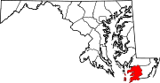
U.S. Highways Categories:- State highways in Maryland
- Roads in Somerset County, Maryland


Wikimedia Foundation. 2010.