- Douglass, Kansas
-
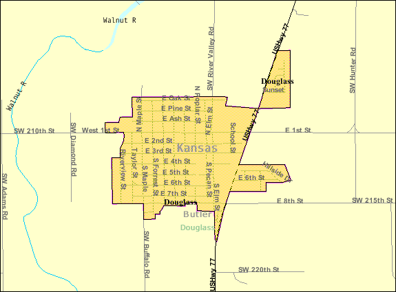
Douglass, Kansas — City — Location of Douglass, Kansas Detailed map of Douglass, Kansas
Coordinates: 37°31′0″N 97°0′42″W / 37.516667°N 97.01167°WCoordinates: 37°31′0″N 97°0′42″W / 37.516667°N 97.01167°W Country United States State Kansas County Butler Established 1869 Government – Mayor Jason Cathey Area – Total 0.8 sq mi (2.1 km2) – Land 0.8 sq mi (2.1 km2) – Water 0.0 sq mi (0.0 km2) Elevation 1,211 ft (369 m) Population (2010)[1] – Total 1,700 – Density 2,125/sq mi (820.5/km2) Time zone Central (CST) (UTC-6) – Summer (DST) CDT (UTC-5) ZIP code 67039 Area code(s) 316 FIPS code 20-18400[2] GNIS feature ID 0481864[3] Website CityOfDouglassKS.com Douglass is a city in Butler County, Kansas, United States. As of the 2010 census, the city population was 1,700.[1]
Contents
History
19th century
In 1877, the Florence, El Dorado, and Walnut Valley Railroad Company built a branch line from Florence to El Dorado, in 1881 it was extended to Douglass, and later to Arkansas City.[4] The line was leased and operated by the Atchison, Topeka and Santa Fe Railway. The line from Florence to El Dorado was abandoned in 1942.[5] The original branch line connected Florence, Burns, De Graff, El Dorado, Augusta, Douglass, Rock, Akron, Winfield, Arkansas City.
21st century
In 2010, the Keystone-Cushing Pipeline (Phase II) was constructed about 1.8 miles west of Douglass, north to south through Butler County, with much controversy over tax exemption and environmental concerns (if a leak ever occurs).[6][7]
Geography
Douglass is located at 37°31′0″N 97°0′42″W / 37.516667°N 97.01167°W (37.516802, -97.011705)[8]. According to the United States Census Bureau, the city has a total area of 0.8 square miles (2.1 km2), all of it land.
Demographics
Historical populations Census Pop. %± 1960 1,058 — 1970 1,126 6.4% 1980 1,450 28.8% 1990 1,722 18.8% 2000 1,813 5.3% 2010 1,700 −6.2% U.S. Decennial Census As of the census[2] of 2000, there were 1,813 people, 658 households, and 492 families residing in the city. The population density was 2,198.4 people per square mile (853.7/km²). There were 733 housing units at an average density of 888.8 per square mile (345.1/km²). The racial makeup of the city was 96.25% White, 0.28% African American, 1.60% Native American, 0.22% Asian, 0.50% from other races, and 1.16% from two or more races. Hispanic or Latino of any race were 1.65% of the population.
There were 658 households out of which 40.0% had children under the age of 18 living with them, 58.2% were married couples living together, 11.9% had a female householder with no husband present, and 25.1% were non-families. 21.1% of all households were made up of individuals and 9.3% had someone living alone who was 65 years of age or older. The average household size was 2.67 and the average family size was 3.13.
In the city the population was spread out with 30.5% under the age of 18, 9.3% from 18 to 24, 29.1% from 25 to 44, 16.4% from 45 to 64, and 14.7% who were 65 years of age or older. The median age was 33 years. For every 100 females there were 91.0 males. For every 100 females age 18 and over, there were 90.9 males.
The median income for a household in the city was $40,833, and the median income for a family was $49,875. Males had a median income of $37,000 versus $25,938 for females. The per capita income for the city was $17,965. About 4.5% of families and 6.1% of the population were below the poverty line, including 6.7% of those under age 18 and 7.0% of those age 65 or over.
See also
References
- ^ a b "2010 City Population and Housing Occupancy Status". U.S. Census Bureau. http://factfinder2.census.gov/faces/tableservices/jsf/pages/productview.xhtml?pid=DEC_10_PL_GCTPL2.ST13&prodType=table. Retrieved March 6, 2011.
- ^ a b "American FactFinder". United States Census Bureau. http://factfinder.census.gov. Retrieved 2008-01-31.
- ^ "US Board on Geographic Names". United States Geological Survey. 2007-10-25. http://geonames.usgs.gov. Retrieved 2008-01-31.
- ^ Marion County Kansas : Past and Present; Sondra Van Meter; MB Publishing House; LCCN 72-92041; 344 pages; 1972.
- ^ Railway Abandonment 1942
- ^ Keystone Pipeline - Marion County Commission calls out Legislative Leadership on Pipeline Deal; April 18, 2010.
- ^ Keystone Pipeline - TransCanada inspecting pipeline; December 10, 2010.
- ^ "US Gazetteer files: 2010, 2000, and 1990". United States Census Bureau. 2011-02-12. http://www.census.gov/geo/www/gazetteer/gazette.html. Retrieved 2011-04-23.
Further reading
- County
- History of Butler County Kansas; Vol P Mooney; Standard Publishing; 869 pages; 1916. (Download 68MB PDF eBook)
- Kansas
- History of the State of Kansas; William G. Cutler; A.T. Andreas Publisher; 1883. (Online HTML eBook)
- Kansas : A Cyclopedia of State History, Embracing Events, Institutions, Industries, Counties, Cities, Towns, Prominent Persons, Etc; 3 Volumes; Frank W. Blackmar; Standard Publishing Co; 944 / 955 / 824 pages; 1912. (Volume1 - Download 54MB PDF eBook), (Volume2 - Download 53MB PDF eBook), (Volume3 - Download 33MB PDF eBook)
External links
- City
- Schools
- USD 396, local school district
- Maps
- Douglass City Map, KDOT
- Butler County Map, KDOT
Municipalities and communities of Butler County, Kansas Cities 
Townships Augusta | Benton | Bloomington | Bruno | Chelsea | Clay | Clifford | Douglass | El Dorado | Fairmount | Fairview | Glencoe | Hickory | Lincoln | Little Walnut | Logan | Milton | Murdock | Pleasant | Plum Grove | Prospect | Richland | Rock Creek | Rosalia | Spring | Sycamore | Towanda | Union | Walnut
Unincorporated
communitiesBeaumont | Bois d'Arc | Brainerd | De Graff | Gordon | Haverhill | Prospect | Rosalia
Ghost towns Oil Hill | Smileyberg
Footnotes ‡This populated place also has portions in an adjacent county or counties
Categories:- Cities in Kansas
- Populated places in Butler County, Kansas
- Wichita metropolitan area

Wikimedia Foundation. 2010.