- Condado de Treviño
-
Condado de Treviño, Spain Nickname(s): Treviño 
Coordinates: 42°44′5″N 2°44′50″W / 42.73472°N 2.74722°W Country Spain Autonomous community Castile and León Province Burgos Enclave Enclave of Treviño Municipality Condado de Treviño Government – Mayor (alcadesa) María Inmaculada Ranedo Gómez (PP) AreaINE – Total 260.71 km2 (100.7 sq mi) Elevation 552 m (1,811 ft) Population (2009) – Total 1,432 – Density 5.49/km2 (14.2/sq mi) – Demonym treviñeses INE Time zone CET (UTC+1) – Summer (DST) CEST (UTC+2) Postal code 09215/09216/09217/09294 Patron saint Saint Formerio Condado de Treviño ("County of Treviño") is a municipality in the province of Burgos, autonomous community of Castile and León, Spain. This municipality and the geographically smaller La Puebla de Arganzón make up the enclave of Treviño. Although the enclave is part of Burgos (and, hence, part of the autonomous community of Castile and León) it is completely surrounded by the province of Álava, part of the autonomous community of the Basque Country. Hence, properly speaking, the enclave of Treviño is an enclave within Álava, and an exclave of Burgos.
As of 2009, the municipality has a population of 1,432.[1]
Contents
History
 Treviño as an exclave of the province of Burgos.
 The white area in this map of Álava is the exclave.
An abundance of prehistoric remains testify that the Condado de Treviño has been inhabited since ancient times. In pre-Roman times, the Varduls, Caristios and Autrigones all lived here at one time or another, attesting to the region's strategic importance.
In the hamlet of Laño one can still see artificial caves that were inhabited by hermits more than 1500 years ago. The Las Gobas caves preserve inscriptions and drawings of animals.[2]
Treviño, the capital of Condado de Treviño was founded some time between 1151 and 1161 by Navarrese king Sancho VI ("Sancho El Sabio", "Sancho the Wise"). In 1200 it was conquered by Alfonso VIII of Castile.
As a crossroads in the Middle Ages, the city of Treviño had an important Jewish quarter. Another early village was Sáseta on the Camino del Vino y el Pescado, the "road of wine and fish" that connected the Ebro valley to the Cantabrian coast.
On 8 April 1366, Henry II of Castile ceded to Pedro Manrique I de Lara, for services rendered, a seigneury consisting of Treviño de Uda and its outlying villages. In 1453 it became the Condado de Treviño as Gómez Manrique, the great-grandson of Pedro Manrique was given the title of Count. The Catholic Monarchs would later (in 1483) grant the title of Duke of Nájera to Gómez Manrique's son Pedro Manrique de Lara, a title that continues in the family down to the present day. In the 16th century these Counts of Treviño, Dukes de Nájera, would build a palace at Treviño, which is now the ayuntamiento (town hall) of the municipality.
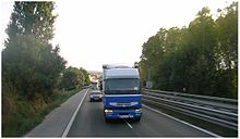 The old route of the Autovía del Norte (Nacional I) passing through Treviño.
Under the 1785 territorial disposition by the Count of Floridablanca, the Condado de Treviño formed part of the partido de Miranda de Ebro; it was divided into the town of Treviño and four cuadrillas: the Cuadrilla de Abajo, the Cuadrilla de río Somoayuda, Cuadrilla de Val de Lauri and the Cuadrilla de Val de Tobera.
The enclave
After Castile conquered Álava, most of the region was left under the relatively egalitarian fueros typical of the Basque Country. Treviño was not. First a royal seigneury, and later under the rule of a noble family, Treviño remained closely tied to Castile. The enclave of Treviño was one of the few enclaves preserved in the 1833 territorial division of Spain, an island of Old Castile in the midst of Álava.
Present-day Basque nationalists wish to integrate the enclave into Álava.
Politics
The municipal elections of 2007 in the Condado de Treviño gave five council seats to the right-of center People's Party, four to the local Agrupación Electoral Independiente del Condado de Treviño, one to the left-of-center Spanish Socialist Workers' Party and one to the Basque nationalist Eusko Abertzale Ekintza.
Demography
Añastro, Pariza and the above-mentioned Sáseta were once independent municipalities. Beginning with the 1857 census, the figures for the municipality of Condado de Treviño incorporate Pariza and Sáseta; beginning with the census of 1930 it incorporates Añastro as well. The adjacent La Puebla de Arganzón forms part of the same enclave, but remains a municipality in its own right.
Demographic evolution 1842–1920 1842 1857 1860 1877 1887 1897 1900 1910 1920 1940 4440 4393 3865 3801 3684 3701 3622 3694 Demographic evolution 1930–2008 1930 1940 1950 1960 1970 1981 1991 2001 2008 3946 3729 3554 2926 2182 1346 907 1139 1399 Hamlets and towns
As can be seen from the numbers in the previous section, throughout most of the second half of the 20th century the population of Condado de Treviño declined steadily. Most of the population was moving to Vitoria, and in 1974 several pedanías—hamlets—ceased to have any formal existence and were simply aggregated into Treviño. The following juntas vecinales—local governments—were dissolved that year: Ajarte, Araico, Ascarza, Burgueta, Dordóniz, Grandival, Meana, Mesanza, Moscador, Pedruzo, Samiano, San Martín de Galvarín, San Vicentejo, Sáseta, and Zurbitu.
As of 2008 there are 36 entidades locales menores ("small local entities"), the status within the autonomous community of Castile and León for a recognized community smaller than a municipality. They are as follows:[3]
- Aguillo
- Albaina
- Añastro
- Argote
- Armentia
- Arrieta (Burgos)
- Ascarza
- Bajauri
- Burgueta
- Busto de Treviño
- Cucho
- Dordóniz
- Doroño
- Franco
- Fuidio
- Golernio
- Grandival
- Imiruri
- Laño
- Marauri
- Muergas
- Obécuri
- Ocilla y Ladrera
- Ogueta
- Ozana
- Pangua
- Pariza
- Samiano
- San Martín de Zar
- San Vicentejo
- Saraso
- Taravero
- Torre
- Treviño
- Uzquiano
- Villanueva Tobera
In addition, the following hamlets have no formal status:
- Ajarte
- Araico
- Arana
- Caricedo
- Meana
- Mesanza
- Moraza
- Moscador de Treviño
- Ochate
- Pedruzo
- San Esteban
- San Martín de Galvarín
- Sáseta
- Uralde
- Zurbitu
Heritage sites and other places of interest
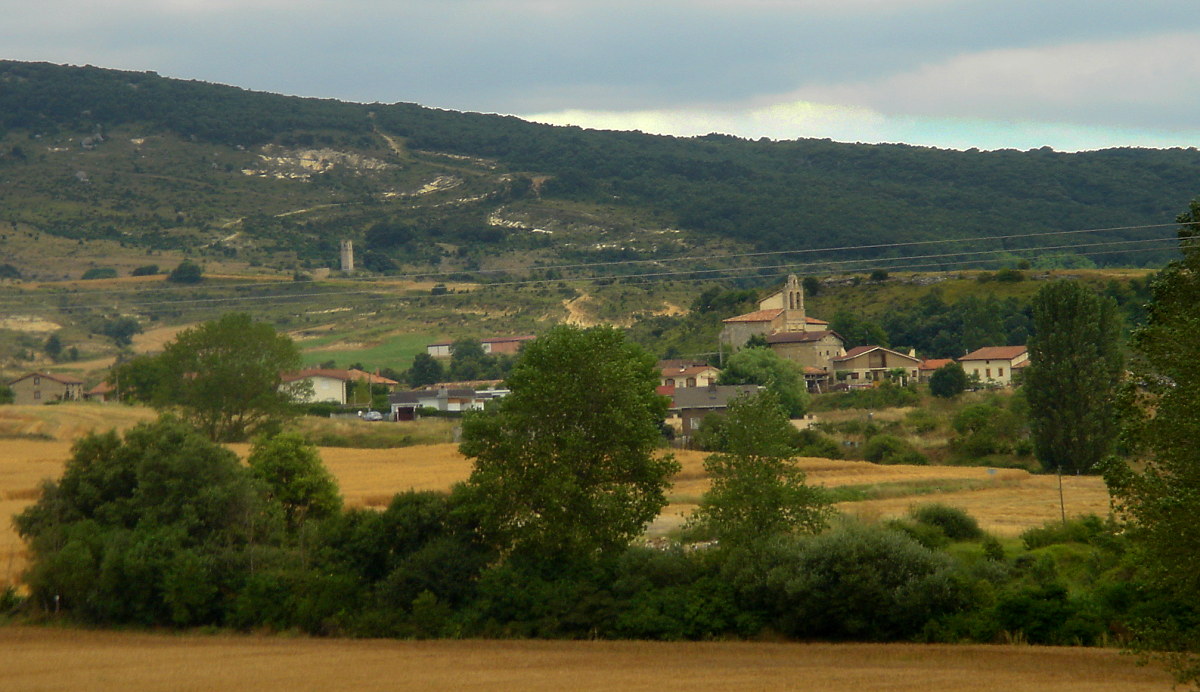
 View of Treviño, the capital of the municipality.
Four sites within Condado de Treviño are formally recognized by the Spanish Ministry of Culture as part of Spain's Patrimonio Histórico (literally "historic patrimony", heritage sites):
- The Cuevas de Laño, artificial caves inhabited by hermits more than 1500 years ago, declared part of the Patrimonio Histórico 23 June 1978.
- The prehistoric caves of "Montico" in Albaina, declared 21 August 1976.
- The artistic-historic assemblage of the town of Treviño, declared 28 September 1983.
- Ermita (Hermitage) de la Purísima Concepción, in San Vicentejo, declared 11 March 1994.
- Source: [4]
Other places of interest include the forests of Obécuri and Bajauri; Izki Natural Park, with the largest massing of Quercus pyrenaica in Europe; the gorge of the river Ayuda; the route from Sáseta to Oquina, crossing Laño-Laguardia; the Aguillo-Ajarte crossing of Palogán mountain; the town of Pariza; the town of Cucho, whose buildings have been completel restored; and the hermitages of San Formerio, San Vicentejo, Ermita de Albaina, and Ermita de Pariza.
Towns of Condado de Treviño
 Panoramic view of the Montes de Vitoria on the northern border with the province of Álava.
-

Treviño, the capital of Condado de Treviño
-

San Andrés Church (16th century) in Añastro
-

Armentia
-

Arrieta (Burgos)
-

A street in Arrieta
-

Busto de Treviño
-

Invención de la Santa Cruz Church in Cucho
-

Doroño
-

Franco town.
-

Golernio
-

Imiruri
-

Obécuri
-

The abandoned town of Ochate, with the tower of the ancient San Miguel Church
-

Asunción de Nuestra Señora Church in Ozana
-

La Concepción Hermitage (12th century) in San Vicentejo
-

San Andrés Church (12th century) in Saraso
-

Late Romanesque church in Uzquiano
Notes
- This article incorporates information from the revision as of 2010-01-04 of the equivalent article on the Spanish Wikipedia.
- ^ INE.
- ^ {es icon}} Francisco Góngora, Las Gobas de Laño (Treviño). Capadocia alavesa, El Correo (Bilbao), 2007-11-16. Fecha de acceso 2010-01-01.
- ^ (Spanish) Relación de Entidades Locales Menores, Autonomous Government of Castile and León.
- ^ (Spanish) Ministerio de Cultura/Base de datos de bienes inmuebles
Coordinates: 42°44′06″N 2°44′49″W / 42.735°N 2.747°W
Categories:- Municipalities in Burgos
- Exclaves
- Basque politics
- Populated places in Burgos
- Burgos province geography stubs


Wikimedia Foundation. 2010.