Úsobí

Úsobí

Geobox | Settlement
name = Úsobí
other_name =
category = Market Town


image_caption =


symbol = Usobi znak.jpg
etymology =
official_name =
motto =
nickname =
country = Czech Republic
country_

state =
region = Vysočina
region_type = Region
district = Havlíčkův Brod
district_type = District
commune = Havlíčkův Brod
municipality =
part =
river =
location =
elevation = 555
lat_d = 49
lat_m = 30
lat_s = 54
lat_NS = N
long_d = 15
long_m = 30
long_s = 4
long_EW = E
highest =
highest_elevation =
highest_lat_d =
highest_long_d =
lowest =
lowest_elevation =
lowest_lat_d =
lowest_long_d =
area = 12.97
area_round = 2
population = 707
population_date = 2006-10-02
population_density = auto
established = 1307
established_type = First mentioned
mayor = Karel Kameník
timezone =


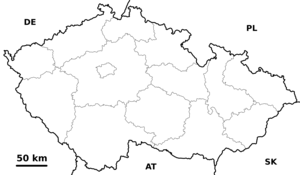
map_background = Czechia - background map.png map_caption = Location in the Czech Republic
map_locator = Czechia
commons = Úsobí
statistics = [http://www.statnisprava.cz/ebe/ciselniky.nsf/i/569658 statnisprava.cz]
website = [http://www.usobi.cz/ www.usobi.cz]
footnotes =

Úsobí (formerly Ousobí, German: Pollerskirchen) is a market town in the Havlíčkův Brod District, Vysočina Region of the Czech Republic. 707 people live in Úsobí and it has 12,97 km². It was first documented in 1307. A historical mansion is situated in the town.


Wikimedia Foundation. 2010.

Игры ⚽ Поможем решить контрольную работу

Look at other dictionaries:

  • Úsobí — Úsobí …   Deutsch Wikipedia

  • Chyška — Chyška …   Deutsch Wikipedia

  • Kosovy — Kosovy …   Deutsch Wikipedia

  • List of German exonyms for places in the Czech Republic — Below are links to subpages with more detailed listings of the German language names of towns and villages in different regions of the Czech Republic. Many of these German names are now exonyms, but used to be endonyms commonly used by the local… …   Wikipedia

  • Liste deutscher Bezeichnungen tschechischer Orte — In dieser Liste werden deutschen (heute großteils nicht mehr geläufigen) topografischen Namen die tschechischen, amtlichen Pendants gegenübergestellt. Durch die Vertreibungen nach 1945 wurden viele kleinere Orte und Gehöfte, insbesondere in… …   Deutsch Wikipedia

  • Lípa u Havlíčkova Brodu — Lípa …   Deutsch Wikipedia

  • Úhořilka — Úhořilka …   Deutsch Wikipedia

  • District de Havlíčkův Brod — 49° 36′ 47″ N 15° 34′ 52″ E / 49.61315, 15.58101 …   Wikipédia en Français

  • Havlíčkův Brod — Coordinates: 49°36′21″N 15°34′43″E / 49.60583°N 15.57861°E / 49.60583; 15.57861 …   Wikipedia

  • Havlíčkův Brod District — Coordinates: 49°36′47″N 15°34′52″E / 49.613157°N 15.581017°E / 49.613157; 15.581017 …   Wikipedia

Share the article and excerpts

Direct link
Do a right-click on the link above
and select “Copy Link”