- Maquoketa, Iowa
-
Maquoketa, Iowa — City — Nickname(s): Timber City Motto: One of a Kind Location of Maquoketa, Iowa
Coordinates: 42°4′1″N 90°39′58″W / 42.06694°N 90.66611°WCoordinates: 42°4′1″N 90°39′58″W / 42.06694°N 90.66611°W Country  United States
State  Iowa
IowaCounties Clinton, Jackson[1] Incorporated 1838 Government – Mayor Jason Hute Area – Total 3.5 sq mi (9.0 km2) – Land 3.4 sq mi (8.9 km2) – Water 0.04 sq mi (0.1 km2) Elevation 702 ft (214 m) Population (2000) – Total 6,112 – Density 1,773.3/sq mi (684.7/km2) Time zone Central (CST) (UTC-6) – Summer (DST) CDT (UTC-5) ZIP code 52060 Area code(s) 563 FIPS code 19-49215 GNIS feature ID 0458789 Maquoketa (
 /ˌməˈkoʊkɨtə/) is a city in Clinton and Jackson counties in the U.S. state of Iowa. Located on the Maquoketa River, it is the county seat of Jackson County.[2]
U.S. Route 61 adjoins the city, which therefore benefits, or possibly hinders, from traffic between Dubuque and the Quad Cities. Iowa Highways 62 and 64 also pass through the city. Maquoketa Caves State Park is located a few miles northwest of the city.
The population was 6,112 at the 2000 census.
Contents
History
In 1838, six years before Iowa became a state, J.E. Goodenow and Lyman Bates came to this location, bought some land and built a log cabin.
On June 4, 1840 J.E. Goodenow was appointed as the Post Master of the original U.S. Post Office located here and it was named "Springfield" after J.E. Goodenow's home town in Vermont. As time went on, there was a problem because of the large number of towns and cities already in the country with the name of Springfield, mail was getting lost by being sent to the wrong Post Offices. John Shaw, Rev. William Salter, and J.E. Goodenow petitioned the Post Office Department for a change of name to “Maquoketa”. It was changed by March 13, 1844. Maquoketa is a Meskwaki [Native American tribe] compound word meaning "bear were here". 'Maquo' [a French spelling pronounced mahk-wah] means "bear" and 'keta' [an English spelling pronounced keh-tah] means "previously, formerly, there were, etc." In 1853 the town was incorporated. The historic Hurstville Lime Kilns are located just north of the city.
Demographics
Maquoketa
Historical PopulationsCensus Pop. %± 1850 168 — 1860 1,090 548.8% 1870 1,756 61.1% 1880 2,467 40.5% 1890 3,077 24.7% 1900 3,777 22.7% 1910 3,570 −5.5% 1920 3,626 1.6% 1930 3,595 −0.9% 1940 4,076 13.4% 1950 4,307 5.7% 1960 5,909 37.2% 1970 5,677 −3.9% 1980 6,313 11.2% 1990 6,130 −2.9% 2000 6,112 −0.3% Iowa Data Center As of the census[3] of 2000, there were 6,112 people, 2,614 households, and 1,599 families residing in the city. The population density was 1,773.3 people per square mile (684.0/km²). There were 2,797 housing units at an average density of 811.5 per square mile (313.0/km²). The racial makeup of the city was 98.10% White, 0.16% African American, 0.21% Native American, 0.11% Asian, 0.34% Pacific Islander, 0.34% from other races, and 0.72% from two or more races. Hispanic or Latino of any race were 0.98% of the population.
There were 2,614 households out of which 29.1% had children under the age of 18 living with them, 46.4% were married couples living together, 11.1% had a female householder with no husband present, and 38.8% were non-families. 34.3% of all households were made up of individuals and 18.1% had someone living alone who was 65 years of age or older. The average household size was 2.26 and the average family size was 2.90.
In the city the population was spread out with 24.4% under the age of 18, 8.3% from 18 to 24, 25.2% from 25 to 44, 20.6% from 45 to 64, and 21.4% who were 65 years of age or older. The median age was 40 years. For every 100 females there were 87.8 males. For every 100 females age 18 and over, there were 81.0 males.
The median income for a household in the city was $28,984, and the median income for a family was $36,705. Males had a median income of $25,819 versus $19,421 for females. The per capita income for the city was $16,360. About 9.1% of families and 12.3% of the population were below the poverty line, including 18.6% of those under age 18 and 8.6% of those age 65 or over.
Geography
Maquoketa is located at 42°4′1″N 90°39′58″W / 42.06694°N 90.66611°W (42.066901, −90.666238),[4] primarily in Jackson County.
According to the United States Census Bureau, the city has a total area of 3.5 square miles (9.1 km2), of which, 3.5 square miles (9.1 km2) of it is land and 0.04 square miles (0.10 km2) of it (0.86%) is water.
Government
Maquoketa is governed by the Mayor with city council form of government, utilizing several departments, boards, and commissions.
The authority of the city resides in the city council. The council votes on and passes motions, resolutions and ordinances. Resolutions are statements of policy and ordinances are the laws of the city. The votes of each council member are recorded in the minutes of the meeting. The council also approves expenditures and the budget, contracts, city policies and zoning changes.[5]Currently (see references) the mayor is Jason Hute who is also the current chief executive officer of the city and presides over council meetings. The city council elected officials are (listed last name alphabetically) Todd Mang, Amy Moore, Neil Morehead, Don Schwenker, Margo Shouse, Eric Pape and Edgar Turney. The day to day operations of the city of Maquoketa are run by the city manager Brian Wagner.[5]
PAST MAYORS from 1853 to 2009[citation needed]- 1853–1855 John E Goodenow
- 1855–1856 Isaiah K Millard
- 1856–1857 Keevin O'Rourke
- 1857–1857 Zalmon Livermore
- 1857–1858 Isaiah K Millard
- 1858–1859 Jonas Clark
- 1859–1862 Seneca S Germond
- 1862–1864 Daniel S Haight
- 1864–1866 Thomas E Cannell
- 1866–1867 Col. Joseph J Woods
- 1867–1868 Dr. John H Allen
- 1868–1869 Frank Amos
- 1869–1871 Dr. John H Allen
- 1871–1872 Benjamin A Spencer
- 1872–1873 Mott Watson
- 1873–1874 Thomas E Cannell
- 1874–1875 John E Goodenow
- 1875–1876 Dudley M Hubbell
- 1876–1878 William M Stephens
- 1878–1879 Seth L Baker
- 1879–1881 Pearce Mitchell
- 1881–1882 Thomas E Cannell
- 1882–1884 Caleb M Sanborn
- 1884–1886 Levi Keck
- 1886–1887 Thomas E Cannell
- 1887–1888 Caleb M Sanborn
- 1888–1891 Matthew S Dunn
- 1891–1892 Dr. Abraham B Dobson
- 1892–1892 Dr. Amos S Hodge
- 1892–1893 Harold P Harvey
- 1893–1897 William M Stephens
- 1897–1899 Caleb M Sanborn
- 1899–1903 William M Stephens
- 1903–1904 Harold P Harvey
- 1904–1905 Frank D Kelsey
- 1905–1909 Fred C Gregory
- 1909–1917 Frederick W Myatt
- 1917–1921 William C Morden, Jr.
- 1921–1931 Dr. Fred J Swift, Sr.
- 1931–1932 John B Harrison
- 1932–1937 Stewart K Peake
- 1937–1938 William J Pendray
- 1938–1945 LeRoy C Schroeder
- 1945–1951 Arthur W Sokol
- 1951–1953 Lanvil Moler
- 1953–1954 Harold D Keeley
- 1954–1958 Benhart Jacobsen
- 1958–1961 Ronald T Cahill
- 1961–1964 Larry Schulte
- 1964–1970 Benhart Jacobsen
- 1970–1972 Dennis W Voy
- 1972–1974 Benhart Jacobsen
- 1974–1976 Edward Myatt
- 1974–1976 Barbara A Wright [pro tem]
- 1976–1977 Larry Schulte
- 1977–1979 Lawrence P Despeghel
- 1979–1982 Howard Elkins
- 1982–1984 Allen R Barker
- 1984–1989 Leighton Hepker
- 1990–1991 Clifton Lamborn
- 1992–1993 James J Hohnecker
- 1994–1995 Clifton Lamborn
- 1995–2001 Jack R Rosenberg
- 2002–2009 Tom Messerli
Economy
Maquoketa is a poor community with relatively few longtime businesses and few jobs paying much above minimum wage. The workforce consists of mostly unskilled labor and there are few job opportunities outside of factory work and almost no career opportunities within a reasonable distance. The median household income was just under $27,500 as reported in 2009.[6] There is little opportunity for growth or new local businesses in Maquoketa because of the large number of residents on fixed incomes or otherwise without much disposable income. As a result there are many empty store fronts on Main Street and it is very common for new businesses to fail within a few months of opening. Few new local businesses last more than two years simply because entrenched long-time businesses are already sufficient to meet demand and many residents have very little extra to spend for new and different types of goods and services. Compounding these problems a recent study commissioned by the Maquoketa Municipal Electric Utility determined that electric rates in the city of Maquoketa were some of the highest in the state.[7]
There is some hope for the future as the recently added Clinton Community College may improve the quality of the available workforce, attracting new industry to the area.
Education
Public School
 Maquoketa Middle School
The Maquoketa Community School District in partnership with the community overseas the public school system of education for the city of Maquoketa and the surrounding area.[8]
The Maquoketa High School home of the Cardinals has a student enrollment of approximately 620 students. grades 9 through 12, with a staff of over 50 educators and administrators.[9]
The Maquoketa Middle School is the oldest school building in Maquoketa, formally a home to a junior high, high school and junior college. The school has a student enrollment of approximately 375 students, grades 6 through 8, with a staff of over 60 educators and administrators.[10]
Briggs Elementary School built in 1954, is named after Ansel Briggs, the first Governor of Iowa, who was an early settler in Jackson County. The school has a student enrollment of approximately 300 students, grades 3 through 5, with a staff of 35 educators and administrators.[11]
Cardinal Elementary School built in 1974, started as a school for grades 1 through 6. Over the years gradual changes were made to the building and the grade levels taught. The decision to teach only kindergarten through 2nd grade was implemented at Cardinal in May 2002. The school has a staff of 37 educators and administrators.[12]
Private
Sacred Heart Elementary School is a Catholic school teaching preschool through the sixth grade. The current school enrollment (see references) has 132 students and 19 staff.[13][14]
Preschools
The Little Shepherd Preschool operates in the lower levels of the First Lutheran Church of Maquoketa.[15]
Sunshine Preschool and Daycare is a nonprofit organization started in 1973. All children age 6 months up to 12 years of age including those with disabilities are accepted. Currently (see references) there are 145 children with 30 staff. [16]
College
Clinton Community College added a Maquoketa campus right next to the Maquoketa High School. The campus is located at 501 W. Washington Street. The 11,000 square foot facility opened in 2009 and offers associate's degrees and non-credit training. They also offer classes to high school students to supplement their high school education and give them an early start upon graduating from high school.[17]
Attractions
 Hurstville Lime Kilns
- Maquoketa Caves State Park
- Hurstville Lime Kilns, north of Maquoketa
- Jackson County Iowa Historical Society
- Clinton Engines Museum
- 61 Drive-in theater [18] One of the few remaining outdoor theaters in the United States.
Notable people
- Norris Brown, Senator from Nebraska
- Craig Callahan, professional basketball player
- Betty Francis, All-American Girls Professional Baseball League player
- Herbert E. Hitchcock, Senator from South Dakota
- Matthew Luckiesh, physicist
- Junius Ralph Magee, former Methodist bishop
- Eben Martin, former U.S. Representative
- Robert A. Millikan, Nobel Prize laureate
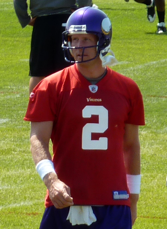
- Sage Rosenfels, quarterback in the NFL
- George Homer Ryan, former Governor of Illinois
- William Welch, originated the printing of high school diplomas
- Adam Hepker, former basketball player for MidAmerica Nazarene University
References
- ^ "Subcounty population estimates: Iowa 2000–2007" (CSV). United States Census Bureau, Population Division. March 18, 2009. http://www.census.gov/popest/cities/files/SUB-EST2007-19.csv. Retrieved April 4, 2009.
- ^ "Find a County". National Association of Counties. http://www.naco.org/Counties/Pages/FindACounty.aspx. Retrieved 2011-06-07.
- ^ "American FactFinder". United States Census Bureau. http://factfinder.census.gov. Retrieved 2008-01-31.
- ^ "US Gazetteer files: 2010, 2000, and 1990". United States Census Bureau. 2011-02-12. http://www.census.gov/geo/www/gazetteer/gazette.html. Retrieved 2011-04-23.
- ^ a b "Official Maquoketa City Website". City Council. http://www.maquoketaia.com/city/citydepartments/index.html. Retrieved November 21, 2010.
- ^ "City Data for Maquoketa Iowa". homepage. http://www.city-data.com/city/Maquoketa-Iowa.html. Retrieved 2011-11-31.
- ^ "Quad City Times article". Quad City Times. http://qctimes.com/news/local/government-and-politics/maquoketa-council-members-support-utility-board-petition/article_4e3b567a-db60-11e0-a284-001cc4c002e0.html. Retrieved 2011-11-31.
- ^ "Maquoketa Community School District". homepage. http://maquoketa.k12.ia.us/. Retrieved 2010-11-21.
- ^ "Maquoketa High School". homepage. http://maquoketa.k12.ia.us/highschool/. Retrieved November 21, 2010.
- ^ "Maquoketa Middle School". homepage. http://maquoketa.k12.ia.us/middleschool/. Retrieved November 21, 2010.
- ^ "Briggs Elementary School". homepage. http://maquoketa.k12.ia.us/briggs/. Retrieved November 21, 2010.
- ^ "Cardinal Elementary School". homepage. http://maquoketa.k12.ia.us/cardinal/. Retrieved November 21, 2010.
- ^ "Sacred Heart Elementary School". homepage. http://www.sacredheartmaquoketa.org/index.html. Retrieved November 21, 2010.
- ^ "Private School Review". for Sacred Heart Elementary School. http://www.privateschoolreview.com/school_ov/school_id/10745. Retrieved November 21, 2010.
- ^ "Little Shepherd Christian Preschool". homepage. http://www.littleshepherdpreschool.com/index.html. Retrieved 2010-11-21.
- ^ "Sunshine Preschool and Daycare". homepage. http://www.sunshinechildren.org/index.html. Retrieved November 21, 2010.
- ^ "Clinton Community College". homepage. http://www.eicc.edu/general/clinton/maquoketa/. Retrieved 2011-10-31.
- ^ "61 DRIVE-IN theater". Business website. http://www.maquoketa.com/61drivein/. Retrieved November 21, 2010.
External links
- Official Maquoketa City Website Portal website, City government, Chamber of Commerce, Economic development, Tourism
- Maquoketa Community School District
- Maquoketa Area Chamber of Commerce
- City Data Comprehensive Statistical Data and more about Maquoketa
Municipalities and communities of Clinton County, Iowa Cities Andover | Calamus | Camanche | Charlotte | Clinton | DeWitt | Delmar | Goose Lake | Grand Mound | Lost Nation | Low Moor | Maquoketa‡ | Toronto | Welton | Wheatland

Townships Bloomfield | Brookfield | Camanche | Center | De Witt | Deep Creek | Eden | Elk River | Grant | Hampshire | Liberty | Olive | Orange | Sharon | Spring Rock | Washington | Waterford | Welton
Unincorporated
communitiesBryant | Elvira | Elwood | Folletts | Teeds Grove
Footnotes ‡This populated place also has portions in an adjacent county or counties
Municipalities and communities of Jackson County, Iowa County seat: MaquoketaCities Andrew | Baldwin | Bellevue | La Motte | Maquoketa‡ | Miles | Monmouth | Preston | Sabula | St. Donatus | Spragueville | Springbrook | Zwingle‡

Townships Bellevue | Brandon | Butler | Fairfield | Farmers Creek | Iowa | Jackson | Maquoketa | Monmouth | Otter Creek | Perry | Prairie Springs | Richland | South Fork | Tete Des Morts | Union | Van Buren | Washington
Unincorporated
communitiesCanton | Green Island
Footnotes ‡This populated place also has portions in an adjacent county or counties
Categories:- Cities in Iowa
- Populated places in Clinton County, Iowa
- Populated places in Jackson County, Iowa
- County seats in Iowa
- Populated places established in 1838


Wikimedia Foundation. 2010.