- Mountain peaks of North America
-
Main article: Geography of North America

This article comprises three sortable tables of major mountain peaks of greater North America.
This article defines greater North America as the portion of the continental landmass of the Americas extending northward from Panama plus the islands surrounding that landmass. This article defines the islands of North America to include the coastal islands of North America, the islands of the Caribbean Sea, the Lucayan Archipelago, the Bermuda Islands, the Islands of Greenland (Kalaallit Nunaat), the islands of Northern Canada, the islands of Alaska, and the islands of the northeastern Pacific Ocean. The Hawaiian Islands are not included because they are considered part of Oceania.
Topographic elevation is the vertical distance above the reference geoid, a precise mathematical model of the Earth's sea level as an equipotential gravitational surface. Topographic prominence is the elevation difference between the summit and the highest or key col to a higher summit. Topographic isolation is the minimum great circle distance to a point of higher elevation.
This article defines a significant summit as a summit with at least 100 meters (328.1 feet) of topographic prominence, and a major summit as a summit with at least 500 meters (1640.4 feet) of topographic prominence. An ultra-prominent summit is a summit with at least 1500 meters (4921.3 feet) of topographic prominence. There are 356 ultra-prominent summits in greater North America.
All elevations in the 48 states of the contiguous United States include an elevation adjustment from the National Geodetic Vertical Datum of 1929 (NGVD 29) to the North American Vertical Datum of 1988 (NAVD 88). For further information, please see this United States National Geodetic Survey note. If a summit elevation or prominence has a range of values, the arithmetic mean is cited.
Contents
Highest major summits
Main article: Table of the highest major summits of North AmericaThe following sortable table lists the 20 highest mountain peaks of greater North America with at least 500 meters (1640.4 feet) of topographic prominence.
Most prominent summits
Main article: Table of the most prominent summits of North AmericaSee also: Table of the ultra-prominent summits of North AmericaThe following sortable table lists the 50 most topographically prominent mountain peaks of greater North America. Of these 50 most prominent summits, 27 are located in the United States, 19 in Canada, 3 in Mexico, and one each in Guatemala, Costa Rica, Greenland, the Dominican Republic, and Haiti. Four of these peaks lie on the international border between Canada and the United States.
Most isolated major summits
The following sortable table lists the 50 most topographically isolated mountain peaks of greater North America with at least 500 meters (1640.4 feet) of topographic prominence. Of these 50 most isolated major summits, 16 are located in Canada, 15 in the United States, 8 in Greenland, 5 in Mexico, and one each in the Dominican Republic, Costa Rica, Guatemala, Guadeloupe, Puerto Rico, and Cuba.
Gallery
-

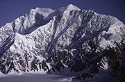
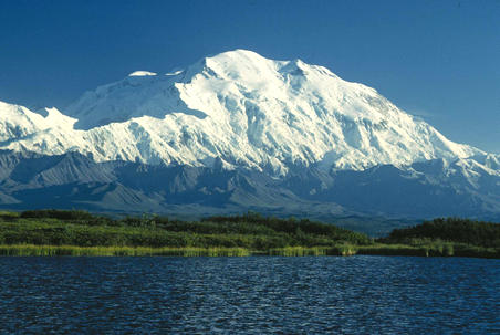
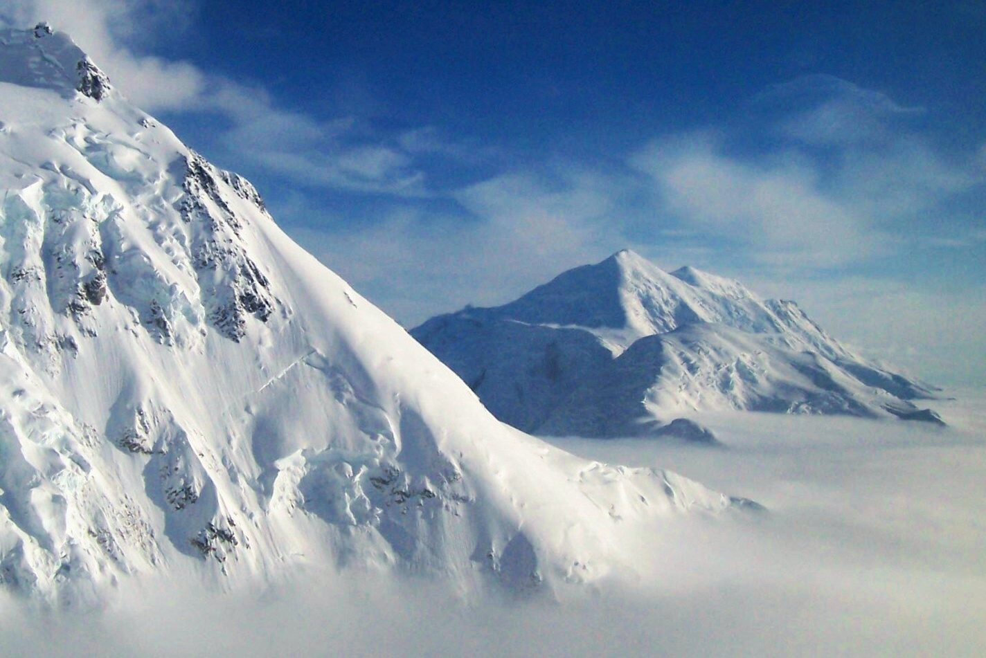
Mount McKinley, or Denali, in Alaska is the highest peak of North America and the third most prominent summit of the Earth.
-
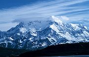
Mount Logan in the Yukon is the highest peak of Canada.
-

The stratovolcano Volcán Citlaltépetl, or Pico de Orizaba, is the highest peak of Mexico.
-
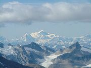
Mount Saint Elias is the second highest peak of both Canada and the United States.
-

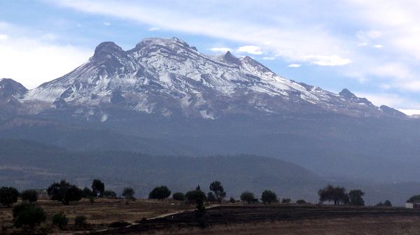
The stratovolcano Volcán Popocatépetl is the second highest peak of México.
-

Mount Foraker is the second highest peak of the Alaska Range.
-

The stratovolcano Volcán Iztaccíhuatl is the third highest peak of Mexico.
-

Mount Blackburn is the highest peak of the Wrangell Mountains of Alaska.
-
Mount Fairweather on the border with Alaska is the highest peak of the Province of British Columbia.
-

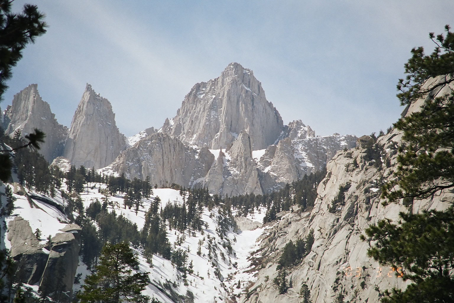
Mount Whitney in California is the highest peak of the contiguous United States.
-

Mount Elbert in Colorado is the highest peak of the Rocky Mountains.
-

The stratovolcano Mount Rainier is the most prominent peak of the contiguous United States.
-

The stratovolcano Volcán Tajumulco is the highest peak in Guatemala and all of Central America.
-

Cerro Chirripó is the highest peak of Costa Rica.
-

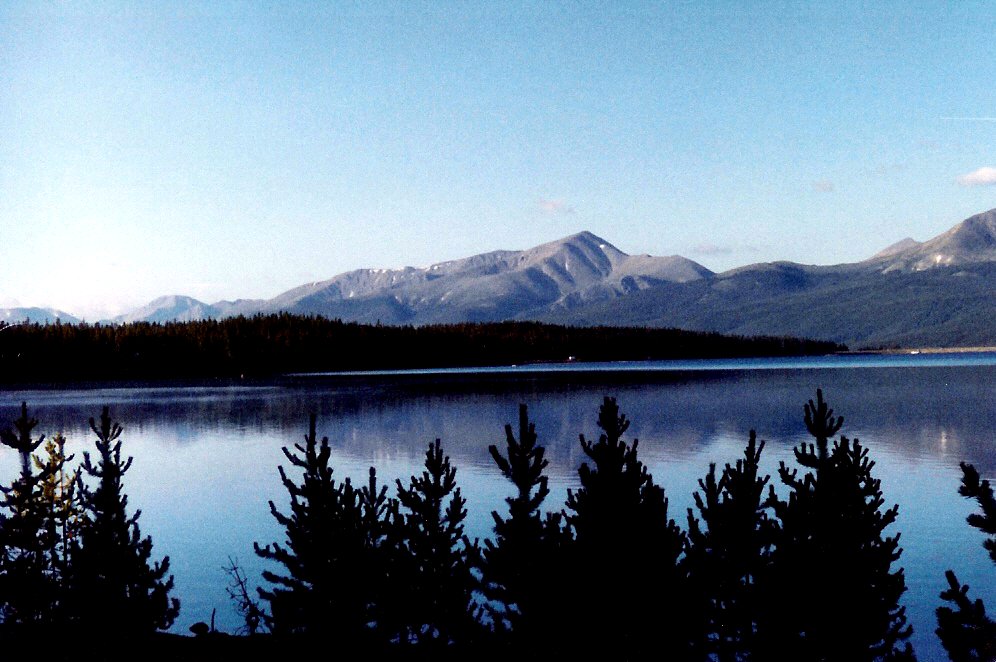
Mount Mitchell in North Carolina is the highest peak of eastern North America.
-

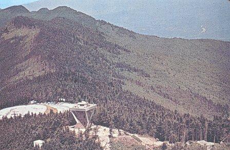
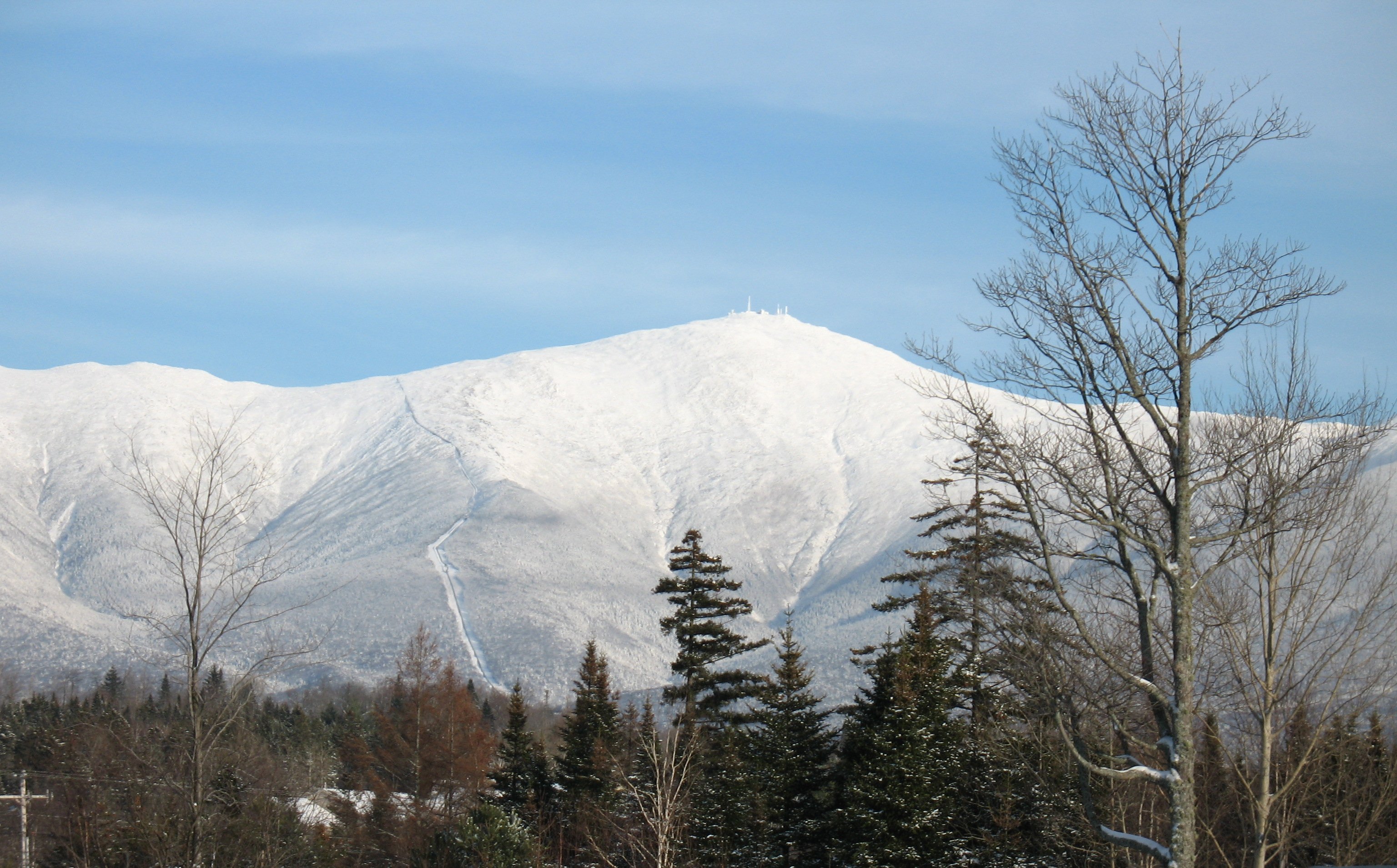
Mount Washington is the highest peak of the Northeastern United States.
See also
- Outline of North America
- North America
- Geography of North America
- Category:Mountains of North America
- Geography of North America
- Physical geography
- Topography
- Topographic elevation
- Topographic isolation
- Topographic prominence
- Topographic summit
- Topography
- Lists of mountains
- Mountain peaks of greater North America
- The 200 highest major mountain peaks of greater North America
- The 124 4000 meter major mountain peaks of greater North America
- The 200 most topographically prominent mountain peaks of greater North America
- The 356 ultra-prominent mountain peaks of greater North America
- The 200 most topographically isolated major mountain peaks of greater North America
- The 234 100 km isolated major mountain peaks of greater North America
- Mountain peaks of Greenland
- Mountain peaks of Canada
- Mountain peaks of the Rocky Mountains
- Mountain peaks of the United States
- Mountain peaks of México
- Mountain peaks of Central America
- Mountain peaks of the Caribbean
- The 200 highest major mountain peaks of greater North America
- Mountain peaks of greater North America
References
- ^ a b c The summit of Mount McKinley (Denali) is the highest point of the Alaska Range, the State of Alaska, the United States of America, and all of North America.
- ^ a b c "Mount McKinley". Summits of the World. peakbagger.com. http://www.peakbagger.com/peak.aspx?pid=271. Retrieved January 27, 2010.
- ^ a b c The summit of Mount Logan is the highest point of the Saint Elias Mountains, the Yukon Territory, and all of Canada.
- ^ a b c "Mount Logan". Summits of the World. peakbagger.com. http://www.peakbagger.com/peak.aspx?pid=541. Retrieved January 11, 2010.
- ^ a b c The summit of Volcán Citlaltépetl (Pico de Orizaba) is the highest point of Estado Libre y Soberano de Puebla, Estado Libre y Soberano de Veracruz de Ignacio de la Llave, and all of México.
- ^ a b c "Volcán Citlaltépetl". Summits of the World. peakbagger.com. http://www.peakbagger.com/peak.aspx?pid=8049. Retrieved January 2, 2010.
- ^ a b The summit of Mount Saint Elias on the international border between Alaska and the Yukon is the second highest mountain peak of both Canada and the United States.
- ^ a b "Mount Saint Elias". Summits of the World. peakbagger.com. http://www.peakbagger.com/peak.aspx?pid=552. Retrieved January 11, 2010.
- ^ a b The summit of Volcán Popocatépetl on the border of Estado Libre y Soberano de Puebla is the highest point of both Estado Libre y Soberano de México and Estado Libre y Soberano de Morelos..
- ^ a b "Volcán Popocatépetl". Summits of the World. peakbagger.com. http://www.peakbagger.com/peak.aspx?pid=8034. Retrieved January 2, 2010.
- ^ The summit of Mount Foraker is the westernmost 5000 m (16,404-foot) summit of North America.
- ^ "Mount Foraker". NGS Station Datasheet. United States National Geodetic Survey. http://www.ngs.noaa.gov/cgi-bin/ds_mark.prl?PidBox=UW6284. Retrieved January 27, 2010.
- ^ "Mount Foraker". Summits of the World. peakbagger.com. http://www.peakbagger.com/peak.aspx?pid=284. Retrieved January 27, 2010.
- ^ a b "Mount Lucania". Summits of the World. peakbagger.com. http://www.peakbagger.com/peak.aspx?pid=517. Retrieved January 11, 2010.
- ^ "Volcán Iztaccíhuatl". Summits of the World. peakbagger.com. http://www.peakbagger.com/peak.aspx?pid=8033. Retrieved January 2, 2010.
- ^ "King Peak". Summits of the World. peakbagger.com. http://www.peakbagger.com/peak.aspx?pid=538. Retrieved January 11, 2010.
- ^ "Mount Bona". NGS Station Datasheet. United States National Geodetic Survey. http://www.ngs.noaa.gov/cgi-bin/ds_mark.prl?PidBox=UV4083. Retrieved January 27, 2010.
- ^ "Mount Bona". Summits of the World. peakbagger.com. http://www.peakbagger.com/peak.aspx?pid=496. Retrieved January 27, 2010.
- ^ The summit of Mount Steele is the easternmost 5000 m (16,404-foot) summit of Canada.
- ^ "Mount Steele". Summits of the World. peakbagger.com. http://www.peakbagger.com/peak.aspx?pid=513. Retrieved January 25, 2010.
- ^ a b "Mount Blackburn". NGS Station Datasheet. United States National Geodetic Survey. http://www.ngs.noaa.gov/cgi-bin/ds_mark.prl?PidBox=UV4136. Retrieved January 11, 2010.
- ^ a b "Mount Blackburn". Summits of the World. peakbagger.com. http://www.peakbagger.com/peak.aspx?pid=437. Retrieved January 11, 2010.
- ^ a b "Mount Sanford". Summits of the World. peakbagger.com. http://www.peakbagger.com/peak.aspx?pid=428. Retrieved January 27, 2010.
- ^ "Mount Wood". Summits of the World. peakbagger.com. http://www.peakbagger.com/peak.aspx?pid=505. Retrieved January 25, 2010.
- ^ a b "Mount Vancouver". Summits of the World. peakbagger.com. http://www.peakbagger.com/peak.aspx?pid=544. Retrieved January 25, 2010.
- ^ "Mount Slaggard". Summits of the World. peakbagger.com. http://www.peakbagger.com/peak.aspx?pid=507. Retrieved January 25, 2010.
- ^ "Nevado de Toluca". Summits of the World. peakbagger.com. http://www.peakbagger.com/peak.aspx?pid=8028. Retrieved January 2, 2010.
- ^ a b The summit of Mount Fairweather (Fairweather Mountain) on the border of Alaska is the highest point of the Province of British Columbia.
- ^ a b "Mount Fairweather". Summits of the World. peakbagger.com. http://www.peakbagger.com/peak.aspx?pid=566. Retrieved January 11, 2010.
- ^ a b "Mount Hubbard". Summits of the World. peakbagger.com. http://www.peakbagger.com/peak.aspx?pid=548. Retrieved January 25, 2010.
- ^ "Mount Bear". Summits of the World. peakbagger.com. http://www.peakbagger.com/peak.aspx?pid=501. Retrieved January 27, 2010.
- ^ a b The summit of Mount Rainier is the highest point of the Cascade Range and the State of Washington.
- ^ a b "Mount Rainier". NGS Station Datasheet. United States National Geodetic Survey. http://www.ngs.noaa.gov/cgi-bin/ds_mark.prl?PidBox=SB1041. Retrieved January 27, 2010.
- ^ a b "Mount Rainier". Summits of the World. peakbagger.com. http://www.peakbagger.com/peak.aspx?pid=2296. Retrieved January 27, 2010.
- ^ a b The summit elevation of Mount Rainier includes a vertical adjustment of +1.935 m (+6.3 ft).
- ^ a b The summit of Volcán Tajumulco is the highest point of the Republic of Guatemala and all of Central America. Volcán Tajumulco is the southernmost and easternmost 4000 m (13,123-foot) summit of North America.
- ^ a b "Volcán Tajumulco". Summits of the World. peakbagger.com. http://www.peakbagger.com/peak.aspx?pid=8079. Retrieved January 11, 2010.
- ^ a b The summit of Chirripó Grande (Cerro Chirripó) is the highest point of the Republic of Costa Rica.
- ^ a b "Chirripó Grande". Summits of the World. peakbagger.com. http://www.peakbagger.com/peak.aspx?pid=8168. Retrieved January 4, 2010.
- ^ a b The summit of Gunnbjørn Fjeld is the highest point on the Island of Greenland, Kalaallit Nunaat, the Kingdom of Denmark, and the entire Arctic.
- ^ a b "Gunnbjørn Fjeld". Summits of the World. peakbagger.com. http://www.peakbagger.com/peak.aspx?pid=719. Retrieved January 2, 2010.
- ^ The summit of Mount Hayes is the northernmost 4000 m (13,123-foot) summit of North America.
- ^ "Mount Hayes". NGS Station Datasheet. United States National Geodetic Survey. http://www.ngs.noaa.gov/cgi-bin/ds_mark.prl?PidBox=TT6365. Retrieved January 27, 2010.
- ^ "Mount Hayes". Summits of the World. peakbagger.com. http://www.peakbagger.com/peak.aspx?pid=305. Retrieved January 27, 2010.
- ^ a b The summit of Mount Waddington is the easternmost 4000 m (13,123-foot) summit of Canada.
- ^ a b "Mount Waddington". Summits of the World. peakbagger.com. http://www.peakbagger.com/peak.aspx?pid=825. Retrieved January 25, 2010.
- ^ "Mount Marcus Baker". Summits of the World. peakbagger.com. http://www.peakbagger.com/peak.aspx?pid=443. Retrieved January 27, 2010.
- ^ a b The summit of Pico Duarte is the highest point on the Island of Hispaniola, the Dominican Republic, and all the islands of the Caribbean Sea.
- ^ a b "Pico Duarte". Summits of the World. peakbagger.com. http://www.peakbagger.com/peak.aspx?pid=8224. Retrieved January 2, 2010.
- ^ a b The summit of Mount Whitney is the highest point of the Sierra Nevada, the State of California, and the contiguous United States.
- ^ a b "Mount Whitney". NGS Station Datasheet. United States National Geodetic Survey. http://www.ngs.noaa.gov/cgi-bin/ds_mark.prl?PidBox=GT1812. Retrieved January 17, 2010.
- ^ a b "Mount Whitney". Summits of the World. peakbagger.com. http://www.peakbagger.com/peak.aspx?pid=2829. Retrieved January 17, 2010.
- ^ a b The summit elevation of Mount Whitney includes a vertical adjustment of +1.869 m (+6.1 ft).
- ^ a b "Mount Shasta". NGS Station Datasheet. United States National Geodetic Survey. http://www.ngs.noaa.gov/cgi-bin/ds_mark.prl?PidBox=MX1016. Retrieved January 17, 2010.
- ^ a b "Mount Shasta". Summits of the World. peakbagger.com. http://www.peakbagger.com/peak.aspx?pid=2477. Retrieved January 17, 2010.
- ^ a b The summit elevation of Mount Shasta includes a vertical adjustment of +1.791 m (+5.9 ft).
- ^ "Monarch Mountain". Summits of the World. peakbagger.com. http://www.peakbagger.com/peak.aspx?pid=816. Retrieved January 25, 2010.
- ^ a b The summit of Shishaldin Volcano is the highest point of Unimak Island and all the Aleutian Islands.
- ^ a b "Shishaldin Volcano". Summits of the World. peakbagger.com. http://www.peakbagger.com/peak.aspx?pid=359. Retrieved January 4, 2010.
- ^ a b The summit of Mount Robson is the highest point of the Canadian Rockies.
- ^ a b "Mount Robson". Summits of the World. peakbagger.com. http://www.peakbagger.com/peak.aspx?pid=4368. Retrieved January 25, 2010.
- ^ "Redoubt Volcano". NGS Station Datasheet. United States National Geodetic Survey. http://www.ngs.noaa.gov/cgi-bin/ds_mark.prl?PidBox=UW6080. Retrieved January 2, 2010.
- ^ "Redoubt Volcano". Summits of the World. peakbagger.com. http://www.peakbagger.com/peak.aspx?pid=411. Retrieved January 2, 2010.
- ^ a b The summit of Mount Elbert is the highest point of the Rocky Mountains and the State of Colorado.
- ^ a b "Mount Elbert". NGS Station Datasheet. United States National Geodetic Survey. http://www.ngs.noaa.gov/cgi-bin/ds_mark.prl?PidBox=KL0637. Retrieved January 17, 2010.
- ^ a b "Mount Elbert". Summits of the World. peakbagger.com. http://www.peakbagger.com/peak.aspx?pid=5736. Retrieved January 17, 2010.
- ^ a b The summit elevation of Mount Elbert includes a vertical adjustment of +1.995 m (+6.5 ft).
- ^ "Mount Sir Wilfrid Laurier". Summits of the World. peakbagger.com. http://www.peakbagger.com/peak.aspx?pid=2939. Retrieved January 25, 2010.
- ^ a b The summit of Nevado de Colima is the highest point of Estado Libre y Soberano de Jalisco.
- ^ a b "Nevado de Colima". Summits of the World. peakbagger.com. http://www.peakbagger.com/peak.aspx?pid=8009. Retrieved January 2, 2010.
- ^ "Mount Sir Sandford". Summits of the World. peakbagger.com. http://www.peakbagger.com/peak.aspx?pid=2968. Retrieved January 25, 2010.
- ^ "Mount Baker". Summits of the World. peakbagger.com. http://www.peakbagger.com/peak.aspx?pid=1633. Retrieved January 27, 2010.
- ^ The summit elevation of Mount Baker includes a vertical adjustment of +1.43 m (+4.7 ft).
- ^ The summit of Pic la Selle is the highest point of the Republic of Haiti.
- ^ "Pic la Selle". Summits of the World. peakbagger.com. http://www.peakbagger.com/peak.aspx?pid=8225. Retrieved January 2, 2010.
- ^ "Mount Torbert". Summits of the World. peakbagger.com. http://www.peakbagger.com/peak.aspx?pid=221. Retrieved January 27, 2010.
- ^ a b The summit of Barbeau Peak is the highest point of Ellesmere Island and the Nunavut Territory.
- ^ a b "Barbeau Peak". Summits of the World. peakbagger.com. http://www.peakbagger.com/peak.aspx?pid=669. Retrieved January 25, 2010.
- ^ "San Jacinto Peak". NGS Station Datasheet. United States National Geodetic Survey. http://www.ngs.noaa.gov/cgi-bin/ds_mark.prl?PidBox=DX5119. Retrieved January 17, 2010.
- ^ "San Jacinto Peak". Summits of the World. peakbagger.com. http://www.peakbagger.com/peak.aspx?pid=1480. Retrieved January 17, 2010.
- ^ The summit elevation of San Jacinto Peak includes a vertical adjustment of +1.107 m (+3.6 ft).
- ^ "San Gorgonio Mountain". Summits of the World. peakbagger.com. http://www.peakbagger.com/peak.aspx?pid=1417. Retrieved January 28, 2010.
- ^ The summit elevation of San Gorgonio Mountain includes a vertical adjustment of +1.303 m (+4.3 ft).
- ^ "Charleston Peak". NGS Station Datasheet. United States National Geodetic Survey. http://www.ngs.noaa.gov/cgi-bin/ds_mark.prl?PidBox=GR1965. Retrieved January 2, 2010.
- ^ "Charleston Peak". Summits of the World. peakbagger.com. http://www.peakbagger.com/peak.aspx?pid=3748. Retrieved January 2, 2010.
- ^ The summit elevation of Charleston Peak includes a vertical adjustment of +1.25 m (+4.1 ft).
- ^ "Pavlof Volcano". NGS Station Datasheet. United States National Geodetic Survey. http://www.ngs.noaa.gov/cgi-bin/ds_mark.prl?PidBox=UW1057. Retrieved January 2, 2010.
- ^ "Pavlof Volcano". Summits of the World. peakbagger.com. http://www.peakbagger.com/peak.aspx?pid=403. Retrieved January 2, 2010.
- ^ "Mount Veniaminof". NGS Station Datasheet. United States National Geodetic Survey. http://www.ngs.noaa.gov/cgi-bin/ds_mark.prl?PidBox=UW1462. Retrieved January 27, 2010.
- ^ "Mount Veniaminof". Summits of the World. peakbagger.com. http://www.peakbagger.com/peak.aspx?pid=400. Retrieved January 27, 2010.
- ^ "Mount Adams". NGS Station Datasheet. United States National Geodetic Survey. http://www.ngs.noaa.gov/cgi-bin/ds_mark.prl?PidBox=SB1004. Retrieved January 17, 2010.
- ^ "Mount Adams". Summits of the World. peakbagger.com. http://www.peakbagger.com/peak.aspx?pid=2365. Retrieved January 17, 2010.
- ^ The summit elevation of Mount Adams includes a vertical adjustment of +1.655 m (+5.4 ft).
- ^ "Skihist Mountain". Summits of the World. peakbagger.com. http://www.peakbagger.com/peak.aspx?pid=888. Retrieved January 25, 2010.
- ^ "Mount Ratz". Summits of the World. peakbagger.com. http://www.peakbagger.com/peak.aspx?pid=789. Retrieved January 26, 2010.
- ^ a b "Mount Chamberlin". NGS Station Datasheet. United States National Geodetic Survey. http://www.ngs.noaa.gov/cgi-bin/ds_mark.prl?PidBox=TT7804. Retrieved January 2, 2010.
- ^ a b "Mount Chamberlin". Summits of the World. peakbagger.com. http://www.peakbagger.com/peak.aspx?pid=117. Retrieved January 2, 2010.
- ^ "Mount Odin". Summits of the World. peakbagger.com. http://www.peakbagger.com/peak.aspx?pid=2956. Retrieved January 26, 2010.
- ^ "Mount Monashee". Summits of the World. peakbagger.com. http://www.peakbagger.com/peak.aspx?pid=2952. Retrieved January 26, 2010.
- ^ "Iliamna Volcano". Summits of the World. peakbagger.com. http://www.peakbagger.com/peak.aspx?pid=412. Retrieved January 2, 2010.
- ^ "Mount Olympus". NGS Station Datasheet. United States National Geodetic Survey. http://www.ngs.noaa.gov/cgi-bin/ds_mark.prl?PidBox=SY1857. Retrieved January 17, 2010.
- ^ "Mount Olympus". Summits of the World. peakbagger.com. http://www.peakbagger.com/peak.aspx?pid=950. Retrieved January 17, 2010.
- ^ The summit elevation of Mount Olympus includes a vertical adjustment of +1.338 m (+4.4 ft).
- ^ The summit of Mount Columbia on the border of British Columbia is the highest point of the Province of Alberta.
- ^ "Mount Columbia". Summits of the World. peakbagger.com. http://www.peakbagger.com/peak.aspx?pid=4470. Retrieved January 2, 2010.
- ^ "Mount Queen Bess". Summits of the World. peakbagger.com. http://www.peakbagger.com/peak.aspx?pid=834. Retrieved January 26, 2010.
- ^ "Mount Cook". Summits of the World. peakbagger.com. http://www.peakbagger.com/peak.aspx?pid=554. Retrieved January 26, 2010.
- ^ The summit of Mount Hood is the highest point of the State of Oregon.
- ^ "Mount Hood". NGS Station Datasheet. United States National Geodetic Survey. http://www.ngs.noaa.gov/cgi-bin/ds_mark.prl?PidBox=RC2244. Retrieved January 17, 2010.
- ^ "Mount Hood". Summits of the World. peakbagger.com. http://www.peakbagger.com/peak.aspx?pid=2382. Retrieved January 17, 2010.
- ^ The summit elevation of Mount Hood includes a vertical adjustment of +1.341 m (+4.4 ft).
- ^ The summit of Mount Mitchell is the highest point of the Appalachian Mountains, the State of North Carolina, and all of eastern North America.
- ^ "Mount Mitchell". Summits of the World. peakbagger.com. http://www.peakbagger.com/peak.aspx?pid=7822. Retrieved January 28, 2010.
- ^ The summit elevation of Mount Mitchell includes a vertical adjustment of +0.025 m (+0.1 ft).
- ^ The summit of Mount Washington is the highest point of the Northern Appalachian Mountains, the State of New Hampshire, and all of northeastern North America. Mount Washington is the easternmost ultra-prominent summit of continental North America.
- ^ "Mount Washington". NGS Station Datasheet. United States National Geodetic Survey. http://www.ngs.noaa.gov/cgi-bin/ds_mark.prl?PidBox=PF0951. Retrieved January 17, 2010.
- ^ "Mount Washington". Summits of the World. peakbagger.com. http://www.peakbagger.com/peak.aspx?pid=6960. Retrieved January 17, 2010.
- ^ The summit elevation of Mount Washington includes a vertical adjustment of +0.02 m (+0.1 ft).
- ^ The summit of Mount Caubvick (Mont d'Iberville) is the highest point of the Province of Newfoundland and Labrador and all of eastern Canada.
- ^ "Mount Caubvick". Summits of the World. peakbagger.com. http://www.peakbagger.com/peak.aspx?pid=5969. Retrieved January 2, 2010.
- ^ "Qiajivik Mountain". Summits of the World. peakbagger.com. http://www.peakbagger.com/peak.aspx?pid=689. Retrieved January 27, 2010.
- ^ "Melville Island High Point". Summits of the World. peakbagger.com. http://www.peakbagger.com/peak.aspx?pid=655. Retrieved January 2, 2010.
- ^ The summit of La Grande Soufrière is the highest point on the Island of Basse-Terre and the French Région Guadeloupe.
- ^ "La Grande Soufrière". Summits of the World. peakbagger.com. http://www.peakbagger.com/peak.aspx?pid=8257. Retrieved January 2, 2010.
- ^ The summit of Tanaga Volcano is the highest point of Tanaga Island.
- ^ "Tanaga Volcano". Summits of the World. peakbagger.com. http://www.peakbagger.com/peak.aspx?pid=328. Retrieved January 2, 2010.
- ^ "Avannaarsua High Point". Summits of the World. peakbagger.com. http://www.peakbagger.com/peak.aspx?pid=702. Retrieved January 2, 2010.
- ^ "Mathiassen Mountain". Summits of the World. peakbagger.com. http://www.peakbagger.com/peak.aspx?pid=683. Retrieved January 25, 2010.
- ^ The summit of Magazine Mountain is the highest point of the Ozark Mountains, the State of Arkansas, and the central United States.
- ^ "Magazine Mountain". NGS Station Datasheet. United States National Geodetic Survey. http://www.ngs.noaa.gov/cgi-bin/ds_mark.prl?PidBox=FG1888. Retrieved January 28, 2010.
- ^ "Magazine Mountain". Summits of the World. peakbagger.com. http://www.peakbagger.com/peak.aspx?pid=6606. Retrieved January 28, 2010.
- ^ The summit elevation of Magazine Mountain includes a vertical adjustment of +0.075 m (+0.2 ft).
- ^ The summit of Mount Odin is the highest point of Baffin Island.
- ^ "Mount Odin". Summits of the World. peakbagger.com. http://www.peakbagger.com/peak.aspx?pid=695. Retrieved January 25, 2010.
- ^ "Cerro El Potosí". Summits of the World. peakbagger.com. http://www.peakbagger.com/peak.aspx?pid=7984. Retrieved January 10, 2010.
- ^ "Keele Peak". Summits of the World. peakbagger.com. http://www.peakbagger.com/peak.aspx?pid=648. Retrieved January 25, 2010.
- ^ "Greenland Icecap South High Point". Summits of the World. peakbagger.com. http://www.peakbagger.com/peak.aspx?pid=729. Retrieved January 2, 2010.
- ^ "Perserajoq". Summits of the World. peakbagger.com. http://www.peakbagger.com/peak.aspx?pid=13337. Retrieved January 2, 2010.
- ^ "Mealy Mountains High Point". Summits of the World. peakbagger.com. http://www.peakbagger.com/peak.aspx?pid=5972. Retrieved January 2, 2010.
- ^ The summit of The Cabox is the highest point of the Island of Newfoundland.
- ^ "The Cabox". Summits of the World. peakbagger.com. http://www.peakbagger.com/peak.aspx?pid=6638. Retrieved January 26, 2010.
- ^ "Peary Land High Point". Summits of the World. peakbagger.com. http://www.peakbagger.com/peak.aspx?pid=696. Retrieved January 2, 2010.
- ^ "Volcán Everman". Summits of the World. peakbagger.com. http://www.peakbagger.com/peak.aspx?pid=8004. Retrieved January 27, 2010.
- ^ "Mont Yapeitso". Summits of the World. peakbagger.com. http://www.peakbagger.com/peak.aspx?pid=5962. Retrieved January 3, 2010.
- ^ "Greenland Icecap High Point". Summits of the World. peakbagger.com. http://www.peakbagger.com/peak.aspx?pid=712. Retrieved January 2, 2010.
- ^ "Sukkertoppen". Summits of the World. peakbagger.com. http://www.peakbagger.com/peak.aspx?pid=725. Retrieved January 2, 2010.
- ^ The summit of Gannett Peak is the highest point of the Central Rocky Mountains and the State of Wyoming.
- ^ "Gannett Peak". NGS Station Datasheet. United States National Geodetic Survey. http://www.ngs.noaa.gov/cgi-bin/ds_mark.prl?PidBox=OW0356. Retrieved January 17, 2010.
- ^ "Gannett Peak". Summits of the World. peakbagger.com. http://www.peakbagger.com/peak.aspx?pid=5352. Retrieved January 17, 2010.
- ^ The summit elevation of Gannett Peak includes a vertical adjustment of +1.737 m (+5.7 ft).
- ^ "Mount Osborn". NGS Station Datasheet. United States National Geodetic Survey. http://www.ngs.noaa.gov/cgi-bin/ds_mark.prl?PidBox=UW3831. Retrieved January 25, 2010.
- ^ "Mount Osborn". Summits of the World. peakbagger.com. http://www.peakbagger.com/peak.aspx?pid=145. Retrieved January 25, 2010.
- ^ Adam Helman. "Alaska Borough Prominences". cohp.org. http://www.cohp.org/prominence/lists/ak_boroughs.html. Retrieved February 11, 2010.
- ^ "Mount Igikpak". Summits of the World. peakbagger.com. http://www.peakbagger.com/peak.aspx?pid=73. Retrieved January 27, 2010.
- ^ "Ulysses Mountain". Summits of the World. peakbagger.com. http://www.peakbagger.com/peak.aspx?pid=16707. Retrieved January 26, 2010.
- ^ The summit of Cerro de Punta is the highest point on the Island of Puerto Rico and the Commonwealth of Puerto Rico.
- ^ "Cerro de Punta". NGS Station Datasheet. United States National Geodetic Survey. http://www.ngs.noaa.gov/cgi-bin/ds_mark.prl?PidBox=TV1204. Retrieved January 2, 2010.
- ^ "Cerro de Punta". Summits of the World. peakbagger.com. http://www.peakbagger.com/peak.aspx?pid=8231. Retrieved January 2, 2010.
- ^ The summit of Cerro Gordo is the highest point of the Sierra Madre Occidental and Estado Libre y Soberano de Durango.
- ^ "Cerro Gordo". Summits of the World. peakbagger.com. http://www.peakbagger.com/peak.aspx?pid=7953. Retrieved January 27, 2010.
- ^ "Pico San Juan". Summits of the World. peakbagger.com. http://www.peakbagger.com/peak.aspx?pid=8218. Retrieved January 3, 2010.
- ^ "Mont Jacques-Cartier". Summits of the World. peakbagger.com. http://www.peakbagger.com/peak.aspx?pid=6644. Retrieved January 26, 2010.
- ^ The summit of Humphreys Peak is the highest point of the State of Arizona.
- ^ "Humphreys Peak". NGS Station Datasheet. United States National Geodetic Survey. http://www.ngs.noaa.gov/cgi-bin/ds_mark.prl?PidBox=FQ0624. Retrieved January 28, 2010.
- ^ "Humphreys Peak". Summits of the World. peakbagger.com. http://www.peakbagger.com/peak.aspx?pid=3938. Retrieved January 28, 2010.
- ^ The summit elevation of Humphreys Peak includes a vertical adjustment of +1.345 m (+4.4 ft).
- ^ "Haffner Bjerg". Summits of the World. peakbagger.com. http://www.peakbagger.com/peak.aspx?pid=706. Retrieved January 2, 2010.
- ^ "Victoria Island High Point". Summits of the World. peakbagger.com. http://www.peakbagger.com/peak.aspx?pid=680. Retrieved January 25, 2010.
External links
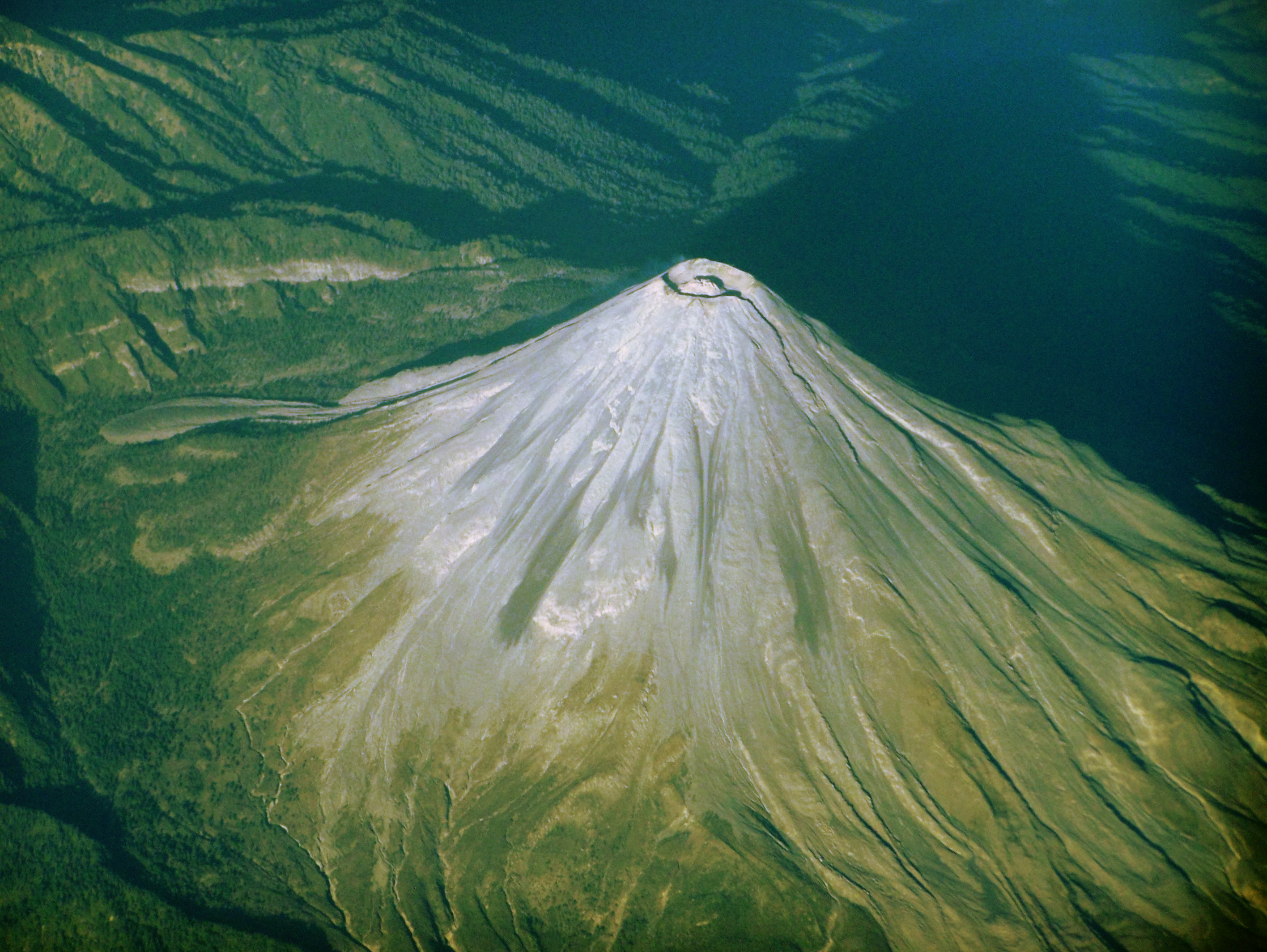
 Colima volcano in Mexico, from 33,000 feet (Feb. 9, 2008). The summit crater dome and pyroclastic flows that ran down the slopes in past eruptions are visible.
- Natural Resources Canada (NRC)
- Instituto Nacional de Estadística, Geografía e Informática (INEGI) de México
- National Geodetic Survey (NGS)
- United States Geological Survey (USGS)
- Canadian Mountain Encyclopedia @ bivouac.com
- North America @ peakbagger.com
- World Mountain Encyclopedia @ peakware.com
- peaklist.org
- summitpost.org
- NY-NJTC: Slide Mountain Wilderness Trail Details and Info
Mountain peaks of North America Sovereign states - Antigua and Barbuda
- Bahamas
- Barbados
- Belize
- Canada
- Costa Rica
- Cuba
- Dominica
- Dominican Republic
- El Salvador
- Grenada
- Guatemala
- Haiti
- Honduras
- Jamaica
- Mexico
- Nicaragua
- Panama
- Saint Kitts and Nevis
- Saint Lucia
- Saint Vincent and the Grenadines
- Trinidad and Tobago
- United States
Dependencies and
other territories- Anguilla
- Aruba
- Bermuda
- Bonaire
- British Virgin Islands
- Cayman Islands
- Curaçao
- Greenland
- Guadeloupe
- Martinique
- Montserrat
- Puerto Rico
- Saint Barthélemy
- Saint Martin
- Saint Pierre and Miquelon
- Saba
- Sint Eustatius
- Sint Maarten
- Turks and Caicos Islands
- United States Virgin Islands
Categories:- Lists of mountains by continent
- Lists of mountains by elevation
- Lists of mountains by prominence
- Lists of mountains by isolation
- Mountains of North America
- North America-related lists
-


Wikimedia Foundation. 2010.