- Novi Sad
-
For other uses, see Novi Sad (disambiguation).
Novi Sad
Нови Сад— City — 

Flag
Coat of armsNickname(s): Serbian Athens Location of Novi Sad within Serbia
Coordinates: 45°15′N 19°51′E / 45.25°N 19.85°E Country  Serbia
Province  Vojvodina
District South Bačka Municipalities 2 Founded 1694 City status 1 February 1748 Government - Mayor Igor Pavličić (DS) Area - City 699 km2 (269.9 sq mi) - Urban 129.4 km2 (49.9 sq mi) - Metro 1,106 km2 (426.5 sq mi) Elevation 80 m (262 ft) Population (2011)[1] - City  359,951
- Density 514.9/km2 (1,333.6/sq mi) - Urban 283,283 - Urban density 2,189.2/km2 (5,670/sq mi) - Metro 388,280 - Metro density 351.1/km2 (910.4/sq mi) Time zone CET (UTC+1) - Summer (DST) CEST (UTC+2) Postal code 21000 Area code(s) +381(0)21 Car plates NS Website www.novisad.rs Novi Sad (Serbian Cyrillic: Нови Сад, pronounced [nɔ̝̂v̞iː sâːd] (
 listen)) is the capital[2] of the northern Serbian province of Vojvodina, and the administrative centre of the South Bačka District. The city is located in the southern part of Pannonian Plain on the Danube river.
Novi Sad is the second largest city in Serbia, after Belgrade.[3][4] According to preliminary results of the latest census in Serbia conducted in October 2011, the city has a population of 335,701.[1] It is located on the border of the Bačka and Srem regions, on the banks of the Danube river and Danube-Tisa-Danube Canal, facing the northern slopes of Fruška Gora mountain.
The city was founded in 1694, when Serb merchants formed a colony across the Danube from the Petrovaradin fortress, a Habsburg strategic military post. In the 18th and 19th centuries, it became an important merchant and manufacturing centre, as well as a centre of Serbian culture of that period, earning the nickname Serbian Athens.[5][6] The city was heavily devastated in the 1848 Revolution, but it was subsequently restored. During the city's long history, it has maintained its multi-cultural identity, with Serbs, Hungarians and Germans being the main ethnic groups. Today, Novi Sad is an industrial and financial centre of the Serbian economy, as well as a major cultural hub. Also, it is associated member of Eurocities[7].
Contents
Name
The name Novi Sad means "New Plantation" (noun) in Serbian. Its Latin name, stemming from establishment of city rights, is "Neoplanta". The official names of Novi Sad used by the local administration are:
In both Croatian and Romanian, which are official in the provincial administration, the city is called "Novi Sad". Historically, it was also called "Neusatz" in German.
In its wider meaning, the name Grad Novi Sad refers to the "City of Novi Sad", which is one of the city-level administrative units of Serbia. Novi Sad could also refer strictly to the urban part of the City of Novi Sad (including "Novi Sad proper", and towns of Sremska Kamenica and Petrovaradin), as well as only to the historical core on the left Danube bank, i.e. "Novi Sad proper" (excluding Sremska Kamenica and Petrovaradin).
History
Main article: History of Novi Sad View from Novi Sad of Petrovaradin Fortress over the Danube river.
Older settlements in the territory of present-day Novi Sad
Human settlement on the territory of present-day Novi Sad has been traced as far back as the Stone Age (about 4500 B.C.). This settlement was located on the right bank of the river Danube in the territory of present-day Petrovaradin. This region was conquered by Celts (in the 4th century B.C.) and Romans (in the 1st century B.C.). The Celts founded the first fortress at this location, which was located on the right bank of the Danube. During Roman rule, a larger fortress was built in the 1st century with the name Cusum and was included into the Roman province of Pannonia. In the 5th century, Cusum was devastated by the invasion of the Huns.
By the end of the 5th century, Byzantines had reconstructed the town and called it by the names Cusum and Petrikon. The town was later conquered by Ostrogoths, Gepids, Avars, Franks, Bulgarians, and again by Byzantines. The region was conquered by the Kingdom of Hungary between the 10th and 12th century, and the town was mentioned under the name Bélakút or Peturwarad (Pétervárad, Serbian: Petrovaradin) in documents from 1237. In the same year (1237), several other settlements were mentioned to exist in the territory of modern urban area of Novi Sad (on the left bank of the Danube).
From 13th to 16th century, the following settlements existed in the territory of modern urban area of Novi Sad:[8][9]
- on the right bank of the Danube: Pétervárad (Serbian: Petrovaradin) and Kamanc (Serbian: Kamenica).
- on the left bank of the Danube: Baksa or Baksafalva (Serbian: Bakša, Bakšić), Kűszentmárton (Serbian: Sent Marton), Bivalyos or Bivalo (Serbian: Bivaljoš, Bivalo), Vásárosvárad or Várad (Serbian: Vašaroš Varad, Varadinci), Zajol I (Serbian: Sajlovo I, Gornje Sajlovo, Gornje Isailovo), Zajol II (Serbian: Sajlovo II, Donje Sajlovo, Donje Isailovo), Bistritz (Serbian: Bistrica).
Some other settlements existed in the suburban area of Novi Sad: Mortályos (Serbian: Mrtvaljoš), Csenei (Serbian: Čenej), Keménd (Serbian: Kamendin), Rév (Serbian: Rivica).
Etymology of the settlement names show that some of them are of Slavic origin, which indicate that they were initially inhabited by Slavs. For example, Bivalo (Bivaljoš) was a large Slavic settlement that dates from the 5th-6th century.[8] Some other settlement names are of Hungarian origin (for example Bélakút, Kűszentmárton, Vásárosvárad, Rév), which indicate that they were inhabited by Hungarians before the Ottoman invasion.[9] Some settlement names are of uncertain origin.
 Map of Novi Sad (Ratzen Stadt) from 1745.
Tax records from 1522 are showing a mix of Hungarian and Slavic names among inhabitants of these villages, including Slavic names like Bozso (Božo), Radovan, Radonya (Radonja), Ivo, etc. Following the Ottoman invasion in the 16th-17th century, some of these settlements were destroyed and most Hungarian inhabitants have left this area. Some of the settlements also existed during the Ottoman rule, and were populated by ethnic Serbs.
Between 1526 and 1687, the region was under Ottoman rule. In the year 1590, population of all villages that existed in the territory of present-day Novi Sad numbered 105 houses inhabited exclusively by Serbs. However, Ottoman records mention only those inhabitants that paid taxes, thus the number of Serbs that lived in the area (for example those that served in the Ottoman army) was larger.[10]
The founding and development of Novi Sad under Habsburg Monarchy
At the outset of Habsburg rule near the end of the 17th century, people of Orthodox faith were forbidden from residing in Petrovaradin, thus Serbs were largely unable to build homes there. Because of this, a new settlement was founded in 1694 on the left bank of the Danube. The initial name of this settlement was Serb City (Ratzen Stadt). Another name used for the settlement was Petrovaradinski Šanac. In 1718, the inhabitants of the village of Almaš were resettled to Petrovaradinski Šanac, where they founded Almaški Kraj ("the Almaš quarter").
According to 1720 data, the population of Ratzen Stadt was composed of 112 Serbian, 14 German, and 5 Hungarian houses. The settlement officially gained the present name Novi Sad (Neoplanta in Latin) in 1748 when it became a "free royal city".
The edict that made Novi Sad a "free royal city" was proclaimed on 1 February 1748. The edict reads:
We, Maria Theresa, by the grace of God Holy Roman Empress,
Queen of Hungary, Bohemia, Moravia, Dalmatia, Croatia, Slavonia, Rama, Serbia, Galicia, Lodomeria, Carinthia, [...]
cast this proclamation to anyone, whom it might concern...so that the renowned Petrovaradinski Šanac, which lies on the other side of the Danube in the Bačka province on the Sajlovo land, by the might of our divine royal power and prestige...make this town a Free Royal City and to fortify, accept and acknowledge it as one of the free royal cities of our Kingdom of Hungary and other territories, by abolishing its previous name of Petrovaradinski Šanac, renaming it Neoplantae (Latin), Új-Vidégh (Hungarian), Neusatz (German) and Novi Sad (Serbian). Petrovaradin fortress used to be known as the Habsburg Gibraltar.
For much of the 18th and 19th centuries, Novi Sad was the largest city in the world populated by ethnic Serbs. The reformer of the Serbian language, Vuk Stefanović Karadžić, wrote in 1817 that Novi Sad is the "largest Serb municipality in the world". It was a cultural and political centre of Serbs, who did not have their own national state at the time. Because of its cultural and political influence, Novi Sad became known as the Serbian Athens (Srpska Atina in Serbian). According to 1843 data, Novi Sad had 17,332 inhabitants, of whom 9,675 were Orthodox Christians, 5,724 Catholics, 1,032 Protestants, 727 Jews, and 30 adherents of the Armenian church. The largest ethnic group in the city were Serbs, and the second largest were Germans.
During the Revolution of 1848-1849, Novi Sad was part of Serbian Vojvodina, a Serbian autonomous region within the Habsburg Empire. In 1849, the Hungarian army located on the Petrovaradin Fortress bombarded and devastated the city, which lost much of its population. According to an 1850 census there were only 7,182 citizens in the city compared with 17,332 in 1843. Between 1849 and 1860, the city was part of a separate Austrian crownland known as the Vojvodina of Serbia and Tamiš Banat. After the abolishment of this province, the city was included into Bačka-Bodrog County.
After 1867, Novi Sad was located within the Hungarian part of Austria-Hungary. During this time, the Magyarization policy of the Hungarian government drastically altered the demographic structure of the city, i.e. from the predominantly Serbian, the population of the city became ethnically mixed.[citation needed]
Novi Sad after 1918
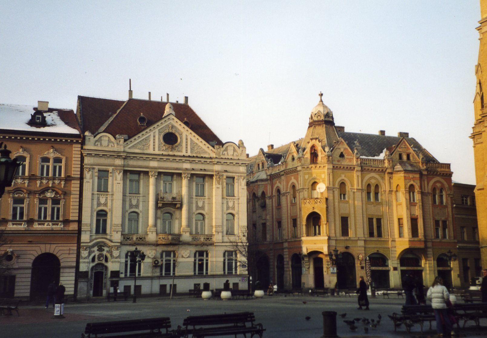
 Main square's neoclassical architecture.
On 25 November 1918, the "Assembly of Serbs, Bunjevci and other nations of Vojvodina" in Novi Sad proclaimed the union of Vojvodina region with the Kingdom of Serbia. Since 1 December 1918, Novi Sad was part of the Kingdom of Serbs, Croats, and Slovenes; and in 1929, it became the capital of the Danube Banovina, a province of the Kingdom of Yugoslavia.
In 1941, the Kingdom of Yugoslavia was invaded and partitioned by the Axis powers, and its northern parts, including Novi Sad, were annexed by Hungary. During World War II, about 5,000 citizens were murdered and many others were resettled. In three days of Novi Sad raid (21—23 January 1942) alone, Hungarian police killed 1,246 citizens, among them more than 800 Jews, and threw their corpses into the icy waters of the Danube, while the total death toll of the raid was around 2,500.[11][12] Citizens of all nationalities - Serbs, Hungarians, Slovaks, and others - fought together against the Axis authorities.[12] In 1975 the whole city was awarded the title People's Hero of Yugoslavia.
The communist partisans from Syrmia and Bačka entered the city on 23 October 1944. During the Military administration in Banat, Bačka and Baranja (October 17, 1944 - January 27, 1945), the partisans killed a number of citizens who were perceived as Axis collaborators or a threat to the new regime. According to article in Večernje novosti from June 9, 2009, most of the people killed by the partisans in Novi Sad were ethnic Serbs.[13]
 Novi Sad in the Interbellum period (1920).
Novi Sad became part of the new socialist Yugoslavia. Since 1945, Novi Sad has been the capital of Vojvodina, a province of the Socialist Federal Republic of Yugoslavia and Serbia. The city went through rapid industrialization and its population more than doubled in the period between World War II and the breakup of Yugoslavia. After 1992, Novi Sad was part of the Federal Republic of Yugoslavia, which, in 2003, was transformed into the State Union of Serbia and Montenegro. Since 2006, Novi Sad is part of an independent Serbia.
Devastated by NATO bombardment, during the Kosovo War of 1999, Novi Sad was left without all of its three Danube bridges, communications, water, and electricity. Residential areas were cluster bombed several times while its oil refinery was bombarded daily, causing severe pollution and widespread ecological damage.
Geography
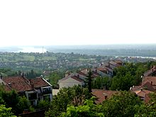
 Satellite image showing urban and metro area of Novi Sad.
The city lies on the S-shaped meander of the river Danube, which is only 350 meters wide beneath the Petrovaradin rock.[14] A section of the Danube-Tisa-Danube Canal marks the northern edge of wider city centre, and merges with the Danube. The main part of the city lies on the left bank of the Danube, in Bačka region, while smaller parts Petrovaradin and Sremska Kamenica lie on the right bank, in Srem (Syrmia) region. Bačka side of the city lies on one of the southern lowest parts of Pannonian Plain, while Fruška Gora side (Syrmia) is a horst mountain. Alluvial plains along Danube are well-formed, especially on the left bank, in some parts 10 km from the river. A large part of Novi Sad lies on a fluvial terrace with an elevation of 80–83 m (262.47–272.31 ft). The northern part of Fruška Gora is composed of massive landslide zones, but they are not active, except in the Ribnjak neighborhood (between Sremska Kamenica and Petrovaradin Fortress).[15]
The total land area of the city is 699 km², while the urban area is 129.7 km².[14]
Novi Sad is a typical Central European town. There are only a few buildings dating before 19th century, because the city was almost totally destroyed during the 1848/1849 revolution, so the architecture from 19th century dominates the city centre. Around the center, old small houses used to dominate the cityscape, but they are being replaced by modern multi-story buildings.
During the socialist period, new blocks with wide streets and multi-story buildings were built around the city core. However, not many communist-style high-rise buildings were built, and the total number of 10+ floor buildings remained at 40-50, most of the rest being 3-6 floor Apartment buildings. City's new boulevard (today's Bulevar oslobođenja) was cut through the old housings in 1962-1964, establishing major communication lines. Several more boulevards were subsequently built in a similar manner, creating an orthogonal network over what used to be mostly radial structure of the old town. Those interventions paved the way for a relatively unhampered growth of the city, which almost tripled its population since the 1950s, and traffic congestions (except on a few critical points) are still relatively mild despite the huge boost of car numbers, especially in later years.
See also: Famous buildings in Novi SadNeighbourhoods
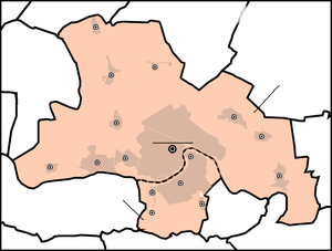
Main article: Neighborhoods of Novi Sad Map of the urban areas of Novi Sad
 Typical neighborhood in downtown Novi Sad
Some of the oldest neighbourhoods in the city are Stari Grad (Old Town), Rotkvarija, Podbara and Salajka. Sremska Kamenica and Petrovaradin, on the right bank of the Danube, were separate towns in the past, but today are parts of the urban area of Novi Sad. Liman (divided into four parts, numbered I-IV), as well as Novo Naselje are neighbourhoods built during 1960s, 1970s and 1980s with modern buildings and wide boulevards.
New neighbourhoods, like Liman, Detelinara and Novo Naselje, with modern high residential buildings emerged from fields and forests surrounding the city to house the huge influx of people from the countryside following World War II. Many old houses in the city centre, Rotkvarija and Bulevar neighbourhoods were torn down in the 1950s and 1960s to be replaced with multi-story buildings, as the city experienced a major construction boom during the last 10 years; some neighbourhoods, like Grbavica have completely changed their face.
Neighbourhoods with individual housing are mostly located away from the city center; Telep in the southwest and Klisa on the north are the oldest such quarters, while Adice, Veternička Rampa and Veternik on the west significantly expanded during last 15 years, partly due to an influx of Serb refugees during the Yugoslav wars.
Suburbs and villages
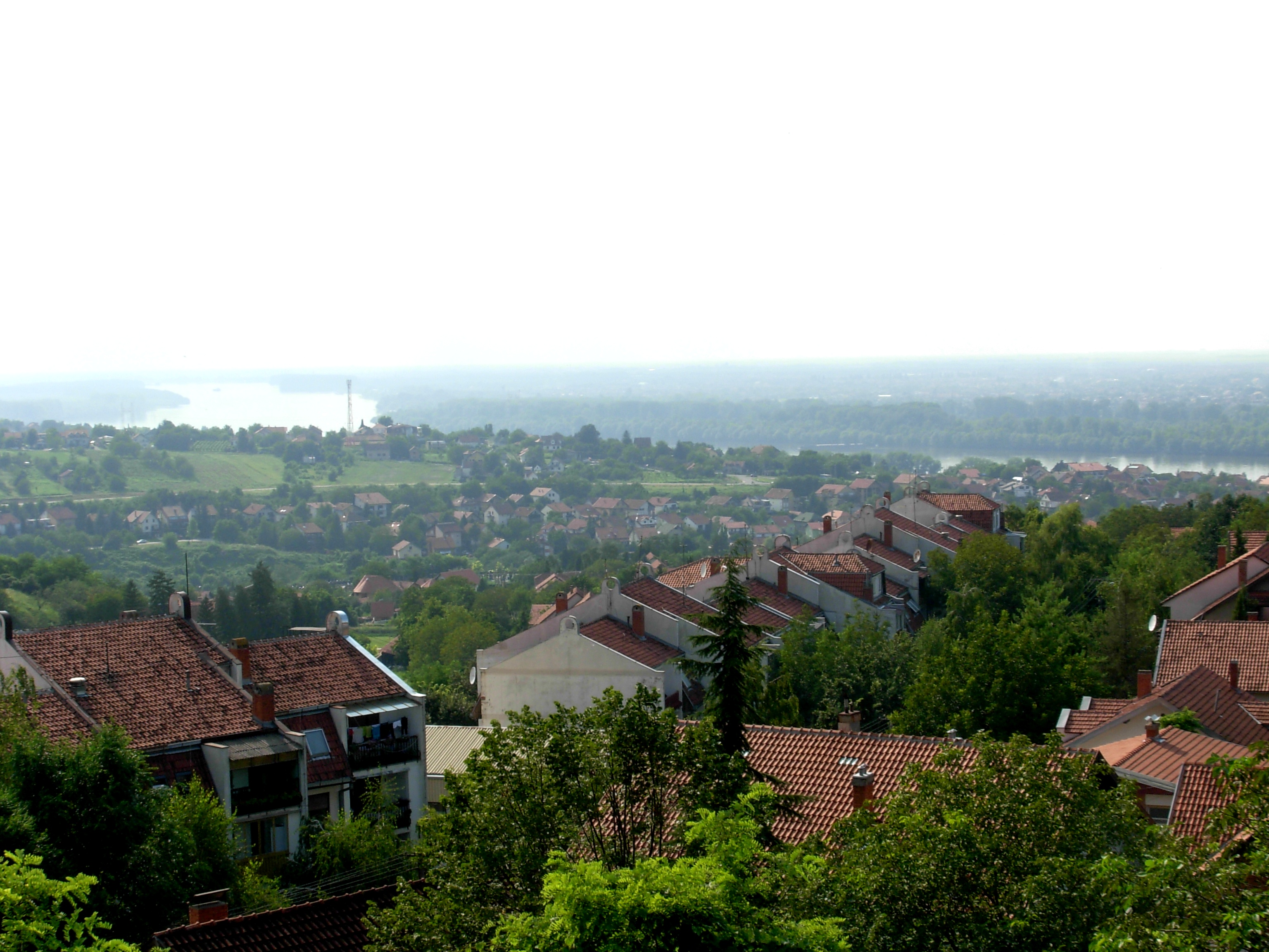
 Stremska Kamenica suburb
Besides the urban part of the city (which includes Novi Sad proper, with population of around 262,000, Petrovaradin (around 17,000) and Sremska Kamenica (around 12,000)), there are 12 more settlements and 1 town in Novi Sad's municipal area.[1] 23.7% of total city's population live in suburbs, the largest being Futog (20,000), and Veternik (17,000) on the West, which over the years, especially in the 1990s, have grown and physically merged to the city.
The most isolated and the least populated village in the suburban area is Stari Ledinci. Ledinci, Stari Ledinci and Bukovac are located on Fruška Gora slopes and the last two have only one paved road, which connect them to other places. Besides the urban area of Novi Sad, the suburb of Futog is also officially classified as "urban settlement" (a town), while other suburbs are mostly "rural" (villages).
Some towns and villages in separate municipalities of Sremski Karlovci, Temerin and Beočin which border City of Novi Sad, share the same public transportation and are also economically connected to Novi Sad.
 Novi SadCity of Novi Sad
●●●●●
No. Name Town or village Urban municipality Population[1](2009 data) 1 Begeč village Novi Sad 3,502 2 Budisava village Novi Sad 4,004 3 Bukovac village Petrovaradin 4,049 4 Čenej village Novi Sad 2,134 5 Futog town Novi Sad 20,378 6 Kać village Novi Sad 12,499 7 Kisač village Novi Sad 5,566 8 Kovilj village Novi Sad 5,612 9 Ledinci village Petrovaradin 1,881 10 Rumenka village Novi Sad 6,485 11 Stari Ledinci village Petrovaradin 926 12 Stepanovićevo village Novi Sad 2,216 13 Veternik village Novi Sad 16,503 Climate
Novi Sad has a temperate continental climate, with four seasons. Autumn is longer than spring, with long sunny and warm periods. Winter is not so severe, with an average of 22 days of complete sub-zero temperature. January is the coldest month, with an average temperature of −1.9 °C (28.6 °F). Spring is usually short and rainy, while summer arrives abruptly. The coldest temperature ever recorded in Novi Sad was −30.7 °C (−23.3 °F) on 24 January 1963; and the hottest temperature ever recorded was 41.6 °C (106.9 °F) on 24 July 2007.
The southeast-east wind Košava, which blows from the Carpathians and brings clear and dry weather, is characteristic of the local climate. It mostly blows in autumn and winter, in 2–3 days intervals. The average speed of Košava is 25–43 km per hour but certain strokes can reach up to 130 km/h. In winter time, accompanied by snow storms, it can cause snowdrifts.
Climate data for Rimski Šančevi, Novi Sad Month Jan Feb Mar Apr May Jun Jul Aug Sep Oct Nov Dec Year Record high °C (°F) 18.0
(64.4)22.4
(72.3)28.4
(83.1)31.0
(87.8)34.2
(93.6)36.1
(97.0)39.8
(103.6)40.0
(104.0)34.7
(94.5)29.3
(84.7)26.9
(80.4)21.0
(69.8)40.0
(104.0)Average high °C (°F) 2.5
(36.5)5.7
(42.3)11.5
(52.7)17.2
(63.0)22.2
(72.0)25.2
(77.4)27.2
(81.0)27.2
(81.0)23.7
(74.7)18.0
(64.4)10.3
(50.5)4.5
(40.1)16.3 Average low °C (°F) −4.4
(24.1)−2.3
(27.9)1.2
(34.2)5.8
(42.4)10.6
(51.1)13.6
(56.5)14.7
(58.5)14.2
(57.6)11.2
(52.2)6.3
(43.3)2.2
(36.0)−1.9
(28.6)5.9 Record low °C (°F) −28.6
(−19.5)−22
(−7.6)−19.9
(−3.8)−4.9
(23.2)−0.4
(31.3)0.2
(32.4)6.6
(43.9)6.9
(44.4)−1.6
(29.1)−5.4
(22.3)−13.8
(7.2)−19.6
(−3.3)−28.6
(−19.5)Rainfall mm (inches) 37.8
(1.488)34.8
(1.37)40.7
(1.602)46.8
(1.843)56.9
(2.24)82.5
(3.248)61.2
(2.409)55.3
(2.177)35.9
(1.413)34.8
(1.37)45.9
(1.807)44.2
(1.74)576.8
(22.709)Source: [16] Demographics
 The Orthodox Cathedral of Saint George.
 The Name of Mary Catholic Church, commonly known as "the Cathedral", dominates the Liberty Square.See also: Demographic history of Novi Sad
Novi Sad is the largest city in Vojvodina, and second largest in Serbia (after Belgrade). Since its founding, the population of the city has been constantly increasing. According to the 1991 census, 56.2% of the people who came to Novi Sad from 1961 to 1991 were from other parts of Vojvodina, while 15.3% came from Bosnia and Herzegovina and 11.7% from Central Serbia.
According to the last official census from 2002, the city's urban population was 216,583 and 299,294 with the surrounding inhabited places of the municipalities included.[3] In 1990s and 2000s, the city continued to experience significant population growth, so its urban population reached nearly 300,000 in 2011.[1]
Historical population
Population of Novi Sad through history:
- 1798: 6,890
- 1848: 18,530
- 1900: 28,763
- 1910: 33,089
- 1921: 39,122
- 1931: 63,985
- 1941: 61,731
- 1948: 69,431
- 1953: 76,752
- 1961: 102,469
- 1971: 141,375
- 1981: 170,020
- 1991: 179,626
- 2002: 191,405 (or 216,583 together with Petrovaradin and Sremska Kamenica)
Ethnic groups
Ethnic groups in the municipal area and the city proper, according to the 2002 census:
Group Municipal area Novi Sad proper Total population 299,294 191,405 Serbs 76.73% 76.15% Hungarians 5.24% 6.03% Yugoslavs 3.17% 3.69% Slovaks 2.41% n/a Croats 2.09% 1.84% Others 9.91% 12.31% Most of the inhabited places in the municipalities have an ethnic Serb majority, while the village of Kisač has an ethnic Slovak majority.
Religion
See also: Religious architecture in Novi SadAccording to the 2002 census, the population of the municipal area of Novi Sad (comprising both municipalities) included 232,995 Orthodox Christians, 24,843 Catholics, 9,428 Protestants, 2,542 Muslims, 129 Jews, and others. City is the seat of the Serbian Orthodox Eparchy of Bačka and of the Muftiship of Novi Sad of the Islamic Community in Serbia.
Politics
 Novi Sad City HallMain article: Politics of Novi Sad
Novi Sad is the administrative centre of the Autonomous Province of Vojvodina, and as such, is home to Vojvodina's Government and Provincial Assembly.
The city's administration bodies consist of city assembly as representative body, mayor and city government as executive body. Members of the city assembly and mayor are elected at direct elections. City assembly has 78 seats, while city government has 11 members. The mayor and members of city's assembly are elected to four-year terms; and city government is elected on mayor’s proposal by the city assembly by majority of votes.
As of 2008 election, mayor of Novi Sad is Igor Pavličić (Democratic Party); while in the city assembly majority have Democratic Party, G17+, Together for Vojvodina and Hungarian Coalition.
Since 2002, when the new statute of Novi Sad came into effect, City of Novi Sad is divided into 46 local communities within two urban municipalities, Novi Sad and Petrovaradin, whose borders are defined by geographic boundaries (Danube river).
Sister cities
See also: List of twin towns and sister cities in SerbiaNovi Sad has relationships with several twin towns. One of the main streets in its city centre is named after Modena in Italy; and likewise Modena has named a park in its town centre Parco di Piazza d'Armi Novi Sad. The Novi Sad Friendship Bridge in Norwich, United Kingdom, by Buro Happold, was also named in honour of Novi Sad. Besides twin cities, Novi Sad has many signed agreements on joint cooperation with many European cities (see also: Twin cities of Novi Sad). As of 2006[update], Novi Sad's twin towns are:
Economy

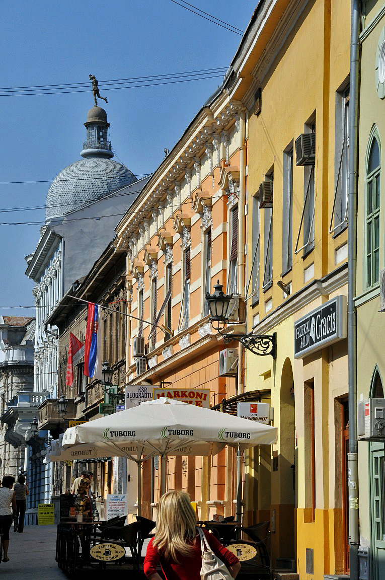
 Dunavska shopping street
Novi Sad is the economic centre of Vojvodina, the most fertile agricultural region in Serbia. The city also is one of the largest economic and cultural centres in Serbia and former Yugoslavia.
Novi Sad had always been a relatively developed city within Yugoslavia. In 1981 its GDP per capita was 172% of the Yugoslav average.[18] In the 1990s, the city (like the rest of Serbia) was severely affected by an internationally imposed trade embargo and hyperinflation of the Yugoslav dinar. The embargo and economic mismanagement lead to a decay or demise of once big industrial combines, such as Novkabel (electric cable industry), Pobeda (metal industry), Jugoalat (tools), Albus and HINS (chemical industry). Practically the only viable remaining large facility is the oil refinery, located northeast of the town (along with the thermal power plant), near the settlement of Šangaj.
The economy of Novi Sad has mostly recovered from that period and it has grown strongly since 2001, shifting from industry-driven economy to the tertiary sector. The processes of privatization of state and society-owned enterprises, as well as strong private incentive, increased the share of privately-owned companies to over 95% in the district, and small and medium-size enterprises dominated the city's economic development.[19]
The significance of Novi Sad as a financial center is proven by numerous banks such as Vojvođanska Bank, Erste Bank, Kulska Bank, Meridian Bank, Metals Bank, NLB Continental Bank and Panonska Bank;[20] and second largest insurance company in Serbia - DDOR Novi Sad. The city is also home to the major oil company - Naftna Industrija Srbije. It is also the seat of the wheat market.
At the end of 2005, Statistical office of Serbia published a list of most developed municipalities in Serbia, placing City of Novi Sad at No.7 by national income, behind some Belgrade municipalities and Bečej, with 201.1% above Serbia's average.[21]
Culture
 Matica srpska, the most prominent cultural institution in the city and of the whole Serbian culture.
In the 19th century, the city was the capital of Serbian culture, earning the nickname Serbian Athens. In that time, almost every Serbian novelist, poet, jurist, and publicist at the end of 19th century and at the beginning of 20th century had lived or worked in Novi Sad some time of his or her career. Among others, these cultural workers include Vuk Stefanović Karadžić, Mika Antić, Đura Jakšić, etc. Matica srpska, the oldest cultural-scientific institution of Serbia, was moved from Budapest to Novi Sad in 1864, and contains a library (the Library of Matica srpska) with over 800,000 books. The Serbian National Theatre, the oldest professional theatre among the South Slavs, was founded in Novi Sad in 1861.
Today, Novi Sad is the second cultural centre in Serbia (besides Belgrade) and city's officials try to make the city more attractive to numerous cultural events and music concerts. Since 2000, Novi Sad is home to the EXIT festival, the biggest music summer festival in Serbia and the region; and also the only festival of alternative and new theatre in Serbia. Zmaj Children Games, International Novi Sad Literature Festival, Sterijino pozorje, Novi Sad Jazz Festival, and many others.[22] Besides Serbian National Theatre, the most prominent theatres are also Youth Theatre, Cultural centre of Novi Sad and Novi Sad Theatre. Novi Sad Synagogue also houses many cultural events in the City. Other city's cultural institutions include Offset of the Serbian Academy of Science and Art, Library of Matica Srpska, Novi Sad City Library and Azbukum. City is also home to cultural institutions of Vojvodina: Vojvodina Academy of Science and Art and Archive of Vojvodina, which collect many documents from Vojvodina dating from 1565.
Novi Sad has several folk song societies, (kulturno-umetničko društvo, KUD). The most well known societies in the city are: KUD Svetozar Marković, AKUD Sonja Marinković, SKUD Željeznicar, FA Vila and the oldest SZPD Neven, established in 1900. National minorities expose their own tradition, folklore and songs in Hungarian MKUD Petőfi Sándor, Slovak SKUD Pavel Jozef Šafárik, Rusyn RKPD Novi Sad, and other societies.
Museums
The city has several museums and galleries, public and privately owned. The most well known museum in the city is Museum of Vojvodina, founded by Matica srpska in 1847, which houses a permanent collection of Serbian culture and a life in Vojvodina through history. Museum of Novi Sad in Petrovaradin Fortress has a permanent collection of history of fortress.
Gallery of Matica Srpska is the biggest and most respected gallery in the city, which has two galleries in the city centre. There is also The Gallery of Fine Arts - Gift Collection of Rajko Mamuzić and The Pavle Beljanski Memorial Collection - one of the biggest collections of Serbian art from 1900s until 1970s.
Education
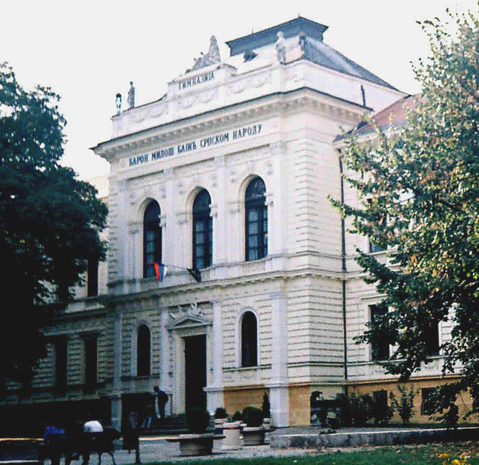
Main article: Education in Novi Sad Jovan Jovanović Zmaj Grammar School, the oldest school in Novi Sad. Established in 1810.
Novi Sad is one of the most important centers of higher education and research in Serbia, with four universities and numerous professional, technical, and private colleges and research institutes, including a law school with its own publication.
Novi Sad is home to two universities and seven private faculties.[23] The largest educational institution in the city is the University of Novi Sad with approximately 38,000 students and 2,700 in staff. It was established in 1960 with 9 faculties in Novi Sad of which 7 are situated in modern university campus. There are also Novi Sad Open University and Novi Sad Theological College in the city.
In Novi Sad there are 36 elementary schools (33 regular and 3 special) with 26,000 students.[24] The secondary school system consists of 11 vocational schools and 4 grammar schools with almost 18,000 students.[24]
Media
Novi Sad has two major daily newspapers, Dnevnik and Građanski list, both in Serbian. Until 2006, Magyar Szó, a newspaper in Hungarian, had its headquarters in Novi Sad, but it was moved to Subotica. The city is home to the main headquarters of the regional public broadcaster Radio Television of Vojvodina - RTV and city's public broadcaster Apolo,[25] as well as a few commercial TV stations, Kanal 9,[26] Panonija[27] and RTV Most.[28] Novi Sad has many local commercial radio stations, dominant being Radio 021[29] and Radio As.[30]
Novi Sad is also known as a center of publishing. The most prominent publishers are Matica srpska, Stilos, Prometej, Zoran Stojanovic’s publishing house, IP Adresa[31] etc. There few well-known journals in literature and art: Letopis Matice srpske, the oldest Serbian Journal; Polja,[32] issued by Cultural Center of Novi Sad and Zlatna greda, which is issued by the Association of Writers of Vojvodina.[33]
Tourism
 Freedom square
The number of tourists visiting Novi Sad each year has steadily risen since 2000. Every year, in the beginning of July, during the annual EXIT music festival, the city is full of young people from all over Europe. In 2005, over 150,000 people visited the festival, which put Novi Sad on the map of summer festivals in Europe.[34] Besides EXIT festival, Novi Sad Fair attract many business people into the city; in May, the city is home to the biggest agricultural show in the region, which 600,000 people visited in 2005.[35] There is also a tourist port near Varadin Bridge in the city centre welcoming various river cruise vessels from across Europe who cruise on Danube river.
The most recognized structure in Novi Sad is Petrovaradin Fortress, which dominates the city and with scenic views of the city. Besides the fortress, there is also historic neighborhood of Stari Grad, with many monuments, museums, caffes, restaurants and shops. There is also a National Park of Fruška Gora nearby, approx. 20 km from city centre.
Sport
Sports started to develop in 1790 with the foundation of "City Marksmen Association". However, its serious development started after the establishment of the Municipal Association of Physical Culture in 1959 and after 1981, when Spens Sports Center was built. Today, about 220 sports organizations are active in Novi Sad. Novi Sad is the second best developed sports city in Serbia (after Belgrade).
The most popular sport in the city is definitely football. There are many football pitches in Novi Sad's neighborhoods, as well as in every town and village in the suburbs. Besides FK Vojvodina, which is in the first league, there are many smaller clubs in the national second and third league. Most well known are: FK Novi Sad, FK Kabel, FK Mladost, FK Slavija Novi Sad, etc.
Citizens of Novi Sad participated in the first Olympic Games in Athens. The largest number of sportsmen from Novi Sad participated in the Atlanta Olympic Games – 11, and they won 6 medals, while in Moscow – 3, and in Montreal and Melbourne – 2.
Novi Sad was the host of the European and World Championships in table tennis in 1981,[36] 29th Chess Olympiad in 1990, European and World Championships in sambo, Balkan and European Championships in judo, 1987 final match in the Cup winners cup of European Basketball[36][37] and final tournament of the European Cup in volleyball.[36] Apart from that Novi Sad is the host of the World League in volleyball and traditional sport events such as Novi Sad marathon, international swimming rally and many other events. Between the 16 and 20 September 2005, Novi Sad co-hosted the 2005 European Basketball Championship.[36]
Club Sport Founded League Venue FK Vojvodina Football 1914 Jelen Superliga Karađorđe Stadium KK Vojvodina Basketball 2000 Sinalco Superleague Spens Sports Center KK Novi Sad Basketball 1985 Sinalco Superleague Spens Sports Center OK Vojvodina Volleyball 1946 Serbian volley league Spens Sports Center HK Vojvodina Hockey 1957 Serbian Hockey League Spens Sports Center HK Novi Sad Hockey 1998 Serbian Hockey League Spens Sports Center  Štrand beach on the Danube River.
Hk Vojvodina hosted the first hockey competitions in the region. Founded by visiting Czech students, the team and youth program continues since 1957. During this time HK vojvodina has captured 6 Yugoslavia/Serbia Champions Cup at the senior level. Recently, in March 2009, the club has won the Panonian league, representing the champion of Serbia/Croatia. A terrible fire tore through the Spens Sports Center after the championship win, resulting in the loss of all equipment. The club has used the friendship built between Canadian hockey teams and players. At the Div II World Championships hosted by Hk Vojvodina in NoviSad, 7 players from the club represented Serbia. Serbia won the gold medal and have been promoted to the Division I level for 2010.
Recreation
Apart from the culture of attending sports events, people from Novi Sad participate in a wide range of recreational and leisure activities. Football and basketball are the most popular participation team sports in Novi Sad. Cycling is also a very popular in Novi Sad. Novi Sad's flat terrain and extensive off-road paths in the mountainous part of town, in Fruška Gora is conducive to riding. Hundreds of commuters cycle the roads, bike lanes and bike paths daily.
Proximity to the Fruška Gora National Park attracts many people from the city on weekends in many hiking trails, restaurants and monasteries on the mountain. In the first weekend of May, there is a "Fruška Gora Marathon", with many hiking trails for hikers, runners and cyclists.[38] During the summer, there is Lake of Ledinci in Fruška Gora, but also there are numerous beaches on the Danube, the largest being Štrand in the Liman neighborhood. There are also a couple of small recreational marinas on the river.
Infrastructure
 Main rail stationMain article: Infrastructure of Novi Sad
Novi Sad lies on the branch B of Pan-European Corridor X. E 75 highway connects the city with Subotica on north and Belgrade on south. It is concurrent with Budapest–Belgrade railroad, which connects it to major European cities. Novi Sad is connected with Zrenjanin and Timişoara on the northwest and Ruma on south with a motorway; there are long-term plans to upgrade it to a highway, with a tunnel under the Fruška Gora shortcutting the Iriški Venac mountain pass.[39][40]
Novi Sad currently does not have its own civil airport. The city is about a one-hour drive from Belgrade Nikola Tesla Airport, which connects it with capitals across Europe. Airports in nearby Timişoara and Osijek also offer low-cost flights to European destinations. Small Čenej Airport north of the city is used for sport and agricultural purposes. There are plans to upgrade it to serve for cargo and small-scale public transport,[41] but the future of this initiative is uncertain.
 Urban bus line network
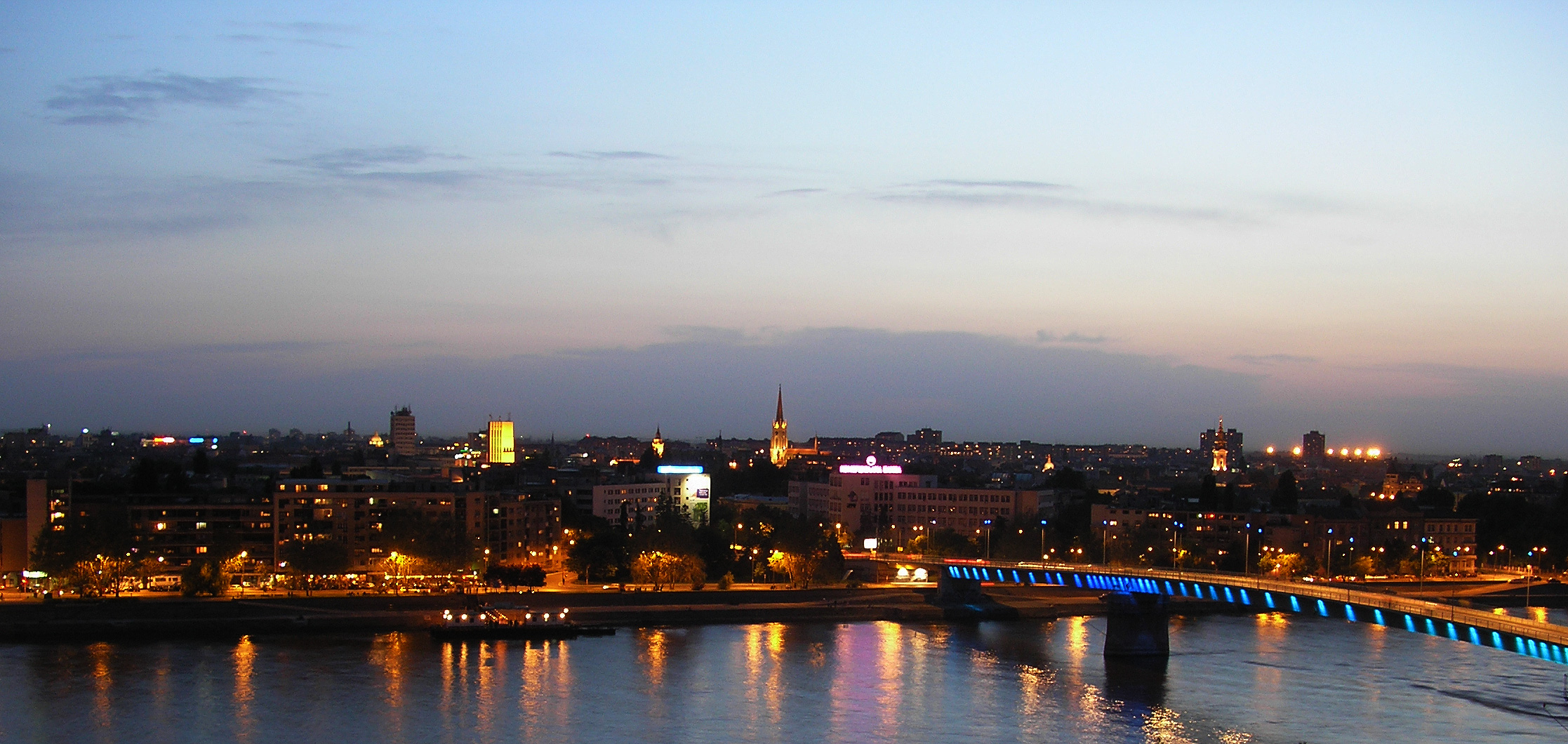
Three bridges cross the Danube in Novi Sad: Liberty Bridge (Most Slobode) connects Sremska Kamenica with the city proper. Varadin Bridge (Varadinski most), connects Petrovaradin with city centre, along with the temporary Road-Railway Bridge, used chiefly for railway and heavy truck traffic. Its replacement with new Žeželj Bridge starts in summer 2011.[42] Three bridges span the Danube-Tisa-Danube canal, running north of the city center.
Public transportation
The main public transportation system in Novi Sad consists of bus lines. There are twenty-one urban lines and twenty-nine suburban lines. The operator is JGSP Novi Sad, with its main bus station at the northern end of the Liberation Boulevard, next to the railway station. In addition, there are numerous taxi companies serving the city. The city used to have a tram system, but it was disassembled in 1958.
See also
- NATO bombing of Novi Sad in 1999
- List of places in Serbia
- List of cities, towns and villages in Vojvodina
- List of people from Novi Sad
- Novi Sad Fair
References
- ^ a b c d e "Prvi rezultati popisa 2011." (in Serbian,English). Zavod za statistiku Republike Srbije. http://media.popis2011.stat.rs/2011/prvi_rezultati.pdf. Retrieved 2011-11-15.
- ^ Official page of government of Vojvodina, 12 November 2009
- ^ a b (in Serbian) Popis stanovništva, domaćinstava i Stanova 2002. Knjiga 1: Nacionalna ili etnička pripadnost po naseljima. Statistical Office of Serbia. 2003. ISBN 86-84443-00-09.
- ^ "Municipalities of Serbia, 2006". Statistical Office of Serbia. http://webrzs.stat.gov.rs/axd/Zip/OG2006webE.zip.
- ^ Mishkova, Diana. We, the people: politics of national peculiarity in Southeastern Europe. pp. 277–278. http://books.google.com/books?id=pbi_wzu7QAMC&pg=PA278.
- ^ "History of Novi Sad". Official Website of Novi Sad. http://www.novisad.rs/en/content/history-of-novi-sad.
- ^ "EUROCITIES - the network of major European cities". Eurocities. http://www.eurocities.eu. Retrieved 8 November 2011.
- ^ a b Branko Ćurčin, Slana Bara nekad i sad, Novi Sad, 2002.
- ^ a b Borovszky Samu: Magyarország vármegyéi és városai, Bács-Bodrog vármegye I.-II. kötet, Apolló Irodalmi és Nyomdai Részvénytársaság, 1909.
- ^ Đorđe Randelj, Novi Sad slobodan grad, Novi Sad, 1997.
- ^ David Cesarani (1997). Genocide and Rescue: The Holocaust in Hungary 1944. Berg Publishers. p. 13. ISBN 1859731260. http://books.google.com/?id=HrK8B0VpFBkC&pg=PR7. Retrieved 2009-08-04.
- ^ a b Enikő A. Sajti (Spring 2006). "The Former 'Southlands' in Serbia: 1918- 1947". The Hungarian Quarterly XLVII (181). http://www.hungarianquarterly.com/no181/9.html. Retrieved 2009-08-04.
- ^ Večernje Novosti, Utorak, 9. Jun 2009, strana 11, mapa masovnih grobnica u Srbiji.
- ^ a b "Novi Sad in numbers". City of Novi Sad. http://www.novisad.rs/en/content/novi-sad-in-numbers. Retrieved 2010-10-12.
- ^ Завод за урбанизам: "Еколошки Атлас Новог Сада" ("Ecological Atlas of Novi Sad"), page 14-15, 1994.
- ^ "Weather data for Rimski Šančevi-Novi Sad" (in (Serbian)). Republic Hydrometeorological Service of Serbia. http://www.hidmet.gov.rs/ciril/meteorologija/stanica_sr.php?moss_id=168. Retrieved 1961-1990.
- ^ "List of Twin Towns in the Ruhr District". © 2009 Twins2010.com. http://www.twins2010.com/fileadmin/user_upload/pic/Dokumente/List_of_Twin_Towns_01.pdf?PHPSESSID=2edd34819db21e450d3bb625549ce4fd. Retrieved 2009-10-28.
- ^ Radovinović, Radovan; Bertić, Ivan, eds (1984) (in Croatian). Atlas svijeta: Novi pogled na Zemlju (3rd ed.). Zagreb: Sveučilišna naklada Liber.
- ^ Regional Chamber of Commerce Novi Sad, Basic data
- ^ National Bank of Serbia - List of Banks operating in Serbia.
- ^ Municipalities of Serbia for 2005 ISSN-1452-4856.
- ^ Cultural events calendar
- ^ Ministry of education, list of private universities and faculties
- ^ a b Serbian statistical office
- ^ Apolotv.rs
- ^ Kanal9ns.com
- ^ Panonija.tv
- ^ Rtvmost.co.rs
- ^ 021.rs
- ^ Radioas.fm
- ^ Adresa.co.rs
- ^ Polja.eunet.rs
- ^ DKV.org.rs
- ^ History of EXIT festival
- ^ About agricultural fair in 2006 (in Serbian)
- ^ a b c d Најзначајније приредбе
- ^ Cup Winners’ Cup 1986-87
- ^ Fruška Gora Marathon
- ^ ""Poluautoput" Novi Sad - Temišvar?" (in Serbian). B92. 2010-04-09. http://www.b92.net/putovanja/vesti.php?nav_id=423315.
- ^ "Tunel kroz Frušku goru" (in Serbian). Blic. 2010-06-07. http://www.blic.rs/Vesti/Vojvodina/192755/Tunel-kroz-Frusku-goru.
- ^ "Betonska pista i toranj neophodni za sletanje aviona" (in Serbian). Danas. 2009-01-20. http://www.danas.rs/vesti/srbija/novi_sad/betonska_pista_i_toranj_neophodni_za_sletanje_aviona_.40.html?news_id=151159.
- ^ "NS: Ugovor za novi Žeželjev most" (in Serbian). Beta. 2011-01-25. http://www.b92.net/info/vesti/index.php?yyyy=2011&mm=01&dd=25&nav_id=488247.
Bibliography
- Boško Petrović - Živan Milisavac, Novi Sad - monografija, Novi Sad, 1987
- Milorad Grujić, Vodič kroz Novi Sad i okolinu, Novi Sad, 2004
- Jovan Mirosavljević, Brevijar ulica Novog Sada 1745-2001, Novi Sad, 2002
- Jovan Mirosavljević, Novi Sad - atlas ulica, Novi Sad, 1998
- Mirjana Džepina, Društveni i zabavni život starih Novosađana, Novi Sad, 1982
- Zoran Rapajić, Novi Sad bez tajni, Beograd, 2002
- Đorđe Randelj, Novi Sad - slobodan grad, Novi Sad, 1997
- Enciklopedija Novog Sada, sveske 1-26, Novi Sad, 1993–2005
- Radenko Gajić, Petrovaradinska tvrđava - Gibraltar na Dunavu, Novi Sad, 1994
- Veljko Milković, Petrovaradin kroz legendu i stvarnost, Novi Sad, 2001
- Veljko Milković, Petrovaradin i Srem - misterija prošlosti, Novi Sad, 2003
- Veljko Milković, Petrovaradinska tvrđava - podzemlje i nadzemlje, Novi Sad, 2005
- Veljko Milković, Petrovaradinska tvrđava - kosmički lavirint otkrića, Novi Sad, 2007
- Agneš Ozer, Petrovaradinska tvrđava - vodič kroz vreme i prostor, Novi Sad, 2002
- Agneš Ozer, Petrovaradin fortress - a guide through time and space, Novi Sad, 2002
- 30 godina mesne zajednice "7. Juli" u Novom Sadu 1974-2004 - monografija, Novi Sad, 2004
- Branko Ćurčin, Slana Bara - nekad i sad, Novi Sad, 2002
- Branko Ćurčin, Novosadsko naselje Šangaj - nekad i sad, Novi Sad, 2004
- Zvonimir Golubović, Racija u Južnoj Bačkoj 1942. godine, Novi Sad, 1991
- Petar Jonović, Knjižare Novog Sada 1790-1990, Novi Sad, 1990
- Petar Jonović - Dr Milan Vranić - Dr Dušan Popov, Znameniti knjižari i izdavači Novog Sada, Novi Sad, 1993
- Ustav za čitaonicu srpsku u Novom Sadu, Novi Sad, 1993
- Sveske za istoriju Novog Sada, sveske 4-5, Novi Sad, 1993–1994
External links
- Novi Sad Gallery
- Novi Sad - Official website (Serbian) (English)
- City assembly - Official website (Serbian)
- Virtual tours through Novi Sad
- Novi Sad - Interactive Map
- Novi Sad travel guide from Wikitravel
Hero Cities of the Socialist Federal Republic of Yugoslavia Cities, towns and villages in the South Bačka District Seat of the district: City of Novi Sad
Novi Sad municipality1: Begeč • Budisava • Čenej • Futog • Kać • Kisač • Kovilj • Rumenka • Stepanovićevo • Veternik
Petrovaradin1: Bukovac • Ledinci • Sremska Kamenica • Stari Ledinci
Bač: Bačko Novo Selo • Bođani • Plavna • Selenča • Vajska
Bačka Palanka: Čelarevo • Despotovo • Gajdobra • Karađorđevo • Mladenovo • Neštin • Nova Gajdobra • Obrovac • Parage • Pivnice • Silbaš • Tovariševo • Vizić
Bački Petrovac: Gložan • Kulpin • Maglić
Bečej: Bačko Gradište • Bačko Petrovo Selo • Mileševo • Radičević
Beočin: Banoštor • Čerević • Grabovo • Lug • Rakovac • Susek • Sviloš
Srbobran: Nadalj • Turija
Sremski Karlovci
Temerin: Bački Jarak • Sirig
Titel: Gardinovci • Lok • Mošorin • Šajkaš • Vilovo
Vrbas: Bačko Dobro Polje • Kosančić • Kucura • Ravno Selo • Savino Selo • Zmajevo
Žabalj: Čurug • Đurđevo • Gospođinci
(*) bold are municipalities, 1 - Novi Sad`s urban municipalities, which aren't fully formedMunicipalities and cities of Serbia Central Serbia Belgrade (Barajevo • Čukarica • Grocka • Lazarevac • Mladenovac • Novi Beograd • Obrenovac • Palilula • Rakovica • Savski Venac • Sopot • Stari Grad • Surčin • Voždovac • Vračar • Zemun • Zvezdara) • Čačak • Jagodina • Kragujevac (Aerodrom • Pivara • Stanovo • Stari Grad • Stragari) • Kraljevo • Kruševac • Leskovac • Loznica • Niš (Crveni Krst • Medijana • Niška Banja • Palilula • Pantelej) • Novi Pazar • Požarevac • Smederevo • Šabac • Užice • Valjevo • Vranje • Zaječar Aleksandrovac • Aleksinac • Aranđelovac • Arilje • Babušnica • Bajina Bašta • Batočina • Bela Palanka • Blace • Bogatić • Bojnik • Boljevac • Bor • Bosilegrad • Brus • Bujanovac • Crna Trava • Čajetina • Ćićevac • Ćuprija • Despotovac • Dimitrovgrad • Doljevac • Gadžin Han • Golubac • Gornji Milanovac • Ivanjica • Kladovo • Knić • Knjaževac • Koceljeva • Kosjerić • Krupanj • Kučevo • Kuršumlija • Lajkovac • Lapovo • Lebane • Lučani • Ljig • Ljubovija • Majdanpek • Mali Zvornik • Malo Crniće • Medveđa • Merošina • Mionica • Negotin • Nova Varoš • Osečina • Paraćin • Petrovac • Pirot • Požega • Preševo • Priboj • Prijepolje • Prokuplje • Rača • Raška • Ražanj • Rekovac • Sjenica • Smederevska Palanka • Sokobanja • Surdulica • Svilajnac • Svrljig • Topola • Trgovište • Trstenik • Tutin • Ub • Varvarin • Velika Plana • Veliko Gradište • Vladičin Han • Vladimirci • Vlasotince • Vrnjačka Banja • Žabari • Žagubica • Žitorađa
Vojvodina 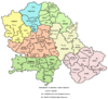 Ada • Alibunar • Apatin • Bač • Bačka Palanka • Bačka Topola • Bački Petrovac • Bečej • Bela Crkva • Beočin • Čoka • Inđija • Irig • Kanjiža • Kikinda • Kovačica • Kovin • Kula • Mali Iđoš • Nova Crnja • Novi Bečej • Novi Kneževac • Odžaci • Opovo • Pećinci • Plandište • Ruma • Sečanj • Senta • Šid • Srbobran • Sremski Karlovci • Stara Pazova • Temerin • Titel • Vrbas • Vršac • Žabalj • Žitište
Kosovo Dečani • Đakovica • Dragaš • Glogovac • Gnjilane • Istok • Kačanik • Klina • Kosovo Polje • Kosovska Kamenica • Kosovska Mitrovica • Leposavić • Lipljan • Mališevo • Novo Brdo • Obilić • Orahovac • Peć • Podujevo • Priština • Prizren • Štimlje • Srbica • Štrpce • Suva Reka • Uroševac • Vitina • Vučitrn • Zubin Potok • Zvečan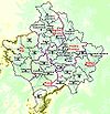 New Municipalities: Đeneral Janković • Gračanica • Junik • Klokot-Vrbovac • Mamuša • Parteš • RanilugPlanned Municipality: North Kosovska Mitrovica
The Danube Countries 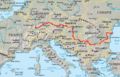
Cities Tributaries Islands List of crossings Categories:- Hero Cities of the Socialist Federal Republic of Yugoslavia
- Populated places established in 1694
- Novi Sad
- Populated places in Vojvodina
- Places in Bačka
- Populated places on the Danube
- Port cities in Serbia
- University towns
- South Bačka District


Wikimedia Foundation. 2010.