- Ohmbach
-
Ohmbach 

 OhmbachLocation of Ohmbach within Kusel district
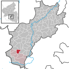
Coordinates 49°26′58″N 7°21′0″E / 49.44944°N 7.35°ECoordinates: 49°26′58″N 7°21′0″E / 49.44944°N 7.35°E Administration Country Germany State Rhineland-Palatinate District Kusel Municipal assoc. Schönenberg-Kübelberg Mayor Jochen Mayer (CDU) Basic statistics Area 3.90 km2 (1.51 sq mi) Elevation 313 m (1027 ft) Population 823 (31 December 2010)[1] - Density 211 /km2 (547 /sq mi) Other information Time zone CET/CEST (UTC+1/+2) Licence plate KUS Postal code 66903 Area code 06386 Website www.ohmbach.de Ohmbach is a municipality in the district of Kusel, in Rhineland-Palatinate, western Germany.
Contents
Geography
The town of Ohmbach is in the Ohmbachtal (literally "Ohm Creek Valley" in the Western Palatinate (Westpfalz). Adjacent to the north lies Herschweiler-Pettersheim, in the east Steinbach am Glan, in the south Brücken and in the west Altenkirchen.
History
Ohmbach evolved out of the originally independent municipalities of Oberohmbach and Niederohmbach (formerly Weitersbach). Ohmbach was first mentioned in a written document in the year 977 as Ovenbach . In 1410 Ovinbach joined Pfalz-Zweibrücken while Weitersbach became part of the Kurpfalz in 1437. The separate history of the two places stood firm until the French Revolution. Around 1600, the town name changed from Weitersbach to Ohmbach In 1793 the French revolutionary army conquered the area. In the newly formed Department Mont-Tonnerre the two places were merged for the first time as Commune d'Ohmbach . From 1816, Ohmbach was Bavarian. In 1840, the community broke up into Oberohmbach and Niederohmbach until it was merged again in 1936. After the Second World War it became part of the then newly formed federal state (Bundesland) of Rheinland-Pfalz (Rhineland-Palatinate).
Politics
Municipal Council
The municipal council consists of twelve council members who were voted into office on the 7th of June, 2009. The honorary Ortsbürgermeister (town mayor) is the chairman.
Seats in the elected council: [2]SPD CDU FWG Total 2009 4 7 1 12 seats 2004 3 7 2 12 seats Culture and sights
The Ohmbach Watchtower (Ohmbacher Wartturm) was built in 2005 slightly below the 375m high Wartenstein hill and serves as a lookout point. The tower is part of the "Begehbares Geschichtsbuch" (literally "Walkable History Book") that describes many places of interest and three country walking tours in and through the Verbandsgemeinde Schönenberg-Kübelberg.
Economy and Infrastructure
The Autobahn A 6 is located in the southeast, and in the northeast there is the A 62. In Glan-Münchweiler, there is a rail station of Glantalbahn.
References
- ^ "Bevölkerung der Gemeinden am 31.12.2010" (in German). Statistisches Landesamt Rheinland-Pfalz. 31 December 2010. http://www.statistik.rlp.de/fileadmin/dokumente/berichte/A1033_201022_hj_G.pdf.
- ^ [3] ^ Kommunalwahl Rheinland-Pfalz 2009, Gemeinderat [2]
Categories:- Municipalities in Rhineland-Palatinate
- Kusel district geography stubs


Wikimedia Foundation. 2010.