- Pine Village, Indiana
-
Pine Village — Town — Lafayette Street at the intersection of 26 and 55 Map of Pine Village
 Pine Village's location in Warren County
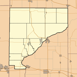
 Pine Village
Coordinates: 40°27′0″N 87°15′14″W / 40.45°N 87.25389°WCoordinates: 40°27′0″N 87°15′14″W / 40.45°N 87.25389°W Country United States State Indiana County Warren Township Adams Founded 1851 Founder Isaac and John Metsker Named for Big Pine Creek Area – Total 0.1 sq mi (0.3 km2) – Land 0.1 sq mi (0.3 km2) – Water 0.0 sq mi (0.0 km2) Elevation[1] 692 ft (211 m) Population (2010) – Total 217 Time zone EST (UTC-5) – Summer (DST) EDT (UTC-4) ZIP code 47975 Area code(s) 765 FIPS code 18-60084[2] GNIS feature ID 0441164[3] Pine Village is a town in Adams Township, Warren County, Indiana, United States. The population was 217 at the 2010 census.
Contents
Geography
Pine Village is located at the intersection of State Road 55 and State Road 26, near Big Pine Creek.[4] It is about 20 miles (32 km) west of Lafayette and about 14 miles (23 km) east of the Illinois border.
According to the United States Census Bureau, the town has a total area of 0.126 square miles (0.33 km2), all of it land.
History
The town was founded at the location of a trading post called Pine Village, which may have been named for a lone pine tree that stood on the bluff of Pine Creek, or it may have been named for the creek itself.[5] The town was laid out in 1851 by Isaac and John R. Metsker, and the plat map was made by county surveyor Perrin Kent. The Methodist Church was already there; it was built several years earlier.[6]
Rail service
Rail service reached the town in the 1870s. The year 1883 witnessed the completion of a north/south Chicago and Great Southern Railway (later the Chicago and Indiana Coal Railway) line between Attica and Fair Oaks, which subsequently came under the ownership of the Chicago and Eastern Illinois Railroad. The line came to be known as the "Coal Road" for the large quantities of coal transported along it. When the C&EI floundered in the early 1920s, Charles F. Propst purchased the Coal Road and in October 1922 incorporated it as the Chicago, Attica and Southern Railroad. The CA&S was placed in receivership on August 5, 1931, and incremental abandonment occurred over subsequent years.[7] The line through Pine Village was scrapped in the fall of 1945, and the rails where pulled up using a Belgian horse and a block and tackle.[8]
The area on the east side of Pine Village near the railroad, consisting of a grain elevator and some homes, was known as Oklahoma[8] and is located at 40°26′59″N 87°14′42″W / 40.44972°N 87.245°W.
Football
From a historical marker entitled "Pine Village Football", located near the town fire station:
Local team was important Indiana precursor to modern professional football organizations. Clinton Beckett introduced football to Pine Village High School 1898. Town and high school teams played on bottomland, northwest of here, starting local football tradition. Town team, the Villagers, managed by C.J. Shackleton and later by Claire Rhode. Team became "professional" 1915, claiming state and regional championships. Jim Thorpe, All-American, played for Villagers in 1915 Thanksgiving Day game against Purdue All-Stars: Villagers won 29 to 0. Team was a founder of Indiana Football League 1917. Following World War I, the Villagers played intermittently until 1927.
-

Pine Village football historical marker
-

The football team of 1915
References
- ^ "USGS detail on Pine Village". http://geonames.usgs.gov/pls/gnispublic/f?p=gnispq:3:::NO::P3_FID:441164. Retrieved 2007-09-23.
- ^ "American FactFinder". United States Census Bureau. http://factfinder.census.gov. Retrieved 2008-01-31.
- ^ "US Board on Geographic Names". United States Geological Survey. 2007-10-25. http://geonames.usgs.gov. Retrieved 2008-01-31.
- ^ "US Gazetteer files: 2010, 2000, and 1990". United States Census Bureau. 2011-02-12. http://www.census.gov/geo/www/gazetteer/gazette.html. Retrieved 2011-04-23.
- ^ Baker, Ronald L.; Carmony, Marvin (1975). Indiana Place Names. Bloomington, Indiana: Indiana University Press. p. 130.
- ^ A History of Warren County, Indiana. Warren County Historical Society. 1966. p. 6.
- ^ Sulzer, Elmer G. (1998). "The Old Coal Road". Ghost Railroads of Indiana. Indiana University Press. ISBN 0253334837.
- ^ a b Rhode, Robert T. (1966). "A Walk Around Pine Village in the Early 1920s". A History of Warren County, Indiana. Warren County Historical Society.
External links
Municipalities and communities of Warren County, Indiana Towns Pine Village | State Line City | West Lebanon | Williamsport

Townships Unincorporated
communitiesCarbondale | Foster | Green Hill | Hedrick | Independence | Johnsonville | Judyville | Kramer | Marshfield | Pence | Rainsville | Stewart | Tab | Winthrop
Ghost towns Baltimore | Brisco | Chatterton | Chesapeake | Dresser | Kickapoo | Locust Grove | Point Pleasant | Sloan | Walnut Grove | Warrenton
Categories:- Towns in Indiana
- Populated places in Warren County, Indiana
- Populated places established in 1851
-


Wikimedia Foundation. 2010.