Okanagan Falls, British Columbia
- Okanagan Falls, British Columbia
-

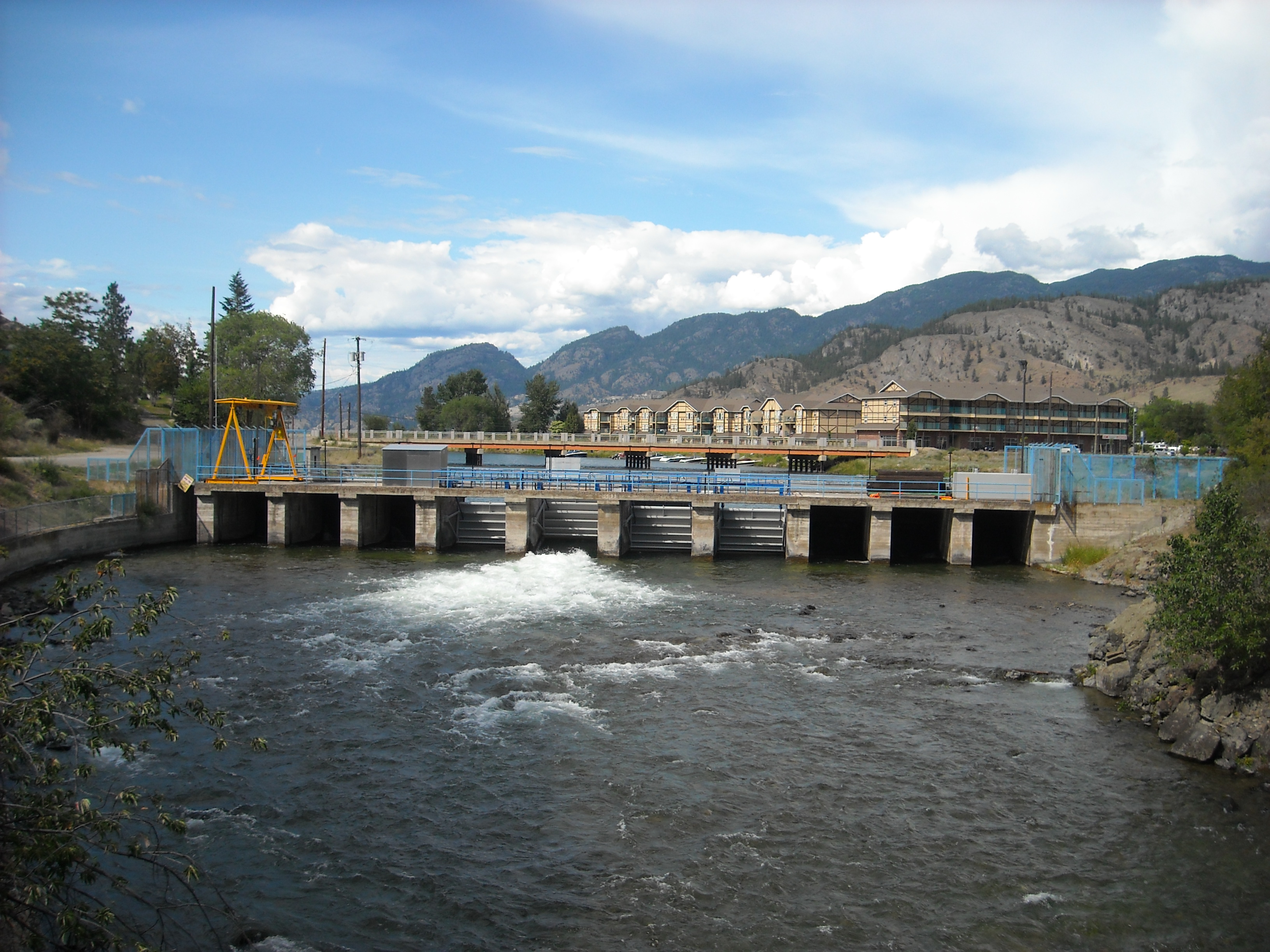
The real
Okanagan Falls have long been submerged by the waters of
Skaha Lake, which rose as a result of the construction of this small dam. The dam is located just below the bridge along
Highway 97 The dam is a vital component of the flood and irrigation controls of the region.
Okanagan Falls is a community located on the south end of Skaha Lake in British Columbia.[1][2] Originally named Dogtown, which was derived from the name Dog Lake ("skaha" means "dog" in the Okanagan language), the current name derives from the former small set of the falls that used to lie on the Okanagan River at the outlet of the lake.[3][4]
References
Coordinates: 49°21′00″N 119°34′00″W / 49.35°N 119.5666667°W / 49.35; -119.5666667
Categories:
- Unincorporated settlements in British Columbia
- Populated places in the South Okanagan
- British Columbia Interior geography stubs
Wikimedia Foundation.
2010.
Look at other dictionaries:
Okanagan Falls Elementary School — Infobox Education in Canada name= Okanagan Falls Elementary imagesize= motto= Effort + Quality = Success motto translation= streetaddress= PO Box 6 city= Okanagan Falls province= British Columbia postalcode= V0H 1R0 areacode= 250 phone= 497 5414… … Wikipedia
Okanagan Falls Provincial Park — is a provincial park in British Columbia, Canada, located in the town of the same name, protecting the area around the waterfall of the same name, which lies below the outlet of Skaha Lake in the course of the Okanagan River. Coordinates:… … Wikipedia
British Columbia — Colombie Britannique 54° N 125° W / 54, 125 … Wikipédia en Français
British Columbia Interior — The British Columbia Interior or BC Interior or Interior of British Columbia, usually referred to only as The Interior, is one of the three main regions of the Canadian province of British Columbia, the other two being the Lower Mainland, which… … Wikipedia
British Columbia Highway 3A — Infobox road state=BC type=Hwy route=3a previous type=Hwy previous route=3 next type=Hwy next route=3BTwo segments of highway in the southern part of British Columbia are designated as Highway 3A.Kootenays Castlegar Nelson CrestonKootenays 0This… … Wikipedia
British Columbia Highway 5 — Highway 5 Southern Yellowhead Highway Coquihalla Highway Route information Length: 524 km (326 mi) … Wikipedia
British Columbia Coast — Howe Sound, along British Columbia s South Coast. The British Columbia Coast or BC Coast is Canada s western continental coastline on the Pacific Ocean. The usage is synonymous with the term West Coast of Canada. In a sense excluding the urban… … Wikipedia
British Columbia Ambulance Service — Infobox company company name = British Columbia Ambulance Service company company type = Crown Agency foundation = July 1, 1974 location = British Columbia, Canada num employees = 3,200 (2006) revenue = $252 Million industry = Emergency Medical… … Wikipedia
Highway 97 (British Columbia) — British Columbia Highway 97 ist die längste, durchgehende Fernstraße in der Provinz British Columbia im Westen von Kanada. Highway 97 südlich von Fort Nelson Inhaltsverzeichnis 1 … Deutsch Wikipedia
Geography of British Columbia — Continent North America Region Western Canada Coordinates … Wikipedia

 Subdivisions of British Columbia