- Creal Springs, Illinois
-
Creal Springs City Country United States State Illinois County Williamson Coordinates 37°37′11″N 88°50′16″W / 37.61972°N 88.83778°W Area 1.0 sq mi (3 km2) - land 1.0 sq mi (3 km2) Population 702 (2000) Density 709.1 / sq mi (274 / km2) Timezone CST (UTC-6) - summer (DST) CDT (UTC-5) Postal code 62922 Area code 618 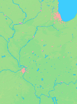

 Location of Creal Springs within Illinois
Wikimedia Commons: Creal Springs, Illinois Creal Springs is a city in Williamson County, Illinois, United States. The population was 702 at the 2000 census.
Contents
Geography
Creal Springs is located at 37°37′11″N 88°50′16″W / 37.61972°N 88.83778°W (37.619805, -88.837699)[1].
According to the United States Census Bureau, the city has a total area of 1.0 square mile (2.6 km2), of which, 1.0 square mile (2.6 km2) of it is land and 1.00% is water.
Creal Springs is located in southeastern Williamson County, on the north slope of the Shawnee Hills.
History
In the early 19th century, Lusk's Ferry Road was an important road that connected Fort Kaskaskia with Lusk's Ferry on the Ohio River. The original survey maps of Illinois show a short segment of this road south of Creal Springs, in Johnson County. This old road most likely ran from Marion through Creal Springs before ascending to the summit of the Shawnee Hills. The modern road running toward the southeast into Creal Springs may be the old road. The road leading south out of Creal Springs toward Lake of Egypt links into the Wagon Creek Road, which leads to the segment mapped in the original survey. Modern maps also show traces of an older road that ran south out of Creal Springs along a less direct line.
The route south out of Creal Springs lead to a difficult passage over the Shawnee Summit. There was an easier, though longer, zigzag route east to New Burnside, southwest along modern U.S. Highway 45, and then back east to Reynoldsburg. Creal Springs may at one time have served as the junction of these alternative routes.
From 1884 to 1916, Creal Springs was the home of the Creal Springs Seminary, later the Creal Springs College and Conservatory of Music, which provided education at the preparatory, baccalaureate and master's levels.
Demographics
Historical populations Census Pop. %± 1900 940 — 1910 936 −0.4% 1920 1,002 7.1% 1930 766 −23.6% 1940 950 24.0% 1950 864 −9.1% 1960 784 −9.3% 1970 830 5.9% 1980 845 1.8% 1990 791 −6.4% 2000 702 −11.3% 2010 543 −22.6% U.S. Census[2] As of the census[3] of 2000, there were 702 people, 292 households, and 186 families residing in the city. The population density was 709.1 people per square mile (273.8/km²). There were 318 housing units at an average density of 321.2 per square mile (124.0/km²). The racial makeup of the city was 97.29% White, 0.14% African American, 0.57% Native American, 0.28% Asian, 0.28% from other races, and 1.42% from two or more races. Hispanic or Latino of any race were 1.71% of the population.
There were 292 households out of which 25.7% had children under the age of 18 living with them, 45.9% were married couples living together, 13.0% had a female householder with no husband present, and 36.3% were non-families. 32.9% of all households were made up of individuals and 14.4% had someone living alone who was 65 years of age or older. The average household size was 2.28 and the average family size was 2.94.
In the city the population was spread out with 23.4% under the age of 18, 9.0% from 18 to 24, 25.2% from 25 to 44, 23.8% from 45 to 64, and 18.7% who were 65 years of age or older. The median age was 39 years. For every 100 females there were 97.7 males. For every 100 females age 18 and over, there were 95.6 males.
The median income for a household in the city was $25,272, and the median income for a family was $29,583. Males had a median income of $26,250 versus $17,125 for females. The per capita income for the city was $13,483. About 18.8% of families and 23.7% of the population were below the poverty line, including 37.6% of those under age 18 and 12.0% of those age 65 or over.
References
- ^ "US Gazetteer files: 2010, 2000, and 1990". United States Census Bureau. 2011-02-12. http://www.census.gov/geo/www/gazetteer/gazette.html. Retrieved 2011-04-23.
- ^ Census of Population and Housing, U.S. Census Bureau, http://www.census.gov/prod/www/abs/decennial/
- ^ "American FactFinder". United States Census Bureau. http://factfinder.census.gov. Retrieved 2008-01-31.
External links
Municipalities and communities of Williamson County, Illinois Cities Carterville | Creal Springs | Herrin | Hurst | Johnston City | Marion‡

Villages Bush | Cambria | Colp | Crainville | Energy | Freeman Spur‡ | Pittsburg | Spillertown | Stonefort‡ | Whiteash
Precincts Blairsville | Carterville | Corinth | Crab Orchard | Creal Springs | East Marion | Grassy | Herrin | Lake Creek | Southern | Stonefort | West Marion
Unincorporated
communitiesAttila | Blairsville | Chittyville | Clifford | Corinth | Crab Orchard | Crenshaw Crossing | Dewmaine | Dykersburg | Egyptian Hills | Egyptian Shores | Ferges | Fergestown | Hafer | Lake Crest | New Camp | No. 9 | Old Camp | Paulton | Paineville | Pulleys Mill | Shakerag
Ghost towns Chamness | Halfway | Halfway (Little Juarez)
Footnotes ‡This populated place also has portions in an adjacent county or counties
Categories:- Cities in Illinois
- Populated places in Williamson County, Illinois


Wikimedia Foundation. 2010.