- Bail' Ùr Tholastaidh
-
Coordinates: 58°21′N 6°13′W / 58.35°N 6.22°W
Baile Ùr Tholastaidh 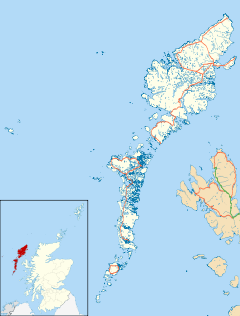
 Baile Ùr Tholastaidh
Baile Ùr Tholastaidh shown within the Outer HebridesLanguage Scottish Gaelic English OS grid reference NB5348 Council area Na h-Eileanan Siar Country Scotland Sovereign state United Kingdom Police Northern Fire Highlands and Islands Ambulance Scottish EU Parliament Scotland UK Parliament Na h-Eileanan an Iar Scottish Parliament Western Isles List of places: UK • Scotland • Baile Ùr Tholastaidh is a village on the Isle of Lewis in the Outer Hebrides, Scotland. It lies to the north of Tolastadh Bho Thuath. To the north of Baile Ùr Tholastaidh lies the beginning of a road that was planned to cross the moor and meet the road end in the village of Skigersta in Ness.
Categories:- Villages in the Outer Hebrides
- Western Isles geography stubs

Wikimedia Foundation. 2010.