- Mill Shoals, Illinois
-
Mill Shoals Village Country United States State Illinois County Wayne Coordinates 38°14′52″N 88°20′48″W / 38.24778°N 88.34667°W Area 0.8 sq mi (2 km2) - land 0.8 sq mi (2 km2) Population 235 (2000) Density 299.9 / sq mi (116 / km2) Timezone CST (UTC-6) - summer (DST) CDT (UTC-5) Postal code 62862 Area code 618 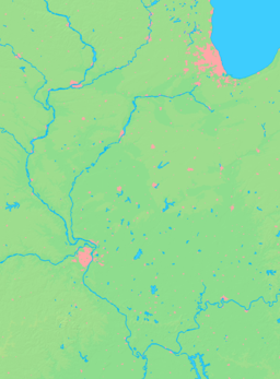

 Location of Mill Shoals within Illinois
Wikimedia Commons: Mill Shoals, Illinois Mill Shoals is a village in Wayne and White Counties in the U.S. state of Illinois. The population was 235 at the 2000 census.
Contents
Geography
Mill Shoals is located at 38°14′52″N 88°20′48″W / 38.24778°N 88.34667°W (38.247904, -88.346608).[1]
According to the United States Census Bureau, the village has a total area of 0.8 square miles (2.1 km2), all of it land.
History
The first white settlers, primarily of Scotch-Irish descent, came to White County, Illinois between 1807 and 1809. The first settlements were near the Little Wabash River and Big Prairie, one of the numerous prairies in the county. Many came through the land office at Shawneetown, which was a port for flatboats which traveled the Ohio River. The second half of the 19th century saw the establishment of the towns of Norris City, Springerton including Mill Shoals. Once the home of a thriving barrel-making industry which depleted the nearby virgin forests Mill Shoals had primarily been an agriculture village until 1939 when oil was discovered in the area. In the early 1970s the oil industry declined steeply and thus returned Mill Shoals to its agricultural roots.
Demographics
As of the census[2] of 2000, there were 235 people, 111 households, and 72 families residing in the village. The population density was 299.9 people per square mile (116.3/km²). There were 133 housing units at an average density of 169.8 per square mile (65.8/km²). The racial makeup of the village was 99.57% White, and 0.43% from two or more races.
There were 111 households out of which 24.3% had children under the age of 18 living with them, 57.7% were married couples living together, 5.4% had a female householder with no husband present, and 35.1% were non-families. 33.3% of all households were made up of individuals and 16.2% had someone living alone who was 65 years of age or older. The average household size was 2.12 and the average family size was 2.67.
In the village the population was spread out with 20.0% under the age of 18, 8.1% from 18 to 24, 18.7% from 25 to 44, 33.6% from 45 to 64, and 19.6% who were 65 years of age or older. The median age was 48 years. For every 100 females there were 92.6 males. For every 100 females age 18 and over, there were 93.8 males.
The median income for a household in the village was $27,292, and the median income for a family was $33,750. Males had a median income of $34,375 versus $20,000 for females. The per capita income for the village was $14,355. About 5.7% of families and 9.9% of the population were below the poverty line, including 17.6% of those under the age of eighteen and 11.4% of those sixty five or over.
References
- ^ "US Gazetteer files: 2010, 2000, and 1990". United States Census Bureau. 2011-02-12. http://www.census.gov/geo/www/gazetteer/gazette.html. Retrieved 2011-04-23.
- ^ "American FactFinder". United States Census Bureau. http://factfinder.census.gov. Retrieved 2008-01-31.
External links
Municipalities and communities of Wayne County, Illinois Cities 
Villages Cisne | Golden Gate | Jeffersonville | Johnsonville | Keenes | Mill Shoals‡ | Mount Erie | Sims | Wayne City
Townships Unincorporated
communitiesFootnotes ‡This populated place also has portions in an adjacent county or counties
Municipalities and communities of White County, Illinois Cities 
Villages Burnt Prairie | Crossville | Enfield | Maunie | Mill Shoals‡ | Norris City | Phillipstown | Springerton
Townships Burnt Prairie | Carmi | Emma | Enfield | Gray | Hawthorne | Heralds Prairie | Indian Creek | Mill Shoals | Phillips
Unincorporated
communitiesBrownsville | Bungay | Calvin | Centerville | Emma | Epworth | Gossett | Herald | Rising Sun
Footnotes ‡This populated place also has portions in an adjacent county or counties
Categories:- Villages in Illinois
- Populated places in Wayne County, Illinois
- Populated places in White County, Illinois


Wikimedia Foundation. 2010.