Old Church Stoke

Old Church Stoke

Coordinates: 52°32′N 3°04′W / 52.53°N 3.06°W / 52.53; -03.06

Old Church Stoke
Old Church Stoke - geograph.org.uk - 654359.jpg
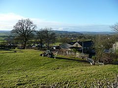
View of the hamlet of Old Church Stoke
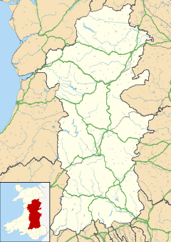
Old Church Stoke is located in Powys
Old Church Stoke

 Old Church Stoke shown within Powys
OS grid reference SO2894
Community Churchstoke
Principal area Powys
Country Wales
Sovereign state United Kingdom
Police Dyfed-Powys
Fire Mid and West Wales
Ambulance Welsh
EU Parliament Wales
List of places: UK • Wales • Powys

Old Church Stoke is a village in the Community of Churchstoke in Powys, Wales. Until 1974 it was in the county of Montgomeryshire.

The name, as a distinct settlement within the township and parish of Churchstoke, was first recorded in the mid 16th century.[1] The current village includes several timber-framed farmhouses of the 17th and 18th century, the former Oak Inn from the same period, and a 19th-century Primitive Methodist chapel.[1]

There was formerly a holy well, or "Lady well", in the village, which was dressed with flowers and rushes.[2]

References

  1. ^ a b Churchstoke Historic Landscape Characterisation, Clwyd-Powys Archaeological Trust
  2. ^ Bird, A. History on the ground: an inventory of unrecorded material relating to the mid-Anglo-Welsh borderland, University of Wales Press, 1977, p.90

External links


Wikimedia Foundation. 2010.

Игры ⚽ Поможем сделать НИР

Look at other dictionaries:

  • Church Stoke — Churchstoke or Church Stoke (Welsh: Yr Ystog) is a large village in Powys, but adjacent to the English Welsh border, on the junction of the A489 and A490 roads. It is overlooked by Roundton Hill. The nearest town is Montgomery. An outline map of… …   Wikipedia

  • Chelsea Old Church — Coordinates: 51°28′59″N 0°10′15″W / 51.48306°N 0.17083°W / 51.48306; 0.17083 …   Wikipedia

  • St Pancras Old Church — St. Pancras Old Church St Pancras Old Church Denomination Anglican St Pancras Old Church is a Church of England parish church in central London. It is believed to be one of the oldest sites of …   Wikipedia

  • Stoke Newington — infobox UK place country = England map type = Greater London region= London population= official name= Stoke Newington latitude= 51.5615 longitude= 0.0731 os grid reference= TQ335865 london borough= Hackney post town= LONDON postcode area= N… …   Wikipedia

  • Stoke Rochford — Coordinates: 52°50′09″N 0°38′20″W / 52.835864°N 0.63894175°W / 52.835864; 0.63894175 …   Wikipedia

  • Stoke-on-Trent —   City and Unitary Authority area   City of Stoke on Trent Stoke on Trent …   Wikipedia

  • St. Mary's Church — Contents 1 Albania 2 Azerbaijan 3 Belarus 4 Bosnia and …   Wikipedia

  • Stoke Minster — [Stoke Minster] [http://www.stokeminster.com] is the town centre and civic church in Stoke upon Trent in England. Legally known as the church of St. Peter ad Vincula, it was informally renamed Stoke Minster in 2005 in recognition of the important …   Wikipedia

  • Stoke Newington Church Street — is a road in north London in the borough of Hackney. The road links Green Lanes (A105) in the west to Stoke Newington High Street (A10) formerly Ermine Street, in the east. First noted in 1329, it was recorded as Newington or Newton Lane in 1403 …   Wikipedia

  • Stoke Gifford — is a large village in South Gloucestershire, England, situated south of Bradley Stoke in the northern suburbs of Bristol. It has around 11,000 residents as of the 2001 Census. It is home to Bristol Parkway station, on the London South Wales… …   Wikipedia

Share the article and excerpts

Direct link
Do a right-click on the link above
and select “Copy Link”