- Old Burghclere
-
Coordinates: 51°19′N 1°20′W / 51.31°N 1.34°W
Old Burghclere 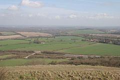
From half-way up Beacon Hill looking north-east across the major road junction and Old Burghclere village to the right.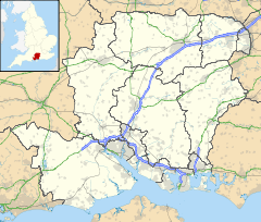
 Old Burghclere
Old Burghclere shown within HampshireOS grid reference SU4657 Parish Burghclere District Basingstoke and Deane Shire county Hampshire Region South East Country England Sovereign state United Kingdom Post town Newbury Postcode district RG20 Dialling code 01635 Police Hampshire Fire Hampshire Ambulance South Central EU Parliament South East England UK Parliament North West Hampshire List of places: UK • England • Hampshire Old Burghclere is a village in Hampshire, England, located south of the large town of Newbury near the A34 road. The village was once on the A34 road and has now been by-passed, although this section is not part of the Newbury bypass.
Governance
The village is part of the civil parish of Burghclere and is part of the Burghclere, Highclere and St Mary Bourne ward of Basingstoke and Deane borough council.[1] The borough council is a Non-metropolitan district of Hampshire County Council.
References
- ^ "Basingstoke and Deane Wards info". 2010. http://www.basingstoke.gov.uk/council/councillors/wardsinfo.htm. Retrieved 26 October 2010.
External links
 Media related to Old Burghclere at Wikimedia Commons
Towns, villages and hamlets in the Basingstoke and Deane District of Hampshire, England 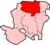
Towns Civil parishes Ashford Hill with Headley · Ashmansworth · Baughurst · Bramley · Burghclere · Candovers · Chineham · Cliddesden · Cole Henley · Dummer · East Woodhay · Ecchinswell, Sydmonton and Bishops Green · Farleigh Wallop · Hannington · Herriard · Highclere · Hurstbourne Priors · Kingsclere · Laverstoke · Litchfield and Woodcote · Mapledurwell and Up Nately · Monk Sherborne · Mortimer West End · Newtown · North Waltham · Nutley · Oakley · Old Basing and Lychpit · Overton · Pamber · Pamber End · Pamber Green · Pamber Heath · Penwood · Plastow Green · Preston Candover · Quidhampton · Ramsdell · Rooksdown · Sherborne St John · Sherfield on Loddon · Silchester · St Mary Bourne · Steventon · Stoke · Stratfield Turgis · Sydmonton · Tufton Warren · Up Nately · Upper Woodcott · Upper Wootton · Upton Grey · Tufton · Turgis Green · Wadwick · Wells-in-the-Field · West Heath · Weston Corbett · Weston Patrick · Whitnal · Whitway · Winslade · Woolton Hill · Wolverton · Wolverton Common · WoottonVillages and hamlets Adbury · Aldermaston Soke · Aldern Bridge · Andwell · Ashe · Ashe Warren · Ashford Hill · Ashley Warren · Axford · Axmansford · Binley · Bishop's Green · Bramley Corner · Bramley Green · Broadmere · Brock's Green · Brown Candover · Charter Alley · Chilton Candover · Deane · East Oakley · Ecchinswell · Ellisfield · Ewhurst · Hare Warren · Headley · Heath End · Ibworth · Inhurst · Litchfield · Little London · Lower Woodcott · Lower Wyke · Malshanger · Mapledurwell · Middle Wyke · Nately Scures · Newfound · Newnham · Newtown Common · North Oakley · North Sydmonton · Old Basing · Old Burghclere ·Districts of
BasingstokeCategories:- Hampshire geography stubs
- Basingstoke and Deane
- Villages in Hampshire


Wikimedia Foundation. 2010.