- Peoria, Illinois
-
City of Peoria City  Peoria City Hall
 Unofficial Flag
Country United States State Illinois County Peoria Elevation 659 ft (200.9 m) Coordinates 40°43′15″N 89°36′34″W / 40.72083°N 89.60944°W Area 46.6 sq mi (120.7 km2) - land 44.4 sq mi (115 km2) - water 2.2 sq mi (6 km2) Population 115,007 (226th in the U.S.) (2010 census) Density 2,543.4 / sq mi (982 / km2) Settled 1680 - Incorporated, Town 1835 - Incorporated, City 1845 Government Council-Manager Mayor Jim Ardis Timezone CST (UTC-6) - summer (DST) CDT (UTC-5) Zip codes 61602–61606, 61614, 61615 Area code 309 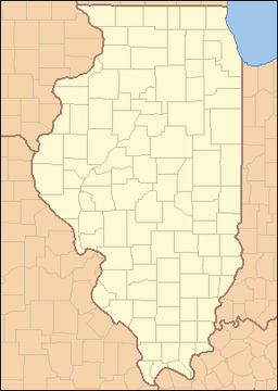
 Location of Peoria within Illinois
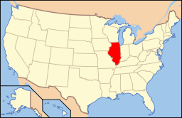 Location of Illinois in the United States
Website: http://www.ci.peoria.il.us/ Peoria (/piːˈɔəriə/) is the largest city on the Illinois River and the county seat of Peoria County,[1] Illinois, in the United States. It is named after the Peoria tribe. As of the 2010 census, the city was the seventh-most populated in Illinois, with a population of 115,007, and is the third-most populated metropolitan area in Illinois outside of the Chicago Metropolitan Area.[2] The Peoria Metropolitan Statistical Area had a population of 372,487 in 2008, making it the third largest metropolitan area in the state after the Chicago metropolitan area and the Metro-East portion of the St. Louis metropolitan area.[3]
Peoria has become famous as a representation of the average American city because of its demographics and its perceived mainstream Midwestern culture. On the Vaudeville circuit, it was said that if an act would succeed in Peoria, it would work anywhere. The question "Will it play in Peoria?" has now become a metaphor for whether something appeals to the American mainstream public. Peoria is the home of Ray LaHood, now serving as Secretary of Transportation in President Obama's cabinet.[4] It is also headquarters for Caterpillar Inc., one of the 30 companies composing the Dow Jones Industrial Average.
Contents
History
Main article: History of Peoria, IllinoisPeoria is one of the oldest settlements in Illinois, as explorers first ventured up the Illinois River from the Mississippi. The lands that eventually would become Peoria were first settled in 1680, when French explorers René-Robert Cavelier, Sieur de La Salle and Henri de Tonti constructed Fort Crevecoeur. This fort would later burn to the ground, and in 1813 Fort Clark, Illinois was built. When the County of Peoria was organized in 1825, Fort Clark was officially named Peoria.
Peoria was incorporated as a village on March 11, 1835. The city did not have a mayor, though they had a village president, Rudolphus Rouse, who served from 1835 to 1836. The first Chief of Police, John B Lishk, was appointed in 1837. The city was incorporated on April 21, 1845. This was the end of a village president and the start of the mayoral system, with the first mayor being William Hale.
Peoria, Arizona, a suburb of Phoenix, was named after Peoria, Illinois because the two men that founded it in 1890 — Joseph B. Greenhut and Deloss S. Brown — wished to name it after their hometown.[5]
The first American automobile, the Duryea, was reportedly produced in downtown Peoria.[citation needed]
In the 1920s Charles Lindbergh flew mail into Peoria as a stop on his mail route between St. Louis and Chicago. He was turned down by the city when asked to sponsor his first transatlantic flight, which then the honor went to St. Louis.
Geography
Peoria is located at 40°43′15″N 89°36′34″W / 40.72083°N 89.60944°W (40.720737, -89.609421).[6]
Topography
According to the United States Census Bureau, the city has a total area of 46.6 square miles (120.7 km2). Land comprises 44.4 square miles (115.0 km2) of the area, and 2.2 square miles (5.7 km2) (4.78%) is water.
Peoria is bounded on the east by the Illinois River except for the enclave of Peoria Heights, which also borders the river. Four bridges run directly between the city and neighboring East Peoria. On the south end of Peoria's western border are Bartonville and the newly established city of West Peoria. Local municipal plans indicate that the city intends to continue its expansion northwest, into an area unofficially considered part of Dunlap, Illinois.[citation needed]
Climate
Peoria has a humid continental climate (Köppen Dfa), with cold, snowy winters, and hot, humid summers. Monthly daily mean temperatures range from 22.5 °F (−5.3 °C) to 75.2 °F (24.0 °C). Snowfall is common in the winter, averaging 26.3 inches (67 cm), but this figure varies considerably for different years. Precipitation, averaging at 36 inches (914 mm), peaks in the spring and summer, and is the least in winter. Extremes have ranged from −27 °F (−33 °C) in January 1884 to 113 °F (45 °C) in July 1936.[7]
Climate data for Peoria, Illinois Month Jan Feb Mar Apr May Jun Jul Aug Sep Oct Nov Dec Year Record high °F (°C) 71
(22)74
(23)87
(31)92
(33)104
(40)105
(41)113
(45)106
(41)104
(40)93
(34)81
(27)71
(22)113
(45)Average high °F (°C) 30.7
(−0.7)36.6
(2.6)49.4
(9.7)62.0
(16.7)73.0
(22.8)82.2
(27.9)85.7
(29.8)83.6
(28.7)76.7
(24.8)64.4
(18.0)48.8
(9.3)35.5
(1.9)60.7 Average low °F (°C) 14.3
(−9.8)19.7
(−6.8)30.2
(−1.0)40.3
(4.6)50.8
(10.4)60.1
(15.6)64.6
(18.1)62.6
(17.0)54.0
(12.2)42.3
(5.7)31.4
(−0.3)20.1
(−6.6)40.9 Record low °F (°C) −27
(−33)−26
(−32)−11
(−24)14
(−10)25
(−4)39
(4)46
(8)41
(5)24
(−4)7
(−14)−2
(−19)−24
(−31)−27
(−33)Precipitation inches (mm) 1.50
(38.1)1.67
(42.4)2.83
(71.9)3.56
(90.4)4.17
(105.9)3.84
(97.5)4.02
(102.1)3.16
(80.3)3.12
(79.2)2.77
(70.4)2.99
(75.9)2.40
(61)36.03
(915.2)Snowfall inches (cm) 7.8
(19.8)5.6
(14.2)3.2
(8.1)1.0
(2.5)0
(0)0
(0)0
(0)0
(0)0
(0)0
(0)2.1
(5.3)6.6
(16.8)26.3
(66.8)Avg. precipitation days (≥ 0.01 in) 9.9 8.4 10.9 11.7 11.6 9.6 9.2 9.3 8.4 9.2 10.2 10.1 118.5 Avg. snowy days (≥ 0.1 in) 7.0 5.0 2.5 .8 0 0 0 0 0 0 2.5 5.3 23.1 Sunshine hours 148.8 158.2 189.1 222.0 272.8 306.0 310.0 279.0 234.0 204.6 129.0 117.8 2,571.3 Source no. 1: NOAA (normals, 1971−2000)[8] HKO (sun, 1961−1990)[9] Source no. 2: Weather.com (extremes)[7] Cityscape
 Main article: List of tallest buildings in Peoria
Peoria's downtown area includes corporate, governmental, convention, educational, and medical facilities. It also boasts the Peoria Civic Center, Theatres, and O'Brien Field, as well as an arts, dining, and entertainment area near the riverfront. The downtown area now also includes high-rise residential developments such as condominiums, apartments, and riverfront lofts. Some of these were office buildings and warehouses converted to residential use.[10][citation needed]
The city of Peoria is home to a United States courthouse, the Peoria Civic Center (which includes Carver Arena), and the world headquarters for Caterpillar Inc.. Medicine has become a major part of Peoria's economy. In addition to three major hospitals, the USDA's National Center for Agricultural Utilization Research, formerly called the USDA Northern Regional Research Lab, is located in Peoria. This lab was where mass production of penicillin was developed.[11]
Grandview Drive, which Theodore Roosevelt purportedly called the "world's most beautiful drive" during a 1910 visit,[12] runs through Peoria and Peoria Heights. In addition to Grandview Drive, the Peoria Park District boasts 9,000 acres (36 km2) of parks, including the Peoria Zoo and five public golf courses. There are also several private and semi-private golf courses. The Peoria Park District, the first and still largest park district in Illinois, was the 2001 Winner of the National Gold Medal Award for Excellence in Parks and Recreation for Class II Parks.[13]
Culture
Museums in Peoria include the Pettengill-Morron House and the John C Flanagan House of the Peoria Historical Society, Lakeview Museum for the Arts and Sciences and the Wheels o' Time Museum. A new Museum Square, under construction downtown, will house a new regional museum, a planetarium, and the Caterpillar World Visitors Center.[14][dead link]
The Steamboat Classic, held every summer, is the world's largest four-mile (6 km) running race and draws international runners.[15]
Peoria's sister cities include Friedrichshafen, Germany; Benxi, China; and Clonmel, Ireland.[16]
Performing arts
 Madison Theatre
The Peoria Symphony Orchestra is the 10th oldest in the nation. Peoria is also home to the Peoria Municipal Band, the Peoria Area Civic Chorale, the Central Illinois Youth Symphony, and the Peoria Ballet. Several community and professional theaters have their home in and around Peoria, including the Peoria Players, which is the fourth-oldest community theater in the nation and the oldest in Illinois.[17] Corn Stock Theatre is another community theater company in Peoria, it being the only outdoor theater in the round in Central Illinois.[citation needed]
The Contemporary Art Center of Peoria, and the Peoria Art Guild and Galleries, host of the Annual Art Fair that was rated as one of the 100 top art fairs in the nation,[18] are in Peoria.
Peoria has significantly expanded and refurbished the Peoria Zoo, formerly Glen Oak Zoo, at Glen Oak Park. Finished in 2009, the new zoo improvements more than triple the size of the zoo and feature a major African safari exhibit.[19] Work had begun in the fall of 2006. In addition, The Peoria Playhouse — An Interactive Children's Museum, spearheaded by the Junior League of Peoria — is planned in conjunction with the zoo expansion and further enhancements to Glen Oak Park campus.[20]
Peoria has hosted the Heart of Illinois Fair every year since 1949. The fair features livestock competitions, rides, concessions, motor contests, and concerts.
Tourism
Registered historic places
- Central National Bank Building
- Cumberland Presbyterian Church
- Grand Army of the Republic Memorial Hall
- Grandview Drive
- International Harvester Building
- John C. Proctor Recreation Center
- Judge Flanagan Residence
- Judge Jacob Gale House
- Madison Theatre
- North Side Historic District
- Peace and Harvest
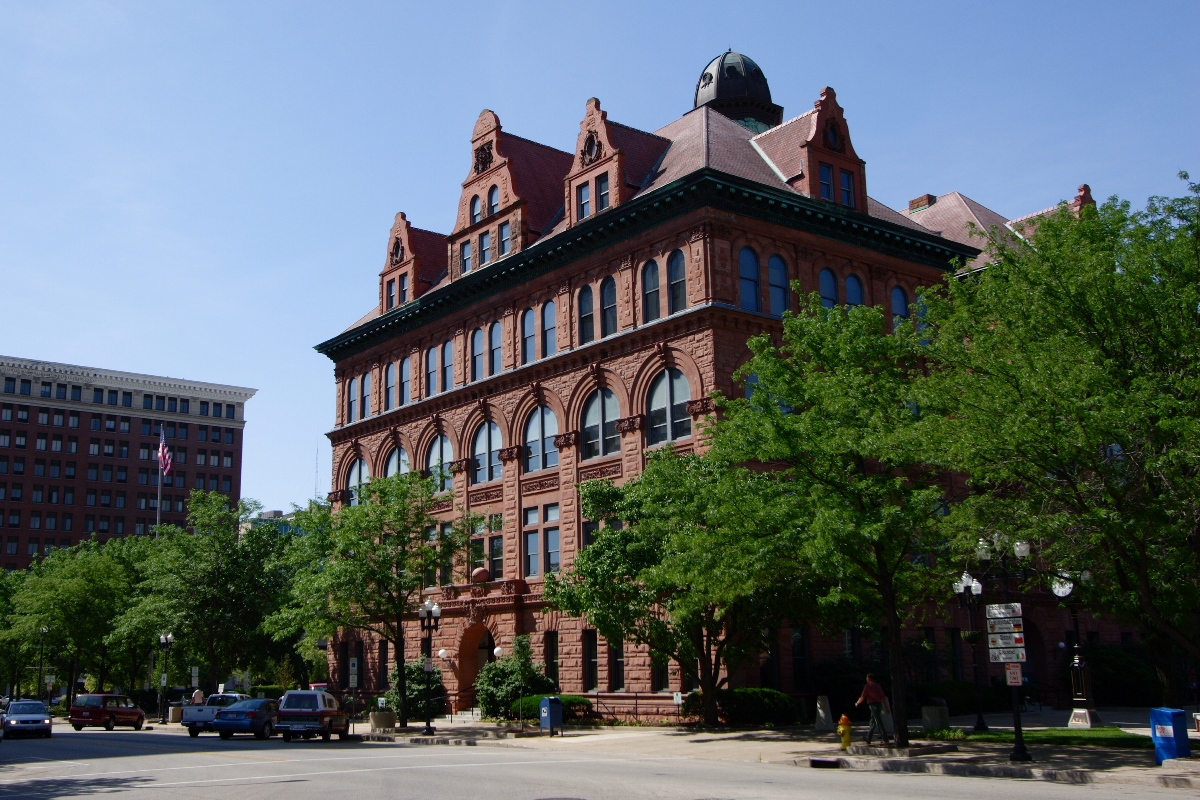
- Peoria City Hall
- Peoria Cordage Company
- Peoria Mineral Springs
- Peoria Waterworks
- Pere Marquette Hotel
- Pettingill-Morron House
- Rock Island Depot and Freight House
- Springdale Cemetery
- West Bluff Historic District
Sports
Peoria is home to professional hockey. The Peoria Rivermen play in the AHL. The current hockey team is the third team to use the name Peoria Rivermen, and they started play in October, 2005 at the Peoria Civic Center.[21] and are affiliated with the St. Louis Blues of the National Hockey League.
The Class A Minor League Baseball team Peoria Chiefs home venue is O'Brien Field, a stadium near downtown Peoria. This team is affiliated with the Chicago Cubs and plays in the Midwest League.[22][23]
The Peoria Sunday Morning League is the longest running semi-pro baseball league in the nation. It has been running for 91 years. The league boasts many former major leaguers such as Kirby Puckett.
Peoria is home of the newly established Midwest Flames (American Basketball Association).
Peoria was also home to the Arena Football League 2 (af2) professional football team, the Peoria Pirates, until mid-2009, when the team was folded, unable to find new buyers.
In 1946, the Peoria Redwings were created as part of the All-American Girls Baseball League (which was officially the American Girls Baseball League after 1950). The Redwings were the ninth team of twelve to enter the league, and were in the league for six of the twelve years of its existence. The Redwings folded after the 1951 season, and the league disbanded in 1954.[24]
The Peoria Rugby Football Club is the Men's rugby club in Peoria Illinois, established in 1973.[25] High school rugby in Peoria began in 2006.
Since 1974, Peoria has hosted the annual Steamboat Classic event, a running race featuring 4-mile (6.4 km) and 15K events. In 2007, the race drew over 4,000 participants.
A chapter about Peoria is included in the basketball book Big Game, Small World by Alexander Wolff.
Peoria is the hometown of several college and professional basketball players, including Shaun Livingston, A.J. Guyton, Sergio McClain, and Frankie Williams.
Peoria is the hometown of American Major League Baseball player Jim Thome, currently a designated hitter for the Cleveland Indians.
Media
Main article: Media in Peoria, IllinoisPeoria is the 153rd largest radio market in the United States[26] and Peoria-Bloomington is the 116th largest television market in the United States.[27]
The area has 14 commercial radio stations with six owners among them; four non-commercial full-power radio stations, each separately owned; five commercial television stations with two operating owners among them; one non-commercial television station; and two daily newspapers (Peoria Journal Star and Pekin Daily Times), both with the same owner.
Civic Center
 Civic CenterMain article: Peoria Civic Center
The Peoria Civic Center includes an arena, convention center, and theater, and was completed in the early 1980s, was designed by the famed late architect Philip Johnson. The three structures are connected via an enclosed glass panel arcade for all-weather protection and aesthetics.[citation needed] As of 2007, it has completed a $55 million renovation and expansion based on demand for larger conventions and entertainment venues.
The Peoria City Council is currently deciding (as of September 2011), because of delays in the project, whether to continue an agreement with a hotel developer, Gary Matthews, to build a Marriott Hotel and to refurbish the existing historic Pere Marquette Hotel. If completed, it is hoped that these developments would boost Downtown Peoria's image and prospects, and its ability to attract larger conventions.
Renaissance Park
Renaissance Park is a research park originally established in May 2003 as the Peoria Medical and Technology District. It consists of nine residential neighborhoods, Bradley University, the medical district, Caterpillar world headquarters, and the National Center for Agricultural Utilization Research. The Peoria NEXT Innovation Center opened in August 2007 and provides both dry and wet labs, as well as conference and office space for emerging start-up companies. Over $1 billion in research is conducted in Peoria annually.[28][dead link]
The Block (formerly Museum Square)
The Block is a $100+ million project that will contain the Peoria Riverfront Museum and The Caterpillar Experience, a museum and visitor's center showcasing Caterpillar past, present, and future. It is proposed as a 6.8-acre (28,000 m2) development in downtown Peoria along the Illinois River at the site formerly known as the Sears Block. The museum project had been on hold since mid-2008. However, the public voted in April 2009 to allow an additional tax to be levied across the entire Peoria County for the project's funding. Construction has begun on the underground parking structure for The Block. The Block is expected to open no earlier than 2012.[29]
Economy
Industry
Peoria's first major industry was started in 1830 by John Hamlin, who constructed the flour mill on Kickapoo Creek. In 1837, another industry was begun with E.F. Nowland's pork planting industry. Many other industries started slowly in Peoria including carriage factories, pottery makers, wholesale warehousing, casting foundries, glucose factories, ice harvesting, and furniture makers.
Peoria became the first world leader for distilleries thanks to Andrew Eitle (1837) and Almiron S. Cole (1843). During this time, Peoria held 22 distilleries and multiple breweries. Together, they produced the highest amount of internal revenue tax on alcohol of any single revenue district in the entire U.S. Peoria also was one of the major bootlegging areas during the prohibition and home to the famed mobsters, the Shelton brothers. This great success placed Peoria into a building boom of beautiful private homes, schools, parks, churches, as well as municipal buildings.
In addition to the distilleries, came farm machinery manufacturing by William Nurse in 1837. Also, two men called Toby and Anderson brought the steel plow circa 1843, which gained immediate success. The dominant manufacturing companies in Peoria were Kingman Plow Co., Acme Harvester Co., Selby, Starr & Co., and Avery Manufacturing Co. In 1889, Keystone Steel & Wire developed the first wire fence and has since been the nation's leading manufacturer.
Around the 1880s, businesses such as Rouse Hazard Co. in Peoria, were dealers and importers of bicycles and accessories worldwide. Charles Duryea, one of the cycle manufacturers, developed the first commercially available gasoline-powered automobile in the U.S. in 1893.
At this time, agricultural implement production declined, which led the earth moving and tractor equipment companies to skyrocket and make Peoria in this field the world leader. In 1925, Caterpillar Tractor Co. was formed from the Benjamin Holt Co. and the C.L. Best Tractor Co. Robert G. LeTourneau's earth moving company began its production of new scrapers and dozers in 1935 which evolved into Komatsu-Dresser, Haulpak Division.[30] Today, the joint venture between Komatsu and Dresser Industries has long since passed. The entity that remains is the off-highway truck manufacturing division for Komatsu America Corporation.
Well-known Peoria businesses
- Ameren Illinois — formerly AmerenCILCO, former Central Illinois Light Company (CILCO); now part of Ameren
- Archer Daniels Midland — corn processing plant and ethanol producer
- Bergner's — department store; started in 1889 in downtown Peoria and eventually bought out Carson Pirie Scott & Co.; now part of Bon-Ton
- Caterpillar Inc. (world headquarters) — heavy equipment and engine manufacturer
- CEFCU — Credit union; started by Caterpillar employees; now serves residents of 14 Central Illinois counties
- Komatsu America Corporation — world's 2nd largest mining equipment manufacturer has a large manufacturing facility in Peoria[31]
- Maui Jim (world headquarters) — sunglasses manufacturer
- National Center for Agricultural Utilization Research — largest USDA research facility; where mass production of penicillin was invented[citation needed]
- RLI Corp. (world headquarters) — specialty insurance company
Demographics
Historical populations Census Pop. %± 1840 1,467 — 1850 5,095 247.3% 1860 14,045 175.7% 1870 22,849 62.7% 1880 29,259 28.1% 1890 41,024 40.2% 1900 56,100 36.7% 1910 66,950 19.3% 1920 76,121 13.7% 1930 104,969 37.9% 1940 105,087 0.1% 1950 111,856 6.4% 1960 103,162 −7.8% 1970 126,963 23.1% 1980 124,160 −2.2% 1990 113,504 −8.6% 2000 112,936 −0.5% 2010 115,007 1.8% [32] As of the census[33] of 2000, there were 112,936 people, 45,199 households, and 27,345 families residing in the city. The population density was 2,543.4 people per square mile (982.1/km²). There were 49,125 housing units at an average density of 1,106.3 per square mile (427.2/km²). The racial makeup of the city was 69.29% White, 24.79% African American, 0.20% Native American, 2.33% Asian, 0.04% Pacific Islander, 1.20% from other races, and 2.16% of mixed races. Hispanic or Latino of any race were 2.51% of the population. The city has a sizable, established Lebanese population with a long history in local business and government.
There were 45,199 households, out of which 29.0% had children under the age of 18 living with them, 41.6% were married couples living together, 15.5% had a female householder with no husband present, and 39.5% were non-families. Individuals made up 33.2% of all households, and 11.7% had someone living alone who was 65 years of age or older. The average household size was 2.39 and the average family size was 3.04.
In the city, the population was spread out, with 25.7% under the age of 18, 12.0% from 18 to 24, 27.2% from 25 to 44, 20.8% from 45 to 64, and 14.2% who were 65 years of age or older. The median age was 34 years. For every 100 females, there were 89.9 males. For every 100 females age 18 and over, there were 85.0 males.
The median income for a household in the city was $36,397. The per capita income for the city was $20,512. Some 18.8% of the population was below the poverty line.
Special censuses were conducted in 2004 and 2007 that noted a total increase of 8,455 in the city's population since the 2000 census,[34] mainly in the northwest corridor making the current population 121,391. The metropolitan area has a population of 370,000, which includes Peoria, Tazewell, Woodford, Stark and Marshall counties. Suburbs and towns in this area include Bartonville, Bellevue, Creve Coeur, Dunlap, East Peoria, Germantown Hills, Groveland, Marquette Heights, Metamora, Morton, North Pekin, Pekin, Peoria Heights, Pottstown, Rome, Tremont, Washington, and West Peoria.[citation needed]
Law and government
Peoria is a home rule municipality with a mayor and ten city council members. The city is divided into five districts. Five council members are elected at-large.[citation needed]
Steven Settingsgaard became Chief of Police on March 9, 2005.
Elected officials[35] Office Office holder Mayor Jim Ardis City Councilperson - District 1 Clyde Gulley Jr. City Councilperson - District 2 Barbara Van Auken City Councilperson - District 3 Timothy Riggenbach City Councilperson - District 4 William R. Spears City Councilperson - District 5 Dan Irving City Councilperson - At Large W. Eric Turner City Councilperson - At Large Jim Montelongo City Councilperson - At Large Ryan Spain City Councilperson - At Large Gary V. Sandberg City Councilperson - At Large George F. Jacob City/Township Clerk Mary L. Haynes City Treasurer/Township Collector Patrick Nichting Township Supervisor Joe Whalen Township Assessor Bonnie D. Gavin Township of the City of Peoria
 Outline of the Township of the City of Peoria in Peoria County
The Township of the City of Peoria (sometimes called City of Peoria Township) is a separate government from the City of Peoria, and performs the functions of civil township government in most of the city. The border of the township matched the Peoria city limits until 1991,[citation needed] when it was frozen at its current boundaries; the City of Peoria itself has continued expanding outside of the City of Peoria Township borders into Kickapoo, Medina, Radnor Townships. In the years before the freeze, the Township of the City of Peoria had grown to take up most of the former area of Richwoods and what is now West Peoria Township.
Education
 The Dingeldine Music Center at Bradley University
Peoria is served by four public K-12 school districts:
- Peoria Public Schools District 150 is the largest and serves the majority of the city. District 150 schools include dozens of primary and middle schools, as well as three public high schools: Richwoods High School, which hosts the competitive International Baccalaureate Program of study; Manual High School; and Peoria High School (Central), the oldest high school in Illinois.[citation needed] Until the end of the 2009-2010 school year, a fourth high school, Woodruff High School, also operating in town. According to SchoolDigger, District 150 has the highest-ranking middle school (Washington Gifted Middle School),[36] but also the third- and eighth-lowest-ranking middle schools (Trewyn and Lincoln, respectively)[37] and the second-lowest-ranking elementary school (Tyng Primary School)[38] in Illinois. Tyng closed in 2009.
- Dunlap Community Unit School District 323 serves the far north and northwest parts of Peoria that were mostly outside the city before the 1990s.
- Limestone Community School District 310 serves a small portion of the western edge of the City of Peoria (western edges of Wardcliffe and Lexington Hills areas), but mainly serves the suburbs of Bartonville, Bellevue and surrounding towns.
- Peoria Heights School District 325 serves the suburb of Peoria Heights; however, parts of the City of Peoria immediately outside the Heights are in this school district.
The Roman Catholic Diocese of Peoria currently[when?] runs six schools in the city: five grade schools and Peoria Notre Dame High School. Non-denominational Peoria Christian School operates a grade school, middle school, and high school.
In addition, Peoria Christian School, Concordia Lutheran School, Peoria Academy, Christ Lutheran School, and several smaller private schools exist.[citation needed]
Bradley University, Midstate College, the University of Illinois College of Medicine at Peoria, the Downtown and North campuses of Illinois Central College, and the Peoria campus of Robert Morris University are based in the city. In addition, Eureka College and the main campus of Illinois Central College are located nearby.
Infrastructure
Health and medicine
The health-care industry accounts for at least 25% of Peoria's economy.[citation needed] The city has three major hospitals: OSF Saint Francis Medical Center, Methodist Medical Center of Illinois, and Proctor Hospital. In addition, the Children's Hospital of Illinois, the University of Illinois College of Medicine at Peoria, and the Midwest Affiliate of St. Jude Children's Research Hospital are located in the city. The hospitals are all located in a medical district around the junction of Interstate 74 and Knoxville Avenue, adjacent to downtown in the southeast of the city, except for Proctor Hospital in the geographic center of the city. The surrounding towns are also supported by Proctor Hospital, Pekin Hospital, Eureka Hospital, and the Hopedale Medical Complex.
Transportation
See also: Bridges in Peoria, Illinois and Peoria-to-Chicago HighwayInterstate and U.S. routes
The Peoria area is served by three Interstate highways: Interstate 74, which runs from northwest to southeast through the downtown area, Interstate 474, a southern bypass of I-74 through portions of Peoria and the suburbs of Bartonville and Creve Coeur, and Interstate 155, which runs south from I-74 in Morton to Interstate 55 in Lincoln which connects to Springfield and St. Louis. I-74 crosses over the Illinois River via the Murray Baker Bridge, while I-474 crosses via the Shade-Lohmann Bridge. The nearest metropolitan centers accessible on I-74 are the Quad Cities to the west, and Bloomington-Normal to the east.
From 2004 to 2006, Interstate 74 between Interstate 474 on the west and Illinois Route 8 on the east was reconstructed as part of the Upgrade 74 project.
In addition, U.S. Route 24 runs along the bank of the Peoria side of the Illinois River, becoming a major arterial downtown as part of Adams Street and Jefferson Avenue, and then continuing southwest towards Bartonville as Washington Street, which turns into Adams Street on the south end of Peoria. U.S. Route 150 serves as the main arterial for the northern portion of the Peoria area, becoming War Memorial Drive before heading west towards Kickapoo. Both of these routes enter from the McClugage Bridge; east of the bridge, U.S. 150 runs southeast to Morton, while U.S. 24 runs due east to Washington.
State routes
The following state routes run through Peoria:
- Illinois Route 6 runs along the northwestern portion of the city as an extension of I-474. It is a four-lane freeway that runs from the I-74/474 intersection northeast to Illinois Route 29 south of Chillicothe. It is marked as a north-south road.
- Illinois Route 8 roughly parallels I-74 to the south. It enters Peoria from Farmington and runs southeast through the city, passing just southwest of the downtown area. Illinois 8 crosses into East Peoria via the Cedar Street Bridge with Illinois Routes 29 and 116. Illinois 8 is marked as an east-west road.
- Illinois Route 29 runs with U.S. 24 through Peoria along the Illinois River from Chillicothe through downtown Peoria. It then joins Illinois 8 and 116 across the Cedar Street Bridge. Illinois 29 is marked as a north-south road, and is called Galena Road north of U.S. 150.
- Illinois Route 40 (formerly 88) enters Peoria from the north as Knoxville Avenue. It runs south through the center of the city and exits southeast over the Bob Michel Bridge. Illinois 40 is marked as a north-south road.
- Illinois Route 91 briefly enters Peoria at the intersection with U.S. 150 in the far northwestern portion of the city. Traffic on Illinois 91 mainly accesses the Grand Prairie Mall, or continues to Dunlap.
- Illinois Route 116 enters from the west at Bellevue. It runs directly east and crosses into East Peoria over the Cedar Street Bridge.
The planned Illinois Route 336 project will also connect Illinois 336 with I-474 between Illinois 8 and Illinois 116. Construction on the segment nearest Peoria has not started, nor has funding been allocated.
Rail transportation
Metro Peoria is served by ten common carrier railroads. Four are Class I railroads: BNSF, Canadian National, Norfolk Southern, and Union Pacific. The last one, Union Pacific, has a north-south oriented line which skirts the west edge of the city but a line branches off of it to enter Peoria. One Class II/Regional, Iowa Interstate, serves the city, coming out of Bureau Junction, Illinois. Five Class III/Shortline railroads: Central Illinois Railroad, which operates a portion of the city-owned Peoria, Peoria Heights and Western Railroad; two Genesee and Wyoming-owned operations: Illinois & Midland Railroad (the former Chicago and Illinois Midland, comes up from Springfield) and Tazewell and Peoria Railroad (leases the Peoria and Pekin Union Railway from its owners Canadian National, Norfolk Southern and Union Pacific; Pioneer Railcorp's Keokuk Junction Railway (which now owns the Toledo, Peoria and Western's West End from Lomax and La Harpe in Western Illinois, plus the branch from Keokuk); and RailAmerica's Toledo, Peoria and Western Railway, which uses BNSF trackage to reach Galesburg and its own line to reach Logansport, Indiana.[citation needed] There is no passenger rail connecting Peoria to other urban centers, although this possibility and the possibility of rail service that connects St. Louis to Chicago (by way of Springfield, Peoria, Bloomington-Normal, and Pontiac) has been and is being investigated.[citation needed]
Peoria's last intercity rail service ended in 1981, when Amtrak withdrew the Prairie Marksman, which stopped in nearby East Peoria.
Public transportation
Public bus service is provided by the Greater Peoria Mass Transit District, which operates 20 bus routes under the name CityLink, that serve the city, Illinois Central College and much of East Peoria, Illinois, Peoria Heights, West Peoria, and points between Peoria and Pekin, Illinois.[39]
Aviation
The General Wayne Downing Peoria International Airport serves Peoria and surrounding communities. The airport is served by 4 passenger airlines (United, American, Delta, and Allegiant Air) and numerous cargo carriers. Nonstop destinations include Chicago, Dallas/Ft. Worth, Las Vegas, Minneapolis/St. Paul, Detroit, Denver, Phoenix, and Tampa.[40] Cargo carriers serving Peoria include FedEx, UPS and Airborne Express (now DHL).
Mount Hawley Airport, on the north end of the city, also accepts general aviation. Numerous other general aviation airports are located in the tri-county region.[citation needed]
Pekin Municipal Airport, in Pekin, Illinois, across the river, also serves the area.
Points of interest
- Civil War Monument at County Courthouse Plaza
- Grandview Drive along the Illinois River bluff in Peoria and Peoria Heights
- Glen Oak Park, including Glen Oak Zoo and George L. Luthy Memorial Botanical Garden
- Spirit of Peoria — paddle wheel riverboat
- Cathedral of Saint Mary of the Immaculate Conception (Peoria, Illinois) (also known as St. Mary's Cathedral)
- Scottish Rite Cathedral
- Wildlife Prairie State Park, about 10 mi (16 km) west of the city
Notable events
- September 19 to October 21, 1813 — Peoria War[citation needed]
- 1844 — Abraham Lincoln came to Peoria to get involved in the Aquilla Wren divorce case and took it to the Supreme Court of Illinois[citation needed]
- October 16, 1854 — Abraham Lincoln first publicized his stand that the United States should move towards restricting and eventually eliminating slavery, a position directly against historic compromises such as the Kansas-Nebraska Act. The speech, which was possibly similar to one given in Springfield, Illinois, 12 days earlier, followed the speech of Stephen A. Douglas, whom Lincoln would later debate regularly in the Lincoln-Douglas Debates of 1858.[41]
- April 15, 1926 — Charles Lindbergh's first air mail route, Contract Air Mail route #2, began running mail from Chicago to Peoria to Springfield to St. Louis and back.[42] Local legend purports that Lindbergh offered Peoria the chance to sponsor his trans-Atlantic flight but refused. The plane would have been called the "Spirit of Peoria".[citation needed]
- April 3, 1967 — The trial of mass murderer Richard Speck begins at the Peoria County courthouse, after a change of venue from Chicago to ensure a fair trial.
- Theodore Roosevelt called Grandview Drive, a street on the bluffs overlooking the Illinois River "the world's most beautiful drive."[citation needed] The Peoria radio station and CBS television affiliate WMBD attached the description to its call sign.[citation needed]
Awards
- Peoria has been awarded the All-America City Award three times (1953, 1966, and 1989).
- In 2007, Forbes ranked Peoria #47 out of the largest 150 metropolitan areas in its annual "Best Places for Business and Careers." Peoria was evaluated on the cost of doing business, cost of living, entertainment opportunities, and income growth.[43]
- In 2005, Sperling and Sanders Best Places to Live Rankings among 331 metropolitan areas placed Peoria #51, citing "low cost of living, low cost of housing, and attractive residential areas" as the main pros to the area.[citation needed][44]
- Peoria was ranked a 5 Star Logistics City by Expansion Management Magazine in 2007[45]
- Peoria consistently ranks in the Top 10 Best Mannered Cities in America as compiled by etiquette expert Marjabelle Young Stewart.[46]
- Peoria was ranked as one of the "50 Next Great Adventure Towns" in the US in the September 2008 issue of National Geographic Adventure magazine. This was mainly based on the extensive mountain biking trails in and around the city and the live entertainment options found on the RiverFront.[47]
- In 2009, Peoria was ranked 16th best city with a population of 100,000–200,000 ("Mighty Micros") in the U.S. Next Cities List. The list was compiled by Next Generation Consulting, a firm which studies and consults on hiring trends and workplace issues nationwide, and the indexes used were divided into earning, learning, vitality, around town, after hours, cost of lifestyle and social capital. Top Mighty Micro was Fort Collins, Colorado; the other Mighty Micro in Illinois was Springfield at #5.[48]
- In 2009, Peoria was ranked #5 best mid sized city to launch a small business by CNN Money and Fortune Small Business.[49]
- Milken Institute released its Best Performing Metropolitan Areas listing for 2008 and the Peoria Area ranked #33 among the top 200 largest metropolitan areas in the country. It was the highest ranking area in Illinois with Chicago coming in next at #148.[50]
Religion
- Episcopal Diocese of Quincy — diocese seat is in Peoria
- Roman Catholic Diocese of Peoria
See also
- List of people from Peoria, Illinois
References
- ^ "Find a County". National Association of Counties. http://www.naco.org/Counties/Pages/FindACounty.aspx. Retrieved 2011-06-07.
- ^ "Cities with 25,000 population or more, table C-1: Area and Population". County and City Data Book: 2007. United States Census Bureau. 2007. http://www.census.gov/statab/ccdb/ccdbcityplace.html. Retrieved 2009-03-12.
- ^ "United States Census Bureau, 1 July 2008 Population Estimate". Census.gov. http://www.census.gov/popest/metro/CBSA-est2008-annual.html. Retrieved 2009-09-14.
- ^ Ohlemacher, Stephen (2007-05-17). "Early Primaries Don't Reflect U.S. Prefs". FoxNews.com. Archived from the original on November 19, 2007. http://web.archive.org/web/20071119014605/http://www.foxnews.com/wires/2007May17/0,4670,AverageState,00.html. Retrieved 2007-05-17.
- ^ "The History of Peoria, Arizona". City of Peoria, Arizona. http://www.peoriaaz.com/. Retrieved 2008-11-09.
- ^ "US Gazetteer files: 2010, 2000, and 1990". United States Census Bureau. 2011-02-12. http://www.census.gov/geo/www/gazetteer/gazette.html. Retrieved 2011-04-23.
- ^ a b "Average Weather for Peoria, IL − Temperature and Precipitation". The Weather Channel. http://www.weather.com/weather/wxclimatology/monthly/graph/USIL0935. Retrieved 2010−05−06.
- ^ "Climatography of the United States No. 20 1971−2000: PEORIA GTR PEORIA AP, IL". National Oceanic and Atmospheric Administration. http://cdo.ncdc.noaa.gov/climatenormals/clim20/il/116711.pdf. Retrieved 2010−05−06.
- ^ "Climatological Information for Lansing, United States". Hong Kong Observatory. http://www.hko.gov.hk/wxinfo/climat/world/eng/n_america/us/lansing_e.htm. Retrieved 2011-01-20.
- ^ Martel, Janelle (December 2003—January 2004). "Modern Perspectives". From House to Home (Publication Services of America, Inc.). http://www.fromhousetohome.com/. Retrieved 2008-04-21.
- ^ "Penicillin: Opening the Era of Antibiotics". National Center for Agricultural Utilization Research website. 2006-04-07. http://www.ars.usda.gov/Main/docs.htm?docid+12764. Retrieved 2007-06-19.
- ^ [1]
- ^ "Welcome to the Peoria Park District, Peoria, Illinois, USA". Peoriaparks.org. http://www.peoriaparks.org/. Retrieved 2009-09-14.
- ^ Development | PeoriaMagazines.com[dead link]
- ^ "Top International Field Expected at Steamboat Classic 4 Mile". Cool Running. San Diego, California: The Active Network, Inc.. 2006-06-15. http://www.coolrunning.com/engine/3/3_5/top-international-field-e-3.shtml. Retrieved 2007-06-19.
- ^ "Sister City US Listings - Directory Search Results - Illinois". Washington, D.C.: Sister Cities International. http://www.sister-cities.org/directory/USlistingsResults.cfm?selectedState=IL. Retrieved 2011-04-25.
- ^ "Peoria Players History". 2007-03-19. Archived from the original on September 21, 2007. http://web.archive.org/web/20070921113658/http://www.peoriaplayers.org/history1.htm. Retrieved 2007-06-19.
- ^ Tori Phelps. "Annual Fine Art Fair | PeoriaMagazines.com". PeoriaMagazines.com. http://www.peoriamagazines.com/aa/2005/sep/annual-fine-art-fair. Retrieved 2009-09-14.
- ^ "Peoria Journal Star". http://www.pjstar.com/entertainment/x795247949/Say-hello-to-Africa. Retrieved 2010-01-21.
- ^ "Peoria Playhouse". http://www.peoriaplayhouse.org/. Retrieved 2009-09-14.
- ^ Official Site of the Peoria Rivermen. Retrieved April 15, 2007.
- ^ Official Site of the Peoria Chiefs. Retrieved April 15, 2007.
- ^ Information about Midwest League teams. Retrieved April 15, 2007.
- ^ All-American Girls Professional Baseball League records. Retrieved February 18, 2007.
- ^ "Peoria RFC - Main". Peoriarugby.com. http://www.peoriarugby.com/. Retrieved 2009-09-14.
- ^ "Market Survey Schedule & Population Rankings". Arbitron. 2011-09-12. http://www.arbitron.com/downloads/redbook_fa11.pdf. Retrieved 2011-09-12.
- ^ "Local Television Market Universe Estimates: Comparisons of 2009-10 and 2010-11 Market Ranks" (PDF). New York City: The Neilsen Company. 2010-08-27. http://www.nielsen.com/content/dam/corporate/us/en/public%20factsheets/tv/2010-2011%20DMA%20Ranks.pdf. Retrieved 2011-01-15.
- ^ [2][dead link]
- ^ http://www.buildtheblock.org/FAQs.aspx#10
- ^ Couri, Dr. Peter J. http://www.peoriahistoricalsociety.org/peoindustry.html. Accessed: 2008-07-02.
- ^ http://www.komatsuamerica.com/?p=view&name=locations
- ^ "Population Estimates for All Places, 2000–2007" (XLS). 2007-04-17. http://www.census.gov/popest/cities/tables/SUB-EST2007-04-17.xls.
- ^ "American FactFinder". United States Census Bureau. http://factfinder.census.gov. Retrieved 2008-01-31.
- ^ Ardis, Jim (February 2008). "State of the City 2008". InterBusiness Issues. Peoria, Illinois: Central Illinois Business Publishers, Inc.. http://www.peoriamagazines.com/ibi/2008/feb/city-issues. Retrieved 2008-02-26.
- ^ http://ci.peoria.il.us
- ^ "Illinois Middle School Rankings". SchoolDigger. Shoreline, Washington: Claarware LLC. http://www.schooldigger.com/go/IL/schoolrank.aspx?pagetype=top10&level=2. Retrieved 2009-06-03.
- ^ "Illinois Middle School Rankings". SchoolDigger. Shoreline, Washington: Claarware LLC. http://www.schooldigger.com/go/IL/schoolrank.aspx?pagetype=bottom10&level=2. Retrieved 2009-06-03.
- ^ "Illinois Elementary School Rankings". SchoolDigger. Shoreline, Washington: Claarware LLC. http://www.schooldigger.com/go/IL/schoolrank.aspx?pagetype=bottom10. Retrieved 2009-06-03.
- ^ "CityLink maps". Greater Peoria Mass Transit District (CityLink). 2007-05-16. http://www.ridecitylink.org/maps.htm. Retrieved 2007-06-19.
- ^ http://flypia.com/
- ^ "Abraham Lincoln at Peoria, IL: The Turning Point". Lincolnatpeoria.com. 2009-06-18. http://www.lincolnatpeoria.com/. Retrieved 2009-09-14.
- ^ Contract Air Mail Route No.2: Chicago — Peoria — Springfield — St. Louis. Includes images of Peoria-addressed and Peoria-postmarked postcards. Retrieved 2007-01-13.
- ^ "Forbes Ranks Peoria No. 47 on Cost of Doing Business Index". Economic Development Council for Central Illinois. Archived from the original on April 4, 2006. http://web.archive.org/web/20060404195426/http://www.edc.centralillinois.org/page/199. Retrieved 2007-08-31.
- ^ "2005 Best Places to Live". Sperling's Best Places. http://www.bestplaces.net/docs/studies/bestplaces05_list.aspx. Retrieved 2007-08-31.
- ^ "Peoria Among The Nation's Top Logistics-Friendly Cities". Economic Development Council for Central Illinois. http://www.edc.centralillinois.org/page/198. Retrieved 2007-08-31.[dead link]
- ^ Glanton, Dahleen (2006-06-14). "America's best-mannered city" (PDF). Chicago Tribune. Archived from the original on 2007-08-31. http://www.edc.centralillinois.org/resource/top%20ten%20ranking.pdf. Retrieved 2007-08-31. "Three Illinois cities — Peoria, Moline and Rock Island — have consistently made the Top 10."
- ^ "Next Great Adventure Towns". National Geographic Adventure. http://adventure.nationalgeographic.com/2008/09/weekend-getaways/best-places-to-live/central-text. Retrieved September, 2008.
- ^ "Best Cities for Next Gen Workforce - What's more important than jobs?". Madison, Wisconsin: Next Generation Consulting. 2009-06-11. http://nextgenerationconsulting.com/index.php/library/blog-post/best-cities-for-next-gen-workforce-whats-more-important-than-jobs/. Retrieved 2009-06-19.
- ^ "Best Places to Launch". CNN. http://money.cnn.com/smallbusiness/best_places_launch/2009/full_list/top_mid.html.
- ^ "2009 Best Performing Cities". http://bestcities.milkeninstitute.org/bestcities2009.taf.
External links
- Peoria (Illinois) travel guide from Wikitravel
- Official municipal site
- The Heartland Partnership — owner of several economic development organizations
- Peoria Area Convention and Visitors Bureau
- Peoria GIS Consortium — geographically-based property data and mapping site for Peoria city and county
- Map of Peoria Neighborhoods
- Peoria 1719-1730
- 336 Coalition — proposed route to Macomb
- Peoria Facebook Fan Page
Notable webcams
- Bradley's WebCam — Bradley University campus: Bradley Hall and quad; installed in 2006
- Peoria District 4 internal traffic — Illinois Department of Transportation site with traffic conditions map and cameras of three Interstate 74 interchanges
- PJStar BridgeCam — user-drivable camera with view of the McClugage Bridge, U.S. Route 150, and nearby areas, from the Peoria Journal Star building
Municipalities and communities of Peoria County, Illinois County seat: PeoriaCities Chillicothe | Elmwood | Pekin‡ | Peoria | West Peoria

Villages Bartonville | Bellevue | Brimfield | Dunlap | Glasford | Hanna City | Kingston Mines | Mapleton | Norwood | Peoria Heights‡ | Princeville
Townships Unincorporated
communitiesAlta | Cramers | Edelstein | Edgewater | Edwards | El Vista | Elmore | Galena Knolls | High Meadows | Holmes Center | Lake Camelot | Lake Lancelot | Lake of the Woods | Laura | Lawn Ridge | Mardell Manor | Mossville | North Hampton | Oak Hill | Orchard Mines | Pottstown | Renchville | Rome | Rome Heights | Smithville | South Rome | Southport | Trivoli | Tuscarora | West Hallock
Footnotes ‡This populated place also has portions in an adjacent county or counties
All-America City Award: Hall of Fame Akron, Ohio • Anchorage, Alaska • Asheville, North Carolina • Baltimore, Maryland • Boston, Massachusetts • Cincinnati, Ohio • Cleveland, Ohio • Columbus, Ohio • Dayton, Ohio • Des Moines, Iowa • Edinburg, Texas • Fort Wayne, Indiana • Grand Island, Nebraska • Grand Rapids, Michigan • Hickory, North Carolina • Independence, Missouri • Kansas City, Missouri • Laurinburg, North Carolina • New Haven, Connecticut • Peoria, Illinois • Philadelphia, Pennsylvania • Phoenix, Arizona • Roanoke, Virginia • Rockville, Maryland • Saint Paul, Minnesota • San Antonio, Texas • Seward, Alaska • Shreveport, Louisiana • Tacoma, Washington • Toledo, Ohio • Tupelo, Mississippi • Wichita, Kansas • Worcester, Massachusetts
Mayors of cities with populations exceeding 100,000 in Illinois - Rahm Emanuel
(Chicago) - Tom Weisner
(Aurora)
- Larry Morrissey
(Rockford) - Thomas Giarrante
(Joliet)
- Jim Ardis
(Peoria) - Dave Kaptain
(Elgin)
 Other states: AL • AK • AZ • AR • CA • CO • CT • DE • FL • GA • HI • ID • IL • IN • IA • KS • KY • LA • ME • MD • MA • MI • MN • MS • MO • MT • NE • NV • NH • NJ • NM • NY • NC • ND • OH • OK • OR • PA • RI • SC • SD • TN • TX • UT • VT • VA • WA • WV • WI • WYCategories:
- Peoria, Illinois
- Cities in Illinois
- County seats in Illinois
- Populated places in Peoria County, Illinois
- Ronald Reagan Trail
- University towns in the United States
- Underground Railroad locations
- Populated places established in 1680
- Peoria metropolitan area


Wikimedia Foundation. 2010.