- Northern Norway
-
Northern Norway
Nord-Norge— Region (landsdel) — A branch of Tysfjord; the coast is home to innumerable fjords.

Country Norway Capital Tromsø, Bodø, Vadsø Counties (fylker) Nordland
Troms
FinnmarkArea – Total 112,951 km2 (43,610.6 sq mi) Population (2002) – Total 462,908 – Density 4.1/km2 (10.6/sq mi) North Norway (Norwegian: Nord-Norge (Bokmål) or Nord-Noreg (Nynorsk), North Sámi: Davvi-Norga) is the geographical region of northern Norway, consisting of the three counties Nordland, Troms and Finnmark, in total about 35% of the Norwegian mainland. Some of the largest towns in North Norway (from south to north) are Mo i Rana, Bodø, Narvik, Harstad, Tromsø and Alta. North Norway is often described as the land of the midnight sun and the land of the northern lights. Further north, halfway to the North Pole, is the arctic archipelago of Svalbard, traditionally not regarded as part of North Norway.
The region is multi-cultural, housing not just Norwegians but also the indigenous Sami people, the Norwegian Finns (known as Kvens) and Russian populations (mostly in Kirkenes). The Norwegian language dominates in most of the area; Sami-speakers are mainly found inland and in some of the fjord areas of Nordland, Troms and particularly Finnmark – though ethnic Sámi who do not speak the language are found more or less everywhere in the region. Finnish is spoken in only a few communities in the east of Finnmark.
Contents
Geography
 Some of the major islands in North Norway
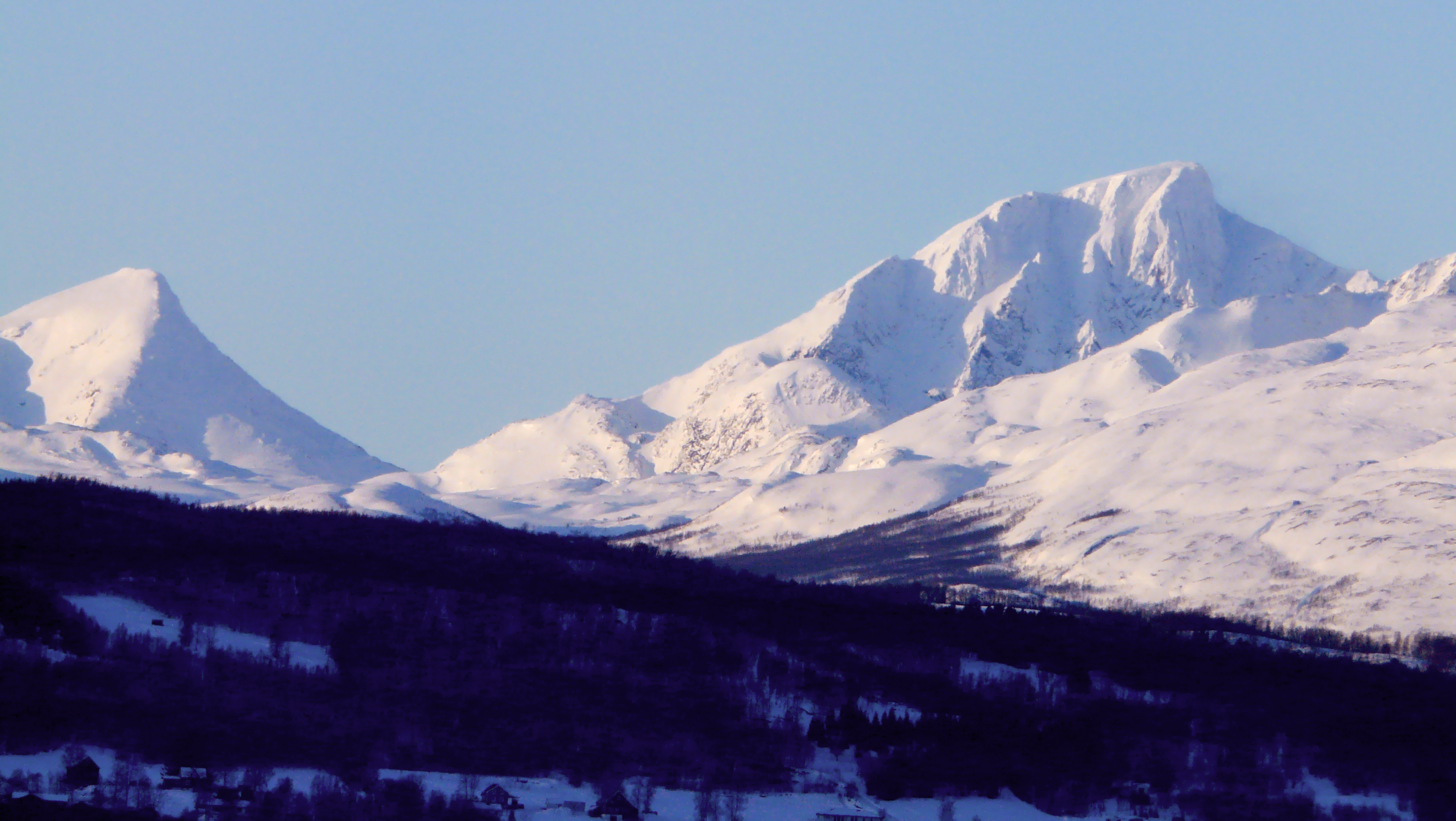
North Norway covers about a third of Norway. The southernmost part, roughly the part south of the Arctic Circle, is called Helgeland. Here there is a multitude of islands and skerries on the outside of the coastal range, some flat, some with impressive shapes, like Mount Torghatten, which has a hole through it, and the Seven Sisters near Sandnessjøen. The inland is covered with dense spruce forests and mountains near the Swedish border; some of the biggest rivers in the region are the Vefsna and the Ranelva. The highest mountain in Northern Norway is found here in the Okstindan range south of Mo i Rana with Oksskolten reaching 1,915 m above sea level, and with the glacier Okstindbreen.
The Saltfjellet range, with its Svartisen glacier and intersecting Arctic Circle, divides Helgeland from the next region, called Salten. Notable peaks in Salten are the Børvasstindan south of Bodø, Suliskongen near Fauske (1,907 m, highest mountain north of the arctic circle), the Steigartindan and the phallic Hamarøytinden. Between Saltfjellet and eastern Finnmark, Norwegian spruce trees have originally been planted and are mostly privately owned. The older plantations are now producing lumber, 80 years after planted.[1]
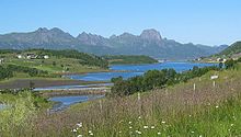
 The islands along the coast creates sheltered sounds on the inside, as here in Lenvik.
Lofoten is a chain of peaks that jut out of the ocean. From the mainland side it looks very barren, but behind the violet-black peaks there are also flatlands with good grazing for sheep, partially on soil made from seaweed. The Vesterålen islands consist of smaller and bigger islands with a huge variation of landscape. Ofoten, further inland, is a fjord landscape with high mountains, the highest is Storsteinfjellet in Narvik, 1,894 m above sea level, but the most well-known is Stetind, the national mountain of Norway. There are also glaciers, like Frostisen and Blåisen.
 Part of Storfjord municipality and the Lyngen fjord; early May 2009.
 National parks in North Norway. Lomsdal-Visten National Park was established May 2009 (no 30). Børgefjell National Park is shared with Nord-Trøndelag and does not show on map.
Troms county has surprising greenery for the latitude, and the inner waterways and fjords are lined with birch forests, and further inland there are pine forests and highlands around the rivers Målselv and Reisa. Big islands like Senja, Kvaløya and Ringvassøya have green, forested interiors and a barren, mountainous coastline, with smaller islands offshore. The Lyngen Alps are the highest mountains of the area, rising to 1,833 metres, an area of glaciers and waterfalls. The waterfall of Mollisfossen in Nordreisa, at 269 metres, is the highest waterfall in the north, while Målselvfossen is Norway's national waterfall.
 The many fjords vary in size and topography. The bedrock and soil in the surrounding land also varies. Eidsfjorden in Sortland, Vesterålen.
Finnmark county has fjords and glaciers in the far southwest, and the northwestern coasts are characterized by big islands, like Sørøya and Seiland. The inland is covered by Finnmarksvidda a plateau about 300–400 metres high, with many lakes and rivers like Alta-Kautokeino and Tana/Deatnu. Even at this latitude, pine forests grow naturally in lowland areas inland. East of Honningsvåg, there are no islands protecting the barren coasts that rise directly up from the sea. The landscape towards the Russian border is comparatively flat. Knivskjellodden on the island of Magerøya marks the northern end of Europe; tourism is directed to the much more accessible North Cape, whereas Kinnarodden on the Nordkinn Peninsula is the northernmost point of Europe's mainland. Finnmark is situated north of northernmost Finland, and to the east Norway has a 196 Km border with Russia
History
 Rock carvings at Alta
Historical populations Year Pop. ±% 1951 403,884 — 1960 437,182 +8.2% 1970 456,121 +4.3% 1980 468,496 +2.7% 1990 460,274 −1.8% 2000 464,328 +0.9% 2010 464,665 +0.1% 2020 475,701 +2.4% 2030 489,019 +2.8% Source: Statistics Norway [1][2][3]. The oldest culture in the area is called Komsa, named after a mountain in Alta. The first people possibly came around 12-13,000 years ago, but it is uncertain whether they came from southern Norway or from the Kola Peninsula. Today the rock carvings at Hjemmeluft in Alta or at Leknes in Nordland are among the remainders of the Stone Age cultures, showing reindeer swimming across the fjords. A significant find area is between the river Tana and the fjord of Varanger, where the reindeer probably ran over the isthmus on the way between the winter and summer grazing. However, we do not know the ethnic identity of the Stone Age cultures. Metals were introduced around 500 BC or possibly somewhat earlier.
The Sami culture can be traced back at least 2,000 years. There are also some archeological evidence of Bronze Age agricultural settlements about 2,500 years old, as in Steigen and Sømna. In 2009, archeologist discovered evidence of barley grown in Kvæfjord near Harstad in the Bronze Age 1000 BC (Norwegian). A larger settlement by people of Germanic origin, with substantial archeological evidence, seem to have occurred around 200-300 AD. These settled along the coasts roughly up to Tromsø. The two ethnic groups traded with each other, and there seems to have been quite a lot of intermarriage. The nature of the co-existence is still being hotly debated.
 The medieval Alstahaug Church.
In the Viking age, several chieftains along the coast played a significant role in Norwegian history, usually resisting unification of Norway. The voyage and story of Ottar from Hålogaland was recorded by the king of England. Hårek from Tjøtta and Tore Hund, who killed Saint Olav at the Battle of Stiklestad in 1030 were important leaders according to Heimskringla. The chieftain and poet Øyvind Skaldespiller was the first to receive international acclaim, as his poems were rewarded when the Icelandic parliament organized a money collection to buy him a thick ring of gold. This flourishing period of resistance was followed by a take-over from the south, reducing the might and wealth of the chieftains.
In the Middle Ages, churches were built along the coast. By 1150, Lenvik was the northernmost. In 1252 the first church was built in Tromsø, adding it to Norway. Finally in 1307 the Vardø church was built, clearly establishing that this was part of Norway. This was accompanied by the building of a fortress. At roughly the same time, the cod fishing gained momentum. Dried cod was exported through Bergen to the whole Hanseatic world, bringing prosperity to the north. This is reflected in the numerous pieces of imported church art from the late Middle Ages. There were numerous wars with the republic of Novgorod in Russia at the time, that stopped by the late 15th century.
Reduced fish prices in the 17th century led to a significant decline in the population. Large coastal areas were depopulated, and Sami culture made a comeback, as it was less dependent on fish exports. After 1700, the Russians started to come every summer on trading expeditions, bringing rye in exchange for fish. In the 1740s the first settlers from Finland, escaping hunger and war, came. In 1789, the trade monopoly of the city of Bergen was lifted, and Hammerfest and Vardø were issued their city charters, and Tromsø followed suit in 1794. Interrupted by the British blockade of the Napoleonic wars, this introduced a period of unprecedented growth in the north. Bodø was founded in 1816, and Vadsø in 1833. The Hurtigruten shipping line, introduced in 1893, gave quicker communications with the south. In 1906, the iron mines in Kirkenes opened.
 Cod fisheries has for more than 1,000 years been of great economic importance to the region. From Svolvær harbour by Gunnar Berg.
At the same time, the ethnic diversity of the area came under threat. All the progress within fishing and agriculture was introduced by Norwegians, making Sami and Finnish ways less attractive. In schools, only Norwegian was promoted, and from around 1900, the Norwegian authorities were very insistent that all should speak Norwegian only. From now on, the Sami language was banned in schools, churches and in public administration. People who wanted to buy parts of the state lands in Finnmark had to prove they could speak Norwegian before they were allowed to settle.
This region of Norway was the area most affected by World War II. In 1940, the Allies and the Germans fought over the strategic port for iron exports of Narvik. King Haakon VII and the government fled towards the north, and stayed in the Tromsø area for three weeks. On 27 May, Bodø was bombed by German planes, and on 7 June, the Allies retreated from the North, and the King and government fled to Britain from Tromsø.
In 1944, the German Wehrmacht started to retreat from the Murmansk front. They burned everything after them in the area between the Russian border and the Lyngen fjord, as part of their tactics. The population was forcibly evacuated, although a third of them chose to hide in the wilderness instead. All who were found were shot.
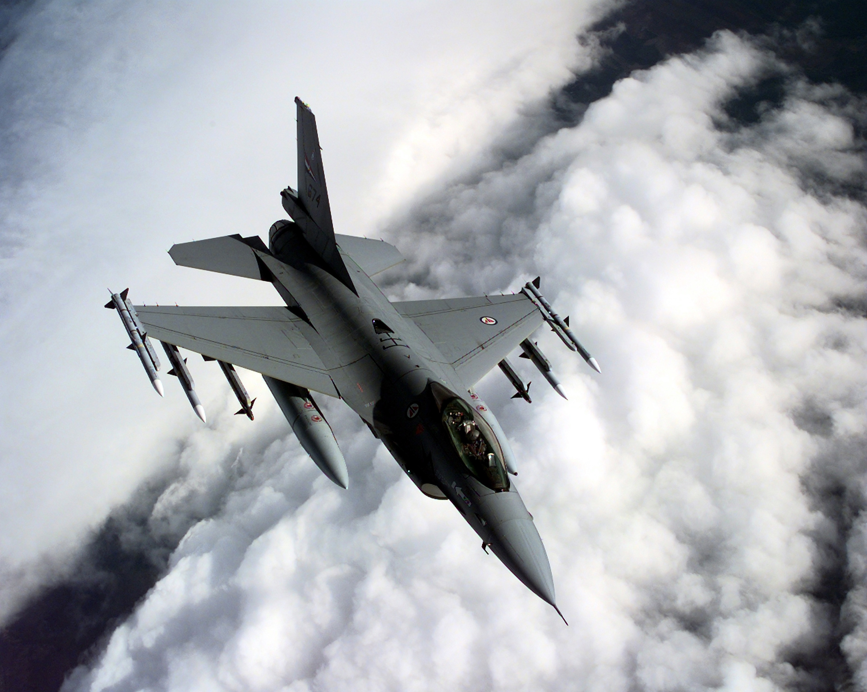
 Bodø was an important air base during the cold war. In more recent years, Norwegian F-16s have deployed to Balkans and Afghanistan.
After WW II, Norway made a huge effort to rebuild the destroyed towns and villages. Modernizing fishing and agriculture was important, as Northern Norway was considerably poorer and less developed than the south. In 1946 the huge steel works of Mo i Rana were founded, heralding industrialization of the north.
Communications were also improved, as airports were built throughout the area, notably in Bodø 1952 and Tromsø in 1964. The train network was extended to reach Bodø in 1961. In 1972, the University of Tromsø opened, accompanied by a number of colleges, notably in Bodø, Alta, Harstad and Narvik. In 1972 and 1994, the strong anti-EU movements of the north were instrumental when Norway voted against EU membership in referendums.
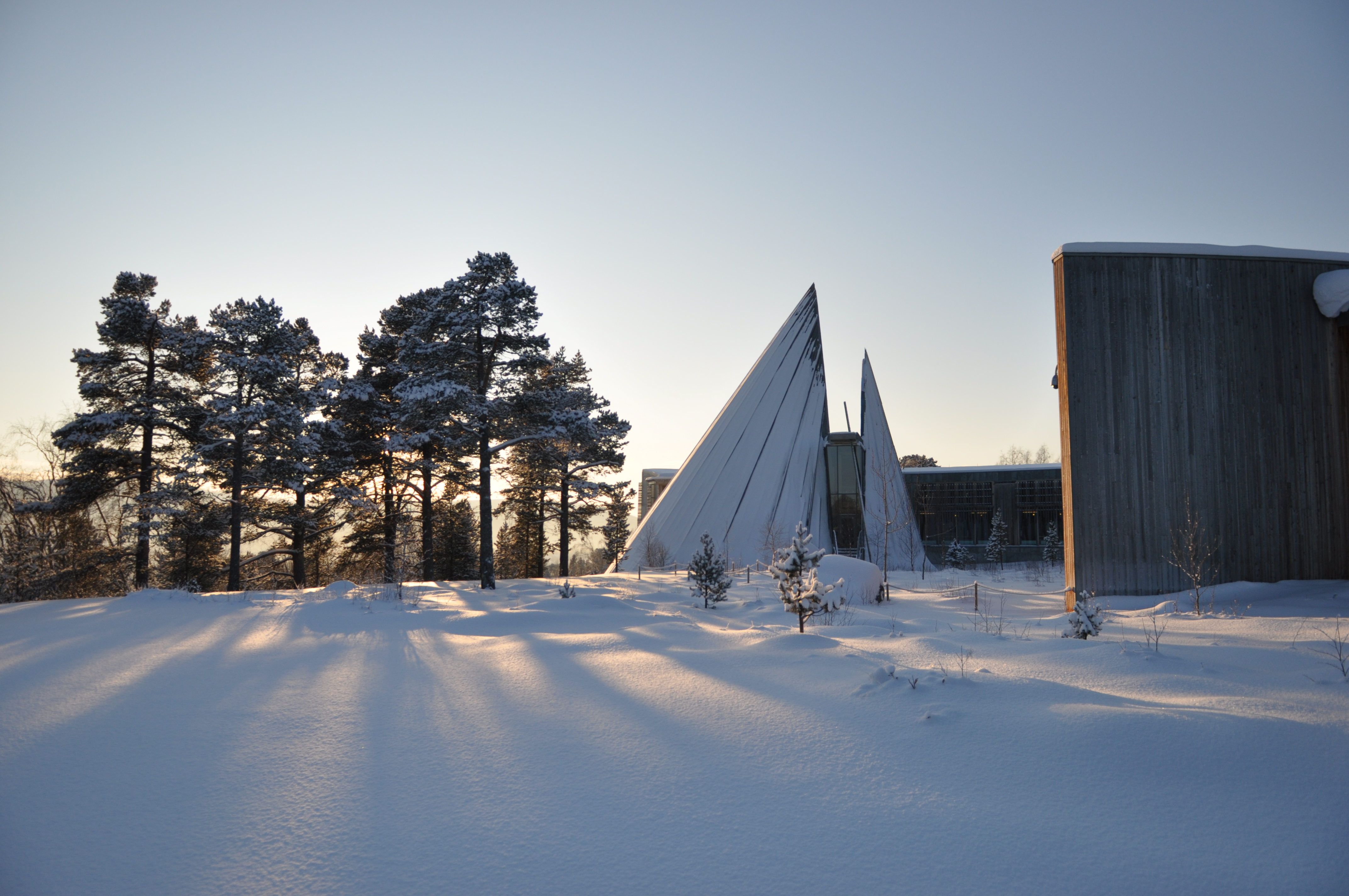
 Samediggi - the Sami Parliament in Karasjok.
Sami-language instruction was introduced in schools in the 1970s. In 1979, and the building of a hydro-electric dam in Alta caused huge demonstrations, giving the Sami question national attention for virtually the first time. The result was a significant effort by the authorities to promote Sami language and culture. In 1989, the Norwegian Sami parliament, Samediggi, opened, and the Law of Finnmark of 2005 dealt with the land question. A similar law is on the way for Nordland and Troms.
Working against all this, emigration to the south has been strong after World War II, and today Oslo is Norway's biggest city. The population is slowly declining in the north, although the regional centres of Bodø, Tromsø and Alta continue to grow. Lately, the off-shore gas field of Snøhvit, off Hammerfest, has brought hopes of new development in the north.
Languages
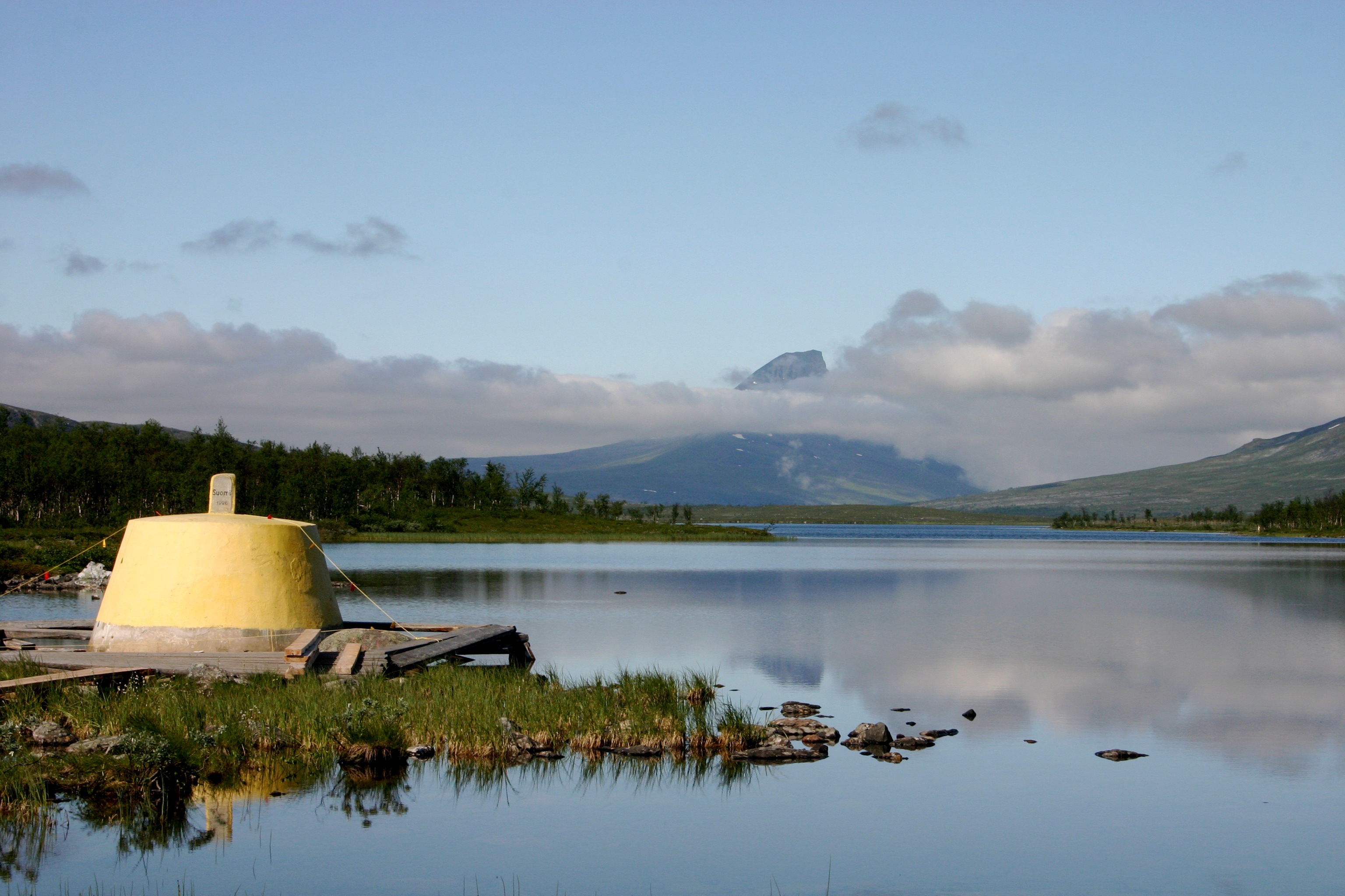
 Treriksrøysa where Norway, Sweden and Finland meet each other.
The North Norwegian dialects share a common, musical intonation, different from the southern dialects of Norway. Apart from this, there is great variation in sound system, grammar and vocabulary. In general, one can say that the southernmost of the northern dialects, particularly in Helgeland and Salten, are the most distinct. Notably they cut grammar endings (like French relative to Italian). Further north, the dialects are somewhat more in line with standard written Norwegian (Bokmål, Nynorsk). In some inland valleys in the county of Troms, settlers from the inland of Southern Norway immigrated 200 years ago. Even today, these dialects have southern characteristics in intonation and vocabulary.
Earlier, northern dialects had a low status in Norway, but recently they have been used extensively in song lyrics, poetry, in TV and radio. Today, anyone from fishermen to university professors can use their dialects even at work.
Sami is spoken in three main dialects: Southern Sami south of the Arctic Circle, Lule Sami mainly between Bodø and Narvik, and Northern Sami in the rest. Originally, Pite Sami and Ume Sami was spoken around Bodø, but these dialects are now extinct on the Norwegian side of the border. Eastern Sami was originally spoken in Neiden, close to Kirkenes, but it is more or less extinct. Sami is an official language (in addition to Norwegian) in the municipalities of Gáivuotna (Kåfjord), Kautokeino, Karasjok, Porsanger, Tana and Nesseby.
The Finnish spoken in eastern regions, from Storfjord to Porsanger, is quite distinct, although comprehensible for people from Finland. Further east, around Vadsø and Kirkenes, the spoken Finnish resembles standard Finnish. Finnish is official in addition to Sami and Norwegian in Porsanger municipality.
Coastal and fjord areas of North Norway have much in common with Western Norway, although the two regions are not connected with each other by land. The topography and fjord landscape, the rich fisheries, the culture and even some aspects of the dialects (Vestnorsk) have clear similarities.
Cuisine
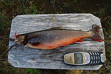 Arctic char (pictured) is common in North Norway; the only part of Norway where they also feed in the sea. Trout is also very common in lakes and rivers.
 Reindeer at sunset near Bugøynes.
North Norway is surrounded by some of the richest seas in the world, and sea products constitute much of the food source for traditional cuisine. However, agricultural produce has existed for at least 3,000 years in parts of the area (Helgeland, Salten, Lofoten, Harstad-Kvæfjord).[4] In addition to fishing, each family traditionally had a small farm with a few cows (see Pietro Querinis shipwrecked at Røst in 1432[5]), and had small grain fields (mostly barley).[6] Agriculture gradually becomes less important as food source as one moves further north, and in the northern half (north of Balsfjord/Tromsø area) was usually of minor importance and certainly less important than fishing or Sami reindeer nomadic pastoralism. Hunting has been important ever since the stone age, and the comparatively large areas of sparsely settled valleys, fells and mountains still hold wildlife.
In the winter, the codfish comes to the coastal waters to spawn, especially to the cod fisheries of Lofoten. Mølja, boiled codfish with liver and roe, is a delicacy that today is served in the best restaurants. In the summer, the coalfish, or saithe, bites, and fresh saithe is often served on the beach, boiled in seawater over an open fire, or fried (typically the smaller coalfish). Halibut is traditional Christmas food. Most fish is served plainly poached, only accompanied by boiled potatoes, carrots and possibly fried bacon. A more particular kind of fish is "gammelsei", saithe that has been conserved for a year or more. Other traditions are lutefisk and boknafisk, the latter made from stockfish, and in Nordland often from herring.[7] Seawolf and rose fish are regarded as good food, the latter often eaten salted and poached, with the brain (krus) highly regarded, sometimes fried with onions. In addition to cod, herring and potatoes were traditional staple food (except in the most northern area). Salmon has long traditions as food along the rivers, and also trout which are common also in the numerous lakes. In the latest decades consumption has increased in correspondence with increased salmon fish farming; smoked salmon is very popular, often on open sandwiches, alone or together with boiled or scrambled eggs or salad. Traditionally, northerners regarded shellfish and prawns as bait, but lately they have developed a taste for it, and the freshest and most succulent prawns and shellfish are easily obtainable all along the coast. Shark meat has traditionally not been used as food, even if some can grow nearly 10 meter long.[8] In later years, the large Red king crab has invaded Norwegian waters from the east and, having reached west to Hammerfest, are now served in the finest restaurants. The large sea bird colonies along the coast provided eggs for the local population, most of these are now protected by law. However, in Tromsø, sea gull eggs and beer from the local brewery is still a highly regarded dish to enjoy in the sun of late spring.[9]
Tender whale meat is usually served as steaks, whereas seals are an acquired taste, due to the smell. However, when processed into "Barents ham", it gets more palatable. Fresh seal meat is served at the end of the hunting season in spring, and Tromsø is the place to look for it. Reindeer are often served as finnebiff, thin slices in a cream sauce. Lamb meat from sheep following the retreating snow line up the hills and mountains to get the most nutritious fresh vegetation throughout summer is highly regarded by the locals, and research seem to indicate that a varied diet does influence the taste of the meat.[10] Game meat includes mountain hare, rock ptarmigan, willow grouse and moose.
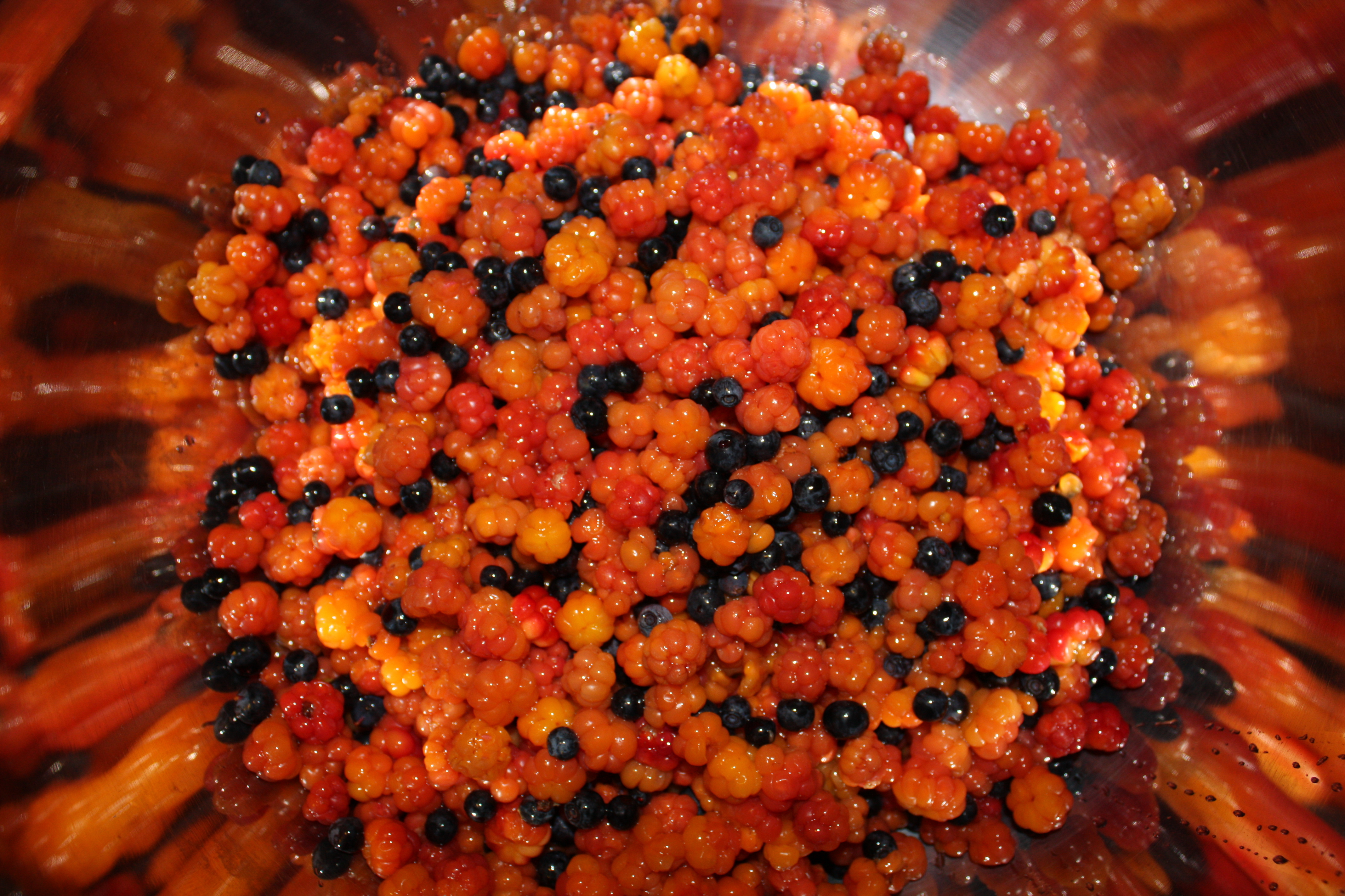
 Cloudberries and blueberries (bilberries)
Food with milk as important incredients includes waffles, pancakes and rømmegrøt (sour-cream porridge), the latter always served with sugar and cinnamon. There are a number of local traditions in this long region, including goat cheese from Balsfjord,[11] Blanklefse and other variations of lefse from Helgeland,[12] and a number of variations of reindeer, an integral part of traditional Sami culture.
 Winter in Balsfjord, the most northern municipality in Norway with fairly large agricultural activity.
Wild berries have long traditions in the local cuisine, and the most sought after is the cloudberry, used in marmelade, desserts and cakes. Other popular wild berries are bilberries, lingonberry, raspberry (southern half of region, also cultivated in some private gardens), and there are also a number of less well known berries used for food.[13] Mushrooms are common in the forests from late July to September and also has seen some use in traditional food.
The use of kitchen gardens is limited by climatic factors, but still has a long history in the southern half of the region. Rhubarb and redcurrant has been used for more than 100 years; redcurrant also grows naturally in much of the region,[14] blackcurrant is also common in gardens. In addition to potatoes and carrots, rutabaga and sometimes cabbage have traditionally been grown (very little in Finnmark). Many wild plants were used for medical purposes or as spices, such as Garden Angelica, but this has become rare in modern times. More lately is the imported strawberry which has become popular and are grown locally (mostly southern half of region).[15] The unique growing conditions, with ripening in 24-hr daylight and modest warmth is sometimes claimed to enhance tastefulness.[16] Bioforsk, with research in terrestrial effects of climate and subarctic agriculture, has branches in four places in North Norway - Tromsø, Bodø, Tjøtta and Svanhovd in Sør-Varanger. [17]
Light

 Aurora Borealis seen from Salangen.
There are extreme variations in daylight between winter and summer. At Nordkapp the midnight sun can be seen from 11 May to 31 July, and the sun does not rise above the horizon from 19 November to 22 January. For Tromsø, the dates are 17 May to 25 July, and 26 November to 15 January, respectively; and for Bodø from 30 May to 12 July (no polar night in Bodø). The mid-winter darkness is not totally dark on the mainland; there is twilight for about three hours around noon in Tromsø. Helgeland does not have true midnight sun, but the upper part of the sun disc never descends below the horizon as far south as Mosjøen in June. February is a transitional period when the sun rapidly returns, and March and April often feel like an explosion of light with long daylight hours and snow cover in most areas except the coastal strip of Nordland. The Aurora Borealis can be seen in the whole area from autumn to mid-April, after which it gets too bright to observe the Aurora.
Month Jan Feb Mar Apr May Jun Jul Aug Sep Oct Nov Dec Bodø sunrise & sunset 15. of the month 10:18 - 14:05 08:16 - 16:18 06:24 - 18:02 05:16 - 20:51 03:06 - 22:56 Midnight sun 01:40 - 00:30 04:27 - 21:43 06:20 - 19:34 08:02 - 17:33 09:04 - 14:29 11:18 - 12:37 Tromsø sunrise & sunset 15. of month 11:31 - 12:17 08:16 - 15:43 06:07 - 17:41 04:43 - 20:48 01:43 - 23:48 Midnight sun Midnight sun 03:44 - 21:50 05:56 - 19:20 07:54 - 17:04 09:25 - 13:32 Polar night Hammerfest sunrise & sunset 15. of month Polar night 08:16 - 15:15 05:50 - 17:22 04:17 - 20:37 Midnight sun Midnight sun Midnight sun 03:11 - 21:42 05:35 - 19:04 07:41 - 16:39 09:28 - 12:50 Polar night Source: Almanakk for Norge; University of Oslo, 2010. Note: In December and the first week of January, the very low sun in Bodø is blocked by mountains. In mid-July, the sun sets after midnight in Bodø due to daylight saving. In Tromsø, the sun is below the horizon until 15.January, but is blocked by mountains until 21. January. Climate
There are large climatic differences from southwest to northeast in this region. Finnmarksvidda in the interior of Finnmark and some valleys in the interior of Troms, experience a more continental climate with much less precipitation and much colder winters compared to the long coastal region.
Maritime to continental subarctic climate Brønnøysund in the southern part of Nordland has January and February averages of -1°C and -0.6°C (31°F), July & August 24-hr averages are both 13°C (56°F), year average is 5.6°C (42°F; about the same as in Oslo), and precipitation is 1,510 mm/year, with autumn as the wettest season ([4]). Brønnøysund experiences on average 63 days/year with strong breeze (22 knots) or more, and 18 of these days reach gale force winds or more (34 knots, data from Leka just south of Brønnøysund, source met.no). In all areas, late autumn and winter is the most windy time of year, as the Atlantic low pressure systems are strongest then.
Karasjok in the eastern part of Finnmarksvidda has January and February averages of -17°C (1°F) and -15°C (4°F), July & August averages are 13°C (56°F) and 11°C (52°F), year average is -2.4°C (28°F) and precipitation is only 366 mm/year ([5]). Situated in a river valley, Karasjok only experiences on average 1 day/year with strong breeze (22 knots) or more, and virtually never sees gale force winds.
The mean annual temperature difference between Brønnøysund and Karasjok is 8°C (15°F), about the same as the difference between Brønnøysund and Madrid, Spain ([6]). The comparatively mild maritime climate dominates along the coast and in the large fjords, even at the most northern coastal locations; in Nordkapp municipality the average January temperature is a modest -4°C (26°F) and the year average is 2°C (35°F) ([7]). Some islands, like Træna and Røst, have average temperatures of approximately 1°C (33°F) in their coldest months.
The warm climate in coastal areas, relative to other locations at the same latitude, is by many attributed to the relatively warm North Atlantic Current, an extension of the Gulf Stream. It has been shown that northern Europe's mild climate is caused primarily by intercontinental weather patterns driven by North America's mountain ranges. But in Northern Norway, this ocean current fundamendally changes climate.[18]Wind
The most windy location in continental Norway (apart from mountain summits) is Fruholmen lighthouse ([8]) in Måsøy not far from the North Cape. The most windy city in North Norway is Bodø with on average 153 days/year with strong breeze or more and 24 days with gale force winds, while Vardø, also lacking shelter, sees 136 days of strong breeze or more and 18 days with gale. Inland valleys and sheltered fjord areas — particularly if sheltered by mountains — are much less windy. Tromsø, partly sheltered by large islands, experiences on average 27 days/year with strong breeze, and 1 day with gale, and Bardufoss sees on average only 11 days with strong breeze or more and scarcely ever experiences gale. In winter, there might sometimes blow cold winds from the freezing highlands out through the large fjords, -10°C and strong breeze will feel very cold on the skin. Mild westerlies are still much more common in most winters. Weather patterns are inherently unpredictable in this northern region — both low pressure and high pressure weather can occur at any time of year, although the strongest winds occur in winter.
 Blåtindan in Målselv, inland Troms. February 2009.
Winter
 Tromsø street. Snow cover persists for many months in most areas, this also insulates the ground from the cold.
Along the coast of Nordland average temperatures hover barely below freezing for 2 – 3 months, statistically from 15 December to 27 February in Brønnøysund; somewhat longer into the fjords. Inland Finnmark, as in Karasjok, average temperatures remain below freezing for 7 months (October — April). In Tromsø, average temperatures stays below freezing for 5 months - statistically from 10 November to 10 April (based on 1961-90 average, more recent years have tended to be somewhat warmer).
Summer
Even if winter temperatures depends largely on the distance to the sea, the length of the season varies mostly with latitude (and altitude): The summer (days/year with 24-hr average 10°C or more; 50°F) lasts on average 108 days in Brønnøysund, 90 in Bodø[19], 85 days in eastern Lofoten[20] and Narvik, 75 days at the inland valleys of Bardufoss[21] and Alta, about 65 days in Tromsø and Kirkenes, 50 in Hammerfest[22] and 0 in Vardø. This is based on a 30 year average (1961–1990) for each day of the year; even Vardø will on occasions experience summer days. Statistically, summer temperatures starts 29 May in Brønnøysund and 22 June in Tromsø. The growing season varies from 180 days at Vega, Brønnøysund and Røst to less than 120 days in Finnmarksvidda and the Varanger Peninsula.
Precipitation
 The main fjords remain ice-free all winter, but some sheltered fjord branches - like Ramfjord in Tromsø pictured here - freeze over in winter, allowing ice fishing.
Precipitation occur in all seasons, usually as snow in winter, although often as rain on the Nordland coast. Snow accumulation in the mountains can exceed 3 m, and this abundance of snow is the reason for the numerous glaciers - more than 500, mostly in Nordland and Troms. Autumn tend to be the wettest season in most areas, often receiving more than twice as much precipitation as does spring and early summer. Only the interior areas of Finnmark - like Karasjok - tend to be wettest in summer. The areas with the least precipitation are some inland valleys, like Dividalen in Målselv with only 282 mm precip/year, and upper Saltdal and Skibotn with about the same. Inland Finnmark is the only large area with less than 450 mm precipitation/year. The wettest areas are generally the Helgeland region; Lurøy on the west coast of Saltfjell averages 2900 mm/year.
The Arctic northeastern coast
The extreme northeastern coast, from Nordkapp to Vardø, is situated in the arctic climate zone due to lack of summer warmth — July average in Vardø is only 9°C (48°F). However, 150 km to the south, in the Pasvik valley south of Kirkenes, July 24-hr average is up to 14°C (57°F). No other parts of Norway experience so large differences in lowland summer temperatures in such a relatively short distance.
Record temperatures
The coldest temperature recorded is -51.4°C (-61°F) in Karasjok, and the warmest recorded is 34.3°C (94°F) in Sihcajavri in Kautokeino.
Sources
- Bjørbæk, G. 2003. Norsk vær i 110 år. N.W. DAMM & Sønn (Norwegian)
- Moen, A. 1998. Nasjonalatlas for Norge: Vegetasjon. Statens Kartverk, Hønefoss (Norwegian)
- Norwegian Meteorological Institute (external link) (Norwegian)
Cities in North Norway
See also: Demographics of Northern Norway Strandgata (street) in Harstad on a warm May day.
Ranked by population in the city itself (not the municipality) as of 1. January 2008:[24]
Cities with less than 30,000 inhabitants, ranked by population:
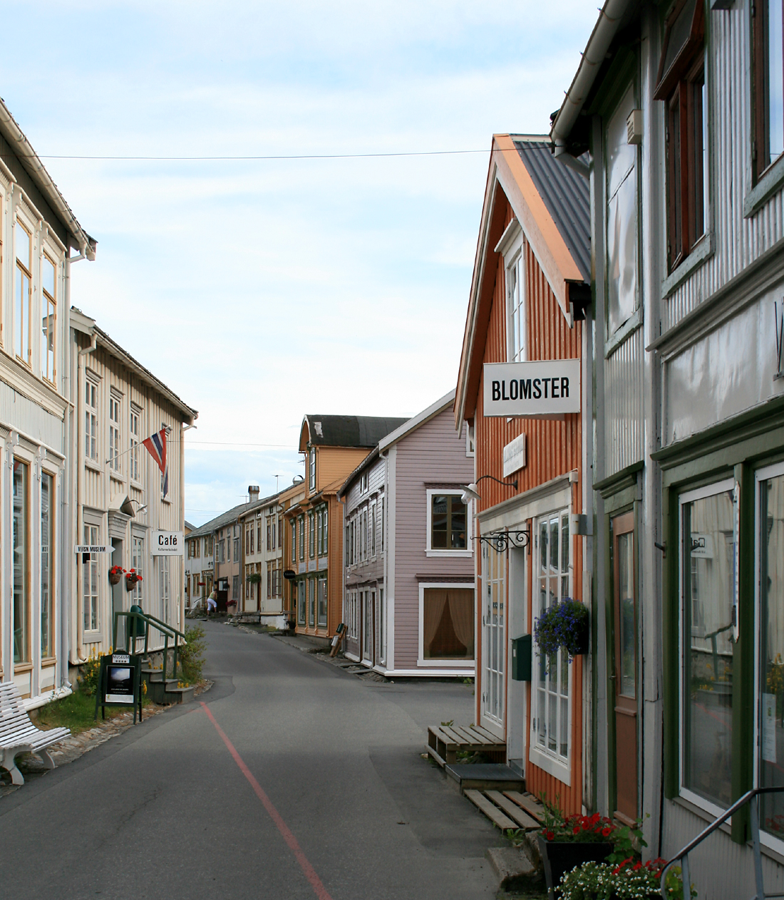
 Sjøgata in Mosjøen, the longest remaining street with 19th.c. wooden buildings in North Norway
Cities (towns) with less than 5,000 inhabitants, ranked by population:
There are settlements larger than Vardø which are not included in the list as they have not been granted or applied for township (such as Rognan, Løding, Andenes, Setermoen and Skjervøy).
Communications
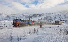 Train on the Ofoten Line crossing the mountains from Sweden to Narvik, which is the largest port in North Norway due to the iron ore shipment
North Norway, located at the very northern periphery of Europe, has seen great improvements in communications in recent decades. The road network connects virtually all villages and towns, the most important roads are the E6, E10, E8. Seven road sections in the region are National Tourist Routes in Norway due to their scenic surroundings, from Helgeland in the south to the Varanger Peninsula in the northeast, including two sections of the Norwegian County Road 17. Airports with long runways and direct flights to Oslo airport are located in Tromsø, Bodø, Evenes (near Harstad), Alta, Kirkenes and Bardufoss, and there are also directs flights connecting Brønnøysund and Sandnessjøen with Oslo. There are smaller airports with regional flights near most towns. For Bodø, Fauske, Mo i Rana and Mosjøen the Nordland Line provides railway connection south to Trondheim (and on to Oslo), while Narvik has railway connection east to Sweden (and on to Stockholm). The Hurtigruten calls at many ports in the region.
Famous people from the north
- Knut Hamsun (1859–1952), author and Nobel laureate, from Hamarøy
- Otto Sverdrup, Arctic explorer, from Bindal
- Iselin Steiro (1985–), supermodel, from Harstad
 The European route E6 is the main road to the north; Storjord in Saltdal by the E6 is situated just north of the Arctic Circle.
- Mads Gilbert, professor of emergency medicine, from Tromsø.
- The Röyksopp band duo Torbjørn Brundtland (1975–) and Svein Berge, from Tromsø
- Lene Marlin (1980–), singer and songwriter, from Tromsø
- Mari Boine (1956–), jazz artist, from Karasjok
- Geir Lundestad (1945–), director of the Nobel Institute and professor of history, from Bodø
- Trond Sollied (1959-), Football manager. Ranked as the ninth best manager in 2006.[25]
- Hans Erik Dyvik Husby ("Hank Von Helvete") (1972-), Vocalist in the death-punk band Turbonegro.
- Harald "Dutte" Berg (1941-), football player.
- Morten Gamst Pedersen (1981-), football player, from Vadsø.
- Ailo Gaup (1980-), FMX World Champion, from Tromsø
- Helmer Hanssen (1870-1956), with Amundsen's team to the South Pole in 1911, from Bjørnskinn
References
- ^ http://www.nrk. - spruce timber from Bjerkvik, Narvik municipality
- ^ Statistics Norway - Church of Norway.
- ^ Statistics Norway - Members of religious and life stance communities outside the Church of Norway, by religion/life stance. County. 2006-2010
- ^ Grain cultivated in Lofoten 4,000 years ago
- ^ Pietro Querinis story from Røst in 1432
- ^ Grain cultivation in North Norway
- ^ Boknafisk is made from stockfish
- ^ http://www.nordlys.no/10 meter basking shark caught in net
- ^ sea gull eggs as food in Norway
- ^ Research: Does diet influence the taste of lamb meat
- ^ Balsfjord goat cheese
- ^ Lefse from Helgeland
- ^ Berries and other food traditionally collected in nature in Norway
- ^ Forskning.no Rips (redcurrant in Norway
- ^ Kvæfjord: Strawberries
- ^ Aperitif: A taste of North Norway
- ^ http://www.bioforsk.no/
- ^ "The source of Europe's mild climate". American Scientist. July–August 2006. http://www.americanscientist.org/issues/feature/2006/4/the-source-of-europes-mild-climate/1.
- ^ http://www.yr.no/climate_Bodø/detailed_statistics.html
- ^ http://www.yr.no/Skrova/detailed_statistics.html
- ^ http://www.yr.no/Målselv/Bardufoss/detailed_statistics.html
- ^ Hammerfest/detailed_statistics.html
- ^ http://retro.met.no/observasjoner/nordland/Meløy climate normals 1961-90
- ^ Population of urban settlements
- ^ "Sollied in European elite". http://www.aftenposten.no/english/sports/article1412744.ece.
- Newscientist: Stockfish trade with Europe, Britain 1,100 years ago
- Almanakk for Norge; University of Oslo, 2010. ISBN 978-82-05-39473-5
 Hurtigruta in Raftsund near Trollfjord.
External links
- NACC MA: North Norway
- NorwayOnline: North Norway
- Europe’s most spectacular cruising coast
- Iron age boat construction in North Norway (Norwegian)
- Spildra - a small isolated Island in the middle of Northern Norway, known for its 8,000 years of continuous settlement
- Image:Ice fishing on a fjord (Ramfjord)
Regions of Norway Eastern Norway (Østlandet / Austlandet) • Northern Norway (Nord-Norge) • Southern Norway (Sørlandet) • Trøndelag • Western Norway (Vestlandet) Categories:
- Nord-Norge
- Regions of Norway


Wikimedia Foundation. 2010.