- Deir ez-Zor
-
"Deyr" redirects here. For the administrative subdivision of Iran, see Deyr County.
Coordinates: 35°20′N 40°9′E / 35.333°N 40.15°E
Deir ez-Zor
دير الزور
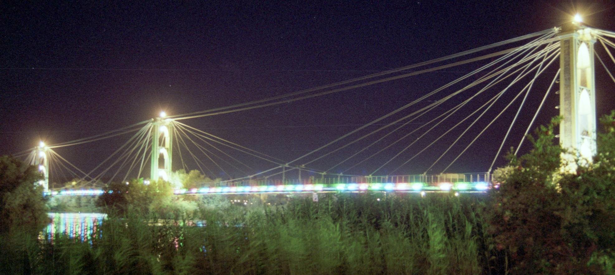
Deir Ezzor, Deir AzzorThe Suspension Bridge of Deir ez-Zor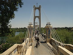 Location in Syria
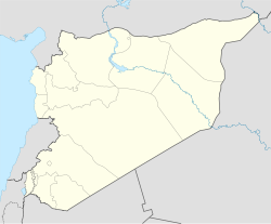
 Deir ez-Zor
Coordinates: 35°20′N 40°9′E / 35.333°N 40.15°E Country  Syria
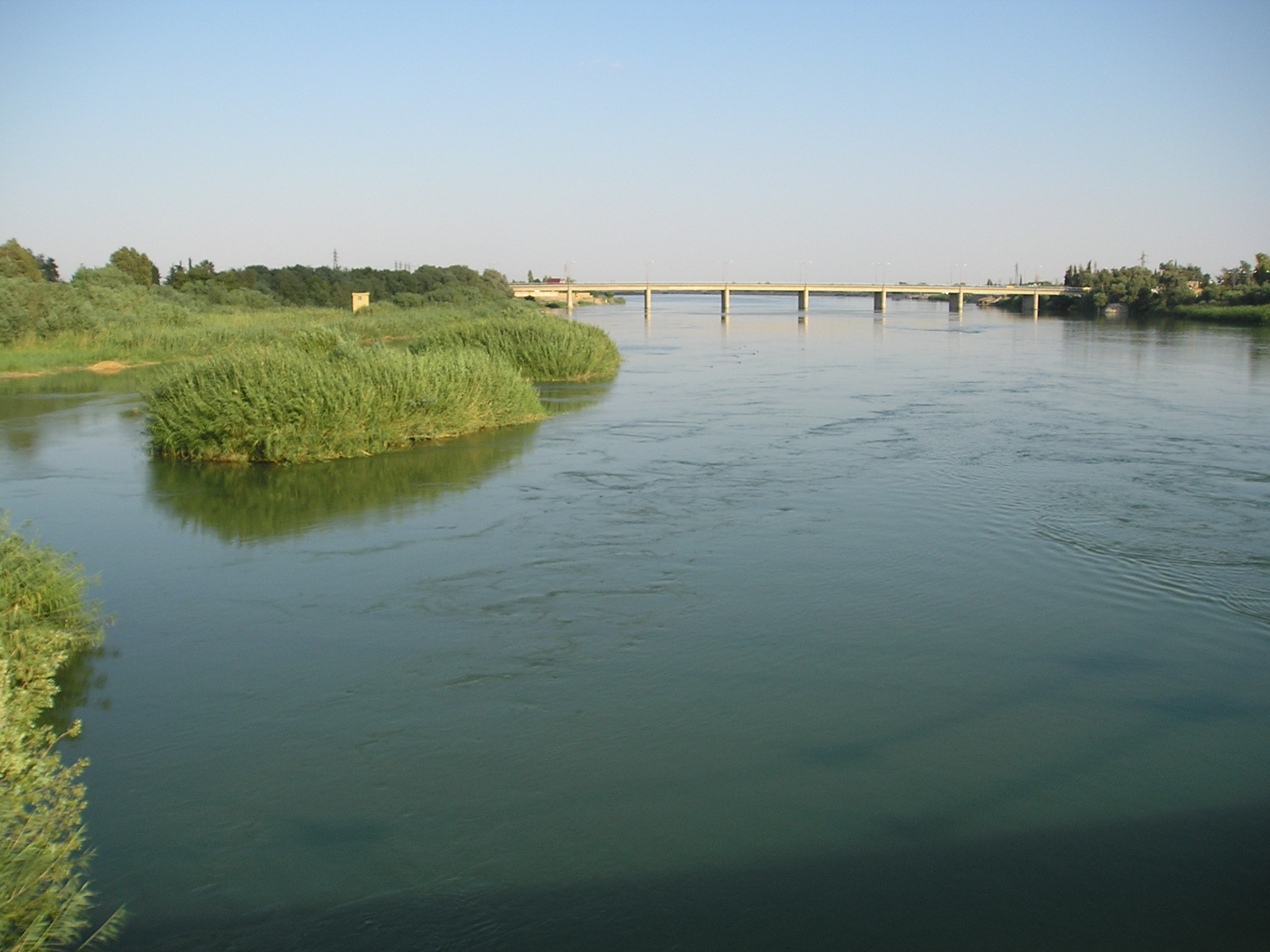
SyriaGovernorate Deir ez-Zor Governorate District Deir ez-Zor District Government – Type Governorate – Governor Elevation 210 m (689 ft) Population (2009) – Total 511,000 Time zone EET (UTC+2) – Summer (DST) EET (UTC+3) Area code(s) 051 Deir ez Zor, also spelled Dayr az-Zawr, Der Ezzor, Deir Azzor, and other variants (Arabic: دير الزور; Syriac: ܕܝܪܐ ܙܥܘܪܬܐ, Armenian: Տէր Զօր, Դեր Զոր, Ter Zor), is the largest city in northeastern Syria on the Euphrates River and capital of the Deir ez-Zor Governorate, 450 km to the northeast from the capital Damascus.[1] As in 2009, there were around 511,000 people living in the metropolitan area of the city.
Contents
Names
Among Syrians and neighbouring regions, Ad-Deir is used for short to indicate Deir ez Zor[citation needed]. The Current name, which has been extended to the region around it, indicates an ancient site for one of the Early Christian secluded monasteries spread since the persecution times and Apostolic Age throughout Mesopotamia.[2] Although Deir, which is Arabic for "monastery", thought to be kept throughout Medieval and Modern Age renaming, Zor, which indicates the riverbank bush, appeared only in some late Ottoman records.[3]
History
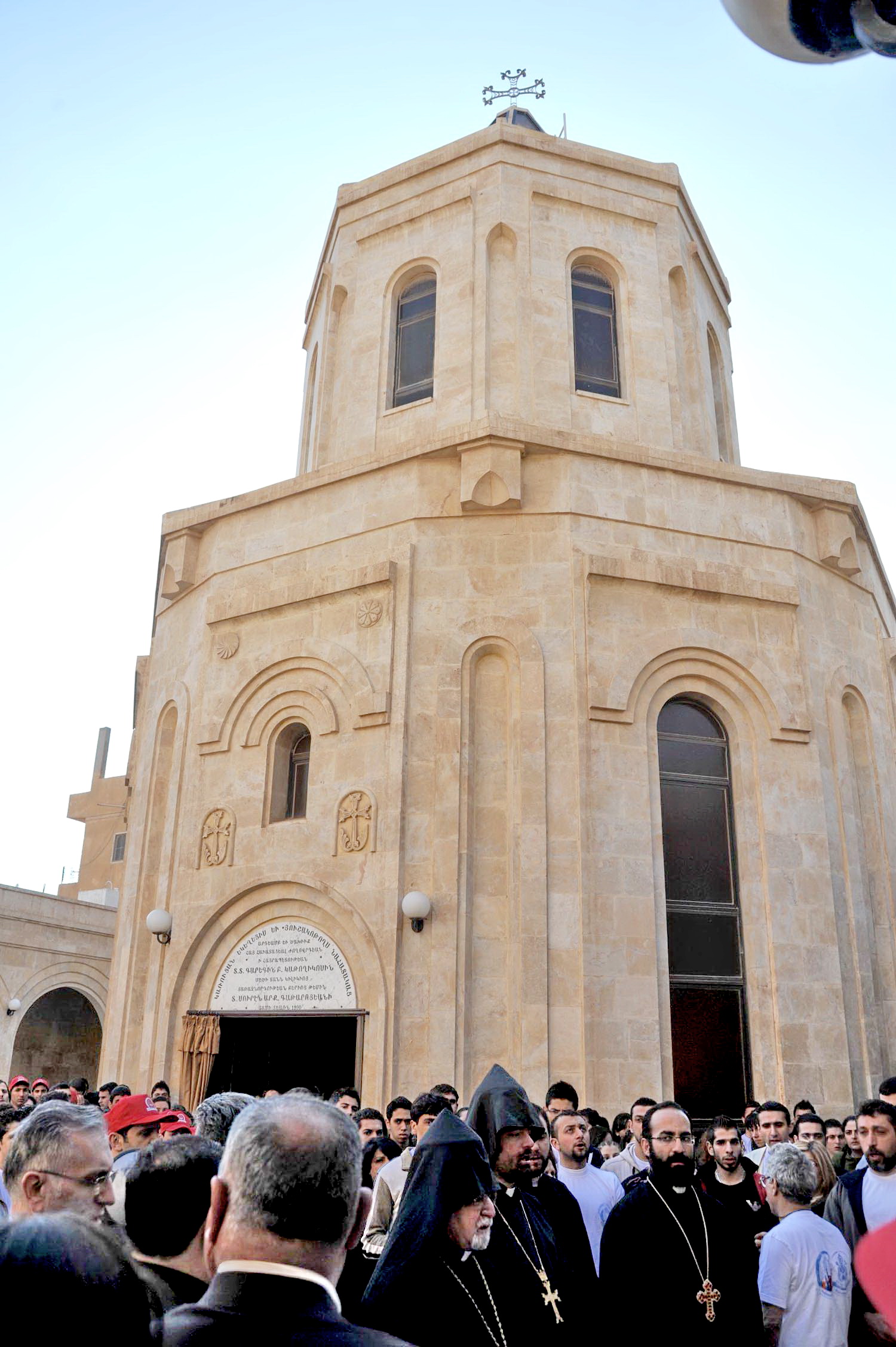
The modern town was expanded by the Ottoman Empire in 1867 around the pre-existing town. In 1915, the city became a major destination point in the Armenian Genocide; This had been the largest destination of Armenians killed in the Armenian Genocide. A memorial commemorating this tragedy was erected in the city in 1991.[4] France occupied Deir ez-Zor in 1921 and made it the seat of a large garrison. Meanwhile, the region was locally ruled by Haj-Fadel Abboud, a member of an aristocratic family. In 1941 British-led forces defeated the Vichy French during the Syria-Lebanon campaign, which included a battle over Deir, and they handed administration of the region to the Free French. In 1946 it became part of the independent Republic of Syria.
Deir ez-Zor is situated 85 km to the northwest of the archaeological remains of Dura-Europos and 120 km northwest of the remains of the ancient city of Mari. During Roman times it was an important trading post between the Roman Empire and India. Conquered by Zenobia, it became part of the kingdom of Palmyra. After a successive wave of conquests, it was finally destroyed by the Mongols as they swept across the Middle East.
Climate
Climate data for Deir Ezzor Month Jan Feb Mar Apr May Jun Jul Aug Sep Oct Nov Dec Year Average high °C (°F) 12.5
(54.5)15.2
(59.4)19.6
(67.3)25.8
(78.4)31.9
(89.4)37.2
(99.0)40.3
(104.5)39.8
(103.6)35.8
(96.4)29.5
(85.1)20.7
(69.3)14.0
(57.2)26.86
(80.34)Average low °C (°F) 2.3
(36.1)3.7
(38.7)6.8
(44.2)12.0
(53.6)17.2
(63.0)22.3
(72.1)25.4
(77.7)24.8
(76.6)20.3
(68.5)14.1
(57.4)17.3
(63.1)3.2
(37.8)14.12
(57.41)Precipitation mm (inches) 28.2
(1.11)25.3
(0.996)27.1
(1.067)19.8
(0.78)8.5
(0.335)0.5
(0.02)0.4
(0.016)0
(0)0.2
(0.008)6.0
(0.236)14.7
(0.579)25.3
(0.996)156
(6.14)Avg. precipitation days 8 9 7 5 3 0 0 0 0 2 4 6 44 Source: World Meteorological Organization Economy
The city and its rural surrounding is a fertile and prosperous farming area, with livestock-breeding (for awassi sheep), cereals and cotton crops. Many agribusiness institutions work there as well.
Since the discovery of light crude petroleum in the Syrian desert it has become a centre for the country's petroleum extraction industry. It is also a minor centre for tourism with many tourist facilities such as traditional French-style riverbank restaurants, up to 5-star hotels, a hub for trans-desert travel and an airport (IATA code: DEZ) in Al-Jafra suburb. There are salt mines nearby.
Culture
The majority of Deiries (from Deir ez-Zor) are Arabs, most of them are farmers from Jazira and urbanised bedouins of the Syrian Desert, with few Kurdish, Armenian and Syriac families. Successive waves of new settlers from surrounding countrysides and provinces were heavily related to severe drought in late 1950s and 1990s most of them looking for standard jobs and giving away farming and herding life-style. North Mesopotamian dialect of Arabic is used there, with slight influence of the North Syrian one can be noticed as well. Dominated by Sunni Muslims, Christianity in Deir ez-Zor can be traced back to the Apostolic Age, with few churches and chapels belong to different denominations are active there.
The city is also famous for the Deir ez-Zor suspension bridge (Arabic: الجسر المعلق) which spans the Euphrates[1] and was completed in 1927. The Deir ez-Zor Museum keeps thousands of antiquities collected from nearby archeological sites in Northern Mesopotamia. Main campuses of Al-Furat University and Al-Jazeera University are also located there.[5] Many other polytechnic schools and professional institutes provides tertiary education are based in the city as well. The local daily newspaper Al Furat and few other publications are published there and circulated in neighboruing Al-Hasakah and Raqqa governorates.
International relations
Deir ez-Zor is home to the third Armenian diplomatic mission in Syria; the Honorary Consulate of the Republic of Armenia, opened on 11 February 2010.[6]
Deir ez-Zor Airport is an under-development domestic and international terminal and important hub mostly connecting with Damascus and destinations in the gulf region.
Twin cities
Gallery
- Deir ez-Zor
-
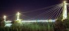
The Suspension Bridge of Deir ez-Zor at night
-

Hatla Bridge on the Euphrates
-
Annual pilgrimage to the Armenian Genocide Memorial
-
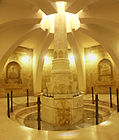
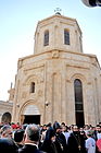
The Armenian Genocide Memorial in Deir ez Zor
-
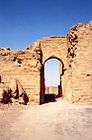
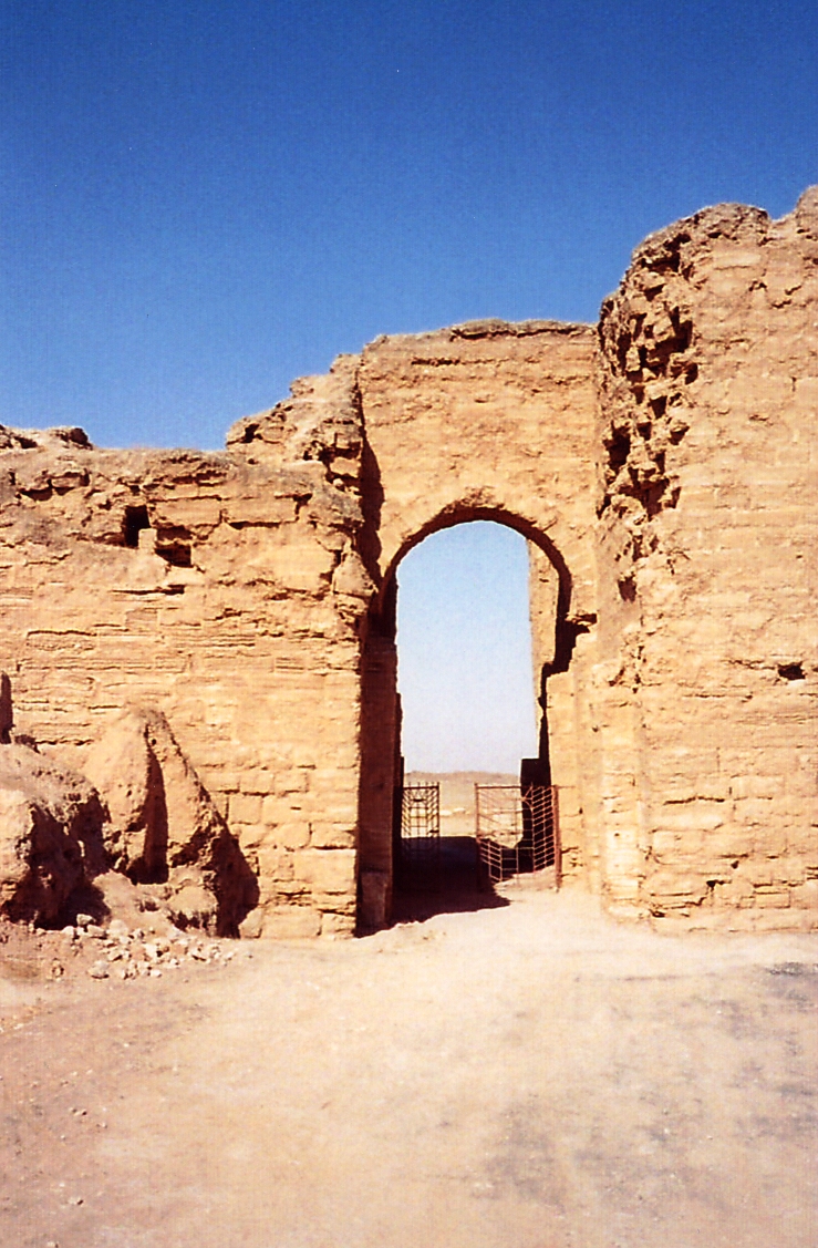
Halabiye site, 40 km north of the city
See also
- Deir ez-Zor Camps
- Armenian Genocide Memorial Church (Der Zor)
References
- ^ a b "Syrian Ministry of Tourism (in Arabic)". http://www.syriatourism.org/index.php?module=subjects&func=viewpage&pageid=2278. Retrieved 2007-05-10.
- ^ Moffett, S. H. (1992): A History of Christianity in Asia: Beginnings to 1500. Harper, San Francisco. ISBN 0060657790
- ^ Shaw, S. J. (1978): Ottoman Census System and Population, 1831–1914. International Journal of Middle East Studies, 9: 325-338.
- ^ Monument and Memorial Complex at Der Zor, Syria
- ^ http://www.jude.edu.sy
- ^ Thawra news (in Arabic)
- ^ Al-Baath news (in Arabic)
External links
- Short history of Deir Ezzor
- Furat Cham Hotel Palace
- Badia Cham Hotel
- watch "Isti'mariyah - windward between Naples and Baghdad"
Deir ez-Zor Governorate Cities 

Towns and villages Cities of Syria Governorate capitals 
District capitals 'Ayn al-'Arab · Abu Kamal · Afrin · Al-Bab · Al-Haffah · Al-Malikiyah · Al-Mukharram · Al-Qamishli · Al-Qusayr · Al-Qutayfah · Al-Nabk · Arihah · Al-Rastan · Al-Safirah · Al-Sanamayn · Al-Suqaylabiyah · Ash-Shaykh Badr · Al-Tall · Al-Thawrah · A'zāz · Baniyas · Darayya · Duma · Duraykish · Fiq · Harem · Afrin · Jableh · Jableh · Jarabulus · Jisr ash-Shugur · Ma'arrat al-Numan · Manbij · Al-Qutayfah · Al-Nabk · Arihah · Al-Rastan · Al-Safirah · Al-Sanamayn · Al-Suqaylabiyah · Masyaf · Mayadin · Mhardeh · Qardaha · Palmyra · Ra's al-'Ayn · Safita · Salamiyah · Salkhad · Shahba · Tal Abyad · Talkalakh · Yabrud · ZabadaniOthers Al-Darbasiyah · Al-Hajar al-Aswad · Binnish · Bosra · Dair Atiah · Harasta · Jaramanah · Kafr Nabl · Khan Shaykhun · Ma'arrat Misrin · Nawa · Salqin · Saraqib · SaidnayaCategories:- Populated places on the Euphrates River
- Armenian diaspora communities
- Armenian Genocide extermination centers
- Fertile Crescent
- Deir ez-Zor
- Populted places in Deir ez-Zor Governorate


Wikimedia Foundation. 2010.