- Nether Alderley
-
Coordinates: 53°17′02″N 2°14′15″W / 53.283795°N 2.237393°W
Nether Alderley 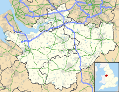
 Nether Alderley
Nether Alderley shown within CheshirePopulation 571 [1] OS grid reference SJ842763 Parish Nether Alderley Unitary authority Cheshire East Ceremonial county Cheshire Region North West Country England Sovereign state United Kingdom Post town MACCLESFIELD Postcode district SK10 Dialling code 01625 Police Cheshire Fire Cheshire Ambulance North West EU Parliament North West England UK Parliament Tatton List of places: UK • England • Cheshire Nether Alderley is a village and civil parish in the unitary authority of Cheshire East and the ceremonial county of Cheshire, England. It lies on the A34 road about a mile and a half south of Alderley Edge.
The parish includes the crossroads of Monk's Heath, where the A34 crosses the A537, and the AstraZeneca research laboratories at Alderley Park.[2] These 20,000m² of multi-disciplinary laboratories house 260 cancer research scientists.[3] According to the 2001 census, the population of the parish was 571.[1]
Contents
Notable residents
- David Beckham with his wife the ex-Spice Girls pop star Victoria used to have a house in Nether Alderley; the Alderley Edge bypass is (as at April 2010) being built very near it.[4]
- Neil Hamilton and his wife Christine used to live next door to St Mary's Church, Nether Alderley.
- Ole Gunnar Solskjær has a house in Nether Alderley.[5]
See also
- St Mary's Church, Nether Alderley
- Nether Alderley Mill
- Alderley Old Hall
References
- ^ a b Official 2001 Census Figures. Retrieval Date: 13 August 2007.
- ^ Astra Zeneca - Alderley Park site
- ^ Astra Zeneca Cancer Research Laboratories
- ^ New road threatens Beckhams' home. Date of page creation:12 July 2002. Retrieval Date: 13 August 2007.
- ^ Ole to demolish mansion. Date of page creation:1 November 2007. Retrieval Date: 1 October 2007.
Images
-

New slip road being built at the Monks Heath crossroads, Cheshire, England, 22 April 2010
-

Widening a country lane which bypasses the Monks Heath crossroads, Cheshire, England
External links
 Media related to Nether Alderley at Wikimedia Commons
Ceremonial county of Cheshire Unitary authorities Major settlements Rivers Topics - History
- Museums
Categories:- Villages in Cheshire
- Civil parishes in Cheshire
- Cheshire geography stubs


Wikimedia Foundation. 2010.