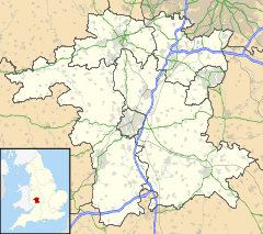
Malvern Hills (district) — Malvern Hills District Non metropolitan district Malvern Hills shown within Worcestershire … Wikipedia
Great Malvern — This article relates to the town centre of Malvern. For in depth treatment see Malvern, Worcestershire. Coordinates: 52°07′N 2°20′W / 52.11°N 2.33°W / … Wikipedia
Malvern Wells — Coordinates: 52°04′43″N 2°19′56″W / 52.078479°N 2.332357°W / 52.078479; 2.332357 … Wikipedia
List of places in Worcestershire — This is a list of cities, towns and villages in the ceremonial county of Worcestershire, England. See the list of places in England for places in other counties.compactTOC NOTOC A*Abberton, Abbots Morton, Alfrick, Alvechurch, Areley Kings, Ashton … Wikipedia
Mamble — Coordinates: 52°20′27″N 2°27′24″W / 52.3407°N 2.4566°W / 52.3407; 2.4566 … Wikipedia
Martley — Coordinates: 52°14′09″N 2°21′37″W / 52.23584°N 2.36018°W / 52.23584; 2.36018 … Wikipedia
Newland, Worcestershire — Coordinates: 52°08′04″N 2°17′59″W / 52.1344°N 2.2997°W / 52.1344; 2.2997 … Wikipedia
Jerry Wiggin — Sir Alfred William Wiggin, known as Jerry Wiggin, (born 24 February 1937) is a British Conservative Party politician. Contents 1 Education 2 Life and career 3 References 4 See also … Wikipedia
Draycott, Worcestershire — Coordinates: 52°07′48″N 2°12′58″W / 52.13011°N 2.21616°W / 52.13011; 2.21616 … Wikipedia
Crowcroft — Coordinates: 52°09′07″N 2°20′46″W / 52.151858°N 2.34616°W / 52.151858; 2.34616 … Wikipedia
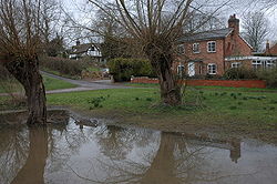
 Clevelode
