- Mount Vernon, Illinois
-
Mount Vernon City  Mount Vernon Downtown
Country United States State Illinois County Jefferson Townships Mount Vernon, Shiloh, Dodds, McClellan Coordinates 38°18′49″N 88°54′29″W / 38.31361°N 88.90806°W Population 15,277 (2010) Density 1,412.1 / sq mi (545 / km2) Timezone CST (UTC-6) - summer (DST) CDT (UTC-5) Postal code 62864 Area code 618 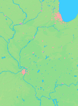

 Location of Mount Vernon within Illinois
Wikimedia Commons: Mount Vernon, Illinois Mount Vernon (Mt. Vernon) is a city located near the center of Jefferson County, Illinois, in the United States. In the 2010 census, the city's reported population was 15,277 people.
Mount Vernon is the principal city of the Mount Vernon Micropolitan Statistical Area, which includes all of Jefferson and Hamilton counties.
Contents
Geography
Mount Vernon is located at 38°18′49″N 88°54′29″W / 38.313512°N 88.908159°W.[1]
According to the United States Census Bureau, the town has a total area of 11.6 square miles (30 km2), of which, 11.5 square miles (30 km2) of it is land and 0.1 square miles (0.26 km2) of it (0.86%) is water.
Mt. Vernon is located on high ground between Casey Creek and the Big Muddy River, which join south of the town in what is now Rend Lake. In pre-settlement times the area around these waterways was a swamp, a heavily forested area that was waist-deep in water during much of the winter and during wet summers. Mt. Vernon was thus often surrounded by water and swamp on three sides.
High ground was located to the north of Mt. Vernon. A ridge ran between the Big Muddy River and Casey Creek north toward what is now Dix.
There are high places west and east of Mt. Vernon from which one can see the town as a forested point of high ground jutting out into the bottoms. These high places are: from the west, near the Woodlawn interchange off Interstate 64 and from the east, on Old Fairfield Road near Summersville School, with the highest point located on Old Route 15 right before it merges with New Route 15, near Bluford.
History
Mt. Vernon was founded in 1817 by Zadok Casey, who was elected to the State Senate in 1822 and was elected Lieutenant Governor in 1833. He served in the U.S. Congress between 1833 and 1843. The town was named for George Washington's plantation, Mount Vernon, which was named for Edward Vernon, a British naval hero.
When the town was founded, there was no road to it. Travellers had to get there by either following the high ground from the north or crossing the swamps from the south. In the early 19th century the Goshen Road crossed Illinois in a northwesterly direction from Old Shawneetown, Illinois to the Goshen Settlement, near what is now Edwardsville. This road was the main road in Illinois.
When Mt. Vernon was first settled, the Goshen Road made a wide arc across Jefferson County, crossing Casey Creek and the Big Muddy north of Mt. Vernon, avoiding the swamps to the south, but bypassing Mt. Vernon. The road entered the county at its southeast corner. It passed through, or near, what are now Opdyke, East Salem, Idlewood, Dix and Walnut Hill.
It was apparent to the early settlers that the town would fail without roads. In 1820 - 1821, Ben Hood and Carter Wilkey built a bridge over Casey Creek, to the southeast of town. This bridge was near the present bridge on Illinois Route 142. A road was built from there northwest, over ground that is now impassable, toward the old cemetery behind the modern Bethel Cemetery. Deep cuts through the old cemetery attest to the location of the road. From there the road probably followed modern Route 37 into town, somewhere shifting from 10th Street on west to 12th Street.
After the State capitol was moved to Vandalia in 1819, it became apparent that a road to Vandalia was needed. A party was sent out to the northwest to mark the road.
In 1823, Thomas D. Minor and William Maxwell built the "Vandalia Road", now called the "Old Centralia Road". It runs northwest out of Mt. Vernon to Walnut Hill. Although legend says that this road is crooked because of the drunken state of the surveyors, the path is probably just the natural path of a pioneer road following the terrain.
After the bridge and the Vandalia Road were built, Mt. Vernon was "on the map". The bridge across Casey Creek and the Vandalia Road provided a much shorter path across Jefferson County than the original Goshen Road. The new Goshen Road soon captured most of the traffic, and Mt. Vernon became an important stop on the road west.
In 1836 Joshua Grant came to Mt. Vernon from Christian County, Kentucky with several of his sons and daughters. His family was an extremely wealthy, southern, slave-owning family, most of which soon moved to Arkansas, probably because slavery was illegal in Illinois. Joshua left behind several daughters and one son, Angus McNeil Grant, who soon became extremely important in the development of the town. "Upon his arrival, there were but four or five houses in the place, and from that time to the present (1883) he has constantly and ably exerted himself in securing to it the full development of its resources."
Angus M. Grant's brother, Joshua Grant, Jr., taught school in Mt. Vernon in 1838. Some sources cite him as the first school teacher in the town.
 City Hall
 5th District Appellate Court
In 1848 the Illinois Supreme Court was relocated to Mt. Vernon. The 5th District Appellate Court was constructed around 1857 and is still in use as the Appellate Court House. When the Supreme Court was in session, the important lawyers in Illinois, including Abraham Lincoln, gathered in Mt. Vernon to argue their cases. The lawyers gathered at the Mt. Vernon Inn, owned by Angus McNeil Grant and his in-laws, the Andersons. This building has been on the National Register of Historic Places since 1973.
In the 1870s Mt. Vernon for a time prohibited the sale of alcohol. A village called "East Mt. Vernon" was organized in 1877 to allow the sale of alcohol. A court fight eventually held that the village was organized illegally. Mt. Vernon then voted alcohol back in, and the area of East Mt. Vernon was annexed into the city.
On February 19, 1888, a tornado cut a path a half mile wide through Mt. Vernon, killing 37 people and destroying more than 450 houses. The Jefferson County Courthouse was destroyed. This event was one of the first disasters to which the American Red Cross responded. Clara Barton herself directed the relief efforts.
The Mt. Vernon Car Manufacturing Company opened in 1889 after moving from Litchfield, Illinois. This relocation may have been an outgrowth of the relief efforts following the tornado. The Louisville and Nashville Railroad hauled in some 1,900 carloads of supplies for reconstruction of the town. Somehow, this effort translated into a major business building railroad cars, at first building about ten cars per day. By 1909, the car shops were producing 25 cars per day, employing more than 1000 workers, with a payroll of $60,000 per month.
During World War II, portions of the "Car Shops," as they were to come to be known, were converted over to wartime production, including the production of bomb casings.
In 1954, the car shops closed, causing a temporary jump in unemployment throughout the city and the 108 communities called "home" by its former employees.
Around 1939, a portion of the car shops was purchased by Precision Engineering, which originally built components for locomotives. During the 1970s, this company purchased old diesel/electric railroad locomotives, which it scrapped out or refurbished. Today, the plant thrives as a hub for National Railway Equipment[2] which rebuilds and services diesel electric locomotives for rail lines across the globe. Ironically, the facility is poised to again become one of the area's largest employers as sales of its innovative hybrid locomotives fuel plant expansion to include another facility across town.
The Interstate Highway System was built in the late 1950s and 1960s. The concurrency of I-57 and I-64 is along the western border of the ridgeline which divides the Big Muddy River and Casey Creek. The stack interchange on the southwest side of town complements the historic Casey Creek bridges, allowing much shorter travel times through the swamps to the east and south.
In April 2007, Mount Vernon voters elected the first female mayor[3] of the city, Mary Jane Chesley. She was sworn into office on May 7, 2007.[4]
Mount Vernon hosts a 48-acre (190,000 m2) facility for Continental Tire of North America - the German company's only manufacturing site in the United States- and is home to major distribution centers for NAPA, National Railway Equipment, ALCO and IPT, these are subsidiaries of NREC, and Walgreens along with many other smaller industries such as Vanex, Central Wholesale Liquors, IL-MO Welding supplies, Pepsi of Mid America, A.L. LEE Corporation, Goodman Air Conditioning, US Supply Co, Mine Supply Company, National Fabrication, IBT, Bearing Headquarters, Mt Vernon Mold Works, Wiese Forklift Service Center, Black Forklift Service Center, Penske, Beelman Trucking, Clinton County Ready-Mix, Calison Wholesale Liquor, Praxair, Ultron Electronics, FedEx, UPS/Overnite, Springfield Electric, Mt Vernon Electric, Roadway Express, Guaranteed Freight, Bennett Metals, Sun Container, Three-States Supply Co, Phoenix Modular Elevator Company and Petter Trucking,which are located in or within close proximity to the city's three industrial parks. In addition two new industries have made Mt Vernon home, Intermountain Electronics, which soon will be located in the Rolland Lewis Industrial Centre on the west side of the city and Veyance Tech/National Belt, which makes 5-6 mile long conveyor belts for coal mines. There is currently discussion of creating a fourth industrial park which is to be used for distribution center's in the area of the new interchange, this park would encompass 100 acres (0.40 km2) and would be eligible for Tax Increment Financing and Enterprise Zone benefits.
The town is a regional hub for recreation, retail, employment, and health care, and is in the process of having a new I-57/64 interchange constructed 0.9 miles (1.4 km) south of the current State Route 15 interchange and will be known as Exit 94 or Veterans Memorial Drive. As of November 25, 2009, Exit 94 is now officially opened for traffic. A portion of Davidson Ave that was unfinished was finally completed in September 2010 allowing another through access road to the Rolland Lewis Industrial Centre and Walgreens distribution center. Recent development includes a Kohl's Department Store which is projected to open early 2011 and Buffalo Wild Wings which opened December 19, 2010. Two new TIF or Tax Increment Finance districts have been created, one TIF is at Exit 95 and is a conservation/industrial use. While Exit 94 is an Industrial Park Conservation TIF. Pepsi has just committed to building a new service and distribution center that will be completed in March 2011, it is to be located off of the new Davidson Ave extension.
Demographics
As of the 2010 census [5], there were 15,277 people, 6,702 households and 4,157 families residing in the city. The population density was 1,412.1 people per square mile (545.3/km²). There were 7,534 housing units at an average density of 678.2 per square mile (261.9/km²). The racial makeup of the city was 80.6% White, 14.7% African American, 0.3% Native American, 1.0% Asian, 0.00% Pacific Islander, 0.7% from other races and 1.97% from two or more races. Hispanic or Latino of any race were 2.6% of the population.
There were 6,702 households out of which 27.4% had children under the age of 18 living with them, 42.1% were married couples living together, 13.9% had a female householder with no husband present and 40.5% were non-families. 35.9% of all households were made up of individuals and 16.7% had someone living alone who was 65 years of age or older. The average household size was 2.25 and the average family size was 2.92.
In the city the population was spread out with 24.7% under the age of 18, 9.1% from 18 to 24, 24.9% from 25 to 44, 21.9% from 45 to 64 and 19.3% who were 65 years of age or older. The median age was 38 years. For every 100 females there were 84.7 males. For every 100 females age 18 and over, there were 80.4 males.
The median income for a household in the city was $28,145 and the median income for a family was $36,660. Males had a median income of $31,569 versus $20,198 for females. The per capita income for the city was $16,268. About 13.0% of families and 17.1% of the population were below the poverty line, including 20.5% of those under age 18 and 12.9% of that age 65 or over.
Local Sports
Boys' Basketball has been in Mount Vernon since 1905 and they have an overall record of 1,733 wins and 849 losses. The Rams are third in the state in total victories and they are tied for second most Illinois State Championships with four . After the recent retirement of Coach Creel, the Boys Varsity team is now led by Coach Scott Gamber. The Junior Varsity Coach is Tom Portner.
The Mount Vernon Rams Varsity American football team has an overall record of 412 wins, 317 losses and 24 ties. The Rams might not look overly impressive with their record but they have rapidly improved over the past six years. The 2002 team put Coach Mings and the Rams on the map, with their first playoff appearance in 14 years. In 2005, the Rams completed a perfect regular season but lost in the playoffs and finished with a record of 11-1. Since Coach Dan Mings has taken the helm in 2001, the Rams have had six playoff appearances (2002, 2003, 2005–2008), two South 7 Championships (2005, 2007) and one undefeated regular season (2005). After Coach Mings' retirement, he was replaced by coach Jared Shayner, who hopes to return to the winning tradition of the Mt. Vernon Football Program. All statistics and records can be found at mtvrams.com.[6]
The Varsity Wrestling team has an overall record of 368 wins, 202 losses and 3 ties. They have struggled over the past eight years but with Coach Scott Tickner back as Varsity Coach, the Rams are in for a bright future once again.
The Rams Varsity Baseball team has an overall record of 361 wins, 292 losses and 3 ties. With new Coach Tim Holloway, the Rams will look to move back into their winnings ways. The Junior Varsity is coached by Nathan Boldt.
The Lady Rams Varsity Basketball team has an impressive overall record of 598 wins and 293 losses. Sara Rennie has coached the Lady Rams for 32 years with only five losing seasons. They have been one of the most consistent teams in Mount Vernon sports history. The Junior Varsity team is coached by Jeff Lonnon.
The Girls' Volleyball team has an overall record of 159 wins, 104 losses and 1 tie.
Records and Stats can be viewed at the Illinois High School Association website.[7] Video & pictures of Mount Vernon sports can be viewed at the Mt. Vernon Register-News.[8] WMIX[9] broadcasts most Rams and Lady Rams sports and stream the games online.
Mount Vernon's Outland Airport is home to the Adult Flag Football League (AFFL). The AFFL was created by former NFL player Vernon Turner and is considered by many as the premiere flag football league in the region. The season begins every year in March and continues until July where there is a playoff. After the Championship Game (Flag Bowl) there is an All-Star game. All Statistics are recorded and shown online at the AFFL official website.[10]
References
- ^ "US Gazetteer files: 2010, 2000, and 1990". United States Census Bureau. 2011-02-12. http://www.census.gov/geo/www/gazetteer/gazette.html. Retrieved 2011-04-23.
- ^ Nationalrailway.com
- ^ Register-news.com
- ^ Register-news.com
- ^ "American FactFinder". United States Census Bureau. http://factfinder.census.gov. Retrieved 2008-01-31.
- ^ MTVrams.com
- ^ IHSA.org
- ^ Register-news.com
- ^ Mywithersradio.com
- ^ Adultflagfootballleague.com
- History of Jefferson County, Illinois, William Henry Perrin, 1883
- Mt. Vernon Illinois A Pictorial History, Thomas A. Puckett, 1991, Bradley Publishing company
External links
- History of Jefferson County
- Official Site of the City of Mount Vernon
- Mt. Vernon Car Shops History
- Register-news.com
- WDML 106.9FM Radio Website
- WMIX Radio Website
- Mount Vernon Township High School
Municipalities and communities of Jefferson County, Illinois County seat: Mount VernonCities 
Villages Belle Rive | Bluford | Bonnie | Dix | Ina | Waltonville | Woodlawn
Townships Bald Hill | Blissville | Casner | Dodds | Elk Prairie | Farrington | Field | Grand Prairie | McClellan | Moore's Prairie | Mt. Vernon | Pendleton | Rome | Shiloh | Spring Garden | Webber
Unincorporated
communitiesFootnotes ‡This populated place also has portions in an adjacent county or counties
 State of Illinois
Topics - Index
- Buildings and structures
- Communications
- Culture
- Delegations
- Economy
- Education
- Environment
- Geography
- Government
- Health
- History
- Music
- People
- Portal
- Society
- Sports
- Tourism
- Transportation
- Windmills
Regions - American Bottom
- Central Illinois
- Champaign–Urbana metropolitan area
- Chicago metropolitan area
- Driftless Area
- Forgottonia
- Fox Valley
- Illinois–Indiana–Kentucky Tri-State Area
- Metro East
- Mississippi Alluvial Plain
- North Shore
- Northern Illinois
- Northwestern Illinois
- Peoria metropolitan area
- Quad Cities
- River Bend
- Rockford metropolitan area
- Southern Illinois
- Streatorland
- Wabash Valley
Major cities,
towns and villages- Alton/Granite City/Edwardsville
- Arlington Heights/Palatine
- Aurora/Naperville/Oswego/Plainfield
- Bartlett/Hanover Park/Streamwood
- Belleville/East St. Louis/Collinsville/O'Fallon
- Berwyn/Cicero
- Bloomington/Normal
- Bolingbrook/Romeoville
- Buffalo Grove/Wheeling
- Calumet City
- Canton
- Carbondale
- Carol Stream/Glendale Heights
- Centralia
- Champaign/Urbana
- Charleston/Mattoon
- Chicago
- Chicago Heights
- Crystal Lake/Algonquin
- Danville
- Decatur
- DeKalb/Sycamore
- Des Plaines/Mount Prospect/Park Ridge
- Dixon
- Downers Grove/Woodridge
- Effingham
- Elgin/Carpentersville
- Elmhurst/Lombard/Addison
- Evanston/Skokie
- Freeport
- Galesburg
- Glenview/Northbrook
- Harrisburg
- Jacksonville
- Joliet
- Kankakee/Bradley/Bourbonnais
- Lincoln
- Macomb
- Marion/Herrin
- Moline/East Moline/Rock Island
- Mount Vernon
- Mundelein
- Oak Lawn
- Oak Park
- Orland Park/Tinley Park
- Ottawa/Streator/LaSalle/Peru
- Peoria/Pekin/East Peoria/Morton
- Pontiac
- Quincy
- Rochelle
- Rockford/Belvidere/Machesney Park/Loves Park
- St. Charles
- Schaumburg/Hoffman Estates/Elk Grove Village
- Springfield
- Sterling/Rock Falls
- Taylorville
- Waukegan/North Chicago/Gurnee
- Wheaton
Counties - Adams
- Alexander
- Bond
- Boone
- Brown
- Bureau
- Calhoun
- Carroll
- Cass
- Champaign
- Christian
- Clark
- Clay
- Clinton
- Coles
- Cook
- Crawford
- Cumberland
- DeKalb
- DeWitt
- Douglas
- DuPage
- Edgar
- Edwards
- Effingham
- Fayette
- Ford
- Franklin
- Fulton
- Gallatin
- Greene
- Grundy
- Hamilton
- Hancock
- Hardin
- Henderson
- Henry
- Iroquois
- Jackson
- Jasper
- Jefferson
- Jersey
- Jo Daviess
- Johnson
- Kane
- Kankakee
- Kendall
- Knox
- LaSalle
- Lake
- Lawrence
- Lee
- Livingston
- Logan
- Macon
- Macoupin
- Madison
- Marion
- Marshall
- Mason
- Massac
- McDonough
- McHenry
- McLean
- Menard
- Mercer
- Monroe
- Montgomery
- Morgan
- Moultrie
- Ogle
- Peoria
- Perry
- Piatt
- Pike
- Pope
- Pulaski
- Putnam
- Randolph
- Richland
- Rock Island
- Saline
- Sangamon
- Schuyler
- Scott
- Shelby
- St. Clair
- Stark
- Stephenson
- Tazewell
- Union
- Vermilion
- Wabash
- Warren
- Washington
- Wayne
- White
- Whiteside
- Will
- Williamson
- Winnebago
- Woodford
Categories:- Cities in Illinois
- Populated places in Jefferson County, Illinois
- Mount Vernon, Illinois micropolitan area
- County seats in Illinois
- Populated places established in 1817


Wikimedia Foundation. 2010.