- Old Shawneetown, Illinois
-
Old Shawneetown Village  Old Shawneetown Court House in 1937
Country United States State Illinois County Gallatin Coordinates 37°41′54″N 88°8′13″W / 37.69833°N 88.13694°W Area 0.5 sq mi (1 km2) - land 0.5 sq mi (1 km2) Population 193 (2000) Density 531.7 / sq mi (205 / km2) Timezone CST (UTC-6) - summer (DST) CDT (UTC-5) Postal code 62984 Area code 618 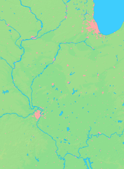

 Location of Old Shawneetown within Illinois
Wikimedia Commons: Old Shawneetown, Illinois Old Shawneetown is a village in Gallatin County, Illinois, United States. As of the 2000 census, the village had a total population of 193. Located along the Ohio River, Shawneetown served as an important United States government administrative center for the Northwest Territory. The village was devastated by the Ohio River flood of 1937. The village's population was moved several miles inland to New Shawneetown.
 1937 flood Shawneetown Illinois refugees
Contents
History
After the Revolution, Shawneetown served as an important United States government administrative center for the Northwest Territory. Shawneetown and Washington, D.C., share the distinction of being the only towns chartered by the United States government. In early November 1803, Lewis and Clark are believed to have stopped at Old Shawneetown on their way to Fort Massac, just down the Ohio River.
Old Shawneetown is the site of the first bank chartered in Illinois in 1812. Originally in a log cabin it was replaced in 1822 with a brick structure (only the second one in the town) now known as the John Marshall House.[1]
Local legend states that the Shawneetown Bank refused to buy the first bonds issued by the city of Chicago on the grounds that no city located that far from a navigable river could survive.
Another historic bank building, the Bank of Illinois, was constructed in 1839-41 to house the offices of the Bank of Illinois at Shawneetown. It later housed numerous other financial institutions before it was closed in the 1930s. This fine example of Greek Revival architecture survives as the Shawneetown Bank State Historic Site.
Residents long remembered the visit by Gilbert du Motier, marquis de La Fayette of France to the city on May 8, 1825, as a highpoint for the early community's social history.[2]
Home of the largest Monster Truck Boat in US History.
Famous residents
- Robert G. Ingersoll, a famous 19th century orator and agnostic, lived in Shawneetown from 1855 to 1857, where he served as deputy clerk in the county and circuit clerk's office and practiced law.
- Civil War general John Alexander McClernand grew up in Shawneetown. He started a newspaper, the Shawneetown Democrat, in 1835. He served in the Illinois General Assembly between 1836 and 1843 before moving to Jacksonville where he was later elected to the United States Congress, serving four terms between 1843 and 1850. He moved to Jacksonville, Illinois the following year.
- Former Revolutionary War officer Thomas Posey died visiting his daughter who lived just outside Shawneetown in 1818 and is buried in the historic Westwood Cemetery that grew up around his grave.
- James Harrison Wilson (1837–1925), a third-generation Shawneetown resident, served as one of the youngest Union generals during the American Civil War.
Geography
Old Shawneetown is located at 37°41′54″N 88°8′13″W / 37.69833°N 88.13694°W (37.698197, -88.136857).[3]
According to the United States Census Bureau, the village has a total area of 0.5 square miles (1.3 km2), all land.
Demographics
As of the census[4] of 2000, there were 278 people, 100 households, and 69 families residing in the village. The population density was 531.7 people per square mile (206.4/km²). There were 146 housing units at an average density of 279.2/sq mi (108.4/km²). The racial makeup of the village was 99.64% White and 0.36% Native American. Hispanic or Latino of any race were 1.08% of the population.
There were 100 households out of which 36.0% had children under the age of 18 living with them, 44.0% were married couples living together, 20.0% had a female householder with no husband present, and 31.0% were non-families. 24.0% of all households were made up of individuals and 7.0% had someone living alone who was 65 years of age or older. The average household size was 2.78 and the average family size was 3.36.
In the village the population was spread out with 33.8% under the age of 18, 8.3% from 18 to 24, 27.0% from 25 to 44, 22.7% from 45 to 64, and 8.3% who were 65 years of age or older. The median age was 32 years. For every 100 females there were 98.6 males. For every 100 females age 18 and over, there were 93.7 males.
The median income for a household in the village was $18,214, and the median income for a family was $20,625. Males had a median income of $25,625 versus $13,750 for females. The per capita income for the village was $9,379. About 33.3% of families and 39.4% of the population were below the poverty line, including 60.6% of those under the age of eighteen and 33.3% of those sixty five or over.
See also
External links
Old Shawneetown photos http://www.lth6.k12.il.us/schools/gallatin/old_shawneetown.htm
Further reading
- 1887. History of Gallatin, Saline, Hamilton, Franklin and Williamson Counties, Illinois. Chicago: Goodspeed Publishing Co.
- Musgrave, Jon, ed. 2002. Handbook of Old Gallatin County and Southeastern Illinois. Marion, Ill.: IllinoisHistory.com. 464 pages.
- Musgrave, Jon. 2004, Rev. ed. 2005. Slaves, Salt, Sex & Mr. Crenshaw: The Real Story of the Old Slave House and America's Reverse Underground R.R.. Marion, Ill.: IllinoisHistory.com. 608 pages.
- Waggoner, Horace Q., interviewer. 1978. "Lucille Lawler Memoir" Shawneetown Bank Project. Sangamon State University. Springfield, Ill.
Municipalities and communities of Gallatin County, Illinois City 
Villages Townships Asbury | Bowlesville | Eagle Creek | Equality | Gold Hill | New Haven | North Fork | Omaha | Ridgway | Shawnee
Unincorporated
communitiesCottonwood | Elba | Gibsonia | Inman | Kedron | Lawler | Leamington
Notes
- ^ Christiana Holmes Tillson; Milo Milton Quaife, ed. 1919, Reprint 1995. A Woman’s Story of Pioneer Illinois. Carbondale, Ill.: Southern Illinois University Press. 49-65.
- ^ 1887. History of Gallatin, Saline, Hamilton, Franklin and Williamson Counties, Illinois. Chicago: Goodspeed Publishing Company. 96-97.
- ^ "US Gazetteer files: 2010, 2000, and 1990". United States Census Bureau. 2011-02-12. http://www.census.gov/geo/www/gazetteer/gazette.html. Retrieved 2011-04-23.
- ^ "American FactFinder". United States Census Bureau. http://factfinder.census.gov. Retrieved 2008-01-31.
Categories:- Populated places in Gallatin County, Illinois
- Villages in Illinois


Wikimedia Foundation. 2010.