- Clay City, Illinois
-
Clay City Village Country United States State Illinois County Clay Coordinates 38°41′13″N 88°21′11″W / 38.68694°N 88.35306°W Area 1.8 sq mi (5 km2) - land 1.8 sq mi (5 km2) Population 1,000 (2000) Density 561.0 / sq mi (217 / km2) Timezone CST (UTC-6) - summer (DST) CDT (UTC-5) Postal code 62824 Area code 618 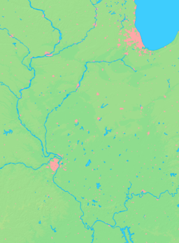

 Location of Clay City within Illinois
Wikimedia Commons: Clay City, Illinois Clay City is a village in Clay County, Illinois, United States. The population was 1,000 at the 2000 census.
Contents
Geography
Clay City is located at 38°41′13″N 88°21′11″W / 38.68694°N 88.35306°W (38.686883, -88.353121).[1]
According to the United States Census Bureau, the village has a total area of 1.8 square miles (4.7 km2), all of it land.
Demographics
As of the census[2] of 2000, there were 1,000 people, 436 households, and 262 families residing in the village. The population density was 561.0 people per square mile (216.9/km²). There were 486 housing units at an average density of 272.7 per square mile (105.4/km²). The racial makeup of the village was 99.40% White, 0.20% Native American, 0.10% Asian, and 0.30% from two or more races. Hispanic or Latino of any race were 0.40% of the population.
There were 436 households out of which 31.2% had children under the age of 18 living with them, 46.1% were married couples living together, 10.6% had a female householder with no husband present, and 39.9% were non-families. 35.6% of all households were made up of individuals and 18.1% had someone living alone who was 65 years of age or older. The average household size was 2.29 and the average family size was 2.98.
In the village the population was spread out with 26.2% under the age of 18, 6.8% from 18 to 24, 26.9% from 25 to 44, 21.0% from 45 to 64, and 19.1% who were 65 years of age or older. The median age was 38 years. For every 100 females there were 90.1 males. For every 100 females age 18 and over, there were 85.0 males.
The median income for a household in the village was $25,750, and the median income for a family was $33,750. Males had a median income of $25,417 versus $18,750 for females. The per capita income for the village was $13,776. About 12.3% of families and 16.4% of the population were below the poverty line, including 24.1% of those under age 18 and 6.2% of those age 65 or over.
History
Established in 1855
In 1810 John McCawley and Seth Evans were traveling west from Fort Vincennes along the old Buffalo Trace when one of their horses died. McCawley sent his companion back for another horse. McCawley stayed behind in a cabin built on the west bank of the Little Wabash River just south and east of Clay City. This made McCawley the first white man to settle in this area. McCawley later decided to build a stage coach stop and trading center on the location which was known as McCawley’s Tavern. It provided a place for travelers to stop, eat, and spend the night.
Clay County was created by an act of the legislature on December 23, 1824. On Tuesday, the 8th day of March, 1825, at John McCawley’s place, the first county commissioners’ court assembled for the new county of Clay. In 1825 Daniel May donated 20 acres (81,000 m2) of land, just over 2 miles (3.2 km) west of McCawley’s Tavern, to the county for the purpose of constructing a court house. This land is 1 block south of US 50 and to the west of what is now South Main Street. This area had previously been known as Hubbardsville but was renamed Maysville. A 2 room court house was constructed in 1825 and court was held at Maysville until 1841 when it was moved to the new and present county seat, Louisville.
In 1855, after the O&M Railroad was located about 1-mile (1.6 km) north of Maysville, Clay City was established by Mr. J.D. Perkey on the north side of the tracks and mostly to the east of the present North Main Street. The business district soon developed to the south of the tracks where it is presently located. Maysville was made a part of the Village of Clay City in 1862.
Clay City served as a trading center for the surrounding countryside. Farmers could bring their produce to town and trade it for dry goods, etc. and very little money would change hands. With the passenger trains stopping in Clay City it also served as a source of transportation for the surrounding area. Many of the tourists who traveled to the once famous resort of Sailor Springs would take the train to Clay City and then use local transportation on up to Sailor Springs. That is why the Sailor Springs link is on this web page.
In 1936 oil was discovered in this area and oil related businesses continue to thrive in Clay City today.[3]
References
- ^ "US Gazetteer files: 2010, 2000, and 1990". United States Census Bureau. 2011-02-12. http://www.census.gov/geo/www/gazetteer/gazette.html. Retrieved 2011-04-23.
- ^ "American FactFinder". United States Census Bureau. http://factfinder.census.gov. Retrieved 2008-01-31.
- ^ Larry Brant - Village of Clay City
External links
Municipalities and communities of Clay County, Illinois City 
Villages Clay City | Iola | Louisville | Sailor Springs | Xenia
Townships Bible Grove | Blair | Clay City | Harter | Hoosier | Larkinsburg | Louisville | Oskaloosa | Pixley | Songer | Stanford | Xenia
Unincorporated
communitiesGhost town Bethel
Footnotes ‡This populated place also has portions in an adjacent county or counties
Categories:- Villages in Illinois
- Populated places in Clay County, Illinois


Wikimedia Foundation. 2010.