- Arimo, Idaho
Infobox Settlement
official_name = Arimo, Idaho
other_name =
native_name =
nickname =
settlement_type =City
motto =
imagesize =
image_caption =
flag_size =
image_
seal_size =
image_shield =
shield_size =
image_blank_emblem =
blank_emblem_type =
blank_emblem_size =
imagesize =
image_caption =
flag_size =
image_
seal_size =
image_shield =
shield_size =
image_blank_emblem =
blank_emblem_type =
blank_emblem_size =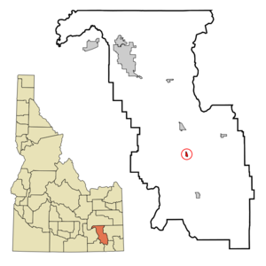
mapsize =
map_caption = Location in Bannock County and the state ofIdaho
mapsize1 =
map_caption1 =
image_dot_
dot_mapsize =
dot_map_caption =
dot_x =
dot_y =
pushpin_
pushpin_label_position =
pushpin_map_caption =
pushpin_mapsize =
subdivision_type = Country
subdivision_name =United States
subdivision_type1 = State
subdivision_name1 =Idaho
subdivision_type2 = County
subdivision_name2 = Bannock
subdivision_type3 =
subdivision_name3 =
subdivision_type4 =
subdivision_name4 =
government_footnotes =
government_type =
leader_title =
leader_name =
leader_title1 =
leader_name1 =
leader_title2 =
leader_name2 =
leader_title3 =
leader_name3 =
leader_title4 =
leader_name4 =
established_title =
established_date =
established_title2 =
established_date2 =
established_title3 =
established_date3 =
area_magnitude =
unit_pref = Imperial
area_footnotes =
area_total_km2 = 1.1
area_land_km2 = 1.1
area_water_km2 = 0.0
area_total_sq_mi = 0.4
area_land_sq_mi = 0.4
area_water_sq_mi = 0.0
area_water_percent =
area_urban_km2 =
area_urban_sq_mi =
area_metro_km2 =
area_metro_sq_mi =
area_blank1_title =
area_blank1_km2 =
area_blank1_sq_mi =
population_as_of = 2000
population_footnotes =
population_note =
population_total = 348
population_density_km2 = 329.8
population_density_sq_mi = 854.1
population_metro =
population_density_metro_km2 =
population_density_metro_sq_mi =
population_urban =
population_density_urban_km2 =
population_density_urban_sq_mi =
population_blank1_title =
population_blank1 =
population_density_blank1_km2 =
population_density_blank1_sq_mi =
timezone = Mountain (MST)
utc_offset = -7
timezone_DST = MDT
utc_offset_DST = -6
latd = 42
latm = 33
lats = 34
latNS = N
longd = 112
longm = 10
longs = 17
longEW = W
elevation_footnotes =
elevation_m = 1446
elevation_ft = 4744
postal_code_type =ZIP code
postal_code = 83214
area_code = 208
blank_name = FIPS code
blank_info = 16-03340
blank1_name = GNIS feature ID
blank1_info = 0397389
website =
footnotes = Arimo is a city in Bannock County,Idaho ,United States . It is part of the 'Pocatello, Idaho Metropolitan Statistical Area'. The population was 348 at the 2000 census.Geography
Arimo is located at coor dms|42|33|34|N|112|10|17|W|city (42.559460, -112.171399)GR|1.
According to the
United States Census Bureau , the city has a total area of 0.4square mile s (1.1km² ), all of it land.Demographics
As of the
census GR|2 of 2000, there were 348 people, 108 households, and 78 families residing in the city. Thepopulation density was 854.1 people per square mile (327.7/km²). There were 118 housing units at an average density of 289.6/sq mi (111.1/km²). The racial makeup of the city was 96.55% White, 0.57% Asian, 0.29% from other races, and 2.59% from two or more races. Hispanic or Latino of any race were 1.44% of the population.There were 108 households out of which 46.3% had children under the age of 18 living with them, 65.7% were married couples living together, 5.6% had a female householder with no husband present, and 26.9% were non-families. 25.0% of all households were made up of individuals and 17.6% had someone living alone who was 65 years of age or older. The average household size was 3.22 and the average family size was 4.00.
In the city the population was spread out with 39.4% under the age of 18, 8.3% from 18 to 24, 21.8% from 25 to 44, 17.0% from 45 to 64, and 13.5% who were 65 years of age or older. The median age was 28 years. For every 100 females there were 93.3 males. For every 100 females age 18 and over, there were 102.9 males.
The median income for a household in the city was $33,500, and the median income for a family was $41,944. Males had a median income of $31,406 versus $19,688 for females. The
per capita income for the city was $10,312. About 7.9% of families and 12.6% of the population were below thepoverty line , including 16.0% of those under age 18 and 6.3% of those age 65 or over.References
External links
Wikimedia Foundation. 2010.