- Pukalani, Hawaii
Infobox Settlement
official_name = Pukalani, Hawaii
other_name =
native_name =
nickname =
settlement_type = CDP
motto =
imagesize =
image_caption =
flag_size =
image_
seal_size =
image_shield =
shield_size =
image_blank_emblem =
blank_emblem_type =
blank_emblem_size =
imagesize =
image_caption =
flag_size =
image_
seal_size =
image_shield =
shield_size =
image_blank_emblem =
blank_emblem_type =
blank_emblem_size =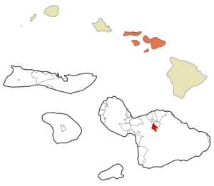
mapsize =
map_caption = Location in Maui County and the state ofHawaii
mapsize1 =
map_caption1 =
image_dot_
dot_mapsize =
dot_map_caption =
dot_x =
dot_y =
pushpin_
pushpin_label_position =
pushpin_map_caption =
pushpin_mapsize =
subdivision_type = Country
subdivision_name =United States
subdivision_type1 = State
subdivision_name1 =Hawaii
subdivision_type2 = County
subdivision_name2 = Maui
subdivision_type3 =
subdivision_name3 =
subdivision_type4 =
subdivision_name4 =
government_footnotes =
government_type =
leader_title =
leader_name =
leader_title1 =
leader_name1 =
leader_title2 =
leader_name2 =
leader_title3 =
leader_name3 =
leader_title4 =
leader_name4 =
established_title =
established_date =
established_title2 =
established_date2 =
established_title3 =
established_date3 =
area_magnitude =
unit_pref = Imperial
area_footnotes =
area_total_km2 = 11.4
area_land_km2 = 11.4
area_water_km2 = 0.0
area_total_sq_mi = 4.4
area_land_sq_mi = 4.4
area_water_sq_mi = 0.0
area_water_percent =
area_urban_km2 =
area_urban_sq_mi =
area_metro_km2 =
area_metro_sq_mi =
area_blank1_title =
area_blank1_km2 =
area_blank1_sq_mi =
population_as_of = 2000
population_footnotes =
population_note =
population_total = 7380
population_density_km2 = 645.2
population_density_sq_mi = 1671.1
population_metro =
population_density_metro_km2 =
population_density_metro_sq_mi =
population_urban =
population_density_urban_km2 =
population_density_urban_sq_mi =
population_blank1_title =
population_blank1 =
population_density_blank1_km2 =
population_density_blank1_sq_mi =
timezone = Hawaii-Aleutian
utc_offset = -10
timezone_DST =
utc_offset_DST =
latd = 20
latm = 50
lats = 24
latNS = N
longd = 156
longm = 20
longs = 38
longEW = W
elevation_footnotes =
elevation_m = 465
elevation_ft = 1526
postal_code_type =ZIP code
postal_code = 96788
area_code = 808
blank_name = FIPS code
blank_info = 15-65900
blank1_name = GNIS feature ID
blank1_info = 0363512
website =
footnotes = Pukalani is acensus-designated place (CDP) in Maui County, Hawaiokinai,United States . The population was 7,380 at the 2000 census. Pukalani is Hawaiian for Heavenly Gates. The general volcano-slope region, including nearby Makawao and Kula, is referred to as upcountry by locals, and is one of the three major population centers on Maui, the other two being Kahului and Kīhei both of which are at sea level.Geography
Pukalani is located at coor dms|20|50|24|N|156|20|38|W|city (20.840039, -156.343808)GR|1.
According to the
United States Census Bureau , the CDP has a total area of 4.4square mile s (11.4km² ), all of it land.Demographics
As of the
census GR|2 of 2000, there were 7,380 people, 2,439 households, and 1,904 families residing in the CDP. Thepopulation density was 1,671.1 people per square mile (644.7/km²). There were 2,522 housing units at an average density of 571.1/sq mi (220.3/km²). The racial makeup of the CDP was 33.97% White, 0.41% African American, 0.23% Native American, 28.04% Asian, 7.38% Pacific Islander, 1.00% from other races, and 28.97% from two or more races. Hispanic or Latino of any race were 9.23% of the population.There were 2,439 households out of which 40.6% had children under the age of 18 living with them, 59.4% were married couples living together, 12.8% had a female householder with no husband present, and 21.9% were non-families. 14.5% of all households were made up of individuals and 3.9% had someone living alone who was 65 years of age or older. The average household size was 3.03 and the average family size was 3.31.
In the CDP the population was spread out with 28.0% under the age of 18, 6.9% from 18 to 24, 29.7% from 25 to 44, 25.5% from 45 to 64, and 9.9% who were 65 years of age or older. The median age was 37 years. For every 100 females there were 98.1 males. For every 100 females age 18 and over, there were 96.0 males.
The median income for a household in the CDP was $62,778, and the median income for a family was $65,087. Males had a median income of $39,128 versus $29,107 for females. The
per capita income for the CDP was $23,662. About 4.7% of families and 6.4% of the population were below thepoverty line , including 8.4% of those under age 18 and 6.0% of those age 65 or over.Education
Pukalani has a relatively new high school,
King Kekaulike High School . It opened its doors in 1995 to its first freshman class.References
External links
Wikimedia Foundation. 2010.