- New Castle, Delaware
-
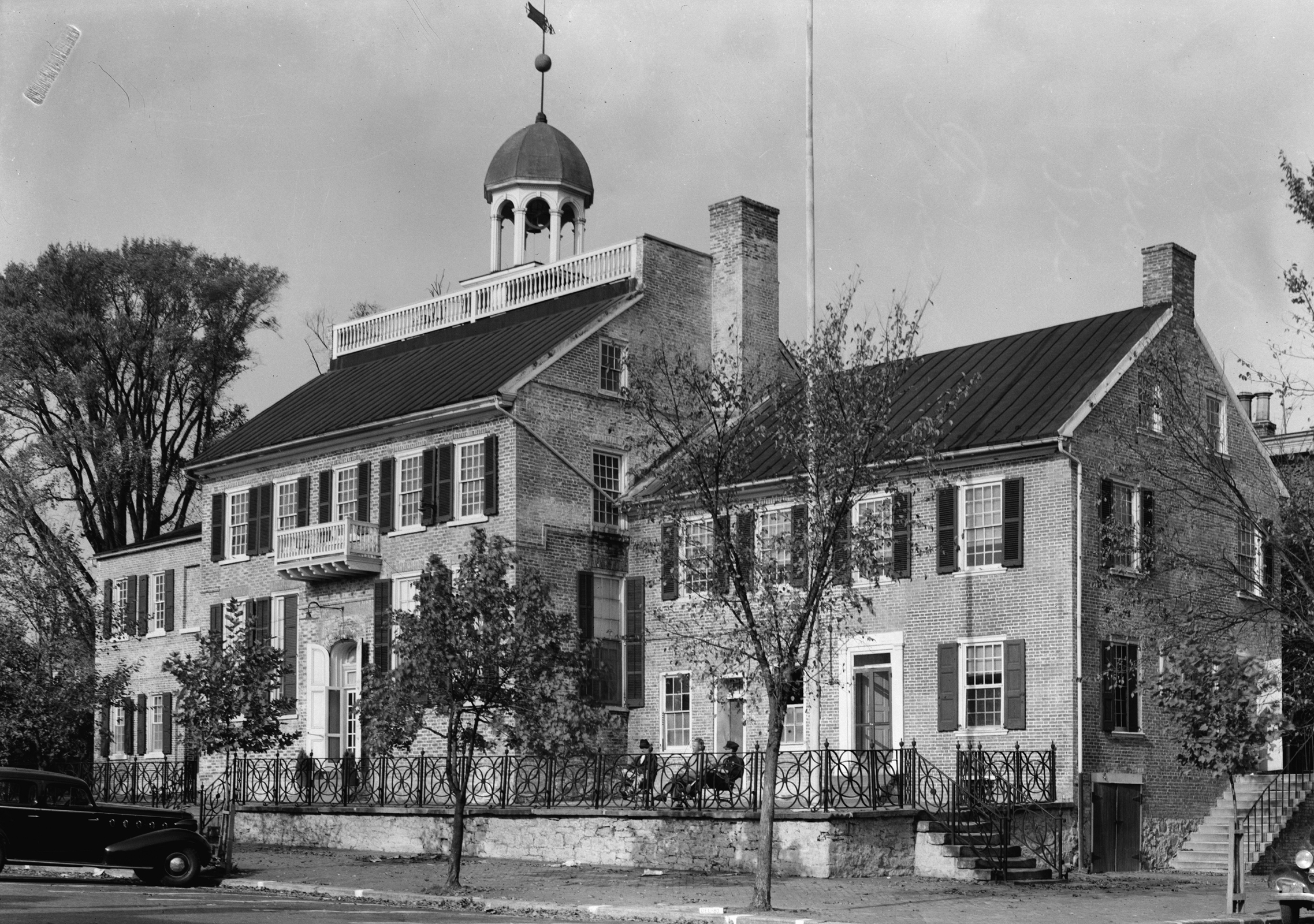
City of New Castle City  Old New Castle Courthouse. (1936)
Country United States State Delaware County New Castle Elevation 10 ft (3 m) Coordinates 39°39′53″N 75°33′55″W / 39.66472°N 75.56528°W Area 3.2 sq mi (8.3 km2) - land 3.1 sq mi (8 km2) - water 0.1 sq mi (0 km2), 3.13% Population 5,285 (2010) Density 1,594.6 / sq mi (616 / km2) Founded 1640 Timezone EST (UTC-5) - summer (DST) EDT (UTC-4) ZIP Codes 19720-19721 Area code 302 
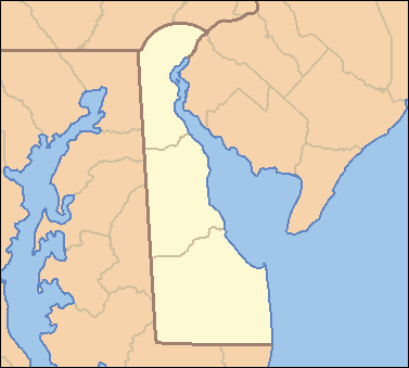
 Location of New Castle in Delaware
 Location of Delaware in the United States
Website: www.newcastlecity.net New Castle is a city in New Castle County, Delaware, six miles (10 km) south of Wilmington, situated on the Delaware River. In 1900, 3,380 people lived here; in 1910, 3,351. According to the 2010 Census, the population of the city is 5,285.[1]
Contents
History
New Castle was originally settled by the Dutch West India Company in 1651, under the leadership of Peter Stuyvesant, on the site of a former aboriginal village, "Tomakonck" ("Place of the Beaver"), to assert their claim to the area based on a prior agreement with the aboriginal inhabitants of the area. The Dutch originally named the settlement Fort Casimir, but this was changed to Fort Trinity (Swedish: Trefaldighet) following its seizure by the colony of New Sweden on Trinity Sunday, 1654. The Dutch conquered the entire colony of New Sweden the following year and rechristened the fort Nieuw Amstel ("New Amstel"). This marked the end of the Swedish colony in Delaware as an official entity, but it remained a semi-autonomous unit within the New Netherland colony and the cultural, social, and religious influence of the Swedish settlers remained strong. As the settlement grew, Dutch authorities laid out a grid of streets and established the town common (The "Green"), which continue to this day.
In 1664, the English seized the entire New Netherland colony in the Second Anglo-Dutch War and changed the name of the town to "New Castle." The Dutch regained the town in 1673 during the Third Anglo-Dutch War but it was returned to Great Britain the next year under the Treaty of Westminster. In 1680, New Castle was conveyed to William Penn by the Duke of York and was Penn's landing place when he first set foot on American soil on October 27, 1682. This transfer to Penn was contested by Lord Baltimore and the boundary dispute was not resolved until the survey conducted by Mason and Dixon, now famed in history as the Mason-Dixon Line.[2][3]
The spire on top of the Court House — Delaware's Colonial capitol and first state house — was used as the center of the 12-mile circle forming the northern boundary of Delaware and part of the Mason-Dixon Line. The Delaware River within this radius to the low water mark on the opposite shore is part of Delaware. Thus the Delaware Memorial Bridge was built as an intrastate span by Delaware, without financial participation by neighboring New Jersey.
The traditional Mason-Dixon line is actually west of the state, although all of Delaware's borders were established by this survey team. The line is the traditional dividing mark between the slave states of the south and the free states of the north. Delaware was a slave state, and voted with the south on all north/south issues. Delaware's northernmost county, New Castle, was more industrial and closely aligned with the north, while the southern two counties, Kent and Sussex, remained agricultural and based on slavery. During the Civil War, Delaware was a border state.
Prior to the establishment of Penn's Philadelphia, New Castle was center of government. After being transferred to Penn, Delaware's Swedish, Dutch, and English residents used to the relaxed culture of the Restoration monarchy grew uncomfortable with the more conservative Quaker influence, so Delaware petitioned for a separate legislature, which was finally granted in 1702. Delaware formally broke from Pennsylvania in 1704. New Castle again became the seat of the colonial government, thriving with the various judges and lawyers that fueled the economy. Many smaller houses were torn down and replaced in this era. In February 1777, John McKinley was elected the first President of Delaware (a title later renamed "Governor"). During the Revolution, when New Castle was besieged by William Howe, the government elected to move its functions south to Dover in May 1777, which pleased the representatives from Kent and Sussex, anyway. McKinley was captured by the British and held prisoner for several months. New Castle remained the county seat until after the Civil War, when that status was transferred to Wilmington. Two signers of the Declaration of Independence were from New Castle — Thomas McKean and George Read.
The 16-mile portage between the Delaware River and Chesapeake Bay saved a 400-mile trip around the Delmarva Peninsula, so this brought passengers, goods, and business to New Castle's port. In the years following the Revolution, a turnpike was built to facilitate travel between the two major waterways. Later, New Castle became the eastern terminus of the New Castle and Frenchtown Railroad, the second-oldest rail line in the country, launched in 1828 with horse-drawn rail cars, then converting to steam power when an engine was purchased from Great Britain in 1832. The line traversed the Delmarva Peninsula, running to the Elk River, Maryland, from where passengers changed to packet boats for further travel to Baltimore and points south. This helped the New Castle economy to further boom; however, by 1840, rail lines were in place between Philadelphia and Baltimore, which had a stop in Wilmington, thus leaving New Castle to deal with a substantial decline in traffic and revenue.
The decline in New Castle's economy had the long-range fortunate effect of preventing most residents from making any significant structural changes to their homes. So, the many buildings of historic New Castle look much as they did in the colonial and Federal periods.
New Castle has a tradition, dating back to 1927, of tours of historical homes, churches, and gardens. These tours, called "A Day in Olde New Castle", are usually held on the third Saturday of May. Householders dress in colonial costumes and an admittance fee is collected which is used toward the maintenance of the town's many historic buildings.
 Cloud's Row, 117-125 Delaware Street in New Castle. (1936)
Historic sites
The New Castle Historic District is an area approximately 4 by 5 blocks square in the center of town with about 500 historic buildings that date from c1700 to 1940. Among the structures located in the Historic Distrcit are:
- Amstel House, 2 E. Fourth St. (~1738) Home of New Castle Historical Society (admission charged)
- Stonum, the house of George Read.
- Read House and Gardens at 42 the Strand, former home of George Read II. The house, built between 1801 and 1804, is owned and operated by the Delaware Historical Society. It is one of finest examples of transitional Georgian/Federal architecture in America. (admission charged).
- Booth House, 212 Delaware St. (1713 but with many renovations since). Birthplace of Judge James Booth, Jr.
- Gilpin House, 210 Delaware St. (One of town's oldest buildings, but three renovations over time have obscured original facade). It was built as the town's hotel/tavern and served as such until Prohibition in 1920. (In 1820 it was called "Arms of the United States"). Today it houses a bank and five apartments.
- Immanuel Episcopal Church on the Green. (1703)
- Old New Castle Court House, opposite Gilpin House on Delaware St. Original colonial capitol; first state house of Delaware. Served as Court House until 1882, when county seat was moved to Wilmington.
- Old "Dutch" House, (ca. 1700). Typical of small early dwellings in town. (admission charged)
- New Castle Academy, On the Green. (1789)
- The Arsenal, On the Green. (1809) Built in anticipation of the War of 1812 and has had numerous public uses since.
- Thomas McKean House, 22 The Strand
- Archibald Alexander House, 26-28 The Green, (~1800)
- Van Leuvenigh House, S.E. corner Delaware St. & The Strand. (~1730),
- Kensey Johns House, 1 Third St., (1789)
- Town Hall & Market Place, Corner 2nd St. & Delaware St. (1826)
- Gunning-Bedford House, 6 The Strand, (~1730)
- New Castle-Frenchtown RR Ticket House, Foot of Delaware St. (1832)
- Old Presbyterian Church, opposite Old Town Hall, (1707)
- Janvier House, 208 Delaware St., (~1800)
- William Penn Guest House (ca. 1680) the oldest building in town, legend says when Penn first stepped foot on American soil, he walked to this house, where his friend and local magistrate lived, and spent the night.
- Lesley Manor, 123 W 7th St. (1855/1870) Built in 1855 for Dr. Allen Voorhees Lesley. Designed by Thomas and James Dixon of Baltimore, MD, who also designed the Wilmington Opera House. Lesley had a large wing added in 1870 to allow the kitchens to be relocated from the basement. The now private residence features gothic bargeboards, large cast bronze gas chandeliers, and a 5 story tower.
The Bellanca Airfield, located outside of the Historic District, is the of the former Bellanca Aircraft Corporation factory (1928–1960) which built over 3,000 airplanes. Delaware Aviation Hall of Fame Museum is located in hangar.
Geography
New Netherland series Exploration Fortifications: • Fort Nassau (North)
• Fort Orange
• Fort Nassau (South)
• Fort Goede Hoop
• De Wal
• Fort Wilhelmus
• Fort Beversreede
• Fort Nya Korsholm
• De Rondout
Settlements: • Rensselaerswyck
• Beverwijck
• Wiltwyck
• Bergen
• Pavonia
• Vriessendael
• Achter Col
• Heemstede
• Rustdorp
• Midwout
• Boswyck
• Swaanendael
• New Amstel
The Patroon System Directors of New Netherland: Cornelius Jacobsen May (1620-25)
Willem Verhulst (1625-26)
Peter Minuit (1626-32)
Sebastiaen Jansen Krol (1632-33)
Wouter van Twiller (1633-38)
Willem Kieft (1638-47)
Peter Stuyvesant (1647-64)
People of New Netherland Flushing Remonstrance 
New Castle is located at 39°39′53″N 75°33′55″W / 39.66472°N 75.56528°W (39.664712, -75.565392)GR1.
According to the United States Census Bureau, the city has a total area of 3.2 square miles (8.2 km²), of which, 3.0 square miles (7.9 km²) of it is land and 0.1 square miles (0.3 km²) of it (3.79%) is water.
This city is the home of Broad Dyke, the first dyke built in the United States.
Demographics
As of the census[4] of 2000, there were 4,862 people, 2,012 households, and 1,339 families residing in the city. The population density was 1,594.6 people per square mile (615.5/km²). There were 2,199 housing units at an average density of 721.2 per square mile (278.4/km²). The racial makeup of the city was 77.48% White, 20.20% African American, 0.25% Native American, 0.39% Asian, 0.84% from other races, and 0.84% from two or more races. Hispanic or Latino of any race were 2.41% of the population.
There were 2,012 households out of which 26.2% had children under the age of 18 living with them, 47.1% were married couples living together, 14.9% had a female householder with no husband present, and 33.4% were non-families. 27.7% of all households were made up of individuals and 9.8% had someone living alone who was 65 years of age or older. The average household size was 2.42 and the average family size was 2.93.
In the city the population was spread out with 21.8% under the age of 18, 7.8% from 18 to 24, 28.6% from 25 to 44, 27.5% from 45 to 64, and 14.4% who were 65 years of age or older. The median age was 40 years. For every 100 females there were 88.3 males. For every 100 females age 18 and over, there were 85.6 males.
The median income for a household in the city was $52,449, and the median income for a family was $56,368. Males had a median income of $40,153 versus $31,571 for females. The per capita income for the city was $24,052. About 3.9% of families and 5.3% of the population were below the poverty line, including 5.8% of those under age 18 and 7.5% of those age 65 or over.

Education
New Castle is served by the Colonial School District and the New Castle Public Library. Private schools located in New Castle include Serviam Girls Academy and Tall Oaks Classical School.
Notable residents
- John Walter Bratton songwriter
- William C. Frazer. United States territorial judge
- Thomas Holcomb, Commandant of the United States Marine Corps, diplomat
- Dave May, MLB former MLB player
- Vinnie Moore, guitarist
- Jeff Otah, NFL player
- George Read I, signer of the Declaration of Independence and the Constitution, second Governor of Delaware.
- Ryan Phillippe, actor
- Nicholas Van Dyke I, President of Delaware
- Nicholas Van Dyke II, son of Nicholas Van Dyke I, United States Senator
Filming Location
New Castle has served as the filming location for numerous films and television series including: Dead Poets Society, Beloved (film), and River Ridge (Web Series) .
See also
References
- ^ http://www.stateplanning.delaware.gov/census_data_center/
- ^ New Castle, Delaware Community History and Archaeology Program (Jeannette Eckman. Wilmington, Delaware: Historical Society of Delaware. 1947) http://jlmeek.com/strand/eckman/sect11-delst_area.asp
- ^ New Sweden on the Delaware 1638–1655 (C. A. Weslager. Wilmington, Delaware: Middle Atlantic Press. 1988)
- ^ "American FactFinder". United States Census Bureau. http://factfinder.census.gov. Retrieved 2008-01-31.
External links
- Virtual tour of New Castle's historic sites
- City of New Castle
- New Castle Historical Society
- Map of the New Castle Historic District
- Three Museums, Four Centuries of New Castle’s History
- New Castle Presbyterian Church
- Friends of Bellanca Airfield
- New Castle Community History and Archaeology Program (NC-CHAP)
- Out of the Hurly-Burly A book about life in New castle about 1870
Municipalities and communities of New Castle County, Delaware Cities Delaware City | New Castle | Newark | Wilmington

Towns Bellefonte | Clayton‡ | Elsmere | Middletown | Newport | Odessa | Smyrna‡ | Townsend
Villages Arden | Ardencroft | Ardentown
CDPs Bear | Brookside | Claymont | Edgemoor | Glasgow | Greenville | Hockessin | North Star | Pike Creek | Pike Creek Valley | Wilmington Manor
Unincorporated
communitiesAshland | Christiana | Collins Park | Henry Clay | Kirkwood | Marshallton | Minquadale | Montchanin | Ogletown | Port Penn | Rockland | St. Georges | Silverbrook | Stanton | Talleyville | Tybouts Corner | Winterthur | Yorklyn
Hundreds Appoquinimink | Blackbird | Brandywine | Christiana | Mill Creek | New Castle | Pencader | Red Lion | St. George's | White Clay | Wilmington
Footnotes ‡This populated place also has portions in an adjacent county or counties
 State of Delaware
Topics - Index
- Architecture
- Communications
- Culture
- Delegations
- Demographics
- Economy
- Education
- Geography
- Government
- History
- Images
- Landmarks
- Law
- Military
- Music
- Nature
- Organizations
- Parks
- Sports
- Symbols
- Transportation
- Visitor Attractions
Cities Towns - Arden
- Ardencroft
- Ardentown
- Bellefonte
- Bethany Beach
- Bethel
- Blades
- Bowers
- Bridgeville
- Camden
- Cheswold
- Clayton
- Dagsboro
- Delmar
- Dewey Beach
- Ellendale
- Elsmere
- Farmington
- Felton
- Fenwick Island
- Frankford
- Frederica
- Georgetown
- Greenwood
- Hartly
- Henlopen Acres
- Houston
- Kenton
- Laurel
- Leipsic
- Little Creek
- Magnolia
- Middletown
- Millsboro
- Millville
- Milton
- Newport
- Ocean
- Odessa
- Selbyville
- Slaughter Beach
- South Bethany
- Townsend
- Viola
- Woodside
- Wyoming
Counties Categories:- New Castle, Delaware
- Cities in Delaware
- United States colonial and territorial capitals
- Populated places established in 1651
- Populated places in New Castle County, Delaware


Wikimedia Foundation. 2010.