- Eldorado Springs, Colorado
Infobox Settlement
official_name = Eldorado Springs, Colorado
other_name =
native_name =
nickname =
settlement_type = CDP
motto =
imagesize =
image_caption =
flag_size =
image_
seal_size =
image_shield =
shield_size =
image_blank_emblem =
blank_emblem_type =
blank_emblem_size =
imagesize =
image_caption =
flag_size =
image_
seal_size =
image_shield =
shield_size =
image_blank_emblem =
blank_emblem_type =
blank_emblem_size =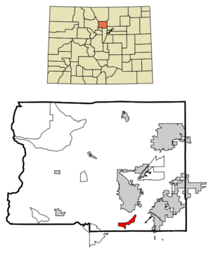
mapsize = 250px
map_caption = Location in Boulder County and the state ofColorado
mapsize1 =
map_caption1 =
image_dot_
dot_mapsize =
dot_map_caption =
dot_x =
dot_y =
pushpin_
pushpin_label_position =
pushpin_map_caption =
pushpin_mapsize =
subdivision_type = Country
subdivision_name = Click-Inline|
United States
subdivision_type1 = State
subdivision_name1 = Click-Inline|
Colorado
subdivision_type2 = County
subdivision_name2 = BoulderGR|3
subdivision_type3 =
subdivision_name3 =
subdivision_type4 =
subdivision_name4 =
government_footnotes =
government_type =
leader_title =
leader_name =
leader_title1 =
leader_name1 =
leader_title2 =
leader_name2 =
leader_title3 =
leader_name3 =
leader_title4 =
leader_name4 =
established_title =
established_date =
established_title2 =
established_date2 =
established_title3 =
established_date3 =
area_magnitude =
unit_pref = Imperial
area_footnotes =
area_total_km2 = 6.2
area_land_km2 = 6.2
area_water_km2 = 0
area_total_sq_mi = 2.4
area_land_sq_mi = 2.4
area_water_sq_mi = 0
area_water_percent =
area_urban_km2 =
area_urban_sq_mi =
area_metro_km2 =
area_metro_sq_mi =
area_blank1_title =
area_blank1_km2 =
area_blank1_sq_mi =
population_as_of = 2000
population_footnotes =
population_note =
population_total = 557
population_density_km2 = 89.8
population_density_sq_mi = 232.1
population_metro =
population_density_metro_km2 =
population_density_metro_sq_mi =
population_urban =
population_density_urban_km2 =
population_density_urban_sq_mi =
population_blank1_title =
population_blank1 =
population_density_blank1_km2 =
population_density_blank1_sq_mi =
timezone = MST
utc_offset = -7
timezone_DST = MDT
utc_offset_DST = -6
latd = 39 |latm = 56 |lats = 27 |latNS = N
longd = 105 |longm = 15 |longs = 21 |longEW = W
elevation_footnotes = GR|3
elevation_m = 1747
elevation_ft = 5732
postal_code_type =ZIP code cite web | date =December 14 2006 | url = http://zip4.usps.com/zip4/citytown.jsp | title = ZIP Code Lookup| format =JavaScript /HTML | publisher = United States Postal Service | accessdate = December 14 | accessyear = 2006]
postal_code = 80025
area_code = 303
blank_name = FIPS code
blank_info = 08-23630
blank1_name = GNIS feature ID
blank1_info = 0181177
website =
footnotes =Eldorado Springs is a
census-designated place (CDP) in Boulder County,Colorado ,United States . The population was 557 at the 2000 census.GR|2 The Eldorado Springs Post Office has theZIP Code 80025.Geography
Eldorado Springs is located at coor dms|39|56|27|N|105|15|21|W|city (39.940786, -105.255930)GR|1.
According to the
United States Census Bureau , the CDP has a total area of 2.4square mile s (6.2km² ), all of it land. To the southwest isEldorado Mountain .Demographics
As of the
census GR|2 of 2000, there were 557 people, 275 households, and 133 families residing in the CDP. Thepopulation density was 232.1 people per square mile (89.6/km²). There were 295 housing units at an average density of 122.9/sq mi (47.5/km²). The racial makeup of the CDP was 94.61% White, 0.72% African American, 0.18% Native American, 1.80% Asian, 0.90% from other races, and 1.80% from two or more races. Hispanic or Latino of any race were 2.87% of the population.There were 275 households out of which 20.0% had children under the age of 18 living with them, 39.3% were married couples living together, 5.5% had a female householder with no husband present, and 51.6% were non-families. 38.5% of all households were made up of individuals and 2.9% had someone living alone who was 65 years of age or older. The average household size was 2.03 and the average family size was 2.74.
In the CDP the population was spread out with 17.2% under the age of 18, 5.6% from 18 to 24, 35.5% from 25 to 44, 33.8% from 45 to 64, and 7.9% who were 65 years of age or older. The median age was 42 years. For every 100 females there were 108.6 males. For every 100 females age 18 and over, there were 110.5 males.
The median income for a household in the CDP was $48,875, and the median income for a family was $96,823. Males had a median income of $61,625 versus $26,750 for females. The
per capita income for the CDP was $42,908. About 15.4% of families and 11.9% of the population were below thepoverty line , including 7.2% of those under age 18 and none of those age 65 or over.The nearby
Eldorado Canyon State Park is famous for the many classic North-American climbing routes.Notable residents
*
Mark Emery Udall (1950- ),U.S. Congressman External links
* [http://www.mountainproject.com/v/colorado/boulder/eldorado_canyon_sp/105744246 Climbing routes in Eldorado Canyon]
* [http://parks.state.co.us/default.asp?parkID=81&action=park Eldorado Canyon State Park]References
Wikimedia Foundation. 2010.