- Arvada, Colorado
-
City of Arvada, Colorado — City — Location in Jefferson County and the state of Colorado
Coordinates: 39°49′12″N 105°6′40″W / 39.82°N 105.11111°WCoordinates: 39°49′12″N 105°6′40″W / 39.82°N 105.11111°W Country United States State Colorado Counties[1] Jefferson County
Adams CountySettled 1859[2] Platted December 1, 1870[2] Incorporated August 24, 1904[2][3] Named for Hiram Arvada Haskin Government – Type Home Rule Municipality[1] – Mayor Bob Frie[4] – City Manager Mark Deven[5] Area – Total 35.759 sq mi (92.616 km2) – Land 35.142 sq mi (91.018 km2) – Water 0.617 sq mi (1.598 km2) Elevation 5,344 ft (1,662 m) Population (2010) – Total 106,433 – Density 3,029/sq mi (1,169/km2) Time zone MST (UTC-7) – Summer (DST) MDT (UTC-6) ZIP codes 80001-80007 and 80403[6] Area code(s) Both 303 and 720 FIPS code 08-03455 GNIS feature ID 0204709 Highways I-70, I-76, SH 72, SH 93, SH 95, SH 121 Website City of Arvada Site of the first documented discovery of gold in the Rocky Mountain Region
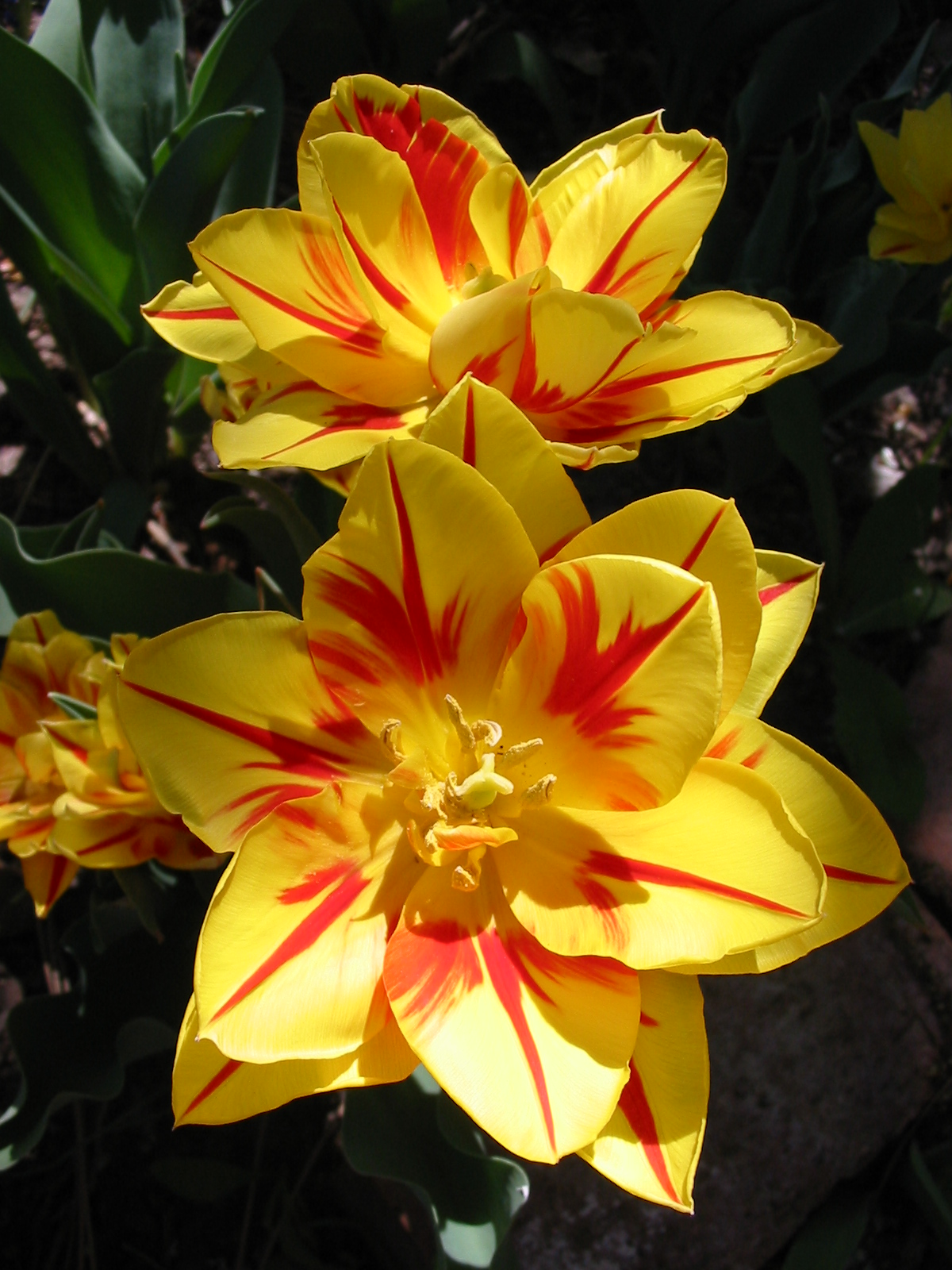
Eighth most populous city in Colorado "Monsella" tulip, blooming in Arvada 2006
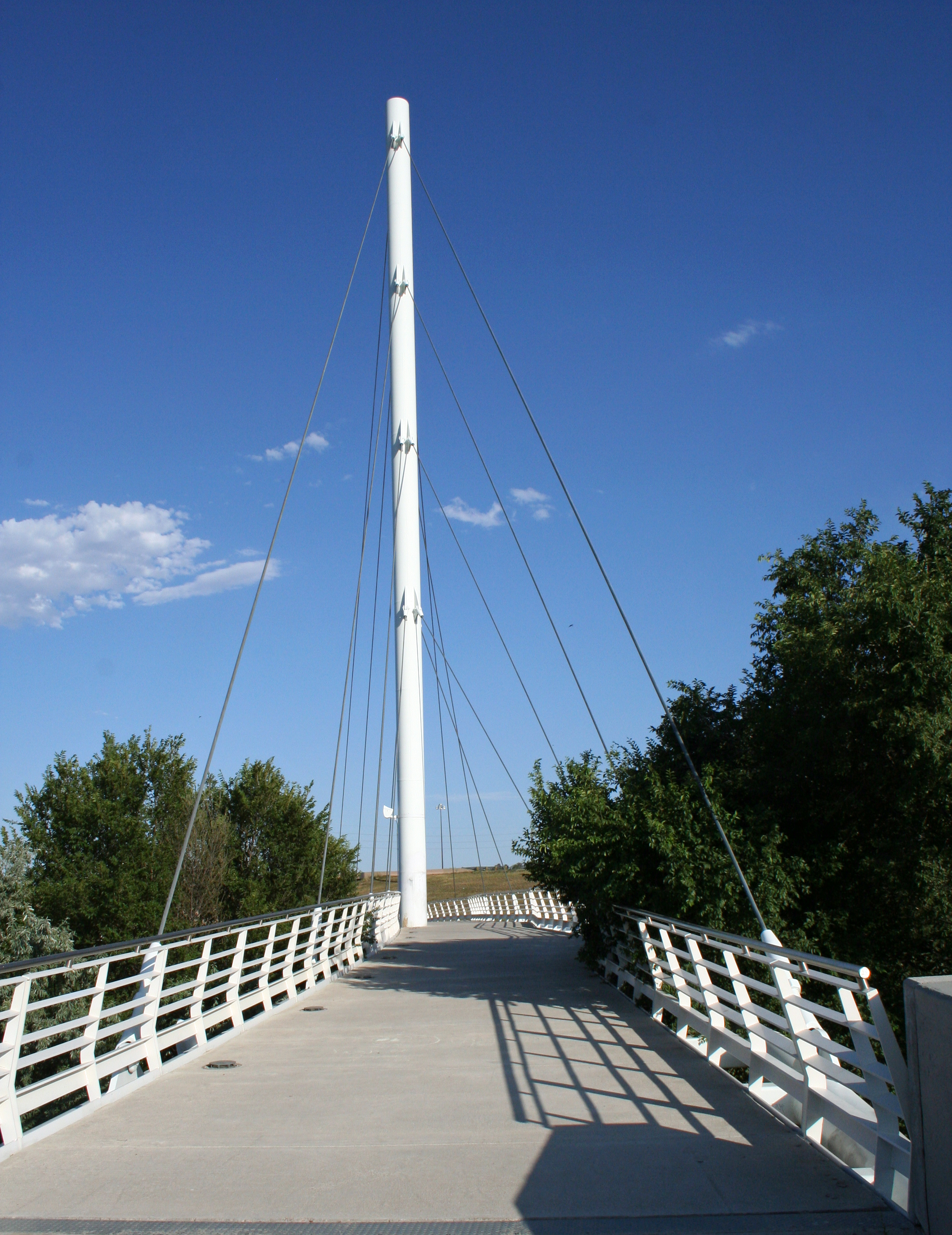
 Cable-stayed bridge At Gold Strike Park
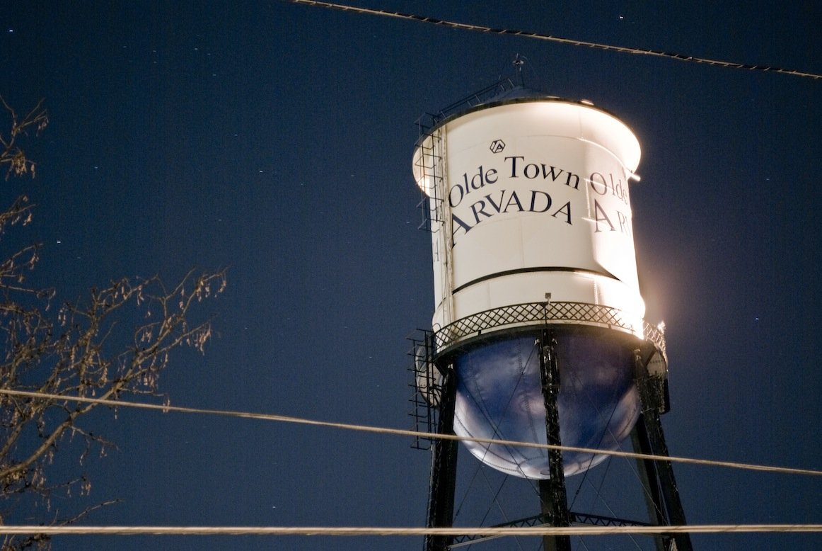
 The water tower situated in Olde Town Arvada
The City of Arvada (
 /ɑrˈvædə/) is a Home Rule Municipality located in Jefferson and Adams counties in the Denver-Aurora-Broomfield, CO Metropolitan Statistical Area of the state of Colorado. Olde Town Arvada is located 7 miles (11 km) northwest of the Colorado State Capitol in Denver. The 2010 United States Census recorded 106,433 residents, making Arvada the eighth most populous city in the state of Colorado.[7]
Contents
History
The first documented discovery of gold in the Rocky Mountain region occurred on June 22, 1850, when Lewis Ralston, a Georgia prospector headed for the California gold fields, dipped his sluice pan into a small stream near its mouth at Clear Creek.[2] Ralston found about 1/4 ounce (6 g) of gold then worth about five dollars. Ralston's companions named the stream Ralston's Creek in his honor, but they all left the next morning, drawn by the lure of the California gold fields.
During the Pike's Peak Gold Rush in 1858, Ralston brought another group of prospectors back to the site of his first discovery. The placer gold in the area soon played out, but hard rock deposits of gold were found in the mountains to the west. Some of the miners abandoned their search for gold and returned to farm the rich bottom land along Ralston Creek and Clear Creek. They found an eager market for their crops among other gold seekers. The Territory of Colorado was formed on February 28, 1861, and the farms in the valley expanded to feed the growing population of the region.
In 1870, the Colorado Central Railroad laid tracks through the area on its route from Golden to link up with the Kansas Pacific Railroad and the Denver Pacific Railroad at Jersey Junction, 3 miles (5 km) north of Denver. On December 1, 1870, Benjamin F. Wadsworth and Louis A. Reno platted the Ralston Point townsite along the railroad. To avoid confusion with other communities along Ralston Creek, Ralston Point was soon renamed Arvada in honor of Hiram Arvada Haskin, brother-in-law of settler Mary Wadsworth.[8] Benjamin Wadsworth became the first postmaster of Arvada. Colorado was granted statehood on August 1, 1876, and the Town of Arvada was formally incorporated on August 14, 1904. A vibrant agricultural community, Arvada claimed the title "'Celery Capital of the World'."
Arvada grew rapidly during the latter half of the 20th century as a suburb of nearby Denver, the state capital. Arvada became a Statutory City on October 31, 1951, and a Home Rule Municipality on July 23, 1963. By the end of the millennium, the population of Arvada exceeded 100,000.
Government
The city of Arvada is a Home Rule Municipality with a council-manager form of government. The Arvada City Council has seven members: a mayor and two councilmembers elected at large, and four councilmembers elected from council districts.
Arvada City Council[4] Office Incumbent Mayor Marc Williams Councilmember At-large Don Allard Councilmember At-large Bob Fifer Councilmember, District One Rachel Zenzinger Councilmember, District Two Mark McGoff Councilmember, District Three Shelley Cook Councilmember, District Four and Mayor Pro Tem Bob Dyer The City Council selects the city manager. The Arvada City Manager is Mark Deven.[5]
Geography
Arvada is located at 39°49′12″N 105°6′40″W / 39.82°N 105.11111°W (39.819962, -105.110975)[9].
According to the United States Census Bureau, the city has a total area of 32.8 square miles (85 km2).84.6 km²; (32.7 sq mi) of it is land and 0.2 square miles (0.52 km2) of it (0.58%) is water.
Plutonium contamination
Main article: Radioactive contamination from the Rocky Flats PlantRadioactive contamination of both the immediate, surrounding area and the entire greater Denver metropolitan area has resulted from decades of radioactive isotope releases, largely plutonium (Pu-239), into the environment from the Rocky Flats Plant, a former nuclear weapons production facility located about 15 miles upwind of Denver that has since been shut down and disassembled.
In terms of major related events, on September 11, 1957, portions of the Denver metropolitan area--substantially including Arvada--became contaminated with radioactive Pu-239 from a then highly classified plutonium fire.[10][11] Another major plutonium fire in 1969[12] produced similar effects but was monitored and reported by civilian agencies, which led to the U.S. government's divulgence of the 1957 fire.
In 1989, a combined Federal Bureau of Investigation and United States Environmental Protection Agency (EPA) raid of the plant for investigation of environmental crimes effectively ended production and further potential for plutonium fires. Superfund decontamination results have been withheld by the U.S. Government, but significant Pu-239 contamination has been found outside Rocky Flats as recently as August 2010.[13][14]
Transportation
Arvada is the western terminus of Interstate 76, which begins at the intersection of Interstate 70 and State Highway 121. Other state highways in Arvada include SH 72, SH 93 and SH 95. Major highways near Arvada include Interstate 25, Interstate 270, U.S. Highway 36 and U.S. Highway 287.
The Amtrak California Zephyr passes through the City of Arvada westbound each morning and eastbound each evening. This route through the scenic heart of the Rocky Mountains is one of the most popular rail routes in the United States. Full Amtrak passenger and parcel service is available at the nearby Denver Union Station.
The Denver Regional Transportation District (RTD) currently serves Arvada with seven local bus routes (31, 51, 52, 72, 76, 80, and 100), four express bus routes (55X, 58X, 72X, and 80X), and one regional bus route (GS). RTD plans to provide Arvada with a commuter rail Gold Line along the old Colorado Central Railroad route (now operated by the BNSF Railway) by 2015.
Arvada is served by Denver International Airport and nearby Rocky Mountain Metropolitan Airport.
In 2008 the League of American Bicyclists designated Arvada as a Bronze Level Bicycle Friendly Community.[15]
Demographics
Historical populations Census Pop. %± 1910 840 — 1920 915 8.9% 1930 1,276 39.5% 1940 1,482 16.1% 1950 2,359 59.2% 1960 19,342 719.9% 1970 49,844 157.7% 1980 84,578 69.7% 1990 89,235 5.5% 2000 102,153 14.5% 2010 106,433 4.2% As of the census[16] of 2000, there were 102,153 people, 39,019 households, and 27,742 families residing in the city. The population density was 3,128.1 people per square mile (1,207.6/km²). There were 39,733 housing units at an average density of 1,216.7 per square mile (469.7/km²). The racial makeup of the city was 91.04% White, 0.66% African American, 0.65% Native American, 2.17% Asian, 0.07% Pacific Islander, 3.08% from other races, and 2.34% from two or more races. Hispanic or Latino of any race were 9.82% of the population.
There were 39,019 households out of which 34.2% had children under the age of 18 living with them, 57.5% were married couples living together, 9.7% had a female householder with no husband present, and 28.9% were non-families. 23.1% of all households were made up of individuals and 7.7% had someone living alone who was 65 years of age or older. The average household size was 2.60 and the average family size was 3.07.
In the city the population was spread out with 26.2% under the age of 18, 7.8% from 18 to 24, 30.4% from 25 to 44, 24.9% from 45 to 64, and 10.7% who were 65 years of age or older. The median age was 37 years. For every 100 females there were 96.0 males. For every 100 females age 18 and over, there were 92.9 males.
The median income for a household in the city was $55,541, and the median income for a family was $63,273. Males had a median income of $42,126 versus $30,802 for females. The per capita income for the city was $24,679. About 3.5% of families and 5.2% of the population were below the poverty line, including 6.4% of those under age 18 and 6.1% of those age 65 or older.
Economy
Arvada is largely a commuter town to Denver and Boulder. The primary retail corridors are along Wadsworth Boulevard, 52nd Avenue, Ralston Road and Kipling Street.
Police scandal
Arvada was home to a police scandal in Colorado in 2010 when a neighboring police agency was needed and requested by the chief of police to intervene in the criminal conduct of some members of Arvada's police force. Arvada's city council had chosen not to intervene in the previous criminal conduct of several members of the Arvada police, despite a cost to the city of close to half a million dollars defending the criminal actions of one police officer alone, during a period of budget crises.[17] The police officers involved had been routinely breaking and entering into peoples homes in the hope they would find criminal activity, as was found by several federal jury trials.[17] Police chief Don Wick sought other avenues of investigation and contacted the Arapahoe County Sheriffs Office[18] to conduct an investigation into the criminal conduct of some members of the Arvada Police Department. This was prompted by the (alleged, but without conviction) assault of a man that the police department had arrested and was in handcuffs. Two officers (Whitney Bauma and Noah Rolfing) (allegedly) watched Charles Humphrey punch a restrained man, then all of them collaborated to cover up the crime. [17][19] At least 6 police officers resigned because of the investigation.[20]. "This has been one of the greatest challenges facing our department in its history. It's been an emotional time for everyone involved," Wick said. "This has impacted officers on the streets to our non-sworn staff who are critical to the operation of the organization." [21][22] Charges were ultimately dropped, but the Arvada police department stood by the resignation of these former police officers because their conduct was not appropriate for a police officer. [23]
Missionary shooting
Main article: 2007 Colorado YWAM and New Life shootingsOn December 9, 2007, Matthew J. Murray walked into the Youth With a Mission Center in Arvada and, after he was refused his request to stay overnight, opened fire and killed two people, injuring two more. A memorial was held the following Wednesday, December 12, in which Youth With a Mission leaders forgave Murray's family for what happened.[24]
Sister cities
Arvada has four sister cities, as designated by Sister Cities International:
Notable residents
Arts
- Clive Cussler (1931– ), popular author and automobile collector
- Chris Daring (19??– ), fiddler
- Joe King (1980– ), composer, guitarist, vocalist, and co-founder of The Fray
- Marty Lindsey (née Marty Mariani) (1970– ), actor - imdb
- Aaron Rothe (198?– ), former keyboardist for Drop Dead, Gorgeous and Sonny Moore
- Isaac Slade (1981– ), composer, pianist, lead singer, and co-founder of The Fray
- Nick Stabile (1971– ), actor
- Dave Welsh (1984– ), lead guitarist for The Fray
- Matt Weatherford (1967– ), writer
- Ben Wysocki (1984– ), percussionist for The Fray
Business
- Bob Enyart (1959– ), radio host
- Brian Ibbott (19??– ), podcaster
- Lloyd J. King (1906–1998), founder of King Soopers grocery chain
- Joel Klatt (1982– ), radio host
Politics
- Robert Louis "Bob" Beauprez (1948– ), former U.S. Congressman
- Joanne Conte (1933– ), politician, political commentator, and transsexual activist
- Sara Gagliardi (1958– ), nurse and former state legislator
- Evie Hudak (1951– ), state senator
- Karl Rove (1950– ), political strategist and White House Deputy Chief of Staff (2005–2007)
- Libby Szabo[citation needed] (1963– ), state representative
- John Charles Vivian (1889–1964), 30th Governor of the State of Colorado
Religion
- James D. Conley (1955– ), Roman Catholic prelate
Sports
- Rick Carelli (1955– ), NASCAR truck racer
- Mark Cooney (1951–2011), NFL linebacker for the Green Bay Packers
- Joe DeCamillis (1965– ), Special Teams coach for the Dallas Cowboys
- Nick Fazekas (1985– ), professional basketball player
- Roy Halladay (1977– ), Major League Baseball pitcher and Cy Young Award recipient
- Phil Heath (1979– ), 2nd World Ranked IFBB professional bodybuilder
- Erika Sutton (1987– ), professional football defender
- Mildred Ella "Babe" Didrikson Zaharias (1911–1956), Olympic gold medalist and professional golfer
See also

- Arvada Downtown historic district
- Colorado cities and towns
- Colorado counties
- Colorado history
- Colorado metropolitan areas
- Denver-Aurora-Broomfield, CO Metropolitan Statistical Area
- Denver-Aurora-Boulder, CO Combined Statistical Area
- North Central Colorado Urban Area
- Front Range Urban Corridor
- Colorado school districts
- Jefferson County R-1 School District
- Adams County School District 50
- Apex Park and Recreation District
- United States Fish & Wildlife Service
- Rocky Flats National Wildlife Refuge
- Two Ponds National Wildlife Refuge
References
- ^ a b "Active Colorado Municipalities". State of Colorado, Department of Local Affairs. http://www.dola.state.co.us/dlg/local_governments/municipalities.html. Retrieved 2007-09-01.
- ^ a b c d "Arvada History" (HTTP). City of Arvada, Colorado. Archived from the original on 2007-06-28. http://web.archive.org/web/20070628033539/http://www.arvada.org/community/history.php. Retrieved 2007-08-20.
- ^ "Colorado Municipal Incorporations". State of Colorado, Department of Personnel & Administration, Colorado State Archives. 2004-12-01. http://www.colorado.gov/dpa/doit/archives/muninc.html. Retrieved 2007-08-18.
- ^ a b "City Council Members" (HTTP). City of Arvada, Colorado. http://arvada.org/government/index.php?pid=1282. Retrieved 2011-11-07.
- ^ a b "City Manager's Office". City of Arvada, Colorado. http://arvada.org/government/index.php?pid=1014. Retrieved 2011-11-06.
- ^ "ZIP Code Lookup" (JavaScript/HTML). United States Postal Service. August 18, 2007. http://zip4.usps.com/zip4/citytown.jsp. Retrieved August 18, 2007.
- ^ "American Factfinder". United States Census Bureau. http://factfinder2.census.gov/main.html. Retrieved May 2, 2011.
- ^ "Profile for Arvada, Colorado". ePodunk. http://www.epodunk.com/cgi-bin/genInfo.php?locIndex=9337. Retrieved 2010-06-15.
- ^ "US Gazetteer files: 2010, 2000, and 1990". United States Census Bureau. 2011-02-12. http://www.census.gov/geo/www/gazetteer/gazette.html. Retrieved 2011-04-23.
- ^ "Citizen Summary Rocky Flats Historical Public Exposures Studies". Colorado Department of Public Health and Environment. http://www.cdphe.state.co.us/rf/1957fire.htm. Retrieved September 15, 2011.
- ^ http://www.rockyflatsnuclearguardianship.org/wp-content/uploads/2011/leroy-moore-papers/1957-fateful-year-may92-1.pdf
- ^ http://www.colorado.edu/journalism/cej/exhibit/index.html
- ^ http://www.ens-newswire.com/ens/aug2010/2010-08-05-01.html
- ^ http://coloradoindependent.com/95372/invasive-weeds-at-rocky-flats-raise-nuclear-concerns
- ^ http://www.bikeleague.org/programs/bicyclefriendlyamerica/communities/pdfs/bfc_masterlist_09_10.pdf
- ^ "American FactFinder". United States Census Bureau. http://factfinder.census.gov. Retrieved 2008-01-31.
- ^ a b c http://www.kdvr.com/news/kdvr-arvada-police-excessive-force-cover-up-txt,0,3401480.story
- ^ http://www.thedenverchannel.com/news/24860911/detail.html?treets=den&tml=den_break&ts=T&tmi=den_break_1_05300109022010
- ^ http://www.thedenverchannel.com/news/25778288/detail.html
- ^ Robles, Yesenia (September 4, 2010). "Sixth Arvada police officer resigns in excessive-force case". Denver Post. http://www.denverpost.com/ci_15988866?source=bb.
- ^ Cite error: Invalid
<ref>tag; no text was provided for refs named9news.com; see Help:Cite errors/Cite error references no text - ^ http://www.9news.com/rss/story.aspx?storyid=163150
- ^ http://www.9news.com/news/local/article/204722/222/Arvada-officer-found-not-guilty-in-excessive-force-case
- ^ Holusha, John (2007-12-09). "Gunman Kills 2 at Missionary Center Near Denver". The New York Times. http://www.nytimes.com/2007/12/09/us/09cnd-shoot.html?hp. Retrieved 2007-12-09.
External links
- City of Arvada website
- Jefferson County website
- Rocky Flats National Wildlife Refuge website
- Two Ponds National Wildlife Refuge website

Rocky Flats Westminster Westminster Leyden 
Westminster  Arvada

Golden Wheat Ridge Denver Municipalities and communities of Jefferson County, Colorado Cities Arvada‡ | Edgewater | Golden | Lakewood | Littleton‡ | Westminster‡ | Wheat Ridge

Towns Bow Mar‡ | Lakeside | Morrison | Mountain View | Superior‡
CDPs Applewood | Aspen Park | Coal Creek‡ | Columbine‡ | Dakota Ridge | East Pleasant View | Evergreen | Fairmount | Genesee | Idledale | Indian Hills | Ken Caryl | Kittredge | West Pleasant View
Unincorporated
communitiesBuffalo Creek | Conifer | Foxton | Pine | Pine Junction
Ghost town Arapahoe
Footnotes ‡This populated place also has portions in an adjacent county or counties
Municipalities and communities of Adams County, Colorado Cities Arvada‡ | Aurora‡ | Brighton‡ | Commerce City | Federal Heights | Northglenn‡ | Thornton‡ | Westminster‡

Towns CDPs Berkley | Derby | North Washington | Sherrelwood | Strasburg‡ | Todd Creek | Twin Lakes | Watkins‡ | Welby
Unincorporated
communitiesAdams City | Dupont | Eastlake | Henderson | Reunion
Footnotes ‡This populated place also has portions in an adjacent county or counties
Mayors of cities with populations exceeding 100,000 in Colorado - Doug Hutchinson
(Fort Collins) - Erik Hansen
(Thornton)
- Bob Frie
(Arvada) - Nancy McNally
(Westminster)
- Barbara Vidmar*
(Pueblo)

- President of the Pueblo City Council
Other states: AL • AK • AZ • AR • CA • CO • CT • DE • FL • GA • HI • ID • IL • IN • IA • KS • KY • LA • ME • MD • MA • MI • MN • MS • MO • MT • NE • NV • NH • NJ • NM • NY • NC • ND • OH • OK • OR • PA • RI • SC • SD • TN • TX • UT • VT • VA • WA • WV • WI • WY
Categories:- Populated places in Adams County, Colorado
- Arvada, Colorado
- Cities in Colorado
- Populated places established in 1858
- Denver metropolitan area
- Populated places in Jefferson County, Colorado
- Russian communities in the United States


Wikimedia Foundation. 2010.