- Mono Vista, California
-
Mono Vista — census-designated place — Location in Tuolumne County and the state of California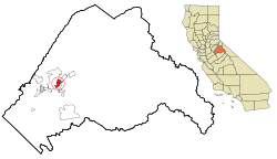
Coordinates: 38°0′44″N 120°16′15″W / 38.01222°N 120.27083°WCoordinates: 38°0′44″N 120°16′15″W / 38.01222°N 120.27083°W Country  United States
State  California
County Tuolumne Area[1] – Total 2.839 sq mi (7.352 km2) – Land 2.836 sq mi (7.345 km2) – Water 0.003 sq mi (0.007 km2) 0.10% Elevation 2,992 ft (912 m) Population (2010) – Total 3,127 – Density 1,101.4/sq mi (425.3/km2) Time zone Pacific (PST) (UTC-8) – Summer (DST) PDT (UTC-7) ZIP code 95370 Area code(s) 209 FIPS code 06-48641 GNIS feature ID 1659158 Mono Vista is a census-designated place (CDP) in Tuolumne County, California, United States. The population was 3,127 at the 2010 census, up from 3,072 at the 2000 census.
Contents
Geography
Mono Vista is located at 38°0′44″N 120°16′15″W / 38.01222°N 120.27083°W (38.012087, -120.270701)[2].
According to the United States Census Bureau, the CDP has a total area of 2.8 square miles (7.3 km2), 99.90% of it land and 0.10% of it water.
Demographics
2010
The 2010 United States Census[3] reported that Mono Vista had a population of 3,127. The population density was 1,101.6 people per square mile (425.3/km²). The racial makeup of Mono Vista was 2,796 (89.4%) White, 6 (0.2%) African American, 58 (1.9%) Native American, 38 (1.2%) Asian, 8 (0.3%) Pacific Islander, 61 (2.0%) from other races, and 160 (5.1%) from two or more races. Hispanic or Latino of any race were 300 persons (9.6%).
The Census reported that 3,102 people (99.2% of the population) lived in households, 25 (0.8%) lived in non-institutionalized group quarters, and 0 (0%) were institutionalized.
There were 1,211 households, out of which 391 (32.3%) had children under the age of 18 living in them, 648 (53.5%) were opposite-sex married couples living together, 129 (10.7%) had a female householder with no husband present, 78 (6.4%) had a male householder with no wife present. There were 94 (7.8%) unmarried opposite-sex partnerships, and 4 (0.3%) same-sex married couples or partnerships. 272 households (22.5%) were made up of individuals and 110 (9.1%) had someone living alone who was 65 years of age or older. The average household size was 2.56. There were 855 families (70.6% of all households); the average family size was 2.98.
The population was spread out with 731 people (23.4%) under the age of 18, 276 people (8.8%) aged 18 to 24, 728 people (23.3%) aged 25 to 44, 908 people (29.0%) aged 45 to 64, and 484 people (15.5%) who were 65 years of age or older. The median age was 40.5 years. For every 100 females there were 99.9 males. For every 100 females age 18 and over, there were 99.0 males.
There were 1,471 housing units at an average density of 518.2 per square mile (200.1/km²), of which 898 (74.2%) were owner-occupied, and 313 (25.8%) were occupied by renters. The homeowner vacancy rate was 5.3%; the rental vacancy rate was 10.5%. 2,199 people (70.3% of the population) lived in owner-occupied housing units and 903 people (28.9%) lived in rental housing units.
2000
As of the census[4] of 2000, there were 3,072 people, 1,113 households, and 846 families residing in the CDP. The population density was 991.3 people per square mile (382.6/km²). There were 1,263 housing units at an average density of 407.5 per square mile (157.3/km²). The racial makeup of the CDP was 94.08% White, 0.46% African American, 0.78% Native American, 0.42% Asian, 0.10% Pacific Islander, 1.63% from other races, and 2.54% from two or more races. Hispanic or Latino of any race were 7.45% of the population.
There were 1,113 households out of which 35.8% had children under the age of 18 living with them, 62.6% were married couples living together, 8.6% had a female householder with no husband present, and 23.9% were non-families. 17.5% of all households were made up of individuals and 7.0% had someone living alone who was 65 years of age or older. The average household size was 2.74 and the average family size was 3.08.
In the CDP the population was spread out with 27.6% under the age of 18, 6.6% from 18 to 24, 25.5% from 25 to 44, 26.4% from 45 to 64, and 14.0% who were 65 years of age or older. The median age was 39 years. For every 100 females there were 97.3 males. For every 100 females age 18 and over, there were 94.7 males.
The median income for a household in the CDP was $42,302, and the median income for a family was $44,419. Males had a median income of $40,104 versus $31,250 for females. The per capita income for the CDP was $19,297. About 6.1% of families and 8.2% of the population were below the poverty line, including 17.0% of those under age 18 and none of those age 65 or over.
Politics
In the state legislature Mono Vista is located in the 14th Senate District, represented by Republican Tom Berryhill, and in the 25th Assembly District, represented by Republican Kristin Olsen. Federally, Mono Vista is located in California's 19th congressional district, which has a Cook PVI of R +10[5] and is represented by Republican Jeff Denham.
References
- ^ U.S. Census
- ^ "US Gazetteer files: 2010, 2000, and 1990". United States Census Bureau. 2011-02-12. http://www.census.gov/geo/www/gazetteer/gazette.html. Retrieved 2011-04-23.
- ^ All data are derived from the United States Census Bureau reports from the 2010 United States Census, and are accessible on-line here. The data on unmarried partnerships and same-sex married couples are from the Census report DEC_10_SF1_PCT15. All other housing and population data are from Census report DEC_10_DP_DPDP1. Both reports are viewable online or downloadable in a zip file containing a comma-delimited data file. The area data, from which densities are calculated, are available on-line here. Percentage totals may not add to 100% due to rounding. The Census Bureau defines families as a household containing one or more people related to the householder by birth, opposite-sex marriage, or adoption. People living in group quarters are tabulated by the Census Bureau as neither owners nor renters. For further details, see the text files accompanying the data files containing the Census reports mentioned above.
- ^ "American FactFinder". United States Census Bureau. http://factfinder.census.gov. Retrieved 2008-01-31.
- ^ "Will Gerrymandered Districts Stem the Wave of Voter Unrest?". Campaign Legal Center Blog. http://www.clcblog.org/blog_item-85.html. Retrieved 2008-02-10.
Municipalities and communities of Tuolumne County, California City 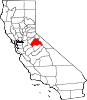
CDPs Cedar Ridge | Chinese Camp | Cold Springs | Columbia | East Sonora | Groveland | Jamestown | Long Barn | Mi-Wuk Village | Mono Vista | Phoenix Lake | Pine Mountain Lake | Sierra Village | Soulsbyville | Strawberry | Tuolumne City | Tuttletown | Twain Harte
Unincorporated
communitiesBlanchard | Buchanan | Bumblebee | Confidence | Dardanelle | Deadwood | Groveland-Big Oak Flat | Mather | Moccasin | Phoenix Lake-Cedar Ridge | Pinecrest | Standard
Categories:- Census-designated places in Tuolumne County, California


Wikimedia Foundation. 2010.