- East Sonora, California
Infobox Settlement
official_name = East Sonora, California
other_name =
native_name =
nickname =
settlement_type = CDP
motto =
imagesize =
image_caption =
flag_size =
image_
seal_size =
image_shield =
shield_size =
image_blank_emblem =
blank_emblem_type =
blank_emblem_size =
imagesize =
image_caption =
flag_size =
image_
seal_size =
image_shield =
shield_size =
image_blank_emblem =
blank_emblem_type =
blank_emblem_size =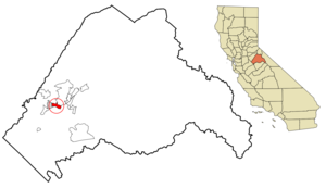
mapsize = 250x200px
map_caption = Location in Tuolumne County and the state ofCalifornia
mapsize1 =
map_caption1 =
image_dot_
dot_mapsize =
dot_map_caption =
dot_x =
dot_y =
pushpin_
pushpin_label_position =
pushpin_map_caption =
pushpin_mapsize =
subdivision_type = Country
subdivision_name =United States
subdivision_type1 = State
subdivision_name1 =California
subdivision_type2 = County
subdivision_name2 = Tuolumne
subdivision_type3 =
subdivision_name3 =
subdivision_type4 =
subdivision_name4 =
government_footnotes =
government_type =
leader_title =
leader_name =
leader_title1 =
leader_name1 =
leader_title2 =
leader_name2 =
leader_title3 =
leader_name3 =
leader_title4 =
leader_name4 =
established_title =
established_date =
established_title2 =
established_date2 =
established_title3 =
established_date3 =
area_magnitude =
unit_pref =
area_footnotes =
area_total_km2 = 6.7
area_land_km2 = 6.7
area_water_km2 = 0
area_total_sq_mi = 2.6
area_land_sq_mi = 2.6
area_water_sq_mi = 0
area_water_percent =
area_urban_km2 =
area_urban_sq_mi =
area_metro_km2 =
area_metro_sq_mi =
area_blank1_title =
area_blank1_km2 =
area_blank1_sq_mi =
population_as_of = 2000
population_footnotes =
population_note =
population_total = 2078
population_density_km2 = 310.1
population_density_sq_mi = 799.2
population_metro =
population_density_metro_km2 =
population_density_metro_sq_mi =
population_urban =
population_density_urban_km2 =
population_density_urban_sq_mi =
population_blank1_title =
population_blank1 =
population_density_blank1_km2 =
population_density_blank1_sq_mi =
timezone = Pacific (PST)
utc_offset = -8
timezone_DST = PDT
utc_offset_DST = -7
latd = 37 |latm = 58 |lats = 50 |latNS = N
longd = 120 |longm = 20 |longs = 53 |longEW = W
elevation_footnotes =
elevation_m = 642
elevation_ft = 2106
postal_code_type =ZIP code
postal_code = 95370
area_code = 209
blank_name = FIPS code
blank_info = 06-21188
blank1_name = GNIS feature ID
blank1_info = 1785607
website =
footnotes =East Sonora is a
census-designated place (CDP) in Tuolumne County,California ,United States . Thepopulation was 2,078 at the 2000 census.Geography
East Sonora is located at coor dms|37|58|50|N|120|20|53|W|city (37.980561, -120.347961)GR|1.
According to the
United States Census Bureau , the CDP has a total area of 2.6square mile s (6.7km² ), all of it land.Demographics
As of the
census GR|2 of 2000, there were 2,078 people, 1,064 households, and 600 families residing in the CDP. Thepopulation density was 805.9 people per square mile (311.0/km²). There were 1,145 housing units at an average density of 444.1/sq mi (171.4/km²). The racial makeup of the CDP was 93.98% White, 0.82% African American, 0.48% Native American, 0.67% Asian, 0.05% Pacific Islander, 0.96% from other races, and 3.03% from two or more races. Hispanic or Latino of any race were 6.11% of the population.There were 1,064 households out of which 15.4% had children under the age of 18 living with them, 46.3% were married couples living together, 7.0% had a female householder with no husband present, and 43.6% were non-families. 39.8% of all households were made up of individuals and 30.3% had someone living alone who was 65 years of age or older. The average household size was 1.94 and the average family size was 2.53.
In the CDP the population was spread out with 15.0% under the age of 18, 3.5% from 18 to 24, 14.9% from 25 to 44, 23.9% from 45 to 64, and 42.7% who were 65 years of age or older. The median age was 60 years. For every 100 females there were 80.5 males. For every 100 females age 18 and over, there were 77.2 males.
The median income for a household in the CDP was $34,922, and the median income for a family was $50,222. Males had a median income of $46,250 versus $23,250 for females. The
per capita income for the CDP was $23,254. About 2.8% of families and 5.4% of the population were below thepoverty line , including none of those under age 18 and 8.7% of those age 65 or over.History
There really is not a place called East Sonora, at least no signs to signify it as such, so most people just say they are from
Sonora, California , proper. They would be "Sonorans" in the 21st century, or "Sonorians" in the 19th century. East Sonora was home to one of the county's first hip-hopwigger crews, known as East Sonora Ghetto or ESG, in the mid- to late-1980s.Politics
In the state legislature East Sonora is located in the 14th Senate District, represented by Republican
Dave Cogdill , and in the 25th Assembly District, represented by RepublicanTom Berryhill . Federally, East Sonora is located inCalifornia's 19th congressional district , which has a Cook PVI of R +10 [cite web | title = Will Gerrymandered Districts Stem the Wave of Voter Unrest? | publisher = Campaign Legal Center Blog | url=http://www.clcblog.org/blog_item-85.html | accessdate = 2008-02-10] and is represented by RepublicanGeorge Radanovich .External links
Wikimedia Foundation. 2010.