- Ducor, California
-
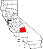
Ducor — census-designated place — Location in Tulare County and the state of California
Coordinates: 35°53′32″N 119°2′53″W / 35.89222°N 119.04806°WCoordinates: 35°53′32″N 119°2′53″W / 35.89222°N 119.04806°W Country  United States
State  California
County Tulare Area[1] – Total 0.610 sq mi (1.581 km2) – Land 0.610 sq mi (1.581 km2) – Water 0 sq mi (0 km2) 0% Elevation 548 ft (167 m) Population (2010) – Total 612 – Density 1,003.3/sq mi (387.1/km2) Time zone Pacific (PST) (UTC-8) – Summer (DST) PDT (UTC-7) ZIP code 93218 Area code(s) 559 FIPS code 06-20032 GNIS feature ID 0241659 Ducor is a census-designated place (CDP) in Tulare County, California, United States. The population was 612 at the 2010 census, up from 504 at the 2000 census.
Contents
Geography
Ducor is located at 35°53′32″N 119°2′53″W / 35.89222°N 119.04806°W (35.892176, -119.048079).[2]
According to the United States Census Bureau, the CDP has a total area of 0.6 square miles (1.6 km2), all of it land.
Demographics
2010
The 2010 United States Census[3] reported that Ducor had a population of 612. The population density was 1,002.9 people per square mile (387.2/km²). The racial makeup of Ducor was 251 (41.0%) White, 0 (0.0%) African American, 15 (2.5%) Native American, 20 (3.3%) Asian, 0 (0.0%) Pacific Islander, 302 (49.3%) from other races, and 24 (3.9%) from two or more races. Hispanic or Latino of any race were 502 persons (82.0%).
The Census reported that 612 people (100% of the population) lived in households, 0 (0%) lived in non-institutionalized group quarters, and 0 (0%) were institutionalized.
There were 142 households, out of which 89 (62.7%) had children under the age of 18 living in them, 103 (72.5%) were opposite-sex married couples living together, 13 (9.2%) had a female householder with no husband present, 16 (11.3%) had a male householder with no wife present. There were 12 (8.5%) unmarried opposite-sex partnerships, and 1 (0.7%) same-sex married couples or partnerships. 6 households (4.2%) were made up of individuals and 1 (0.7%) had someone living alone who was 65 years of age or older. The average household size was 4.31. There were 132 families (93.0% of all households); the average family size was 4.40.
The population was spread out with 200 people (32.7%) under the age of 18, 90 people (14.7%) aged 18 to 24, 135 people (22.1%) aged 25 to 44, 136 people (22.2%) aged 45 to 64, and 51 people (8.3%) who were 65 years of age or older. The median age was 27.6 years. For every 100 females there were 104.0 males. For every 100 females age 18 and over, there were 113.5 males.
There were 154 housing units at an average density of 252.4 per square mile (97.4/km²), of which 105 (73.9%) were owner-occupied, and 37 (26.1%) were occupied by renters. The homeowner vacancy rate was 0.9%; the rental vacancy rate was 11.9%. 434 people (70.9% of the population) lived in owner-occupied housing units and 178 people (29.1%) lived in rental housing units.
2000
As of the census[4] of 2000, there were 504 people, 120 households, and 101 families residing in the CDP. The population density was 829.2 people per square mile (319.0/km²). There were 123 housing units at an average density of 202.4 per square mile (77.9/km²). The racial makeup of the CDP was 34.33% White, 0.20% African American, 0.40% Native American, 1.59% Asian, 61.11% from other races, and 2.38% from two or more races. Hispanic or Latino of any race were 72.62% of the population.
There were 120 households out of which 46.7% had children under the age of 18 living with them, 66.7% were married couples living together, 9.2% had a female householder with no husband present, and 15.8% were non-families. 12.5% of all households were made up of individuals and 5.0% had someone living alone who was 65 years of age or older. The average household size was 4.18 and the average family size was 4.58.
In the CDP the population was spread out with 39.3% under the age of 18, 11.3% from 18 to 24, 26.2% from 25 to 44, 17.7% from 45 to 64, and 5.6% who were 65 years of age or older. The median age was 25 years. For every 100 females there were 119.1 males. For every 100 females age 18 and over, there were 115.5 males.
The median income for a household in the CDP was $33,125, and the median income for a family was $30,694. Males had a median income of $33,750 versus $26,250 for females. The per capita income for the CDP was $9,701. About 24.8% of families and 30.0% of the population were below the poverty line, including 37.1% of those under age 18 and 13.8% of those age 65 or over.
Politics
In the state legislature Ducor is located in the 16th Senate District, represented by Democrat Dean Florez, and in the 34th Assembly District, represented by Republican Bill Maze. Federally, Ducor is located in California's 21st congressional district, which has a Cook PVI of R +13[5] and is represented by Republican Devin Nunes.
Ducor Union Elementary School District services the students in Ducor, CA. The District website is located at www.ducorschool.com
References
- ^ U.S. Census
- ^ "US Gazetteer files: 2010, 2000, and 1990". United States Census Bureau. 2011-02-12. http://www.census.gov/geo/www/gazetteer/gazette.html. Retrieved 2011-04-23.
- ^ All data are derived from the United States Census Bureau reports from the 2010 United States Census, and are accessible on-line here. The data on unmarried partnerships and same-sex married couples are from the Census report DEC_10_SF1_PCT15. All other housing and population data are from Census report DEC_10_DP_DPDP1. Both reports are viewable online or downloadable in a zip file containing a comma-delimited data file. The area data, from which densities are calculated, are available on-line here. Percentage totals may not add to 100% due to rounding. The Census Bureau defines families as a household containing one or more people related to the householder by birth, opposite-sex marriage, or adoption. People living in group quarters are tabulated by the Census Bureau as neither owners nor renters. For further details, see the text files accompanying the data files containing the Census reports mentioned above.
- ^ "American FactFinder". United States Census Bureau. http://factfinder.census.gov. Retrieved 2008-01-31.
- ^ "Will Gerrymandered Districts Stem the Wave of Voter Unrest?". Campaign Legal Center Blog. http://www.clcblog.org/blog_item-85.html. Retrieved 2008-02-10.
Municipalities and communities of Tulare County, California Cities Dinuba | Exeter | Farmersville | Lindsay | Porterville | Tulare | Visalia | Woodlake
CDPs Allensworth | Alpaugh | California Hot Springs | Camp Nelson | Cedar Slope | Cutler | Delft Colony | Ducor | Earlimart | East Orosi | East Porterville | East Tulare Villa | El Rancho | Goshen | Hartland | Idlewild | Ivanhoe | Kennedy Meadows | Lemon Cove | Lindcove | Linnell Camp | London | Matheny | McClenney Tract | Monson | Orosi | Panorama Heights | Patterson Tract | Pierpoint | Pine Flat | Pixley | Plainview | Ponderosa | Poplar-Cotton Center | Posey | Poso Park | Richgrove | Rodriguez Camp | Sequoia Crest | Seville | Silver City | Springville | Strathmore | Sugarloaf Mountain Park | Sugarloaf Saw Mill | Sugarloaf Village | Sultana | Terra Bella | Teviston | Three Rivers | Tipton | Tonyville | Tooleville | Traver | Waukena | West Goshen | Wilsonia | Woodville | Yettem
Unincorporated
communitiesAdvance | Angiola | Badger | Balance Rock | Cairns Corner | Calgro | Johnsondale | Kaweah | Rocky Hill | White River | Yokohl Valley | Zante
Ghost town Fountain Springs
Indian
reservationTule River Reservation
Categories:- Census-designated places in Tulare County, California
- Populated places in California with Hispanic majority populations


Wikimedia Foundation. 2010.