- Daly City, California
-
City of Daly City — City — Part of Daly City with San Bruno Mountain and the San Francisco neighborhood of Crocker Amazon in the background.

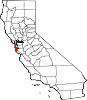
SealNickname(s): Gateway to the Peninsula Location in San Mateo County and the state of California
Coordinates: 37°41′11″N 122°28′06″W / 37.68639°N 122.46833°WCoordinates: 37°41′11″N 122°28′06″W / 37.68639°N 122.46833°W Country  United States
State  California
County San Mateo Incorporated[1] March 18, 1911 Named for John Daly Government[2][3] – Type Council-Manager – Mayor Michael P. Guingona – City council Council Members– State Assembly Fiona Ma (D)
Gene Mullin (D)– State Senate Leland Yee (D) – U.S. House Jackie Speier (D) Area[4] – Total 7.664 sq mi (19.849 km2) – Land 7.664 sq mi (19.849 km2) – Water 0 sq mi (0 km2) 0% Elevation[5] 187 ft (57 m) Population (2010) – Total 101,123 – Rank 1st in San Mateo County
65th in California
273rd in the United States– Density 13,194.5/sq mi (5,094.4/km2) Time zone PST (UTC-8) – Summer (DST) PDT (UTC-7) ZIP codes[6] 94013-94017 Area codes[7][8] 415, 650 FIPS code[9] 06-17918 GNIS feature ID[5] 2410291 Website http://www.dalycity.org/ Daly City is the largest city in San Mateo County, California, United States, with a 2010 population of 101,123. Located immediately south of San Francisco, it is named in honor of businessman and landowner John Daly.
Contents
History
Archaeological evidence suggests the San Francisco Bay Area has been inhabited as early as 2700 BC[10] People of the Ohlone language group occupied Northern California from at least the 6th century.[11][verification needed] Though their territory had been claimed by Spain since the early 16th century, they would have relatively little contact with Europeans until 1769, when, as part of an effort to colonize Alta California, an exploration party led by Don Gaspar de Portola learned of the existence of San Francisco Bay.[12] Seven years later, in 1776, an expedition led by Juan Bautista de Anza selected the site for the Presidio of San Francisco, which Jose Joaquin Moraga would soon establish. Later the same year, the Franciscan missionary Francisco Palóu founded the Mission San Francisco de Asís (Mission Dolores).[13][verification needed] As part of the founding the priests claimed the land south of the mission for sixteen miles for raising crops and for fodder for cattle and sheep.[14] In 1778, the priests and soldiers marked out a trail to connect San Francisco to the rest of California.[14] At the top of Mission Hill, the priests named the gap between San Bruno Mountain and the hills on the coast La Portezuela("The Little Door").[14] La Portezuela was later referred to as Daly's Hill, the Center of Daly City, and is now called Top of the Hill.[14]
 Mission San Francisco de Asís (Mission Dolores)
During Spanish rule, the area between San Bruno Mountain and the Pacific remained uninhabited.[15] Upon independence from Spain, Mexican nobles were granted land parcels to establish large ranches, three of which covered areas now in Daly City and Colma.[15] Rancho Buri Buri was granted to Jose Sanchez in 1835 and covered 14,639 acres (59.24 km2) including parts of modern day Colma, Burlingame, San Bruno, South San Francisco, and Millbrae.[15][16] Rancho Laguna de la Merced was 2,219 acres (8.98 km2) acres and covered the area around a lake of the same name.[15][16] The third ranch covering parts of the Daly City-Colma area was named Rancho Canada de Guadalupe la Visitacion y Rodeo Viejo and stretched from the Visitacion Valley area in San Francisco, to the city of South San Francisco covering 5,473 acres (22.15 km2).[15][16]
Following the Mexican Cession of California at the end of the Mexican–American War the owners of Rancho Laguna de La Merced tried to claim land between San Bruno Mountain and Lake Merced. An 1853 US government survey declared that the contested area was in fact government property and could be acquired by private citizens. There was a brief land rush as settlers, mainly Irish established ranches in farms in parts of what is now the neighborhoods of Westlake, Serramonte, and the cities of Colma and Pacifica.[17] A decade later, several of families left as increase in the fog density killed grain and potato crops. The few remaining families switched to dairy and cattle farming as a more profitable enterprise.[17] In the late 19th century as San Francisco grew and San Mateo County was established, Daly City also gradually grew including homes and schools along the lines for the Southern Pacific railroad.[18] Daly City served as a location where San Franciscans would cross over county lines to gamble and fight.[19] As tensions built in approach to the American Civil War, California was divided between pro-slavery, and Free Soil advocates. Two of the main figures in the debate were US Senator David C. Broderick, a Free Soil advocate and David S. Terry who was in favor of extension of slavery into California. Quarreling and political fighting between the two eventually led to a duel in the Lake Merced area at which Terry mortally wounded Broderick, who would die three days later.[20] The site of the duel is marked with two granite shafts were the men stood, and designated is California Historical Landmark number 19.[21]
 Displaced victims of the SF earthquake, in front of a temporary tent shelter.
On the morning of April 18, 1906 a major earthquake struck just off the coast of Daly City near Mussel Rock.[22] After quake and subsequent fire destroyed many San Franciscans homes, they left to temporary housing on the ranches of the area to the south, including the large one owned by John Daly.[23] Daly had come to the Bay Area in 1853 where he had worked on a dairy farm, and after several years married his bosses' daughter and acquired a 250 acres (1.0 km2) at the Top of the Hill area. Over the years Daly's business grew, as did his political clout.[24] When a flood of refugees from the quake came, Daly and other local farmers donated milk and other food items.[25] Daly later subdivided his property, from which several housing tracts emerged.[24]
As some of the refugees established homes in the area, the need for city services grew. This, combined with the fear of annexation by San Francisco and being ignored by San Mateo county, whose seat far to the south left residents feeling ignored created a demand for incorporation. The first such attempt was proposed in 1908 for incorporation as the city of Vista Grande. Vista Grande would have spanned from the Pacific to the Bay, with San Francisco as its northern border and South San Francisco and the old Rancho Buri Buri as its southern border. The proposal was rejected over the scope of the planned city was too broad for many residents.[26] The initial proposal also revealed rifts in the community among the various regions, including the area around the cemeteries, who were excluded from further plans of incorporation.[26] On January 16, 1911 an incorporation committee filed a petition with San Mateo County supervisors to incorporate the City of Daly City. The city would run from San Francisco along the San Bruno Hills until Price and School streets with San Francisco and west to the summit of the San Bruno Hills. The city would have an estimated population of 2,900.[27] On March 18, 1911 a special election was held, with incorporation narrowly succeeding by a vote of 132 to 130.[28]
It remained a relatively small community until the late 1940s, when developer Henry Doelger established Westlake, a major district of homes and businesses, including the Westlake Shopping Center.On March 22, 1957 Daly City was again the epicenter of an earthquake, this one a 5.3 magnitude quake on the San Andreas Fault which caused some structural damage in Westlake and closed State Route 1 along the Westlake Palisades.[29] In October 1984 Taiwanese American writer Chiang Nan was assassinated, allegedly by Kuomintang agents.[30] The Daly City BART station opened on September 11, 1972, providing northern San Mateo County with rail service to downtown San Francisco and other parts of the Bay Area. The line was extended south to Colma in 1996 and then to Millbrae and the San Francisco International Airport in 2003.
Geography
According to the United States Census Bureau, the city has a total area of 7.7 square miles (20 km2), all of it land.
Daly City is bordered by the cities of San Francisco, Brisbane, Pacifica, South San Francisco, and the town of Colma. The city borders several unincorporated areas of San Mateo County. It surrounds Broadmoor, borders San Bruno Mountain State Park, the Olympic Club, and unincorporated areas near Colma.[31] Seismic faults in and near Daly City include the San Andreas Fault, Hillside Fault and Serra Fault. Lake Merced is associated with the city.
Neighborhoods
Neighborhoods of Daly City include Westlake, St. Francis, Serramonte, Top of the Hill, Hillside, Crocker, Southern Hills, and Bayshore. Westlake is notable for its distinct architecture and for being among the earliest examples of a planned, large-tract suburb. Bayshore, the easternmost neighborhood of Daly City, was once an incorporated city, Bayshore City, until being annexed to Daly City in the mid-1960s. Several Daly City neighborhoods, such as Crocker, Southern Hills, and Bayshore, share a street grid and similar characteristics with adjacent San Francisco neighborhoods, such as Crocker-Amazon and Visitacion Valley.
Several neighborhoods associated with Daly City lie outside of its city limits. Broadmoor is an unincorporated area completely surrounded by Daly City. Colma is an incorporated town sandwiched between Daly City, South San Francisco, and San Bruno Mountain. These enclaves are in charge of their own police and fire services, but also share some services with Daly City.
Demographics
2010
The 2010 United States Census[32] reported that Daly City had a population of 101,123. The population density was 13,195.0 people per square mile (5,094.6/km²). The racial makeup of Daly City was 23,842 (23.6%) White, 3,600 (3.6%) African American, 404 (0.4%) Native American, 56,267 (55.6%) Asian (33.2% Filipino, 15.4% Chinese, 1.8% Burmese, 1.0% Vietnamese, 0.6% Indian, 0.6% Korean, 0.6% Japanese, 0.2% Indonesian, 0.2% Thai), 805 (0.8%) Pacific Islander, 11,236 (11.1%) from other races, and 4,969 (4.9%) from two or more races. Hispanic or Latino of any race were 23,929 persons (23.7%); 9.4% of Daly City is Mexican, 4.9% Salvadoran, 2.7% Nicaraguan, 1.3% Guatemalan, 0.7% Peruvian, 0.7% Puerto Rican, and 0.5% Honduran.
The Census reported that 100,442 people (99.3% of the population) lived in households, 273 (0.3%) lived in non-institutionalized group quarters, and 408 (0.4%) were institutionalized.
There were 31,090 households, out of which 11,050 (35.5%) had children under the age of 18 living in them, 15,883 (51.1%) were opposite-sex married couples living together, 4,667 (15.0%) had a female householder with no husband present, 2,238 (7.2%) had a male householder with no wife present. There were 1,632 (5.2%) unmarried opposite-sex partnerships, and 293 (0.9%) same-sex married couples or partnerships. 5,855 households (18.8%) were made up of individuals and 2,136 (6.9%) had someone living alone who was 65 years of age or older. The average household size was 3.23. There were 22,788 families (73.3% of all households); the average family size was 3.63.
The population was spread out with 19,614 people (19.4%) under the age of 18, 10,506 people (10.4%) aged 18 to 24, 29,663 people (29.3%) aged 25 to 44, 27,717 people (27.4%) aged 45 to 64, and 13,623 people (13.5%) who were 65 years of age or older. The median age was 38.3 years. For every 100 females there were 97.5 males. For every 100 females age 18 and over, there were 95.3 males.
There were 32,588 housing units at an average density of 4,252.2 per square mile (1,641.8/km²), of which 17,565 (56.5%) were owner-occupied, and 13,525 (43.5%) were occupied by renters. The homeowner vacancy rate was 1.9%; the rental vacancy rate was 4.2%. 58,239 people (57.6% of the population) lived in owner-occupied housing units and 42,203 people (41.7%) lived in rental housing units.
2000
As of the census of 2008, there were 101,514 people, 29,843 households, and 21,847 families residing in the city.[33] The population density was 15,703.8 people per square mile (7,292.1/km²), making it among the most densely populated cities in the country. There were 31,876 housing units at an average density of 5,140.9 per square mile (2,599.1/km²).
There were 29,843 households out of which 35.1% had children under the age of 18 living with them, 51.5% were married couples living together, 11.2% had a female householder with no husband present, and 28.0% were non-families. 22.1% of all households were made up of individuals and 5.7% had someone living alone who was 65 years of age or older. The average household size was 4.34 and the average family size was 4.78.
In the city the population was spread out with 25.5% under the age of 18, 11.5% from 18 to 24, 32.2% from 25 to 44, 21.8% from 45 to 64, and 10.0% who were 65 years of age or older. The median age was 32 years. For every 100 females there were 99.8 males. For every 100 females age 18 and over, there were 96.3 males.
The median income for a household in the city was $60,310, and the median income for a family was $66,365. Males had a median income of $36,227 versus $34,147 for females. The per capita income for the city was $22,900. About 5.2% of families and 9.1% of the population were below the poverty line, including 8.4% of those under age 18 and 6.3% of those age 65 or over.
As of 2008 census figures, 40.7% of Daly City residents are of Filipino descent, the highest concentration of Filipino/Filipino Americans of any mid-sized city in North America. This partly explains Daly City's place in the vernacular as the 'Pinoy Capital'. Benito M. Vergara, Jr. goes into the details of this history in his ethnography Pinoy Capital: The Filipino Nation in Daly City.[34] There is also a significant proportion of Samoans, Tongans, and Hawaiians in Daly City, shown in the restaurants, shops, churches, and dance centers concentrated in central Daly City.
Culture
Entertainment
 Cow Palace
The Cow Palace arena grounds straddle the border with San Francisco and is the home for the annual Grand National Rodeo, Horse & Stock Show.[35] It has hosted diverse events such as concerts by the Beatles, the NHL San Jose Sharks hockey team, the short-lived IHL San Francisco Spiders hockey team, and two Republican National Conventions (in 1956 and 1964).
Century 20 Daly City is a modern megaplex movie theatre opened in 2002 as part of the Pacific Plaza business and retail development.
Recreation
Several golf courses are located within or straddle the border with San Francisco. The Olympic Club is designated to host the USGA U.S. Open in 2012, hosting the U.S. Open four times previously. The private San Francisco Golf Club and Lake Merced Country Club have part or all of their course in Daly City.
The Golden Gate National Recreation Area includes the city's Thornton Beach. The topography of this area (due to the San Andreas fault) is conducive to paragliding and hang gliding.
Since 1934, the Daly City Parks and Recreation Department has been serving Daly City and other neighboring cities. Today, the Department offers over 259 classes, sponsors adult, teen, and youth athletic leagues, aquatic programs, gymnastics, youth and teen services as well as a comprehensive senior adult program, park maintenance, hall rentals, special events and more.
Giammona Pool and Jefferson Pool are two public indoor swimming pools which provide swimming lessons, aquatic recreation, and host local swimming related organizations including the Daly City Dolphins.
Shopping
Daly City and neighboring Colma have emerged as shopping meccas for San Francisco residents. A combination of plentiful free parking space (compared to the constrained and expensive parking options in San Francisco) and San Mateo County's historically slightly lower state sales tax rate[36] have contributed to this trend. Many big box retailers that are unable to operate in San Francisco due to real estate prices, space restrictions, or political / community opposition have opened stores in the Serramonte and Westlake neighborhoods. Daly City's shopping centers are Serramonte Center and Westlake Shopping Center.
Politics
In the state legislature Daly City is located in the 8th Senate District, represented by Democrat Leland Yee, and in the 12th and 19th Assembly Districts, represented by Democrats Fiona Ma and Gene Mullin respectively. Federally, Daly City is located in California's 12th congressional district, which has a Cook PVI of D +22[37] and is represented by Democrat Jackie Speier.
Education
 M. H. Tobias Elementary School
There are several public school districts in Daly City. The biggest are the Jefferson Elementary School District and Jefferson Union High School District, both of which are headquartered in the city. In addition, there is the Bayshore Elementary School District (2 schools), Brisbane School District (1 school in Daly City), and South San Francisco Unified School District (2 schools in Daly City). Daly City has two high schools: Westmoor High School and Jefferson High School, plus a continuation school, Thornton High School. Daly City is also home to two Catholic parochial schools: Our Lady of Perpetual Help on Top-Of-The-Hill and Our Lady of Mercy in Westlake.
The city has four Peninsula Library System branches.
Transportation
 BART
BARTDaly City’s highway infrastructure includes State Routes 1, 35 and 82, and Interstate 280. Interstate 280, which bisects Daly City, is a primary transportation corridor linking San Francisco with San Mateo and Santa Clara counties.
The U.S. Census Bureau has identified Daly City as among the cities with the highest transit ridership. Public transportation is provided by SamTrans, BART (at the Daly City Station and the Colma Station, which abuts the Daly City limits), and some San Francisco Muni lines. Daly City is approximately eight miles south-west of downtown San Francisco and the San Francisco International Airport is nine miles south-east of Daly City; both are easily accessible by freeway or BART. In the 1980s planning was conducted for the BART extension south from San Francisco, the first step being the Daly City Tailtrack Project, upon which turnaround project the San Francisco Airport Extension would later build.[38]
Economy
Top employers
According to the City's 2009 Comprehensive Annual Financial Report,[39] the top employers in the city are:
# Employer # of Employees 1 Seton Medical Center 1,659 2 City of Daly City 761 3 Jefferson Union High School District 693 4 United States Postal Service 602 5 Jefferson Elementary School District 584 6 Cow Palace 405 7 Genesys Telecommunications Laboratories 373 8 Target 336 9 McDonald's 227 10 Walgreens 227 Sister cities
The City of Daly City has one sister city, as designated by Sister Cities International:
 Quezon City, Philippines
Notable people
- Xian Lim, Filipino model and actor
- Greg Adams, trumpeter and musician notably of the band Tower of Power.
- Alvin Chea, Author & Bass Vocalist of 10-time Grammy Award Winning A capella sextet Take 6.
- John Donald Daly, landowner and city founder.
- Henry Doelger, developer of the Westlake neighborhood and many other developments in San Francisco and San Mateo County.
- Kimberly Guilfoyle, cable news personality and host of The Lineup.
- E. Floyd Kvamme, venture capitalist of Kleiner Perkins Caufield & Byers.
- John Madden, NFL Hall of Fame Coach. Graduated from Jefferson High School in 1954.[40]
- Ed Montague, baseball player; also his baseball umpire son of the same name.
- Edwin Mulitalo, American football player.
- David Evan Pedley, co-founder of the Dominion of Melchizedek.
- Dave Pelzer, author and child abuse survivor.
- Richard Quitevis aka DJ Qbert, musician.
- John Robinson, American football coach.
- Sam Rockwell, actor.
- Bob St. Clair, NFL Hall of Fame. Served as City Councilman and Mayor (1958–1961).
- Michael Schwartz, aka Mix Master Mike, attended Westmoor High School (class of 1988)
- Duncan Sheik, alternative musician
- John Charles Wester, Roman Catholic Bishop of Diocese of Salt Lake City, Utah. Graduate of Our Lady of Mercy parochial school.
- Sal Torres, former TV host and three time Mayor and first elected City Councilman of Latino descent in Daly City history.
- Mike Carroll, San Francisco skateboarder and co-owner of Crailtap enterprises.
Bibliography
- Chandler, Samuel (September 1973). Gateway to the Peninsula. Daly City: City of Daly City. OCLC 799903. http://www.dalycityhistory.org/Gateway.htm.
- Gillespie, Bunny (2003). Daly City. Images of America. Charleston, SC: Arcadia Publishing. ISBN 0738528676. OCLC 53875125. http://www.arcadiapublishing.com/mm5/merchant.mvc?Screen=PROD&Product_Code=9780738528670&Store_Code=arcadia&search=CA&offset=0&filter_cat=&PowerSearch_Begin_Only=&sort=&range_low=&range_high=%20%26srch_state%3D1.
- Keil, Rob. (2006). Little Boxes: The Architecture of a Classic Midcentury Suburb. Daly City, CA: Advection Media. ISBN 0977923649.
- Vergara, Jr., Benito M. (2009). Pinoy Capital: The Filipino Nation in Daly City. Asian American History and Culture. Philadelphia, PA: Temple University Press. ISBN 1-59213-665-6. http://www.temple.edu/tempress/titles/1920_reg.html.
References
- ^ Gillespie, p.32
- ^ "DC Online - Elected Officials". City of Daly City. http://www.dalycity.org/about/official.htm. Retrieved 2009-06-26.
- ^ "DC Online - State & Federal Representatives". City of Daly City. http://www.dalycity.org/city_services/state_federal.htm. Retrieved 2009-06-26.
- ^ U.S. Census
- ^ a b "City of Daly City". Geographic Names Information System. US Geological Survey. http://geonames.usgs.gov/pls/gnispublic/f?p=gnispq:3:::NO::P3_FID:2410291. Retrieved 2009-06-26.
- ^ "USPS - ZIP Code Lookup - Search By City". United States Postal Service. http://zip4.usps.com/zip4/citytown.jsp. Retrieved 2009-06-26.
- ^ "North American Numbering Plan Letter" (PDF) (Press release). Bellcore. 1996-11-22. http://www.nanpa.com/pdf_previous/08_02_99/pl_nanp_022.pdf. Retrieved 2009-06-26.
- ^ "NANP Administration System". North American Numbering Plan Administration. http://nanpa.com/nas/public/npa_city_query_step2.do;nanpaid=z20cKF7WNycJChhrcl2QTf5PqcpThWlMThGYCn15JrtFqXzgHQcw!1335039869?method=displayData. Retrieved 2009-06-26.
- ^ "Daly City (city) QuickFacts from the US Census Bureau:". US Census Bureau. http://quickfacts.census.gov/qfd/states/06/0617918.html. Retrieved 2009-06-26.
- ^ Stewart, Suzanne B (November 2003). "Archaeological Research Issues For The Point Reyes National Seashore - Golden Gate National Recreation Area" (PDF). Sonoma State University - Anthropological Studies Center. p. 100. http://www.sonoma.edu/asc/projects/pointreyes/overview2.pdf. Retrieved June 12, 2008.
- ^ Levy, Richard (1978). "Costanoan". In William C. Sturtevant and Robert F. Heizer. Handbook of North American Indians. 8. Washington D.C.: Smithsonian Institution. pp. 486. ISBN 0-16-004578-9.
- ^ "Visitors: San Francisco Historical Information". City and County of San Francisco. Archived from the original on Mar 31, 2008. http://web.archive.org/web/20080331220353/http://www.sfgov.org/site/visitor_index.asp?id=8091. Retrieved June 10, 2008.
- ^ Edward F. O'Day (October 1926). "The Founding of San Francisco". San Francisco Water. Spring Valley Water Authority. http://www.sfmuseum.org/hist6/founding.html. Retrieved February 14, 2009.
- ^ a b c d (Chandler 1973, p. 1)
- ^ a b c d e (Chandler 1973, p. 2)
- ^ a b c "Mexican Land Grants / Ranchos San Mateo County". Earth Sciences & Map Library University of California, Berkeley. Regents of the University of California. 2003-06-16. http://www.lib.berkeley.edu/EART/SanMateoRanchos.html. Retrieved 2009-07-06.
- ^ a b (Chandler 1973, p. 5)
- ^ (Gillespie 2003, p. 11)
- ^ (Chandler 1973, p. 17)
- ^ (Chandler 1973, p. 18)
- ^ "San Mateo". Office of Historic State Preservation California State Parks. 2009. http://ohp.parks.ca.gov/default.asp?page_id=21520. Retrieved 2009-07-05. "NO. 19 BRODERICK-TERRY DUELING PLACE ... The site is marked with a monument and granite shafts where the two men stood."
- ^ Kim, Ryan (2004-04-11). "DALY CITY / Officials unmoved by quake notoriety / Plan to note change of 1906 epicenter lacking support:". The San Francisco Chronicle (Hearst Communications Inc.): pp. B1. http://www.sfgate.com/cgi-bin/article.cgi?f=/c/a/2004/04/11/BAGB163KV81.DTL. Retrieved 2009-07-06.
- ^ (Chandler 1973, p. 27)
- ^ a b (Gillespie 2003, p. 8)
- ^ (Chandler 1973, pp. 27–28)
- ^ a b (Chandler 1973, p. 79)
- ^ (Chandler 1973, p. 83)
- ^ (Chandler 1983, p. 84)
- ^ "Historic Earthquakes - 1957 March 22 19:44:21 UTC Magnitude 5.3". Earthquake Hazards Program. US Geological Survey. 2009-01-30. http://earthquake.usgs.gov/regional/states/events/1957_03_22.php. Retrieved 2009-07-06.
- ^ Bishop, Katherine (1988-03-09). "California Jury Is Told Defendant Admitted Slaying Journalist". The New York Times. http://query.nytimes.com/gst/fullpage.html?res=940DE2DF1230F93AA35750C0A96E948260. Retrieved 2007-11-13.
- ^ [1]
- ^ All data are derived from the United States Census Bureau reports from the 2010 United States Census, and are accessible on-line here. The data on unmarried partnerships and same-sex married couples are from the Census report DEC_10_SF1_PCT15. All other housing and population data are from Census report DEC_10_DP_DPDP1. Both reports are viewable online or downloadable in a zip file containing a comma-delimited data file. The area data, from which densities are calculated, are available on-line here. Percentage totals may not add to 100% due to rounding. The Census Bureau defines families as a household containing one or more people related to the householder by birth, opposite-sex marriage, or adoption. People living in group quarters are tabulated by the Census Bureau as neither owners nor renters. For further details, see the text files accompanying the data files containing the Census reports mentioned above.
- ^ "Daly City city, California - Fact Sheet - American FactFinder". 2000 Census. US Census Bureau. http://factfinder.census.gov/servlet/SAFFFacts?_event=&geo_id=16000US0617918&_geoContext=01000US. Retrieved 2009-06-26.
- ^ Pinoy Capital: The Filipino Nation in Daly City.
- ^ http://www.grandnationalrodeo.com
- ^ [2]
- ^ "Will Gerrymandered Districts Stem the Wave of Voter Unrest?". Campaign Legal Center Blog. http://www.clcblog.org/blog_item-85.html. Retrieved 2008-02-10.[unreliable source?]
- ^ C. Michael Hogan, Kay Wilson, M. Papineau et al., Environmental Impact Statement for the BART Daly City Tailtrack Project, Earth Metrics, published by the U.S Urban Mass Transit Administration and the Bay Area Rapid Transit District 1984
- ^ City of Daly City CAFR
- ^ [3]
External links
Mayors of cities with populations exceeding 100,000 in California - Antonio Villaraigosa
(Los Angeles) - Jerry Sanders
(San Diego) - Chuck Reed
(San Jose) - Edwin M. Lee
(San Francisco) - Ashley Swearengin
(Fresno) - Kevin Johnson
(Sacramento) - Bob Foster
(Long Beach) - Jean Quan
(Oakland) - Harvey Hall
(Bakersfield) - Tom Tait
(Anaheim) - Miguel A. Pulido
(Santa Ana)
- Ronald O. Loveridge
(Riverside) - Ann Johnston
(Stockton) - Cheryl Cox
(Chula Vista) - Bob Wasserman
(Fremont) - Sukhee Kang
(Irvine) - Pat Morris
(San Bernardino) - Jim Ridenour
(Modesto) - Thomas E. Holden
(Oxnard) - Acquanetta Warren
(Fontana) - William H. Batey II
(Moreno Valley)^ - John Drayman
(Glendale)
- Cathy Green
(Huntington Beach)^ - Bob Kellar
(Santa Clarita)^ - William Dalton
(Garden Grove) - Susan Gorin
(Santa Rosa)^ - Jim Wood
(Oceanside) - Donald Kurth
(Rancho Cucamonga) - Paul S. Leon
(Ontario) - R. Rex Parris
(Lancaster) - Pat Hume
(Elk Grove) - James C. Ledford Jr.
(Palmdale) - Stan Skipworth
(Corona)^
- Dennis Donohue
(Salinas) - Elliot Rothman
(Pomona) - Frank Scotto
(Torrance) - Michael Sweeney
(Hayward) - Sam Abed
(Escondido) - Tony Spitaleri
(Sunnyvale) - Bill Bogaard
(Pasadena) - Carolyn Cavecche
(Orange) - F. Richard Jones
(Fullerton)^ - Jacqui Irwin
(Thousand Oaks)^ - Jesus Gamboa
(Visalia)
- Paul Miller
(Simi Valley) - William D. Shinn
(Concord)^ - Gina Garbolino
(Roseville) - Jamie L. Matthews
(Santa Clara) - Osby Davis
(Vallejo) - Rudy Cabriales
(Victorville) - Ernest Gutierrez
(El Monte) - Tom Bates
(Berkeley) - Rick Trejo
(Downey)^ - Eric R. Bever
(Costa Mesa)^ - James T. Butts, Jr.
(Inglewood)
 ^Mayor selected from city council
Other states: AL • AK • AZ • AR • CA • CO • CT • DE • FL • GA • HI • ID • IL • IN • IA • KS • KY • LA • ME • MD • MA • MI • MN • MS • MO • MT • NE • NV • NH • NJ • NM • NY • NC • ND • OH • OK • OR • PA • RI • SC • SD • TN • TX • UT • VT • VA • WA • WV • WI • WYMunicipalities and communities of San Mateo County, California Cities and towns Atherton | Belmont | Brisbane | Burlingame | Colma | Daly City | East Palo Alto | Foster City | Half Moon Bay | Hillsborough | Menlo Park | Millbrae | Pacifica | Portola Valley | Redwood City | San Bruno | San Carlos | San Mateo | South San Francisco | Woodside
CDPs Unincorporated
communitiesGhost towns Categories:- Incorporated cities and towns in California
- Daly City, California
- Cities in San Mateo County, California
- Cities in the San Francisco Bay Area
- Populated places in the United States with Asian American majority populations


Wikimedia Foundation. 2010.